Showing posts with label hiking. Show all posts

Monday, December 1, 2025

Christmas events in the Upstate


LIGHTS
Roper Mountain Holiday Lights became a family tradition over the years, but 2017 marked the 26th, and final, year of the event. We were happy to see the giant star atop the mountain continue to shine (over 30 years now!), and it has become a symbol of the holiday season here in Greenville. However, Hurricane Helene did a number on the Buck Michel star, and this year Roper Mountain Science Center had to take the star off the pedestal for repairs. 

The good news is that RMSCA is kicking off the "Relight the Star" campaign to raise the estimated funds needed to fully restore the star’s structure, wiring, and lighting system! For $20 you can “buy a bulb” and have your name listed on the website as a supporter of the Relight the Star campaign commemorating the 40th anniversary of Roper Mountain Science Center. Help us bring the light back to the mountain and donate here: https://secure.qgiv.com/for/fq5itn/event/relightthestar/


PARADES
The local Poinsettia Christmas Parade will take place this Saturday (December 2nd) in downtown Greenville, and is always a great way to kick off the holiday season, especially when combined with hot chocolate from Spill the Beans, a walk through Falls Park, and a stop at M. Judson Books to browse for gifts (or to compose your holiday wish list!).


If you’re looking for a small-town Christmas parade, head to Cashiers, NC and you might even see a snowflake or two in the higher elevations! Make sure to stop at the Village Green for some time on a really cool playground, and if you’re feeling a bit more adventurous, check out the hiking and waterfalls in nearby Highlands on Mountain Waters Scenic Byway, Whiteside Mountain, or Sunset Rock.

GREENVILLE STAYCATION
Ice on MainSkate for $5 every Tuesday after 3 pm courtesy of United Community, excluding Christmas Eve and New Year's Eve, and skate for $4 on December 4, 2025 courtesy of WYFF News Channel 4.


The Festival of Trees is from December 1st through January 1st, with 80 holiday trees decorated by local businesses, schools and community groups showcased in the Hyatt Regency Greenville, the Courtyard Greenville Downtown and the Hampton Inn & Suites RiverPlace. It’s an easy, free afternoon/evening to combine a tour of the Hyatt with a ride on the Greenville Trolley, and for supermom-status, pack a thermos of hot chocolate and holiday cookies to snack on while admiring the lights from the warmth of the trolley!

Make sure to stop by the Children’s Museum of the Upstate with the kids. With reindeer crafts, Frosty the Snowman Storytime, special events like Breakfast with Santa, and the holiday-themed room on the 1st floor, take a breather from your holiday preparations!


…And while you’re at Heritage Green, swing by the library for a free kids holiday program, or stop in the Upcountry History Museum for Beyond Halloween Land | Tim Burton’s The Nightmare Before Christmas.

HIKES
With cooler temperatures and longer to-do lists around the house, we tend to stick closer to home in December. Local State Parks are among our favorite destinations, Paris Mountain being an obvious one as it’s only 20 minutes away. Rose Hill Plantation State Historic Site hosts a Victorian-style Christmas December 2-3rd, and Table Rock presents Santa at the Lodge on December 6th.

Or head to Lake Conestee Nature Preserve, for one of their winter events. We love hiking the trails in all different seasons, but winter is one of our favorites because there are no mosquitos, it isn’t hot, and it’s a relative wilderness just outside of the city.

In addition to their Winter Lights, the NC Arboretum is currently hosting Trolls: A Field Study! After finding all twelve trolls, head to the Baker Exhibit Hall for the children’s exhibit Snow: Tiny Crystals, Global Impact for some snow-related fun. 

WEEKEND GETAWAYS
There are still a few last tickets available to ride the Great Smoky Mountain Railway Polar Express, and Bryson City goes all out for the holidays! Visit the train museum, then board the historic train for a 1¼ hour ride to visit Santa at the North Pole.


For a destination a little closer to home, head to Asheville for the Grove Park Inn gingerbread competition. Christmas at Grove Park Inn is full of twinkling lights, Christmas music, and surprises around every corner in the 100 year old hotel.

  
If you’re still looking for ideas on holiday activities with the kids, check out Kidding Around Greenville’s events list – it’s got everything Greenville + kids!

For those of you who would like to keep in touch this December, I’ll be posting on Instagram throughout the month with our adventures here in the Upstate. Happy December!

Trolls: A Field Study at the NC Arboretum

From the Field Study guide: "Not long ago, we trolls were baffled by little humans - zipping around in metal beasts, scrolling on your pocket stars. But then we saw how your eyes still light up when you see a handsome snail or a beautiful leaf, and we thought... maybe you're not so strange after all! So we've come to study you further, and see if we can find some wild treasure together (much better than shiny coins). You in?"

The North Carolina Arboretum and Explore Asheville are celebrating the arrival of Trolls: A Field Study, which made its North American debut on November 10, 2025 at the Arboretum. Produced by Imagine in collaboration with Danish artist Thomas Dambo, twelve friendly troll sculptures are scattered throughout the Arboretum in a scavenger hunt of epic proportions!

We previously explored one of Dambo's troll exhibits at the Morton Arboretum in Illinois and were so excited to have another chance to see one of his art installations!

The sculptures range from seven to nine feet tall, and are crafted from wooden materials like fallen branches, pallets and twigs. They are created to be interactive, and my kids had so much fun crawling into nets for photo ops, taking up-close looks at the materials used, and learning each troll’s name and story!

"On the night he was born, a little troll named Taks wandered into the human world. What he saw left him puzzled—strange machines, noisy boxes, people rushing around without stopping to talk to the trees. When he returned to the forest, he shared his discoveries with his eleven siblings - and so it started: Trolls: A Field Study!

Make sure to get the map from the education center, it has activities corresponding to each site for the kids to complete, as well as providing a checklist of sorts, so that you can locate all 12 trolls without too much backtracking.

Admission to Trolls: A Field Study is included in the standard Arboretum parking fee, and no advance tickets are required. However, be aware that on weekends you may encounter crowds and a longer wait to enter the Arboretum and should plan accordingly.

The exhibit is at the NC Arboretum from November 15, 2025 through February 17, 2026. As Winter Lights is also currently running at the Arboretum, daily hours have been shortened to 8am to 5pm, with last admission at 4pm. After the holidays normal business hours will resume: 8am to 7pm starting January 5, 2026. A Winter Lights/Daytime combo ticket is available, but those ticket holders must also exit at 5:00 p.m. and return at the entry time listed on their Winter Lights ticket.


While you’re at the Arboretum, make sure to check out the children’s exhibit Snow: Tiny Crystals, Global Impact in the Baker Exhibit Hall, which runs through January 4, 2026. Visitors can peek inside the snowpack to find animals that make their homes in the snow, walk through a snowstorm, or even build a snowman! The outdoor “Playing Woods” area is always a hit with our family; we plan for snack time and a rest there. The NC Arboretum is also a participant in the ecoEXPLORE citizen science program and the Kids in Parks TRACKTrail program, both of which make a visit even more immersive.

Location: NC Arboretum, 20 Frederick Law Olmsted Way, Asheville, NC 28806

Admission: Free, but there is a parking fee for non-members ($20 for standard vehicle)

Hours: 8 a.m. – 5 p.m., with the last entry at 4 p.m.

Exhibit runs from November 15, 2025 through February 17, 2026

Website: Trolls: A Field Study - The North Carolina Arboretum

This article first appeared on Kidding Around Greenville as Trolls Take Over the Arboretum: A New Family Experience.

The article Hunting for trolls at the Morton Arboretum, on the topic of Dambo's "Hunting for Trolls" exhibit can be found here.


Wednesday, March 20, 2024

Scenic Overlooks and Pull-offs in Upstate SC

While my family loves a good hike (and there’s no shortage of them in the Upstate!) we sometimes find ourselves looking for those stunning views – but with little to no hiking. Whether it’s because we have an out-of-town guest visiting that might have less experience on the trail or not be physically capable of tackling local hikes, or because I was pregnant (or adventuring with an infant), we found a dozen sites that we could pull right up to for that spectacular vista – with just a short walk! Head out to one or two of them, or take an epic driving tour of all of them for a taste of the SC Upcountry.

Wildcat Branch Falls

After breakfast at one of the many cute spots in Traveler’s Rest, head north to Cherokee Foothills Scenic Highway 11 and drive west. The first stop is Wildcat Wayside, the old rest stop for travelers on their way to Asheville. With over a mile of trail that loops into the Mountain Bridge Wilderness Area, this trailhead can be a popular spot; be careful pulling in and out of the roadside parking area. However, you won’t have to go far to see the star attraction, as the 30ft waterfall is visible from the road. The shallow pool at the base is a popular swimming hole on hot summer days!

Address: 5500 Geer Hwy, Cleveland, SC 29635


Bald Rock Heritage Preserve

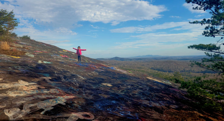
From Greenville, stay on Highway 276 North, following signs to Caesars Head State Park. From Fire Station #64 on the left, drive 1.4 mile to turn right into Persimmon Ridge Road. Another 0.4 mi to the parking lot on the left, and you'll find the trailhead across the road. It's an easy half mile walk through the woods to the iconic view of Table Rock and the surrounding mountains from Bald Rock’s large open rock face. 165-acre Bald Rock Heritage Preserve is home to several rare plants, as well as panoramic views stretching from Table Rock to downtown Greenville.

Address: Highway 280 Persimmon Ridge Rd.Cleveland, SC 29635

Caesars Head State Park

In another 4.6 miles’ drive north on Highway 276 you’ll reach the Caesars Head State Park Visitor Center. There is ample parking here, as well as restrooms, picnic tables and a gift shop. Take the short, 0.1-mile trail to the overlook featuring a wonderful view of Table Rock and the reservoir.

Address: 8155 Geer Highway, Cleveland, SC, 29635

Grant Meadow Overlook

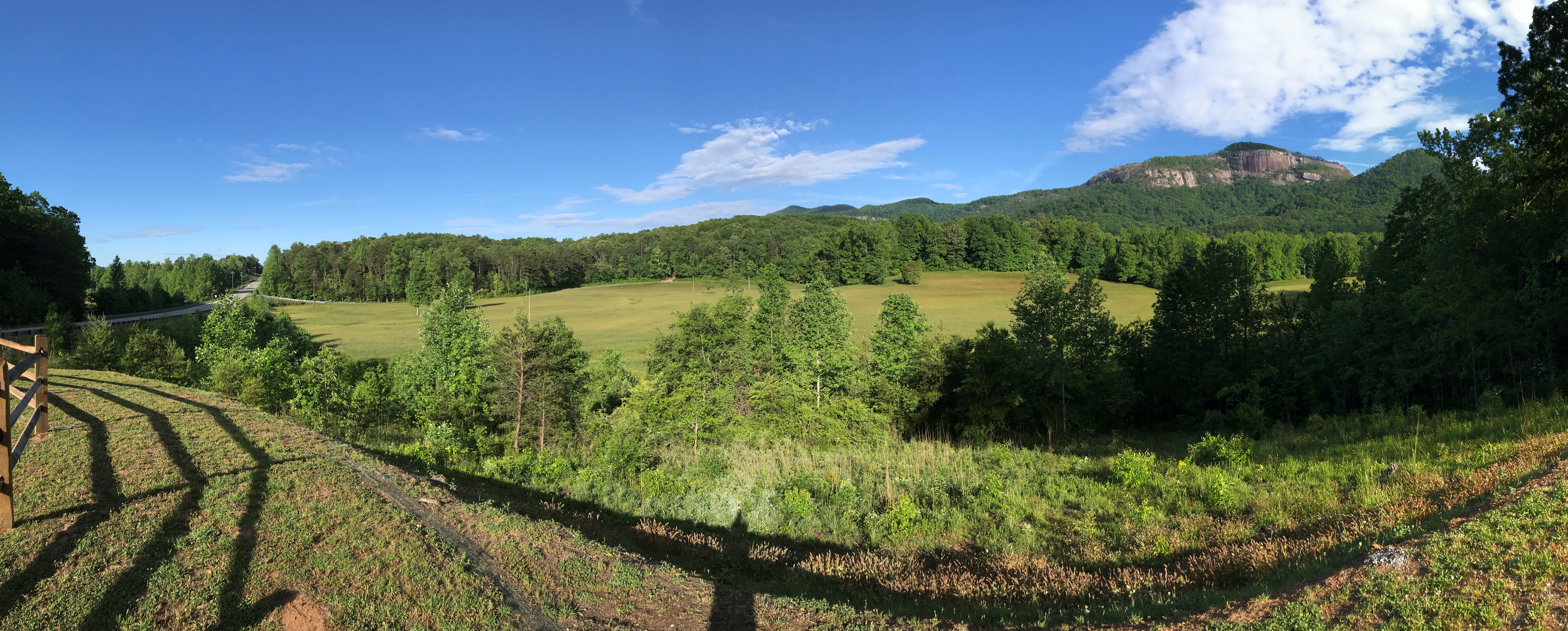
From Caesars Head, retrace your steps back to Cherokee Foothills Scenic Highway 11 and continue west. Just under a mile after Aunt Sue’s Country Corner look for Grant Meadow Overlook to your right. This scenic pull-off is newly open, an Upstate Forever conservation easement protecting the 57-acre property that includes the meadow and streams to the north. Behind them, the focal point – Table Rock. Take a minute to read the historical marker that tells the story of the granite dome, or just soak in the view from the bench before continuing on to Table Rock State Park.

Address: Grant Meadow Overlook, Pickens, SC 29671
GPS Coordinates: 35.034126, -82.684248

Table Rock Overlook

Table Rock Mountain rises 3,124 feet above sea level and can be seen miles. But if you want to get up close without the strenuous 7+mi hike, just head to the Table Rock Viewpoint within Table Rock State Park. To access the pull-off you’ll need a State Park Pass (or to pay admission); it is located about halfway between the Table Rock Nature Center and Gaines Lodge parking areas. If the Park is full or you don’t have a Park pass, head instead to the Table Rock State Park Visitor Center on Lake Oolenoy, where you’ll find restrooms and a gift shop, plus rocking chairs on a wide porch with a prime view of Table Rock.

Address for overlook: 182-346 Table Rock State Park Rd, Pickens, SC 29671
Address for Visitor Center: 158 E Ellison Ln, Pickens, SC 29671

Sassafras Mountain

From Table Rock State Park it’s another 4 miles or so to the intersection of Highway 11 and Moorefield Memorial Highway, where you make a right to drive north 7.5 miles to Rocky Bottom, SC. Make another right on F. Van Clayton Memorial Highway (Sassafras Mountain Rd) and take it all the way to the end to Sassafras Mountain Observation Tower. From the parking lot to the tower is just over a tenth of a mile, but the short stroll is worth it as on a clear day you’ll have 360-degree views of North & South Carolina and Georgia.

Address: 1391 F Van Clayton Memorial Hwy, Sunset, SC 29685

Jumping Off Rock

This next stop requires a bit of time, and patience, as it requires a long drive down a gravel road. Once you are back on Moorefield Memorial Highway, go north 0.9 miles to Horse Pasture Road. This road is open year-round, but will close due to hazardous weather conditions: see SCDNR for updates. High clearance is recommended for the 9.6-mile drive to the overlook, but not required. On your way in you’ll pass several Heritage Preserves and Wildlife Management Areas, with multiple waterfall hike and Foothills Trail trailheads located on Horse Pasture Road. Look for a small pull-off with an obvious trail, it’s only a couple hundred feet to the view. Jumping Off Rock is the first of several stops located in the Jocassee Gorges region in this driving tour that features views of Lake Jocassee; if you opt to skip it you’ll get similar views from the Bad Creek Overlook.

Address: 448 Horse Pasture Rd, Sunset, SC 29685

Long Shoals Wayside Park

Once back on Cherokee Foothills Scenic Highway, look for the intersection with Roy F. Jones Rd. After driving 1.4 miles west on Highway 11 you’ll see the entrance to Long Shoals Roadside Park. There are picnic tables located right next to the parking area, but this stop does require a short climb to reach Little Eastatoe Creek. While not as long as the walk to the Sassafras Mountain tower, it is a little steeper – it descends about 100ft.

Address: Scenic Hwy 11, Pickens, SC 29671
GPS Coordinates: 34.949246, -82.851151

Bad Creek Overlook

From Long Shoals Park drive west on Highway 11 for almost 10 miles. Turn right on SC-130 N and continue for 10.1 miles. Bad Creek is the site of the largest hydroelectric station operated by Duke Power, and includes 7,500-acre Lake Jocassee, a 375-acre upper reservoir, an underground powerhouse and a one-mile long tunnel bored through the mountain bedrock connecting the reservoirs and powerhouse. The site is open to the public year-round, however visitors must abide by the Bad Creek visitor regulations posted at the electronic gate at the entrance to the site, which is at the turn off SC-130 N onto Bad Creek Road. Proceed carefully on Bad Creek Rd. for 3.6 miles until you come to the entrance to the parking lot for the Bad Creek Visitor Overlook. This overlook has more breathtaking views of the emerald Lake Jocassee, with a backdrop of the mountains of the Jocassee Gorges.

Address: Bad Creek Visitor Overlook, Bad Creek Rd, Salem, SC 29676
GPS Coordinates: 34.995363, -82.992124

Note: Just to the north is the North Carolina border and Whitewater Falls, one of the tallest waterfalls in the east. We’ve chosen not to include it in this guide as the hike to the viewing platform is about 0.6 miles and involves stairs; this is also a fee area. However, it is close enough that it is definitely an option if interested!

Wigington Overlook

Once back on Whitewater Road drive south for 0.7 miles, then turn right and head west on Oscar Wigington Memorial Highway. This short connector route between SC-107 and SC-130 offers a fantastic bird's-eye-view of Bad Creek Reservoir and the Carolina foothills from the Wigington Overlook, which is 1.4mi from Whitewater Rd.

Address: Oscar Wigington Memorial Highway Scenic Overlook, State Rd S-37-413, Tamassee, SC 29686
GPS Coordinates: 35.001087, -83.043677

Sloan Bridge & Chattooga Pull-Offs and Picnic Areas

Continue west on Wigington Highway until you reach Highway 107, Falling Waters Scenic Byway. Just north of the intersection is the Sloan Bridge Picnic Area, with restroom facilities and picnic tables. 2.3 miles south is Fish Hatchery Road, which leads to the Walhalla State Fish Hatchery, another picnic area, and a popular spot for fishing.

Sloan Bridge address: Sloans Bridge Access, Tamassee, SC (GPS Coordinates: 35.003620, -83.054143)
Walhalla State Fish Hatchery address: 198 Fish Hatchery Road, Mountain Rest, SC 29664

Burrell's Place Pull-off

One mile south of Fish Hatchery Road is a memorial site for five service members who were killed when a B-25 Army Air Corps plane crashed into a mountain top at night on March 10, 1943. At the Burrell’s Place Pull-Off visitors can find a memorial marker with the names of the servicemen. 1/3 mile further is a wide spot in the road that has room for a couple of cars, with a view of Cantrell Mountain and the Upstate beyond.

GPS Coordinates: 34.964861, -83.078429


Russell Farmstead (Chattooga Town)

After cruising the rest of Falling Waters Scenic Byway, you’ll reach Highway 28S. Make a right and continue towards the SC/GA border, and in 7.5 miles you’ll reach the pull-off for Chattooga Town, which is listed in the National Register of Historic Places. The Russell house was a busy Appalachian farmstead in the late 1800s and early 1900s, and served as a stopover for travelers headed north to NC to escape the hot South Carolina summers. A fire destroyed the main house and three outbuildings in 1988, leaving only a chimney of the main house, but the foundations are visible and an interpretive sign on the site details the layout of the farmstead.

Address: Mountain Rest, SC 29664
GPS Coordinates: 34.909300, -83.172708

Source: Google Maps

Chattooga River (Oconee county) pulloff

Retracing your steps to Mountain Rest, SC, you’ll take Chattooga Ridge Road to Long Creek Highway; the next destination is where Highway 76 crosses the Chattooga. Just before the river there is a 10-minute parking pull-off with room for about 6 cars, and a walkway that leads to an overlook of the Chattooga River and the bridge. If you would prefer a closer look at the river, park at the US Forest Service Chattooga River Access site across the way, though that will require a short walk.

Address: Highway 76 Chattooga River Access, Mountain Rest, SC 29664
GPS Coordinates: 34.814151, -83.303892


The fastest way back to Greenville from the Chattooga River is through Clemson on Highway 123, though if you’re looking to take the scenic route (or headed to our our starting point in Traveler’s Rest) you’ll want to take Highway 11. We often detour through Pickens to stop for food, or watch the sun set from Glassy Mountain.

Pack that bag of gear & snacks, and hit the road this spring with this guide to scenic viewpoints and pull-offs. Make sure to leave a comment to let us know what you enjoyed most!


This article first appeared on Kidding Around Greenville as Stunning Scenic Spots With No Hiking: An Upstate SC Driving Tour.

Wednesday, April 27, 2022

Femme au Foyer Guide to the Foothills Trail

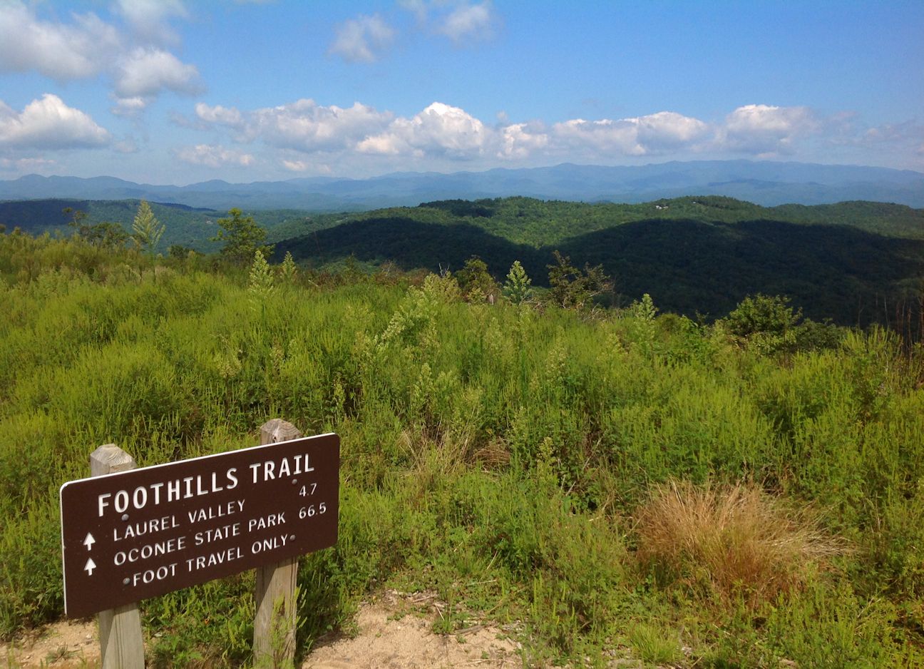
Waterfalls, wilderness areas, wildflowers and epic views… No, I'm not talking about a national park somewhere out west, but our very own Foothills Trail! Backpacker magazine rated it as “one of the best long trails (fifty plus miles) in the country,” and it traverses the Jocassee Gorges, which National Geographic named one of "50 of the World's Last Great Places—Destinations of a Lifetime"… this isn’t just any walk in the park! Well-suited for a through-hike for families looking for a challenge, yet accessible even for the shortest day-trip ramble, the Foothills Trail is rapidly gaining notoriety as one of the premiere trails in the southeast.

Map via Foothills Trail Conservancy

Totaling 77 miles, the trail stretches from Oconee to Table Rock State Park with additional spur trails to numerous waterfalls and Caesars Head State Park. Major trailheads are located at the state parks, as well as US 178, SC 130 and SC 107. You’ll find all this and more on the trail’s website, and the following interactive map has access points, campsites, water sources and other info:

With 77 miles of trail, it can be daunting to choose the right hike for your family. I’ve put together a guide to help identify shorter hikes on/near the Foothills Trail and spurs that will take you to points of interest, as well as give you the info you’ll need to plan your trip: parking, hike difficulty, cost, etc. The trail is broken down into sections, the numbers corresponding to the system the Foothills Trail Conservancy uses on their website: “A” denoting access points and “S” spur trails.

A short history of the Foothills Trail

The push to protect the Appalachian Foothills began in the 1960s, with Clemson University and the US Forest Service (USFS) leading the way. The first component connecting Oconee to Table Rock was built in Sumter National Forest by the USFS, and by the early 1970s, the Foothills Trail effort was gaining momentum. Duke Power offered to build and maintain the central section of the Foothills Trail during the process of planning the Bad Creek Hydroelectric project, and in 1974 the Foothills Trail Conference was established.

The 77-mile trail linking Oconee and Table Rock State Parks was finished in 1981, and for the last 40 years the Conservancy has promoted and supported the trail through trail maintenance and developing the Foothills Trail Guidebook and map. To become a member, please visit the FTC’s website! Join Now – Foothills Trail Conservancy


The Trail

Table Rock State Park (A1)

Chances are, you’ve been on the Foothills Trail already, as a portion of this section shares trail with beloved Carrick Creek Trail in Table Rock. The one mile of trail that follows Carrick Creek up from the Nature Center has a waterfall, countless cascades, and a gentle grade with well-maintained trail - perfect for young children. From there you can keep hiking, although the trail gets much steeper. A short spur goes up to the summit of Pinnacle Mountain, though all the views are found along the Foothills Trail: Bald Knob (3.6 miles from Table Rock) and Drawbar Cliffs (4.6 miles from Table Rock). Both make great destinations, though be warned they are difficult hikes; less experienced hikers will want to stick to Carrick Creek!

The easy way out(side): Carrick Creek loop trail 

Know before you go: State Park pass required, hikers must register at kiosk at Nature Center.

On the top of Sassafras Mountain

Sassafras Mountain (A2)

Another spot on the Foothills Trail you may have already checked out is Sassafras Mountain. Remember, as it’s the highest point in the state, any direction you hike will be descending from the summit… which means you’ll have to go back up to get to your car!

The easy way out(side): The observation tower and the rock outcrops located adjacent to the medium-sized parking area guarantee that you will not have to go far to soak in those views! Remember to bring a picnic to enjoy at one of the picnic tables.

Know before you go: Parking is free, but the road up can be closed in the winter for inclement weather; to check on the status, call the Pickens County Sheriff’s Office at (864) 898-5500.

Beech Bottom Falls

Chimneytop Gap (A3)

Just two miles from the summit, the section of trail from Chimneytop to the top of Sassafras makes for a nice day hike. Start at the Chimneytop parking area to get the hard part out of the way first; the views at the peak will be so much more spectacular as for having earned them with the climb up!

The easy way out(side): Park at Chimneytop and hike the Beech Bottom Falls trail

Know before you go: Up until Sassafras the Foothills Trail has just been passing back and forth into the Jim Timmerman Natural Resources Area at Jocassee Gorges, but after Chimneytop it heads right into the heart of the wilderness area. Be prepared for fewer road access points and limited cell service!

Raven Cliff Falls from Naturaland Trust Trail spur

Caesar's Head Trail: Sassafras (S1) to Caesars Head (S2) spur

The 14.2 miles from Sassafras Mountain to Caesars Head are strenuous, but the trail borders Greenville watershed property, some of the most pristine forest in South Carolina. A highlight of this section is Raven Cliff Falls, the tallest waterfall in the state. To reach a viewing platform across the valley from the falls, hike in from the Caesars Head SP end (use the Raven Cliff Falls parking area) – the 4-mile in-and-out hike is moderate in difficulty.

The easy way out(side): Park at the Caesars Head Visitor Center and walk out to the overlook to get a birds-eye view of the terrain!

Know before you go: State Park pass required, hikers must register at kiosk. Parking lot fills up fast, plan to get an early start and have a back-up plan if overflow lot is full.

Jumping Off Rock

Laurel Valley (A4)

The medium-sized parking area on Horsepasture Road serves as a gateway to the Jim Timmerman Natural Resources Area at Jocassee Gorges, and marks the last vehicle access point to the Foothills Trail for many miles. A popular dayhike destination from this trailhead is Virginia Hawkins Falls, an 8.5 round trip, although by driving a bit further on Horespasture Road you can reach a second trailhead that cuts down the mileage to 2.6 miles in-and-out.

The easy way out(side): Take a slow, scenic drive on Horsepasture Road, with a stop at Jumping Off Rock to take in one of the most epic views of the Jocassee Gorges.

Know before you go: Horsepasture Rd. is a primitive road maintained by the SC DNR. It’s open year-round, but allow for extra travel time – the 9 miles to Jumping Off Rock can take around an hour.


The Narrows

Eastatoe Gorge: Laurel Valley (S3) to the Narrows (S4)

A moderate hike of 5.4 miles round trip (with a steep, if short section that might tend towards strenuous), a Foothills Trail spur takes hikers into the Eastatoe Creek Heritage Preserve. This section is characterized by amazing spring wildflowers and a view of Eastatoe Creek as it funnels through a narrow rock channel called “the Narrows.”

Know before you go: Park at the Laurel Valley parking area, not at the gate a little further up the road where the trail enters the forest – the road there serves as emergency access, and blocking the gate can get you heavy fines and possibly towed.

Bad Creek Access (A7)

The Bad Creek Hydroelectric Site is a 360 acre "pump-back" storage facility that pumps water from Lake Jocassee and stores it until needed for peak energy demands. It has a scenic viewpoint over Lake Jocassee as well as a public parking area providing access to the Foothills Trail, the Jocassee Gorges Wildlife Management Area, and Lower Whitewater Falls.

The easy way out(side): It is 0.7 miles one-way from the parking area to the Foothills Trail and Whitewater River, a nice destination for those looking for a short hike with some time by the water. The viewing platform for Lower Whitewater Falls is a little more of a challenge, 4 miles in-and-out.

Know before you go: There are three boat access points to the Foothills Trail in the 33 miles from Laurel Valley to Bad Creek Access (Laurel Fork A5, Canebrake A6 and Horsepasture River) and a 5-mile connector trail (Cane Brake Trail from Frozen Creek), though no vehicle access save for a few intersections with 4WD forest roads. This is a popular section for camping, especially with families and novice hikers looking to get a feel for backpacking. The Foothills Trail Hiking group on Facebook can be very helpful for planning purposes, with advice from experienced hikers/campers as well as up-to-date trail conditions. It is very important to be well-prepared if entering this section, as there is little-to-no cell service, and you are crossing through the heart of the Jim Timmerman Natural Resources Area at Jocassee Gorges in addition to Laurel Fork Heritage Preserve, NC Gorges State Park and the NC Gamelands. 

Upper Whitewater Falls

Upper Whitewater Falls (A8)

The NC Hwy 281 Upper Whitewater Overlook parking area proves access to spectacular views of Upper Whitewater Falls, the highest waterfall east of the Rockies!

The easy way out(side): A paved, accessible, ¼ mile trail leads to the upper observation area, then 154 steps further you’ll have reached the lower observation area. You can continue on to descend to the river – just remember, you’ll have to climb back up!

Know before you go:  A parking fee of $3 per vehicle goes toward continued improvements of the park. Please don’t venture off-trail, as deaths and serious injuries have occurred here!

View from Wigington Overlook

Sloan Bridge (A9)

The 5.5-mile hike from Whitewater to Sloan Bridge is along a ridge, and has superb views of Jocassee in the winter, but the majority of visitors are drawn to Sloan Bridge for a picnic at one of the tables, to cool down in the East Fork of the Chattooga River, or for a short hike to one of the several waterfalls to the south.

The easy way out(side): After a picnic at Sloan Bridge, drive over to the nearby Wigington Overlook for a picture-perfect view of Lake Jocassee.

Know before you go: There are no trash receptacles at Sloan Bridge Picnic Area; remember, if you pack it in, please pack it out!

Fish Hatchery Road (A10)

It’s just 3.3 miles to Sloan Bridge from Fish Hatchery Road, and with multiple trails in the area, many hikers plan a loop to make a day out of their visit to this corner of the state.

The easy way out(side): Just a little bit further up the road is the Walhalla State Fish Hatchery: take a self guided tour, go fishing, have a picnic, and enjoy the natural beauty of the Ellicott Rock Wilderness Area!

Know before you go: A visit to the Walhalla State Fish Hatchery is free, but if you want to feed the fish, bring quarters for the fish food dispensers.

King Creek Falls

Burrell’s Ford (A11)

There is so much to do in this remote corner of the state! In addition to numerous major waterfalls, Burrell’s Ford offers camping, fishing and picnicking along the Chattooga Wild & Scenic River. For more on Burrell’s Ford, see my post King Creek Falls and Burrells Ford.

The easy way out(side): Enjoy a hike to King Creek Falls or Spoonauger Falls

Know before you go: Burrell’s Ford is free, but can be popular on weekends. Get there early for parking and first choice of a campsite!

Chattooga River, as seen from the Foothills Trail

The Highway 107 access points

Headed south on Highway 107 from Sloan Bridge you’ll pass several access points to the Foothills Trail. However, being small dirt lots that only have room for a handful of cars, we’ve grouped them together for this guide.

Nicholson Ford Access: This access point to the Foothills Trail is also the trailhead for hikes to Licklog and Pigpen Falls. The gravel road can sometimes get a little washed out, if you would rather stay on pavement park at Cheohee Road.

Cheohee Road (A12): Just off Highway 107, Cheohee Road is also known as Winding Stairs Rd. A gravel forest road leads to several popular waterfalls and a Forest Service campground.

Jumping Branch Trailhead (A13): The last access point before entering Oconee State Park!


Oconee State Park (A14)

The southern terminus to the Foothills Trail, Oconee also serves as a connector to Oconee Station via the Palmetto Trail

The easy way out(side): Enjoy Oconee State Park! From multiple hiking trails leading to historic sites, views and waterfalls, to putt putt golf, boat rentals and a beach – Oconee has got it all!!

Know before you go: State Park pass required, hikers must register at kiosk at Nature Center

The rest of it! 

Hikers who complete all 77 miles of The Foothills Trail—from Oconee State Park to Table Rock State Park – are eligible for the Peregrine Award, which was started in 2011 in honor of longtime FTC member Heyward Douglass. The word peregrine comes from the Spanish word peregrino, which means pilgrim. It is also the name of one of Heyward’s favorite birds; he was instrumental in the re-introduction of the Peregrine Falcon to the mountains of Upstate South Carolina. For more information, please visit the Foothills Trail website

Hopefully this guide helps you identify which sections of the Foothills Trail are closest to your home, and will assist in figuring out how you can best get your family out on the trail this summer! Please remember to hike within your comfort and skill level, and always plan ahead – research the trail, local regulations, weather, hazards, and what to do in an emergency. Happy hiking!

Related Posts Plugin for WordPress, Blogger...