
The
Chattooga was the first river east of the Mississippi to be granted the
designation, allowing no roads to the river or development of any kind on 39.8
miles of the river since 1974. This is a remote corner of the state, the river bisecting
the Ellicott Rock Wilderness which straddles three states (Georgia, North
Carolina and South Carolina) and three National Forests (the Chattahoochee,
Nantahala and Sumter National Forests). The 15,432 acre protected corridor isn’t
easily reached, especially as a portion of the “wild” river is closed to boats –
your transportation here will be your own two feet.

One of
the best ways to experience the Wild & Scenic Chattooga is by hiking the Chattooga
Trail, a 15.5 mile trail that stretches from SC Highway 28 to Ellicott’s Rock and the SC border with
NC and GA. This is the section of river that is closed to
boats and there is only one other road that crosses the trail – the gravel
Burrells Ford Road. This isn’t to say that it’s hard to hop on the trail –
there are spur trails and intersections with other trails that lead to Oconee State Park, Cherry Hill campground, the Walhalla Fish Hatchery, and to Sassafras Mountain and beyond via the Foothills Trail.

We
opted to park at the Ridley Fields parking area and hike north to Burrells Ford
for a total of 11.8 miles. If you add in spur trails to the many waterfalls,
this total approaches something more like 14 miles. Ellicott’s Rock, while only
an additional 3.3 miles north, is an in-and-out hike – the closest parking in
SC is at Burrells Ford – so truly to hike the entire Chattooga would be 18.4
miles, plus any spur trails bringing the total up to around 20.

From
the southern trailhead, the trail immediately turns inland, climbing in
altitude away from the Chattooga and skirting the slope of Reed Mountain. There
is an option to stay on an old roadbed closer to the river, but we opted to
follow the Chattooga Trail, shared with the Bartram Trail. In 1765-1766, John
Bartram visited the Southeast as King George III-appointed Botanist Royal in
America, bringing with him his son William Bartram. William returned to explore
the Southeast when he was offered financial support from a friend in England,
and traversed a significant portion of North Georgia, including Ellicott Rock;
the Bartram Trail continues south along the Chattooga on the Georgia side of
the river from Highway 28.

Three
miles in the trail descends to the river and joins the old roadbed, and not
long after crosses Ira Branch. There is a spur trail here, although I’m unsure
where it comes out; the indication was that it’s 3.5 miles to SC Highway
something, but the number was scratched out. There were multiple campsites
along this stretch, with small sandy beaches and a towering white pine canopy. Just
before hitting the 4 mile mark we passed Nicholson Ford, and soon we turned
into the Lick Log Creek Valley.
 |
| Bottom tier of Lick Log Falls |
At 4.3
miles, a spur trail leads directly down the slope to the confluence of Lick Log
Creek with the Chattooga. The unofficial trail is steep, but takes you to the
base of the lower tier of the two-tiered, 80 foot Lick Log Falls. Returning to
the main trail and continuing on, you can catch glimpses of the upper tier of
the falls through the rhododendron before emerging to a small flat at the head
of the falls.
 |
| Pigpen Falls and plunge pool |
Just
after crossing Lick Log Creek on a wooden bridge, Pigpen Falls is off to the
right. This 25-foot waterfall marks the junction with the Foothills Trail.
Taking a right and heading 0.8 miles east will take you to the Nicholson Ford
parking area, and we saw several people that had taken advantage of the
proximity to the Chattooga to camp for the weekend.

We
followed the signs to stay on the Chattooga Trail, now hiking the Foothills
Trail as well. Around 9 miles into our hike we came to Big Bend, where a steep
spur trail took us down to the highest single drop on the Chattooga. The water
cascades over a rocky slope before being forced between massive boulders for a
15-foot drop before widening out across the bedrock once again. Once back on
the trail we soon came to the intersection with Big Bend Trail, which leads to
SC 107 and Cherry Hill campground.
 |
| Big Bend Falls on the Chattooga River |
The
final third of our hike went quickly, with frequent stops to take in the
scenery from the banks of the river. Eventually we encountered a higher frequency of
visitors, signaling our approach to Burrells Ford campground. Here the
Foothills Trail splits off to the east (with a spur trail to King Creek Falls),
while the Chattooga Trail continues along the edge of the river. A myriad of
paths crisscrosses the campground, but following the green blazes takes you
through the campground alongside the river, then up through the forest to
Burrells Ford Road; the trailhead has room for a dozen vehicles. Another option
is to park in the campground parking lot; in this case make a right on the
gravel road (which is actually the historic Burrells Ford) and follow it up to
the road and parking area.
Chattooga
has historically been spelled Chatooga, Chatuga, and Chautaga, and to some is
known as Guinekelokee River. It gained fame as the fictional Cahulawassee River
in the book and film Deliverance, but these days is much better known as a
hiking, camping and fishing wonderland. A favorite of anglers due to trout
released by the SC DNR, and beloved by waterfall hunters due to the number of
falls on creeks that tumble down the Chattooga Ridge. In some places the river
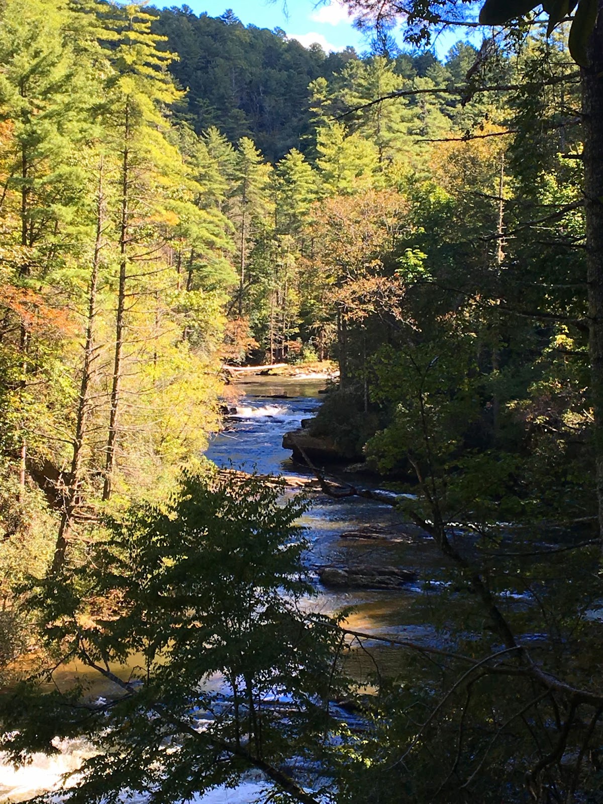
is a wide, calm river flowing over bedrock, in others it splashes noisily on
down from the Blue Ridge Mountains. In the summer the green shores shade the
cold mountain waters, while in autumn the colorful hardwoods are reflected in
the waters around lone trout fisherman. The Chattooga is a mysterious beauty
that will lure you back again and again to the most remote corner of our state.
However, with each visit you’ll discover another of the many faces of this wild
& scenic mountain river that defines the boundaries of SC as surely as the
character of the South Carolina wilderness.

No comments:
Post a Comment