Showing posts with label film. Show all posts

Monday, October 15, 2018

The Wild and Scenic Chattooga River & trail

From its headwaters southwest of Cashiers NC, the Chattooga River runs 57 miles south, emptying into Lake Tugalo. Here, the Tallulah River emerges from the Tallulah River Gorge and is held back by the Tugalo Dam before continuing south. Water, in one form or another, forms the South Carolina/Georgia border all the way from North Carolina to where the Savannah River flows into the Atlantic. However only at the very northern section of the state is the water undammed, undeveloped, untamed – this is the “crown jewel” of the southeast, the Wild & Scenic Chattooga River.


The Chattooga was the first river east of the Mississippi to be granted the designation, allowing no roads to the river or development of any kind on 39.8 miles of the river since 1974. This is a remote corner of the state, the river bisecting the Ellicott Rock Wilderness which straddles three states (Georgia, North Carolina and South Carolina) and three National Forests (the Chattahoochee, Nantahala and Sumter National Forests). The 15,432 acre protected corridor isn’t easily reached, especially as a portion of the “wild” river is closed to boats – your transportation here will be your own two feet.


One of the best ways to experience the Wild & Scenic Chattooga is by hiking the Chattooga Trail, a 15.5 mile trail that stretches from SC Highway 28 to Ellicott’s Rock and the SC border with NC and GA. This is the section of river that is closed to boats and there is only one other road that crosses the trail – the gravel Burrells Ford Road. This isn’t to say that it’s hard to hop on the trail – there are spur trails and intersections with other trails that lead to Oconee State Park, Cherry Hill campground, the Walhalla Fish Hatchery, and to Sassafras Mountain and beyond via the Foothills Trail.


We opted to park at the Ridley Fields parking area and hike north to Burrells Ford for a total of 11.8 miles. If you add in spur trails to the many waterfalls, this total approaches something more like 14 miles. Ellicott’s Rock, while only an additional 3.3 miles north, is an in-and-out hike – the closest parking in SC is at Burrells Ford – so truly to hike the entire Chattooga would be 18.4 miles, plus any spur trails bringing the total up to around 20.


From the southern trailhead, the trail immediately turns inland, climbing in altitude away from the Chattooga and skirting the slope of Reed Mountain. There is an option to stay on an old roadbed closer to the river, but we opted to follow the Chattooga Trail, shared with the Bartram Trail. In 1765-1766, John Bartram visited the Southeast as King George III-appointed Botanist Royal in America, bringing with him his son William Bartram. William returned to explore the Southeast when he was offered financial support from a friend in England, and traversed a significant portion of North Georgia, including Ellicott Rock; the Bartram Trail continues south along the Chattooga on the Georgia side of the river from Highway 28.


Three miles in the trail descends to the river and joins the old roadbed, and not long after crosses Ira Branch. There is a spur trail here, although I’m unsure where it comes out; the indication was that it’s 3.5 miles to SC Highway something, but the number was scratched out. There were multiple campsites along this stretch, with small sandy beaches and a towering white pine canopy. Just before hitting the 4 mile mark we passed Nicholson Ford, and soon we turned into the Lick Log Creek Valley.

Bottom tier of Lick Log Falls

At 4.3 miles, a spur trail leads directly down the slope to the confluence of Lick Log Creek with the Chattooga. The unofficial trail is steep, but takes you to the base of the lower tier of the two-tiered, 80 foot Lick Log Falls. Returning to the main trail and continuing on, you can catch glimpses of the upper tier of the falls through the rhododendron before emerging to a small flat at the head of the falls.

Pigpen Falls and plunge pool

Just after crossing Lick Log Creek on a wooden bridge, Pigpen Falls is off to the right. This 25-foot waterfall marks the junction with the Foothills Trail. Taking a right and heading 0.8 miles east will take you to the Nicholson Ford parking area, and we saw several people that had taken advantage of the proximity to the Chattooga to camp for the weekend.


We followed the signs to stay on the Chattooga Trail, now hiking the Foothills Trail as well. Around 9 miles into our hike we came to Big Bend, where a steep spur trail took us down to the highest single drop on the Chattooga. The water cascades over a rocky slope before being forced between massive boulders for a 15-foot drop before widening out across the bedrock once again. Once back on the trail we soon came to the intersection with Big Bend Trail, which leads to SC 107 and Cherry Hill campground.

Big Bend Falls on the Chattooga River

The final third of our hike went quickly, with frequent stops to take in the scenery from the banks of the river. Eventually we encountered a higher frequency of visitors, signaling our approach to Burrells Ford campground. Here the Foothills Trail splits off to the east (with a spur trail to King Creek Falls), while the Chattooga Trail continues along the edge of the river. A myriad of paths crisscrosses the campground, but following the green blazes takes you through the campground alongside the river, then up through the forest to Burrells Ford Road; the trailhead has room for a dozen vehicles. Another option is to park in the campground parking lot; in this case make a right on the gravel road (which is actually the historic Burrells Ford) and follow it up to the road and parking area.
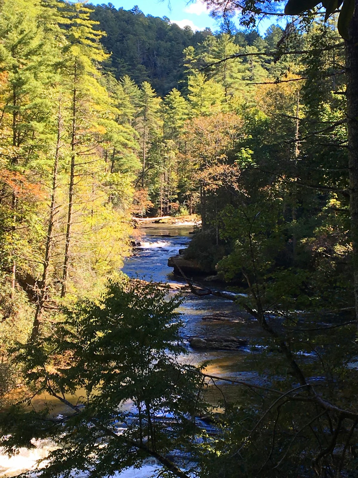

Chattooga has historically been spelled Chatooga, Chatuga, and Chautaga, and to some is known as Guinekelokee River. It gained fame as the fictional Cahulawassee River in the book and film Deliverance, but these days is much better known as a hiking, camping and fishing wonderland. A favorite of anglers due to trout released by the SC DNR, and beloved by waterfall hunters due to the number of falls on creeks that tumble down the Chattooga Ridge. In some places the river is a wide, calm river flowing over bedrock, in others it splashes noisily on down from the Blue Ridge Mountains. In the summer the green shores shade the cold mountain waters, while in autumn the colorful hardwoods are reflected in the waters around lone trout fisherman. The Chattooga is a mysterious beauty that will lure you back again and again to the most remote corner of our state. However, with each visit you’ll discover another of the many faces of this wild & scenic mountain river that defines the boundaries of SC as surely as the character of the South Carolina wilderness.

Monday, August 6, 2018

Exploring Lake Jocassee

There is no doubt that the best way to explore the 75 miles of Lake Jocassee’s shoreline is by water. The 7,500 acre lake is at the heart of the Jocassee Gorges, regarded by National Geographic as one of “50 of the World’s Last Great Places,” and the uniqueness of the area in terms of geography, plant diversity and natural beauty is second to none. The majority of land around Lake Jocassee is protected from development, a large portion being part of the Jim Timmerman Natural Resources Area at Jocassee Gorges. Meanwhile public road access is mostly restricted to Devils Fork State Park at the very south end of the lake. Public boat ramps at the Park were our means of access on a recent visit; for more on Devils Fork State Park and its trails and amenities please visit my post, Devils Fork.


Lake Jocassee is tremendously deep, up to 350’ in places. At the southeast corner of the lake you’ll find the Jocassee Hydro Station holding back all this water, standing 385 feet high and 1,750 feet long, and separating Jocassee from what eventually becomes Lake Keowee. The shoreline north of the dam is popular with boaters due to the tall cliffs rising out of the water. You’ll often see multiple pontoons anchored and swimmers enjoying the aqua waters, and the white sand beach (depending on the water level) will even have folks with barbecues and tents on sunny weekends.


Created by the state of SC in partnership with Duke Power in 1973, Jocassee is famous for its clear and cool waters, fed by rivers descending from the Appalachians. The easternmost is Horsepasture River, which flows into the northeast corner of Lake Jocassee along with Toxaway River, together forming the right ‘arm’ of the lake. Access to the wilderness to the east is complicated. Horsepasture Road winds 16 unpaved miles through the Jocassee Gorges from Rocky Bottom and the Eastatoe Gorge all the way to Lake Keowee, with a handful of smaller two-tracks (not always open to vehicle traffic) and a network of trails providing some access. However, the terrain is breathtakingly rugged, and while there are spectacular views of Lake Jocassee along Horsepasture Road (see my post on Jumping Off Rock), the only way to get down to the lake is via an arduous hike, such as on the Foothills Trail.

Laurel Fork Falls, from cove and from grotto

The large, steep valleys that surround Lake Jocassee are responsible for a large number of waterfalls, many of which are visible from the water. The crown jewel is Laurel Fork Falls, an 80 foot waterfall that is on the same river that flows over Virginia Hawkins Falls (see my post on the Laurel Fork Heritage Preserve). Although the view from the Laurel Creek cove is extraordinary, you'll have to turn the corner into the grotto behind the rocky tower to see the waterfall plunge into the lake (see photo above). Nearby you’ll find an access trail to the Foothills Trail along with multiple other waterfalls including Devils Hole Creek Falls and Mills Creek Falls. Additional popular destinations on the east arm of Jocassee include the many small islands jutting out of the turquoise waters, and a rock formation our friends call ‘jump off point’ due to the convenient access to a ledge for jumping into the lake. *PLEASE exercise extreme caution when jumping into any lake, checking depth and searching for obstructions (underwater as well as above water) as well as considering safe footing.* Navigating to the mouths of Horsepasture and Toxaway Rivers will take you into North Carolina, so make sure you’ve got your passport with if you’re headed that far…

Cliffs near the Jocassee Hydro Station

Flowing into Lake Jocassee in the northwest corner of the lake are Whitewater River and Thompson River, together forming a left ‘arm’ to Lake Jocassee. Land access to this corner of the lake is via trails from the Bad Creek Trail Access Point; the Bad Creek Hydroelectric Station on Whitewater River is a 1,065 megawatt pumped-storage facility that started generating electricity in 1991 and is owned by Duke Power. The Bad Creek site provides a trailhead for the Foothills Trail, a trail through the Coon Branch Natural Area, and a ½ mile spur trail to the Whitewater River. While there is a platform overlooking Lower Whitewater Falls off the Foothills Trail, a small waterfall on Whitewater River can be seen from Lake Jocassee (Lower Lower Whitewater Falls?) just beyond the hydro station. Further east are Wright Creek Falls and Thompson Falls, as well as multiple unnamed waterfalls that are more/less easily found depending on water flow. A map of the larger waterfalls can be found online here (please note that what is labeled ‘Unnamed Falls’ is actually located at the mouth of Bad Creek).

Waterfalls on Lake Jocassee clockwise from top left: Wright Creek Falls, Thompson River Falls (from top), Devils Hole Creek Falls and Mills Creek Falls

As you follow what used to be Whitewater River back south to the main reservoir and the Devils Fork State Park boat ramps, at some point you’ll pass over the remains of Atakulla Lodge. The structure was left standing when the valley was dammed, and preserved by the cold waters of Jocassee, the Lodge still stands under 300’ of water. Experienced divers can visit the site, as well as the Mount Carmel Baptist Church Cemetery (a setting for a scene in the film Deliverance, 1972) which is about 130 feet underwater on the lake’s south end.


Guided waterfalls tours are available, fresh water fishing charters depart from the boat ramp at the park, and boats ranging from kayaks to pontoons can be rented from various vendors in the area. Fishermen will be excited to learn that Lake Jocassee holds state records for 5 species of fish: redeye bass, smallmouth bass, spotted bass, brown trout and rainbow trout. Visitors can either stay at one of the park's villas, in the campground, or at one of the many nearby private vacation rentals. Regardless, plan a return trip to Devils Fork in the spring to view the rare Oconee Bell wildflower, and hit Bear Cove trail in the autumn for the fall foliage. However you choose to explore the Jocassee Gorges, an exploration of Lake Jocassee by boat should be on your South Carolina bucket list; nothing compares to a day spent soaking in the resplendent beauty of its pristine shores, turquoise waters and cascading waterfalls with a backdrop of breathtaking blue mountains.


Monday, April 23, 2018

Cape Hatteras National Seashore on the Outer Banks


A persnickety spring has us in shorts one day, then back to bundling up the next. It’s a cold, rainy day such as today that has me dreaming of summer beach weather, which I have no doubt will arrive and have me begging for the cooler temperatures we’re presently shuffling through. Whether it is the thought of warm sunshine and ocean surf, or because this week is National Park Week, it is Cape Hatteras National Seashore that is calling to me today; this is one of a couple more posts to wrap up the North Carolina series after which I’ll turn my attention back to the Upstate & a few more Florida adventures.


Cape Hatteras National Seashore preserves 70 miles of shoreline on the Outer Banks, from Bodie Island to Ocracoke Island. Easily accessible thanks to the Virginia Dare Memorial Bridge, the north end of the National Seashore is just across Roanoke Sound from Roanoke Island (home of Fort Raleigh) and south of the Wright Brothers National Memorial and Jockey Ridge. The Bodie Island section is home to the Whalebone Junction information station, Coquina Beach, the Oregon Inlet camping area, a marina, and the Bodie Island Lighthouse and Visitor Center.


The black and white striped lighthouse that stands on Bodie Island is familiar to many, and photographs of the photogenic icon are often found in coffee table books about lighthouses and the outer banks. Construction on a first lighthouse in this location began in 1847, but the structure was shortly abandoned after major structural issues resulted in a leaning lighthouse. A second lighthouse was destroyed two years after its construction by Confederate soldiers during the Civil War, but the third lighthouse had what it takes to survive the elements on the Outer Banks, and still shines out on the Atlantic today.


The third incarnation of the Bodie Island Light was located further inland and to the north from its predecessors, and was almost twice as tall as the previous two at 156 feet; this translates to 214 steps to the top. With a First Order Fresnel Lens the lighthouse can shine its beam 19 miles offshore. A lighthouse keepers' structure was also constructed (which today houses the ranger station and Visitor Center), and the lighthouse was operational by 1872, fully automated in 1932, and came under the care of the National Park Service in 1953. Today the lighthouse and grounds are open to visitors; for more information and hours, please visit the National Park Service website.


The Bodie Island Lighthouse is surrounded by marshes, maritime forests and small saltwater ponds, making it a popular destination for bird watching. Hundreds of migratory bird species pass through annually, due in part to the location of Pea Island Wildlife Refuge south of Bodie Island. Be sure to stop in the Fish & Wildlife Service Visitor Center on your way south.


South of the Refuge are the towns of Rodanthe, Waves and Salvo. The enormous house that was featured in the movie Nights in Rodanthe was formerly located just south of Pea Island NWR, but multiple storms and a shifting coastline resulted in the structure being condemned. Two superfans of the Richard Gere-Diane Lane tear-jerker purchased it and moved it to a safer spot in 2010, and today the Inn at Rodanthe is a vacation rental.

Inn at Rodanthe: source here

Further south is Little Kinnakeet, the Historic US Life Saving Service Station. The original station building was among the first seven constructed on the Outer Banks, and the site remained active under the U.S. Coast Guard until 1954. Continuing south you’ll reach the Hatteras Island Visitor Center and the Cape Hatteras Lighthouse; the nearby town of Buxton features numerous vacation rentals as well as campgrounds, bathhouse facilities and even an airstrip in the town of Frisco.


The last island in the series is Ocracoke. With its own Visitor Center, the Ocracoke Lighthouse and additional campgrounds, the island is a popular destination despite being only accessible by ferry. A free shuttle runs daily between Hatteras and Ocracoke; visit NC Dept. of Transportation website for more info. Southwest of Ocracoke is another National Seashore, Cape Lookout. However, travel to the mainland or Cedar Island involves a 2.5 hour toll ferry.


Portions of Cape Hatteras National Seashore are open to off-road vehicles, with ramps providing access to the beach. In other places boardwalks take visitors to the water, but regardless how you access the shore, there are 70 miles of sandy beaches to explore. Go for a hike or shelling, or just choose a spot to relax, picnic and build sand castles. The constant winds coming off the ocean provide ideal kite-flying weather, and beach fires are allowed with a free beach fire permit, allowing visitors to stay late and enjoy the starry night sky. Whether you are enjoying the beach, kayaking the sound, or climbing the Bodie Island Lighthouse, Cape Hatteras National Seashore is a highlight of an Outer Banks visit that will be sure to provide memories plenty for beach daydreams until the next visit. Happy Earth Day, and happy National Park Week!

Wednesday, April 18, 2018

The Black Lagoon and Wakulla Springs

Billed ‘strange and mysterious waters,’ a 6,000-acre sanctuary is hidden away in a quiet corner of the Florida panhandle, 30 minutes from Tallahassee and more than an hour from St. George Island. However the unique cinematic history as well as its incredible geographic features convinced us to make the trip to Wakulla Springs State Park, and we were so entranced that we are already making plans to return!

The deepest part of the spring is just beyond the buoy

The heart of the park is Wakulla springs, one of the largest and deepest in the world. The freshwater springs are a result of the unique geology created by the prehistoric seas that once covered the area; when the seas retreated they left behind sandy soils over limestone, and when water eats away at the limestone, holes develop. The result is called ‘karst,’ and the holes and tunnels (resembling Swiss cheese) are linked in an enormous underground cave system that serves as the aquifer for the region. The freshwater springs are 185 feet deep with a flow rate of 250 million gallons of water per day.


Several underwater scenes for the 1954 horror movie “Creature from the Black Lagoon” were filmed in Wakulla Springs, as well as Tarzan movies from the 1930s, “Return of the Creature,” “Night Moves” and “Airport 77.” The clear water of the deep spring along with the tropical vegetation growing along the Wakulla River (and the alligators that go with it!) make for ideal filming conditions. If you take the boat tour your guide might point out some of the spots utilized most frequently in filming.

One of the River Tour boats making the rounds

One of the boys’ favorite portions of our visit was the boat tour. When the water is clear enough, the Park offers glass-bottom boat tours over the spring itself, however on our visit rainfall (with higher nitrogen levels) and the invasive & exotic species of hydrilla and algae had teamed up to create a dark water day; on these days visibility in the basin is too low to permit the glass-bottom boats to operate. However, the 3-mile River Tour operates 365 days a year (with exceptions for extreme weather) taking visitors up the river among the giant bald cypress trees to see alligators, native birds, turtles and other wildlife up close. The morning of our visit dozens of alligators were taking advantage of the warm day to sun themselves on the banks, and a manatee was seen on its way out to the coast to feed; the gentle giants cruise the waters in the summer, and a pod has been known to winter around the springs where the water stays a constant 70° year round.

See it?

The tour guide was very knowledgeable on the flora and fauna of the park, but also the historical aspects. Archaeologists have uncovered giant Mastodon bones and evidence of inhabitants dating back more than 14,000 years in the area! A complete mastodon skeleton recovered from the spring is on display at the Museum of Florida History in Tallahassee.

Clockwise from left: white ibis, hooded mergansers, male anhinga (during breeding season flesh around the eyes turns bright emerald green), double -crested cormorants and the common gallinule

The river boat tour presented an opportunity to get up-close views (and identification) of wading birds, anhingas, grebes, ducks, and many others.  A number of species breed and raise their young in the waters of Wakulla River, and migratory species travel through from fall through spring. For boat tour pricing please see the Wakulla Springs website.

A cooter sunning itself among the cypress knees

It isn’t necessary to take the boat tour to see the spring, however. The deepest spot is adjacent to the swimming area, and a dive tower allows for viewing the spring and a two-story perch to plunge into the cool waters. The historic tower used to be four stories; I will admit jumping off the bottom level provided enough excitement for us, and swimming/jumping is at your own risk – no lifeguards are present. Also, swimming and snorkeling are limited to this designated swimming area (alligators!), and although scuba diving is allowed at some designated sinkhole areas, the Wakulla Springs are off limits.

Then and now. Historic photo source here

Another way to see the park is on the 9 miles of trail, either on foot, bicycle or horseback. The Nature Trail leads through southern hardwood and maple-cypress forests, with several state and national champion trees along the way. The entrance to the Cherokee Sink trailhead is on Hwy 61 two miles south of Hwy 267, and leads 1.4 miles to an 80 foot deep sinkhole lake. On the Riversinks Tract of the park visitors can hike the Bob Rose Trail, which follows the cave system and showcases karst features such as dry and wet sinks, swallets, and collapsed caves. On our visit we stopped at Sally Ward Spring, the reason why the area is called Wakulla SpringS, not spring; the second, 18ft deep spring is located near the park entrance and flows into the Wakulla River just downstream of its sister spring.


Placards throughout the park describe the biological, historical and other features that make Wakulla Springs so unique. It was shortly after Edward Ball purchased the property in 1931 that the Historic Wakulla Springs Lodge was built, and period furnishings include a grand piano, marble checker tables, a massive fireplace and the lodges only TV. The Spanish-Moorish style mansion (Mediterranean Revival architecture) is two stories with 27 rooms, lavished with pink and grey marble (including one of the world’s longest marble counters in the gift shop), and cypress beans and ornate hand painted ceilings grace the grand reception room. Upon Ball’s death in 1981 the property went to the State of Florida, and today the Lodge is listed on the National Register of Historic Places and is designated as a National Natural Landmark. Even if you’re not staying/dining in the lodge, plan to stop in, if only to see “Old Joe,” the 11’2” stuffed alligator that was a longtime resident of Wakulla Springs before it was illegally killed in 1966.


Visitors should definitely plan on spending the whole day at Wakulla. We utilized picnic tables for lunch, swam for several hours, toured the grounds, took the boat tour and still had multiple things we wanted to do before we left. In the immediate vicinity of the Park you’ll find other points of interest as well, including state capital Tallahassee, St. Mark’s Wildlife Refuge and the St. Mark’s Lighthouse (on the Forgotten Coast Lighthouse driving tour), the world’s smallest police station in Carrabelle (plus stop here for coffee!), and the National Forest. That evening our route would take us to a favorite spot for Apalachicola Bay oysters back on St. George Island, and the next day we would be on our way west through Apalachicola and St. Joe, to Panama City Beach.


Sunday, March 25, 2018

The “Birthplace and Deathbed of the Confederacy," Abbeville SC

Abbeville was settled by French Huguenot settlers in 1758, and together with the county was named for the French town of the same name. Officially incorporated on December 20, 1832, it was the city’s role in the Civil War that has earned it the nickname of “Birthplace and Deathbed of the Confederacy.” The meeting that prompted the state's secession from the Union took place on Nov. 22, 1860 on Secession Hill, and then five years later Jefferson Davis and his cabinet decided to dissolve the Confederacy at the Burt-Stark Mansion. The noteworthy historic district featuring these locations as well as dozens of other historic sites is just a little over an hour from Greenville and the Upstate.


The very center of Abbeville is the Court Square, quaint historic storefronts lining the greenspace that contains the monument that honors those who served in the Civil War. Beginning with the death of J. Allen on Sullivan’s Island in 1861, almost 350 Abbeville residents would lose their lives in the Civil War, close to ½ the male population of the district at this time. The monument is a replacement that was erected in 1996, 90 years after the Daughters of the Confederacy first placed a monument there. The original was replaced after the Christmas tree surrounding the marker burned in 1991, flaking off large sections of stone.


Across the street is a marker that symbolizes the remembrance of the lynching of Anthony Crawford. On October 21, 1916, a white mob lynched a black leader for refusing to sell his cottonseed to a white merchant for a lower price. The marker is located near the Abbeville County Courthouse, the 1908 Beaux Arts building which is on the National Register of Historic Places. 


Facing the square directly next to the court house is the Abbeville Opera House, whose doors first opened on October 10, 1908. The ‘Official Rural Drama State Theatre of South Carolina’ is listed on the  National Register of Historic Places, and is the only "Hemphouse" remaining in South Carolina, the 7,800 ft² stage using the same rope-pulled rigging system as when it was originally built.


The actual spot where the secession speeches were made is a little to the east of the square, near the intersection of Branch Street and Secession Avenue. The location is marked by a stone, historical markers, and the grave of an unknown Confederate soldier.


About ¼ mile northeast from Court Square is the Burt-Stark Mansion, the Greek Revival style home that is now property of the Abbeville County Historic Preservation Commission. It was in this stately mansion that Confederate President Jefferson Davis held the last council of the war of the Confederacy on May 2nd 1865. Fleeing from Richmond with the Confederacy in shambles, Davis was convinced by his generals and cabinet that Southern resources were completely exhausted and that any attempt to continue the campaign would be futile. Davis officially acknowledged the dissolution of the Confederate government.


Another site listed on the National Register of Historic Places is the Trinity Episcopal Church, the French Gothic church built in 1860. The pink hue is due to the locally made bricks (and native clay) which are beneath the exterior layer of cement, and the original bell still hangs in the tower to this day. The historic churchyard beyond contains the graves of several Confederate soldiers and one Union soldier.

McGowan-Barksdale-Bundy House

If you are touring Abbeville with children, make sure to schedule a stop at the park behind the McGowan-Barksdale-Bundy House, headquarters of the Abbeville County Historical Society. The grounds contain three servants’ cabins, two of which date back to 1857; however it is Caboose No. 5759 that draws their attention, built in August 1963 and a testament of Abbeville at a rail-crossroads. The caboose traveled through town on its way to Richmond, Atlanta, Miami, Washington DC, Baltimore and Cincinnati, and as far as Chicago IL, St. Louis MO & New Orleans LA.


Finally, film buffs should plan to drive down Magazine Street. There they'll find the white Victorian which Julia Roberts moved into in the movie Sleeping With the Enemy

404 Magazine Street, Abbeville

The area around Abbeville is home to a number of state parks, as well as the Long Cane Ranger District of Sumter National Forest. Located near the Savannah River Basin, nearby Lake Secession is owned and operated by the City of Abbeville. Abbeville is also part of the South Carolina National Heritage Corridor due to its rich heritage of textiles; the Heritage Corridor stretches from the coast near Charleston to the mountains of Oconee County. It is this combination of the historic with natural that makes Abbeville a great weekend destination from the Upstate.

Gothic Revival style servants cabin
Livery stable built in 1870s after original destroyed in fire


Friday, November 24, 2017

Disney on Ice Presents Frozen!

Mickey and Minnie Mouse are in town for Disney on Ice at the Bon Secours Wellness Arena! Tickets are on sale now for 6 shows, today Nov 24th through November 26th, and start at only $15. Shows are at 1pm and 5pm daily, and include 1.5-2 hours of Disney fun for the whole family.


Opening night was Wednesday night, and the boys and I (plus a couple of our favorite Frozen fans!) headed to Bon Secours a little early for a Tweet & Greet with Mickey himself!


Once it was time for the show to start we took our seats and were soon transported to Arendelle for the Frozen extravaganza: “Be a part of Anna’s fearless adventure to find her sister, Queen Elsa, whose icy powers have trapped the kingdom in an eternal winter. Join the hilarious snowman Olaf, rugged mountain man Kristoff and his loyal reindeer sidekick Sven as they help Anna in a race to bring back summer. Encounter Everest-like conditions and mystical trolls as you sing along to Academy Award®-winning songs like Let It Go and ultimately discover true love is the most powerful magic of all. Hosted by Mickey Mouse and Minnie Mouse, your whole family will delight in special appearances by stars from Toy Story, Finding Dory, The Lion King and the inspiring Disney Princesses. Experience magic at every turn and create memories to last a lifetime at Disney On Ice presents Frozen - the show worth melting for!”


Between the little girls and boys in the audience belting out “Let It Go,” the dazzling skating and special effects, and the wide ranging cast of Disney characters, we were enthralled from start to finish. Having been my first Disney on Ice experience, I didn’t know what to expect; now I know it isn’t just a show for little girls – it’s fun geared towards the whole family. Just “Let It Go,” and join Mickey, Minnie and Elsa for a great Disney experience at the Frozen Disney on Ice spectacular! 


For ticket and other info, please visit the Disney on Ice Frozen website.

Friday, July 28, 2017

Five on Friday: the August edition

It’s hot. With temperatures in the mid-90s for the past week, I don’t think I’m the only Upstate mom that has been spending more time indoors. While we’ve been enjoying our time at the library, The Children’s Museum of the Upstate, Summer Movie Express $1 movies and on the couch at home watching TV (shhh, don’t tell!), we’ll be making the effort to get out to cross some last things off the summer bucket list before school starts this month. Now if only we could get temperatures to drop under 90 for a week or so, that would be great.

1. The Carolina Panthers return to Spartanburg! The Panthers kicked off their training camp at Wofford College Wednesday with a kickoff party, and practice will continue through mid-August here in the Upstate. For more on what to expect, check out last year’s post, Carolina Panthers training camp. For a training camp practice schedule, please visit the official team page.


2.  Every Friday night the Roper Mountain Science Center hosts two showings of their feature show Eclipse: The Sun Revealed in the newly renovated T.C. Hooper Planetarium. Learn about the historical and cultural view of eclipses, the geometry behind them, and how to safely view one in preparation for the total solar eclipse that will take place on August 21st. Starry Nights at RMSC have never been more exciting! For more information and for tickets please visit the RMSC Starry Night website, and for a review of the show please see my post on Starry Nights. Bonus: Hooper Planetarium is air conditioned…

3. The Indie Craft Parade is coming back to Greenville for the 8th year this September, and tickets go on sale August 1st! The three-day festival celebrates handmade art, and has become one of the premier Southern craft events showcasing quality southern-made goods. Read about it here, buy tickets here.

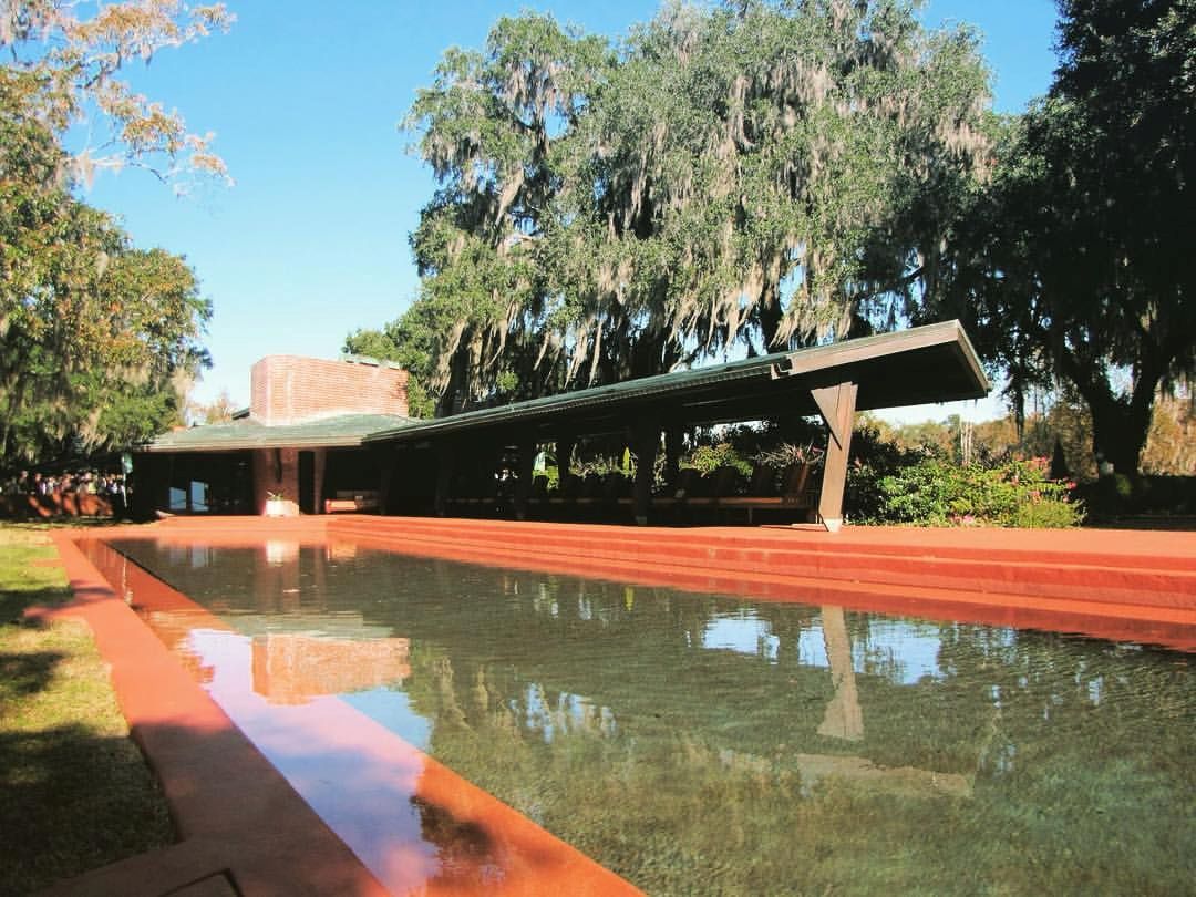
4. This next event requires a bit more of a commitment, but it is a once-in-a-lifetime opportunity to explore one of the two Frank Lloyd Wright properties in South Carolina, and his only plantation – Auldbrass. The estate is only opened to the public every other year on one weekend in November, and online ticket reservations are opening August 1st. Warning - the tickets sell out quickly! For a picture tour of Frank Lloyd Wright’s Auldbrass please visit my post on the subject, and for ticket reservations visit the Open Land Trust website.


5. A public service announcement: The $10 lifetime National Park Service senior pass for U.S. citizens age 62 or over will increase to $80 on August 28, 2017. Although still a good deal in my opinion, if you’re not already a lifetime pass holder, you might want to take advantage of the lower rate by visiting a federal recreation site before the end of the month. If you would prefer to buy online from the USGS store, or by USPS, there is an additional charge of $10 for processing the application. The passes are valid at more than 2,000 Federal recreation sites where entrance fees are charged. The National Parks centennial has passed, but our public lands need our support now more than ever!

Stay cool,
x Femme au Foyer

Related Posts Plugin for WordPress, Blogger...