Showing posts with label Georgia. Show all posts

Tuesday, April 30, 2019

The ascent of Kennesaw Mountain

At over 420,000, the population of Atlanta is more than seven times that of Greenville. Occasionally we’ll make a stop in the 'big city', such as on our recent trip to see Yayoi Kusama’s Infinity Mirrors exhibit at the High Museum of Art, other times it’s just a race to beat the traffic as we follow the brake lights through to Florida. Most recently it was a combination of both as we bounced around the perimeter to Marietta, and Kennesaw Mountain National Battlefield.


Union and Confederate forces maneuvered and fought near Kennesaw Mountain from June 19, 1864 until July 2, 1864. Today, the 2,965-acre park is managed by the National Park Service, and features a visitor center and a driving tour, as well as monuments, historical markers, cannon emplacements, and 22 miles of hiking trails. The visitor center is a great place to start your tour of the park; a short film, exhibits and knowledgeable staff will help you get oriented.

Trail to summit of Kennesaw Mountain

Although there are trails that ascend Kennesaw Mountain, we opted to take the shuttle bus to the top of the mountain. On weekends it is not possible to drive to the top; visitors have to either hike the road or trails (ranging from 1-2 miles to the mountaintop), or take the shuttle. The fee was $3/adult, $1.50/kids ages 6-12, and we felt it was well worth due to the time we saved and utilized on a couple of later hikes. From the shuttle stop near the top of the mountain there was an overlook with a panoramic view of Atlanta, and a short trail to the summit.

Atlanta, just the way I like it - from a distance

The driving tour of the battlefield includes seven major points of interest, each with parking and wayside exhibits. After descending from Kennesaw Mountain, we loaded up the car and headed on to stop #2 on the tour, the 24-Gun Battery. Located on a small, wooded rise facing Little Kennesaw and Pigeon Hill, this Federal gun emplacement is called the 24-Gun Battery because it housed four batteries, each one with six artillery pieces. From their location the Federals bombarded Confederate forces on Kennesaw Mountain for 10 days. Although it’s less than 1.5 miles from tour stop #2 to the visitor center by trail, we opted to park at stop #2 and walk in to the battery – it was less than a mile in and out. Some cannons have been positioned along the trail to assist in visualizing the emplacement.

24-Gun Battery cannons

The third point of interest is the Wallis House, dating back to about 1853 and abandoned upon the approach of Sherman’s armies. We continued on to stop #4, Pigeon Hill (where a trail leads to Confederate entrenchments where one of Sherman’s two major attacks was repelled), and then to Cheatham Hill.

View from the 'Dead Angle'

The mounds at Cheatham Hill are the remains of earthworks defended by the Confederate army; 11 miles of these defenses stretch through the park. At Cheatham Hill (tour stop #5) Confederate Gen. Benjamin F. Cheatham created an angle in their lines that due to the high casualty count came to be known as the “Dead Angle.” We hiked ¼ mile along the earthworks to the Illinois Monument, then looped around back to the parking lot, stopping to read the markers. The Illinois Monument is the largest monument on the battlefield, and near its base is a monument at the entrance of a tunnel constructed by Union soldiers intending to blow up a section of the Confederate defenses.

The Illinois Monument

Stop #6 on the driving tour is the Sherman/Thomas Headquarters where the two Union generals met to discuss the assault on Confederate Gen. William Hardee’s troops on Cheatham Hill. And finally, at stop #7 is Kolb’s Farm, where on June 22, 1864, Union soldiers repulsed Confederate General Hood’s attack. The Kolb house is not open to the public, although there is a small wayside with a placard adjacent to the Kolb family cemetery.

The Kolb Farmhouse, restored in 1964

Kennesaw Battlefield provided more than we had envisioned when we first planned our stop. Not only does it preserve a historic Civil War battleground of the Atlanta Campaign, but it interprets the events of those two years and presents it as part of the larger Civil War story. Kennesaw also provides a valuable greenspace in a what is densely populated urban area. The wildflowers and forest we saw there provided a glimpse into what the woodlands of this part of Georgia looked like hundreds of years ago.

Fire pink, found along 24-Gun Battery trail

Luckily, we were headed west, and so wouldn’t have to fight traffic once we concluded the driving tour of the battlefield. As we continued on our journey, Kennesaw Mountain shrinking in the rearview mirror, we followed the sinking sun into Alabama and another adventure. 


Wednesday, January 30, 2019

Yayoi Kusama: Infinity Mirrors in Atlanta


Just one month left to see the Yayoi Kusama: Infinity Mirrors exhibit at the High Museum of Art in Atlanta on its last stop in the US!

Yayoi Kusama: Dots Obsession-Love Transformed Into Dots, 2007

Tickets for the exhibit went on sale in September, selling out in three days. If you didn’t manage to purchase tickets, approximately 100 walk-up tickets are available at the museum daily until February 10th. Walk-up ticket sales begin 1 hour before the Museum opens (10 am Tuesday through Saturday, 12pm on Sunday), but it is advised to get there early as lines form before then.

Yayoi Kusama: Infinity Mirrored Room-Aftermath of Obliteration of Eternity, 2009

If making the trip all the way to Atlanta without a guarantee of getting tickets isn’t an option, you have yet another chance to score tickets to the highly acclaimed exhibit. High Museum reserved the final week of tickets to accommodate possible cancellations due to inclement weather, and these remaining tickets will be released for sale February 5, at 10 am online at high.org. The tickets are for specific time slots from February 11 through 17; walk-up tickets will not be sold during this week.

Yayoi Kusama: Infinity Mirrors at the High Museum of Art, Atlanta

Yayoi Kusama (Japanese, born 1929) has been described as one of the twentieth century’s most influential artists, and the Infinity Mirrors exhibit earning her the title of most-Instagrammed artist of our times. Organized by the Hirshhorn Museum and Sculpture Garden, the exhibit is a showcase of six decades of Kusama’s work, culminating with the Infinity Mirror Rooms, her iconic, kaleidoscopic environments. According to the High Museum website, the exhibition presents six of these rooms as well as sculptures, paintings, works on paper, film excerpts, archival ephemera, and additional large-scale installations that span the early 1950s to the present day.

Yayoi Kusama: Life (Repetitive Vision), 1998

If you do manage to purchase tickets, be prepared to show up early to give yourself time to park and find the museum. There is a queue in the lobby, and visitors with tickets are allowed into the exhibit at the designated time. The Infinity Mirror Rooms have separate queues, allowing visitors in 2, 3 or 4 at a time. Tip: If you don’t particularly care who you enter the room with, you may line up in the ‘singles’ line for certain rooms, which will get you in much faster than the main line.

Yayoi Kusama: Infinity Mirrored Room-The Souls of Millions of Light Years Away, 2013

Some of the rooms feature strobe lights, while others can have a dizzying effect from depth (mis)perception. You only get 20-30 second per room, so take advantage of the moment by experiencing it, instead of trying to snap photos. You can always duck in a second time for a photo or two. One room, All the Eternal Love I Have for the Pumpkins, does not allow photography. Another ‘room’ Love Forever is only for sticking your head in; in all the Infinity Mirror Rooms the viewer becomes a part of the exhibit. The final room, The Obliteration Room, allows guests to place stickers on the surfaces of the room, thereby leaving their own mark on the exhibit.

Yayoi Kusama: The Obliteration Room, 2002-present, installed 2018

If you don’t make it to Atlanta to see the exhibit, next time you’re in Raleigh stop by the North Carolina Museum of Art. Last year the museum added Yayoi Kusama’s “Light of Life" to their permanent collection, the porthole exhibit similar to Love Forever. And make sure to use #infinitekusama when tagging on Instagram…


Note: The High Museum posted a timelapse on their Facebook site of the Obliteration Room - you can see it here.

Monday, October 15, 2018

The Wild and Scenic Chattooga River & trail

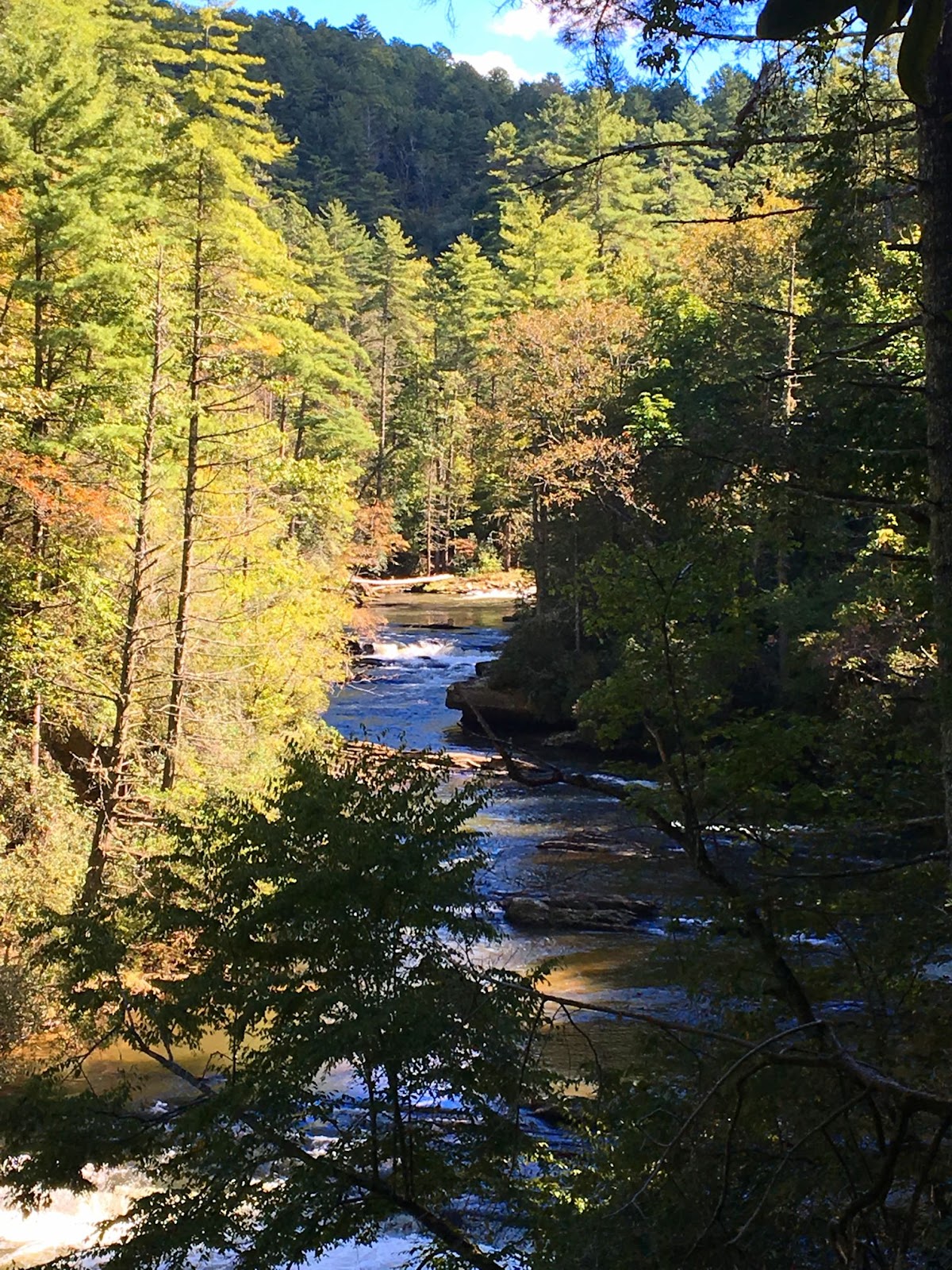
From its headwaters southwest of Cashiers NC, the Chattooga River runs 57 miles south, emptying into Lake Tugalo. Here, the Tallulah River emerges from the Tallulah River Gorge and is held back by the Tugalo Dam before continuing south. Water, in one form or another, forms the South Carolina/Georgia border all the way from North Carolina to where the Savannah River flows into the Atlantic. However only at the very northern section of the state is the water undammed, undeveloped, untamed – this is the “crown jewel” of the southeast, the Wild & Scenic Chattooga River.


The Chattooga was the first river east of the Mississippi to be granted the designation, allowing no roads to the river or development of any kind on 39.8 miles of the river since 1974. This is a remote corner of the state, the river bisecting the Ellicott Rock Wilderness which straddles three states (Georgia, North Carolina and South Carolina) and three National Forests (the Chattahoochee, Nantahala and Sumter National Forests). The 15,432 acre protected corridor isn’t easily reached, especially as a portion of the “wild” river is closed to boats – your transportation here will be your own two feet.


One of the best ways to experience the Wild & Scenic Chattooga is by hiking the Chattooga Trail, a 15.5 mile trail that stretches from SC Highway 28 to Ellicott’s Rock and the SC border with NC and GA. This is the section of river that is closed to boats and there is only one other road that crosses the trail – the gravel Burrells Ford Road. This isn’t to say that it’s hard to hop on the trail – there are spur trails and intersections with other trails that lead to Oconee State Park, Cherry Hill campground, the Walhalla Fish Hatchery, and to Sassafras Mountain and beyond via the Foothills Trail.


We opted to park at the Ridley Fields parking area and hike north to Burrells Ford for a total of 11.8 miles. If you add in spur trails to the many waterfalls, this total approaches something more like 14 miles. Ellicott’s Rock, while only an additional 3.3 miles north, is an in-and-out hike – the closest parking in SC is at Burrells Ford – so truly to hike the entire Chattooga would be 18.4 miles, plus any spur trails bringing the total up to around 20.


From the southern trailhead, the trail immediately turns inland, climbing in altitude away from the Chattooga and skirting the slope of Reed Mountain. There is an option to stay on an old roadbed closer to the river, but we opted to follow the Chattooga Trail, shared with the Bartram Trail. In 1765-1766, John Bartram visited the Southeast as King George III-appointed Botanist Royal in America, bringing with him his son William Bartram. William returned to explore the Southeast when he was offered financial support from a friend in England, and traversed a significant portion of North Georgia, including Ellicott Rock; the Bartram Trail continues south along the Chattooga on the Georgia side of the river from Highway 28.


Three miles in the trail descends to the river and joins the old roadbed, and not long after crosses Ira Branch. There is a spur trail here, although I’m unsure where it comes out; the indication was that it’s 3.5 miles to SC Highway something, but the number was scratched out. There were multiple campsites along this stretch, with small sandy beaches and a towering white pine canopy. Just before hitting the 4 mile mark we passed Nicholson Ford, and soon we turned into the Lick Log Creek Valley.

Bottom tier of Lick Log Falls

At 4.3 miles, a spur trail leads directly down the slope to the confluence of Lick Log Creek with the Chattooga. The unofficial trail is steep, but takes you to the base of the lower tier of the two-tiered, 80 foot Lick Log Falls. Returning to the main trail and continuing on, you can catch glimpses of the upper tier of the falls through the rhododendron before emerging to a small flat at the head of the falls.

Pigpen Falls and plunge pool

Just after crossing Lick Log Creek on a wooden bridge, Pigpen Falls is off to the right. This 25-foot waterfall marks the junction with the Foothills Trail. Taking a right and heading 0.8 miles east will take you to the Nicholson Ford parking area, and we saw several people that had taken advantage of the proximity to the Chattooga to camp for the weekend.


We followed the signs to stay on the Chattooga Trail, now hiking the Foothills Trail as well. Around 9 miles into our hike we came to Big Bend, where a steep spur trail took us down to the highest single drop on the Chattooga. The water cascades over a rocky slope before being forced between massive boulders for a 15-foot drop before widening out across the bedrock once again. Once back on the trail we soon came to the intersection with Big Bend Trail, which leads to SC 107 and Cherry Hill campground.

Big Bend Falls on the Chattooga River

The final third of our hike went quickly, with frequent stops to take in the scenery from the banks of the river. Eventually we encountered a higher frequency of visitors, signaling our approach to Burrells Ford campground. Here the Foothills Trail splits off to the east (with a spur trail to King Creek Falls), while the Chattooga Trail continues along the edge of the river. A myriad of paths crisscrosses the campground, but following the green blazes takes you through the campground alongside the river, then up through the forest to Burrells Ford Road; the trailhead has room for a dozen vehicles. Another option is to park in the campground parking lot; in this case make a right on the gravel road (which is actually the historic Burrells Ford) and follow it up to the road and parking area.


Chattooga has historically been spelled Chatooga, Chatuga, and Chautaga, and to some is known as Guinekelokee River. It gained fame as the fictional Cahulawassee River in the book and film Deliverance, but these days is much better known as a hiking, camping and fishing wonderland. A favorite of anglers due to trout released by the SC DNR, and beloved by waterfall hunters due to the number of falls on creeks that tumble down the Chattooga Ridge. In some places the river is a wide, calm river flowing over bedrock, in others it splashes noisily on down from the Blue Ridge Mountains. In the summer the green shores shade the cold mountain waters, while in autumn the colorful hardwoods are reflected in the waters around lone trout fisherman. The Chattooga is a mysterious beauty that will lure you back again and again to the most remote corner of our state. However, with each visit you’ll discover another of the many faces of this wild & scenic mountain river that defines the boundaries of SC as surely as the character of the South Carolina wilderness.

Friday, June 22, 2018

Līgo, līgo // Jāņi 2018

They say that on Jāņi night the animals can speak, that you must not sleep or you’ll sleep all summer. That if you go in search of the fern flower and find it, that the mošķi will not bother you all year. That the flowers and Jāņu zāles picked have magical powers. This Latvian holiday with roots in the pagan and branches in the present day awakens in each of us our connection to nature. We weave crowns of flowers and oak leaves, jump over fires with skirts held high, make pīrāgi and curd cheese with caraway seed, and sing until the sun paints the skies pink at dawn.


This year we celebrated the summer solstice with our bŗāļu tauta, the Lithuanians. The Atlanta Lithuanian-American community was kind to invite us to their Joninės / Midsummer festivities, and so we donned our linen shirts and tautiskās jostas and headed west to the forests of Georgia. Some customs we share, others were new, but the underlying connection with nature united us in our merriment.


Yesterday was the summer solstice: longest day of the year, shortest night. The lightning bugs are bringing fairy magic to our homes at dusk, the smell of rain (līst kā pa Jāņiem) and tomato plants creeping into the subconscious with memories of summers past. I weave some mint and lavender into my Jāņu vainags, then as an afterthought add some rosemary and oregano; all night the comforting smells follow me around.


We burn the crowns from the previous summer in the bonfire, watching all of our worries and fears from the last year flame up, disappear in smoke. The Lithuanians have taken their vainagi  to the shoreline, lighting a candle and letting them float away as just a few more twinkling lights in the glittering waters of the lake. We wade in, the water cool on our overheated skin, the moonlight reflecting around us as some otherworldly portal.


May your voices join the chorus of Līgo on this most enchanted of evenings. Good luck in your search for the fern flower, and strength in your leaps over the Jāņuguns. May the magic of the solstice find you all, and as you turn your gaze upwards at the dark skies of the shortest night, may the generations of līgotāji who have come before you give you strength as you face the shortening days.


Pūt, Jānīti, vara tauri
Pašā Jāņu vakarā`i,
Lai sanāca Jāņa bērni,
Lai dziedāja Jāņu dziesmas,
Lai atnesa Jāņu zāles,
Lai iedzēra Jāņu alu,
Lai uzkoda Jāņu sieru
Lai aizdedza darvas mucu,
Lai darīja vainadziņus,
Lai gaidīja Jāņu rītu,
Kad saulīte rotājās`i.

Sunday, December 10, 2017

Baltic Christmas Day 10 - The Peace Light from Bethlehem

From candle to candle, lantern to lantern, scout to scout…


For 30 years the Peace Light from Bethlehem has been spreading a message of peace and unity across the world. Every year, a Scout from Austria retrieves the light from the Grotto of the Nativity in Bethlehem, lighting a candle from the eternal flame. From there the Light travels back to Vienna, Austria under the auspices of the International Scouting Movement, and like the branches of a tree, the symbol of peace spreads through Europe during the month of December.

For 14 years the Peace Light has traveled to the Baltics, some years brought by the Ukrainian scouts, other years traveling north from Austria/Poland: Lithuania, to Latvia, to Estonia. Taikos šviesa iš Betliejaus, Betlēmes miera gaisma, Petlemmi rahu valgus; many names in different languages, but bringing the same message of peace & hope to cities, towns, communities and homes across the world.

12 year old Tobias Flachner lighting the Peace Light in Bethlehem in 2017 (source)

From Vienna, Austrian Airlines transported the Light of Peace to New York and to Toronto, arriving at JFK on November 25, 2017. After a sharing ceremony at the airport, the Light immediately started its travels across the United States; last week the Latvian Scouts in Chicago received it, and will pass it on Christmas Eve during candlelight ceremonies.

The Latvian scouts receive the Peace Light in 2014 (source)

We watched the connections travel west, then south: from Pembroke, MA  to Indianapolis with BSA Pack 105 from the Mayflower Council, Indiana to Chattanooga with Lincoln Heritage Council Troop 1, from Chattanooga to Atlanta with Troop 370 of the Atlanta Area Council…

And then, on the day after it snowed two inches here in the South (where it never snows!) I drove to Atlanta to bring the Light to Upstate SC. A red lantern was fueled and ready, and a supply of vigil candles awaited us at home.

Representative of Atlanta Area Council sharing the Light in Atlanta

Today we will have a Welcome Ceremony for the Peace Light, bringing Latvian Scouts, Boy Scouts of America, Girl Scouts and the community together in this wonderful tradition. Represented will also be Troop 553 from the Indian Waters Council in Columbia, and through them the Light will continue its travels south to Florida, hopefully making it all the way to Key West.

We are honored to have been a part of bringing the Peace Light to Greenville (and possibly the Upstate) for the first time. It wouldn’t have been possible without the help of dozens of people, from the Scouts who transported the Light hundreds of miles from JFK, to the folks who manage www.peacelight.org and the Peace Light Facebook page…. From the Scout Leaders of Troop 30 here in Greenville today, to those leaders with a vision 30 years ago… Tonight our home will be lit by the Light of Peace, and I am warmed by the knowledge that I share this Light with Lithuanian, Latvian & Estonian Scouts, my family in Chicago, and communities and homes across the world.
If you are in the US/Canada and interested in participating in this tradition, please join the Facebook group “Peace Light – North America” where distribution plans and route maps are shared, as well as event information and photos. You will find links to the UK and other World Scouting Peace Light contacts at GAZ’s website. This website includes information about safe handling of the Peace light flame and how it is distributed throughout the European Continent and History of the Peace Light “movement.”


The Peace Light is a live flame, and precautions should be taken when transporting it and keeping it. When traveling, a lantern in a stabilizing carrier is most often used, and the car windows left partly open for ventilation. At home we prefer to keep the Light with the 3-day vigil candles. They are in glass cylinders, have no odor, and burn for up to three days. Instructions on building carriers for lanterns, as well as other ideas and suggestions can be found on the Peace Light website and Facebook group.


May you have Peace and Light in your home this holiday season, and please join us tomorrow with the 24 Days of a Baltic Christmas Beginner's Guide to Galerts!

Sunday, December 4, 2016

Yet Another Baltic Christmas - Day 4 Lithuanians in ATL, the World's Busiest Airport

From Seattle to Atlanta, today during the 24 Days of a Baltic Christmas we have landed at Hartsfield-Jackson International Airport, where the Atlanta Lithuanian-American Community has decorated a Christmas tree in the International Terminal!


The Director of International Business at Hartsfield-Jackson Atlanta International Airport Ms. Arlene Barr invited the Atlanta Consular Corp (which represents 75 nations worldwide) to participate in ATL’s Winter Wonderland Celebration. Of the ten trees available to decorate throughout the International Terminal, the Lithuanian Honorary Consulate was selected to decorate one to showcase the beauty and unique qualities of the Lithuanian Christmas tradition. 


Šarunė Stankevičienė and Silvija Aniulienė joined Honorary Consul Dr. Roma Kličius to decorate the tree last week. The ornaments are all hand-made of straw (natural and plastic) by members of the Atlanta community, a portion especially crafted for this tree by Stankevičienė and Aniulienė.

Sarune adding the finishing touches

For information on events organized by the Lithuanian community in the Atlanta area please visit their website. The Atlantos Lietuviu Bendruomene / Atlanta Lithuanian-American Community is also on facebook here, with information on future events such as the December 10th Lithuanian Mass and Traditional Christmas Eve Dinner in Marietta on the events tab.


Šarunė Stankevičienė, Silvija Aniulienė and Dr. Roma Kličius, Honorary Consul of the Republic of Lithuania

Dr. Kličius writes, "We are really proud and thankful to Atlanta International Airport for the opportunity to display our Lithuanian 'business card' at the busiest airport in the world!" Thank you to Silvija Aniulienė and Dr. Kličius for their photographs and assistance with this post! Please join us tomorrow in our journery from ATL to ORD...

Monday, September 26, 2016

Minnehaha Falls

A jam-packed weekend: the natural water slide at Long Shoals Wayside Park, a hike to Bull Sluice on the Chattooga River, Anna Ruby Falls, and the highest points in two states, Sassafras Mountain and Brasstown Bald. We were taking the scenic route home from Lake Chatuge; from Unicoi State Park we headed west towards Lake Burton and Clayton, with one final stop in mind.


It was getting to be late in the afternoon when we arrived at the parking area for Minnehaha Falls, basically a wide spot in Bear Gap Rd. Only a couple of other cars were parked at the trailhead, Labor Day weekend being in full swing. We had come in past Seed Lake, and now we were parked overlooking Lake Rabun; both were filled with water skiers and boats, the air fragrant with barbecues. My guess is that had we arrived earlier, we might have seen bigger crowds at what is a popular local waterfall.


Minnehaha is named for the Dakota word for ‘waterfall’. The falls trail is managed by the Forest Service, a green diamond and #147 marking the spot off Bear Gap Road. This Georgia waterfall should not be confused with Minnehaha Falls in Minnesota, which Henry Wadsworth Longfellow made famous in “The Song of Hiawatha.” However, this is the waterfall featured in the photograph behind the desk in the Lodge at Amicalola Falls in the movie “ A Walk in the Woods” (starring Robert Redford and Nick Nolte).


We made quick work of the short trail; there and back is less than ½ mile. It starts with a wooden staircase labeled “Minnehaha” and climbs southwest along Falls Creek through a forest of rhododendron. After passing several smaller waterfalls we reached Minnehaha, a 60-foot cascade. Being the tail-end of summer, the water flow wasn’t as impressive as in some of the photographs I had seen, but the beauty of the water flowing over the sharp, geometric ridges was breathtaking, and I could have spent hours on the banks and splashing in the creek.


The boys quickly donned swimsuits and waded in. A word of warning; the rocks are slick in parts, and as always, extreme care should be exercised on, in and around all waterfalls. However the boys had a great time searching for treasure in the shallow waters beneath the falls, and with such a short hike out we stayed longer than we had intended.


This waterfall is one of my favorites in eastern Georgia, and I would love to get back in the spring when the rhododendron are in full bloom and the water is really flowing. It could possibly be combined with a trip to Tallulah Gorge, and it’s really not that far from the Chattooga and the point we had crossed into the state on Highway 76. With these thoughts in mind we headed out towards Clayton, racing daylight to make it out of the mountains and back home to Greenville.


Friday, September 23, 2016

Anna Ruby Falls

It might have been a mistake… We were stuck in traffic outside the Georgia mountain town of Helen with three impatient boys in the backseat, only to finally make it to the Anna Ruby Falls Recreation Area to find the park was at capacity – one car in for every one out. It was Labor Day weekend, and we had just come from Brasstown Bald, otherwise we would have arrived much earlier than the afternoon hour.


Once we finally made it to the ticket booth and paid our $3/person (15 and under free), it was relative smooth sailing… only the littlest of the boys had fallen asleep. We found a parking spot, packed a backpack, and set out for the trailhead, Vilis still asleep in my arms.


Although you must pass through Unicoi State Park to reach it, the site is operated by the USDA Forest Service, part of the Chattahoochee-Oconee National Forest (in the Chattooga River Ranger District). The Visitor Center has full facilities, and the 0.1-mile Lion's Eye Trail that is designed for people in wheelchairs and those with visual disabilities guides visitors right down to the bank of Smith Creek on one side. To the other is the trailhead for Anna Ruby Falls Trail, the 0.4 mile trail paved foot trail that takes you up along Smith Creek to two observation decks near the base of the falls.


Legend has it that a local Confederate soldier, Colonel John H. Nichols, found the waterfall while horseback rising in the area, and named them after his only daughter, Anna Ruby. The majestic Falls are formed by two separate creeks flowing over exposed granite, and then together to form Smith Creek: Curtis Creek falls 153 feet, York Creek falls 50. Together they continue south, forming the lake in Unicoi State Park and then emptying into the Chattahoochee in the town of Helen. The two observation platforms at the end of the trail give two different vantage points, but it was a weekend of crowds, and my boys (including Vilis who woke up once I sat down at the top of the trail) weren’t impressed. The snacks I had packed received more attention than the scenery, and so it happened that we were soon on our way down, searching for a quieter spot to enjoy the summer afternoon.


At the opposite end of the parking lot is the picnic area, located right along Smith Creek. We spread our shoes and socks out next to a picnic table and waded on in, spending the next hour searching for interesting rocks and water striders in the cool mountain stream. Compared to the crowds we had passed on the way to the falls, we only saw two other people in the picnic area; we had the river to ourselves. It was tempting to spend the rest of the afternoon in the shade of the giant poplars, but we still had one more stop to make on our way back to Greenville…


Final verdict; if you're out on a busy weekend, you're better off choosing another spot to visit as the crowds will diminish the power of the falls. If we hadn't experienced Brasstown Bald that morning I would have been terribly disappointed; is all of Georgia covered in kudzu? Luckily the afternoon was redeemed by the next spot we visited, another waterfall. Oh, one additional piece of information; the Smith Creek Foot Trail links the Anna Ruby Falls trail to Unicoi State Park. For those looking for a more challenging route to the waterfall, the 4.6-mile trail starts at the campground in Unicoi and emerges near the upper bridge across Smith Creek right next to the first observation deck. 

Related Posts Plugin for WordPress, Blogger...