The
Pinnacle Mountain fire started on November 9th last year, and in
less than a month had blackened over 10,000 acres in and around Table Rock
State Park. Although most trails in the area were closed and much of the
Upstate smoked out, the fire was finally contained with no structures lost. Historically
the Southern Appalachians burn during drought years, so fire on Pinnacle
Mountain is nothing new... it had just been a few years since such a
high-intensity burn had occurred within State Park borders, and I was curious as to state of things now that a year had passed.

We
jumped on the Blue Ridge Electric Co-op Passage of the Palmetto Trail, passing through an enormous field of boulders to reach
the section of Foothills Trail that heads up to Pinnacle Mountain. Most foot traffic comes
via the Table Rock Mountain State Park Nature Center – following Carrick Creek Nature Trail up Pinnacle Mountain Trail, or on Ridge Trail from Table Rock. From the Nature Center to the summit of Pinnacle is more than 7 miles
round-trip, coming in from Sassafras Mountain might be around 10.

From
the Foothills Trail you actually have to take a left on Pinnacle Mountain to
reach the summit (adding about ½ mile to your hike), but the 3,425 ft peak does
not have any views. Taking a right on
Pinnacle Mountain Trail would take you to Bald Knob (also about ½ mile detour) and fantastic views, but either route will add a significant climb in elevation. What’s so special
to go through all the trouble? Pinnacle Mountain is the tallest mountain
contained entirely within the state of South Carolina (Sassafras Mountain at
3,563 feet is partially in NC), and the views near the top overlook both the
Jocassee Gorges and the Mountain Bridge Wilderness Area, which remain
relatively untouched by development.

Coming
up on Pinnacle Mountain along the ridge from the south, the first signs of the fire
were scorch marks on trees, easily visible because the trail had been used as a
fire break for a short distance. The proximity to the line indicated this had
been a back-burn, meaning firefighters had intentionally used a controlled fire
to create black that acted as a fire break for the advancing flames. The low
intensity fire didn’t leave much evidence other than some partially-burned
branches and the occasional charred stump of a tree that had died long before
the fire.
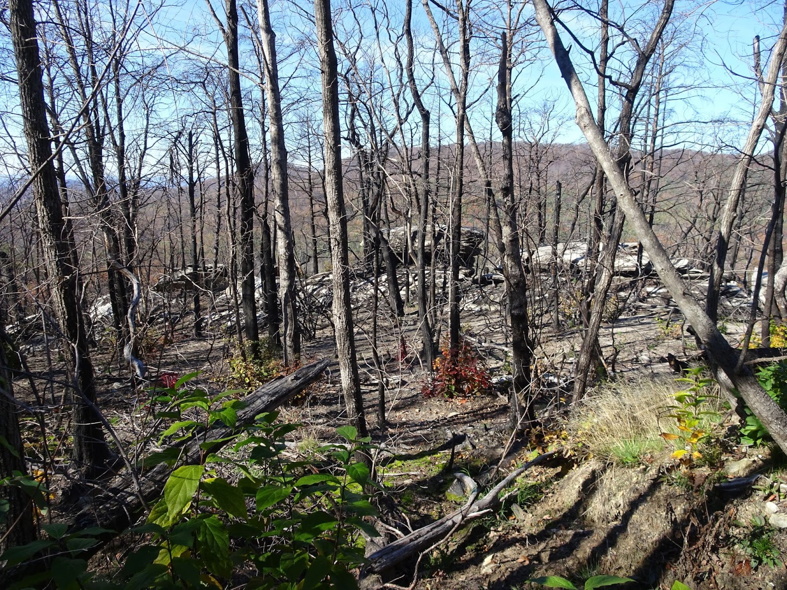
It was
once we had ascended the ridge and hiked a distance from the firelines that we saw
evidence of a higher-intensity fire. The granitic balds had white char marks
where layers of organic matter had been scorched off, and the jack pine,
although standing, were mostly dead. However, I wasn’t surprised to see the
brightly colored autumn foliage of deciduous tree seedlings – an indication
that the soil had not been sterilized. The fire simply opened up the canopy and
cleared the way for new growth.

In
addition to tree seedlings, the grasses and herbaceous plants had really taken
off. Nourished by an enriched soil and provided unimpeded access to sunlight, a
year’s worth of growth was highly encouraging, serving as a reminder that fire is
the natural order for our mountains.

Although
in some places the granitic balds had been burned clear of vegetation, in most
the moss and lichen communities were left intact, the fire naturally stopped by
the expanse of bare rock and the lower intensity back-burns not having much an
effect on the moist seep areas. We found prickly pear cactus, grasses and even an
occasional wildflower still blooming in November, and marveled at the
spectacular views which stretched from the Pinnacle Mountain summit all the way
to Lake Jocassee.

It was
on one of these granitic balds that more than 600 prehistoric petroglyphs were
discovered in the late 1990s. The petroglyphs are believed to be created by the
Hopewell culture (pre-dating the Cherokees) and are believed to be between 1,500
and 3,500 years old. What is now the Foothills Trail that follows the spine of
the escarpment from Jones Gap to Oconee State Park was once a highway that
primitive men and early European settlers used to cross the into the rich
valleys of North Carolina. I don’t find it surprising that the granite still
holds evidence of these early travelers; instead, I am astounded that the
petroglyphs were not identified sooner, as close as they are to such a
well-traveled path.

These
scars on Pinnacle Mountain – left by fire and man – remained in my thoughts on
the hike down. The fire breaks and raw earth as discordant with their
surroundings as the white char marks on the granite balds, the circular
petroglyphs as symmetrical as the dimples left on the granite by decades of
water eroding rock. We descended through the hardwoods lit ablaze, but by
sunlight and season, not flames, and I wondered at the wonder of it all. A
thick carpet of leaves crunching underfoot accompanied us as Vilis loudly sang “everything
is awesome”… and for once, I felt like
joining in. There, on Pinnacle Mountain, just 45 minutes from home – you can experience
the millennia.

No comments:
Post a Comment