Showing posts with label lakes. Show all posts

Tuesday, July 21, 2020

Your Guide to the Palmetto Trail

The Palmetto Trail is really not one trail at all; it is a network of them, stitched together from the trail systems and roads that criss-cross the state. The nearly-continuous passageway stretches from Oconee State Park in the Upstate Foothills, to its low-country terminus at Awendaw and Buck Hall on the Intracoastal Waterway. Established in 1994, it is South Carolina’s longest pedestrian & bicycle trail. Today 350 of the proposed 500 miles of trail have been completed!

By offering 26 passages ranging from 1.3 to 47 miles, with easy, moderate, and strenuous levels of difficulty, the Palmetto Trail is accessible for day trips, weekend excursions, and longer treks. The entire Palmetto Trail is open to hiking and backpacking, but designated sections are available for biking, horseback riding and camping. Whether thru-hiking, or just out for a stroll, the trail explores the rich diversity and fascinating history, culture, and geography of the Palmetto State.

The goals of the Palmetto Trail (according to the Palmetto Trail Conservancy) are to:
  • Showcase conservation and preservation from mountains to sea
  • Provide free public access to active, healthy outdoor recreation
  • Foster tourism, business, and economic development 


THE PASSAGES (from NW to SE)

Stumphouse Passage: 1.5 mile hiking trail and 9.34 mile mountain bike park
The Stumphouse Mountain Passage is the newest addition to the Palmetto Trail. It begins in Sumter National Forest at the Stumphouse Tunnel Park in Oconee County’s Walhalla. Stumphouse Mountain Tunnel is an incomplete railroad tunnel for the Blue Ridge Railroad of South Carolina, listed on the National Register of Historic Places in 1971. The park is also home to Issaqueena Falls.

Ross Mountain: 5.0 miles

The newest passage to be completed along the Palmetto Trail, this passage connects the Stumphouse Passage to Oconee State Park.

Oconee Passage: 3.2 miles

This Passage begins in Oconee State Park and ends at Oconee Station State Historical Site, a backcountry military garrison and trading post from the 1790s. Make sure to visit Station Cove Falls on the way! Intersections with the Foothills Trail and Tamassee Knob Trail allow easy access to Hidden Falls and Tamassee Knob in Oconee State Park.

A ¼ mile spur trail from the Oconee Passage leads to Station Cove Falls

Eastatoe Passage: 4.6 miles
Starting in Keowee Toxaway State Park on Natural Bridge Trail, this Passage travels along Eastatoe Creek upstream from Lake Keowee and climbs through mountain forest in the acclaimed Jocassee Gorges with its abundance of flowers, birds and wildlife. Two new bridges including the Zeke wilderness trail bridge were recently opened to the public and are destinations in themselves!

Blue Ridge Electric Co-Op Passage (Jocassee Gorges): 12.3 miles
This section of the Palmetto Trail offers a view of the remote and rugged Jocassee Gorges area, with it abundance of wildflowers and wildlife, mountaintop vistas, and waterfalls. The Passage starts in Table Rock State Park, which boasts stunning trails such as the Pinnacle Mountain, Carrick Creek and Table Rock Trails. The Foothills Trail can also be accessed from the Park.

Roundtop Mountain: 5.9 miles
Connecting the Blue Ridge Electric Co-Op Passage to the Foothills Trail and Sassafras Mountain, this section creates opportunities for circular hikes in the Jocassee Gorges wilderness in Pickens County. 

Middle Saluda Passage: 10.9 miles
With its waterfalls and challenging elevation, this passage connects about 14 miles of existing trails in the Mountain Bridge Wilderness Area of Jones Gap and Caesars Head State Parks. Highlights include Hospital Rock, Rainbow Falls, and 420-foot Raven Cliff Falls. Camp in Jones Gap State Park, or continue beyond Hospital Rock to Falls Creek Falls for an added 2½ miles. (For more on Jones Gap Falls: click here)'

Rainbow Falls, as seen from spur trail

Saluda Mountains Passage: 9.1 miles
The Saluda Mountains Passage runs along the ridge dividing the Carolinas, with the Poinsett Watershed to the south. The 19,000-acre watershed is a pristine wilderness area providing habitat for multiple rare plants and animals, including the threatened Peregrine falcon.

Poinsett Reservoir Passage: 6.6 miles
Poinsett Reservoir Passage travels the mountain ridges along the northern boundary of Poinsett Watershed. This pristine watershed of 19,000 acres contains the headwaters feeding Poinsett Reservoir of the Greenville Water System.

Blue Wall Passage: 14 miles
The Blue Wall Passage is home to a wide array of wildlife, stunning scenery including a 30-foot cascading waterfall, and 100+ species of birds. The eastern trailhead is located in the Foothills Equestrian Nature Center (FENCE), and country roads and sidewalks wind through Landrum and around lovely Lake Lanier before entering the Blue Wall Preserve and climbing the Southern Blue Ridge Escarpment to Vaughns Gap.

View of Hogback Mountain from Blue Wall Passage

Peach Country Passage: 14.1 miles
The numerous peach orchards of the region are spectacular when blooming, which is why cycling the Peach Country Passage along the back roads from Inman to Landrum brings such joy in the spring. The passage traverses mostly lightly traveled gravel roads, except for a quarter mile on the Cherokee Foothills Scenic Highway (SC Hwy 11) near Campobello.

USC Upstate Passage: 1.3 miles
This short passage begins on the campus of the University of South Carolina Upstate campus in Spartanburg, SC, and descends through the woods to Lawson’s Fork Creek.

Hub City Connector: 12 miles
The Connector includes sections of greenways, bicycle lanes, and safe, signed sidewalks through the city of Spartanburg, traveling along the Mary Black Foundation Rail Trail and through Liberty Garden, and connecting the School for the Deaf and Blind, with downtown, Converse College, Wofford College, Spartanburg Regional Heart Center, Spartanburg Medical Center, and USC Upstate. Trail spurs include Chinquapin Greenway, a 1.6-mile trail spur located at the city’s northern gateway.

Croft Passage: 12.6 miles
In the 1700s, the area that today is part of Croft State Park was a hotbed of mills, trading, and political activity centered around the shoals. There was a Revolutionary militia victory at the First Battle of Cedar Springs in 1780, and during World War II it served as an Army training center.


Glenn Springs Passage: 7 miles
Rolling farmlands, mature forests, and the historic town of Glenn Springs highlight the Glenn Springs Passage. In the 19th century, Glenn Springs was known for the health benefits of its mineral waters. Now listed in the National Register, the historic district includes 20 historic buildings from about 1840 to 1940 and the site of a popular resort hotel.

Blackstock Battlefield Passage: 4 miles
Enjoy four miles of nature trails, camping, and mountain biking along the Tyger River at the site where Revolutionary War patriots defeated the British; on November 20, 1780, patriot militia fighting under Gen. Thomas Sumter prevailed over British regulars under Lt. Col. Banastre Tarleton. Two months later Tarleton lost the Battle of Cowpens and fled north with his remaining troops.

Life on the Enoree

Enoree Passage: 36 miles
Hike or bike the 36 miles of trail through Sumter National Forest linking Newberry, Laurens and Union counties. The trail meanders through the diverse habitats located in the Enoree Ranger District and River corridor, while Macedonia, Sedalia, and John’s Creek lakes provide plenty of opportunities to fish on the way to the northern trailhead at Sedalia Campground.

Lynch’s Woods Passage: 4.9 miles
This 
Park is a well-kept secret just outside of Newberry. Created by the 1930s Civilian Conservation Corps, the park protects 276 acres of woodlands full of old-growth hardwoods and the rambling Rock Branch Creek and tributaries, and allows hiking, cycling and horseback riding. 

Newberry Passage: 11 miles
The Newberry Passage is one of three urban passages on the trail, taking you through the heart of Historic Downtown Newberry and showcasing a number of historical and cultural points of interest.

Peak to Prosperity Passage: 10.8 miles
The highlight of this section of trail is the impressive 1,100-foot-long Broad River trestle. From there the former railway follows Crims Creek west through the Dutch Fork area to Pomaria and Interstate 26. Read more about this Passage here.

Crossing the trestle bridge over the Broad River between Peak and Prosperity

Capital City Passage: 10.2 miles
The first urban passage on the Palmetto Trail features South Carolina’s largest city and seat of state government. The passage follows city sidewalks through Columbia’s neighborhoods, past city parks and schools, along the historic Horseshoe at the University of South Carolina, and across the steps of the State Capitol. The passage links Fort Jackson Passage to Riverfront Park and the Broad River.

Fort Jackson Passage: 16.2 miles
Fort Jackson Passage takes you through the heart and into the woods of this military facility located just east of Columbia, SC. Fort Jackson was established in 1917 in preparation for WWI, named in honor of Major General Andrew Jackson. At 52,000 acres, it’s the Army’s largest basic training center.

Wateree Passage: 11.4 miles
One of the most diverse sections of the Palmetto, this portion of the trail crosses swamps and hills on its way from Poinsett State Park then through the SCE&G property to Hwy 601. Passing through a section of Manchester State Forest traveling along the remnants of the old SC Railroad through Sumter Junction, it crosses over the Wateree River and Molly’s Bluff - elevation 260 feet – with excellent views across Wateree swamp.

High Hills of Santee Passage: 9.4 miles
Named for the high, sandy ridges that are part of the Sandhills geographical region, these rolling hills are the remains of an ancient ocean shoreline found in the Carolinas and Georgia. Over time, the beach sand and shells transformed into coquina, which can be seen today throughout the park. In the 1930s, the Civilian Conservation Corps used the native stone to build many structures in the park. Birdwatching includes the endangered red-cockaded woodpecker.


Lake Marion Passage: 33.6 miles
This passage skirts along the north side of Lake Marion between Santee and Mill Creek County Park. A short side trip down Fort Watson Road leads to the site of ancient Santee Indian burial mounds (3,500 years old); the site is now part of Santee National Wildlife Refuge.

Santee Passage: 12.7 miles
This passage utilizes the dirt roads and rural highways of Orangeburg County, traveling through farmlands to the town of Santee.

Eutaw Springs Passage: 21.3 miles
From the site of the Revolutionary War Battle of Eutaw Springs to downtown Eutawville, with a 5-mile spur trail that connects to Santee-Cooper Wildlife Management Refuge and Lake Marion.

Lake Moultrie Passage: 26.9 miles
Hugging the eastern and northern shores of 60,000-acre Lake Moultrie, the views make this a popular passage for mountain bikers. Following levees and service roads, the trail crosses the Santee Canal and traverses the swamps around Bulltown Bay.


Swamp Fox Passage: 47.2 miles
This passage named for Revolutionary War hero Francis Marion is the Palmetto Trail’s longest. From the swamps of Francis Marion National Forest, to long-leaf pine forests that are home to the endangered red-cockaded woodpecker, from the grassy savannas near Dog Swamp and Turkey Creek, to Wadboo Swamp; three trailheads provide users with plenty of options! Just make sure to bring plenty of water, as there is only one water source on the Swamp Fox Passage at the Ranger Station off Steed Creek Road.

Awendaw Passage: 7.1 miles
The coastal terminus of the mountains-to-sea Palmetto Trail, the Trail’s namesake trees greet users at the Buck Hall Recreation Area trailhead. Starting at the Intracoastal Waterway, the Trail meanders westward through maritime forest and offers sweeping vistas of Lowcountry salt marsh along Awendaw Creek. At Walnut Grove, look for a scenic overlook and boardwalk. A canoe launch for Awendaw Creek is located at the end of Rosa Green Road.

------------------------------------------------------------

One way to see the trail is during the Annual Palmetto Trail Challenge. Each year, Palmetto Conservation Foundation hosts The Palmetto Challenge to inspire teams of two, three, or four to hike or bike as many miles as possible between March 9 and April 26; more information can be found here.


If you want to see the state - really get out there and experience what South Carolina has to offer - the Palmetto Trail is the way to go! As Palmetto Conservation puts it: “Backcountry. Rails-to-Trail. Greenways. City sidewalks. Urban bikeways. Steps of the State Capitol. Bridle. (The trail) connects state and county parks, national forests, nature preserves, wildlife management areas, Revolutionary War battlefields, Native American paths, urban to rural, swamps to mountains, maritime to sandhills to piedmont, and much more…"

Well, what are you waiting for? You've got 350 miles to go!!!

Tuesday, February 19, 2019

Tall Pines Wildlife Management Area


Tall Pines Lake island
 
The South Carolina Department of Natural Resources on Friday announced that 1,757 acres in northern Greenville County are now open to the public as Tall Pines Wildlife Management Area (WMA). $3 million of the total of $4 million needed to preserve the site came from the South Carolina Conservation Bank, with the remainder covered by the SC DNR Heritage Land Trust Fund and timber management funds.


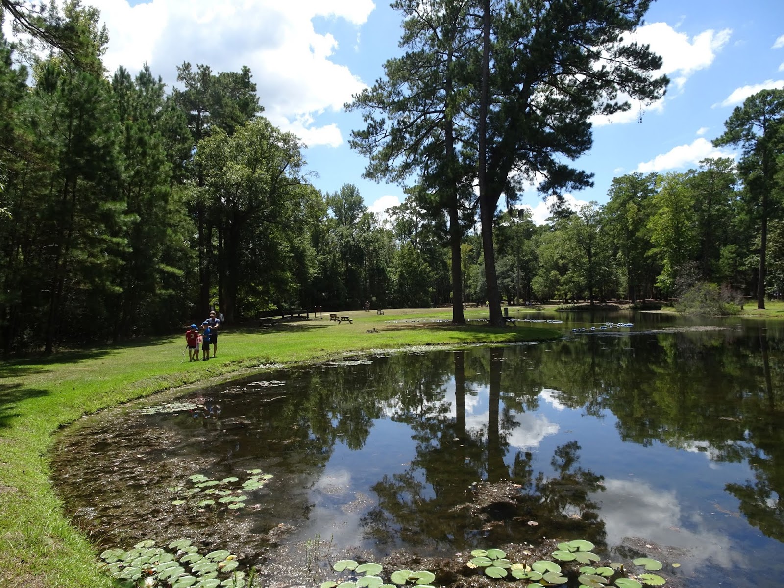
The parking area for Tall Pines WMA is located some 8 miles north of Travelers Rest at 552 Moody Bridge Road, and the gravel lot looks out over Tall Pines Lake, one of the ponds on the property. Braided footpaths along the shoreline are evidence that this is a popular spot for angling; fishing website hookandbullet reports perch, largemouth bass, rainbow trout, crappie and bullhead. In the center of the lake is a small island with a block structure; the small tower is certainly unique, though my research didn’t reveal a purpose other than aesthetic.

Tall Pines Wildlife Management Area parking

For a short ¾ mile loop hike, follow the old road behind the red gate from the corner of the parking area. It climbs a little in elevation, with a view of Table Rock to the west. Once you reach a second red gate at Moody Bridge Road, make a sharp turn and follow the old road south. You’ll hear the frogs before you see the lake, the north end being quite marshy. The road brings you to the point where two lakes connect, and from here it’s just a matter of following the narrow footpaths along the shoreline to return to the parking lot.

View of Table Rock from Tall Pines WMA

In addition to the lakes, Tall Pines also has wetlands, about 600ft of elevation change to the top of Little Mountain, and a mile of frontage on the South Saluda River. From the parking area, cross Moody Bridge Road and follow the old road west to access the river. You’ll see the ruins of a structure down on the creek, and the woods have quite a bit of evidence of past agricultural activity: wire fencing rolls, old machinery, miscellaneous debris. The road emerges to one of several meadows before taking a turn south to follow a second creek upstream. On our recent visit this area was completely flooded (and evidence of beavers abounded) – plan on getting your feet wet if you are going to hike the system of old roads that crisscross the western half of Tall Pines. Or, you can skirt the edge of the field to reach the Saluda.

South Saluda river frontage on Tall Pines WMA

The South Saluda runs parallel to Scenic Highway 11 for some 3 miles, then turns south to tumble through the Class III-IV/V rapids at Blythe Shoals. There is a Naturaland Trust River Access and Parking Area at 25 S. Blythe Shoals Road that serves this stretch of the river, although after passing through the shoals and under Talley Bridge Road the waters calm considerably. The one mile of South Saluda fronting Tall Pines runs quick and clear, high banks complicating access. In addition to the trout lilies and other native species there are plenty of privet, multiflora rose and other invasives, further tangling the banks. The tributary from Tall Pines Lakes empties into the river between the two fields, and the waters continue south, eventually passing west of Greenville and through Piedmont on their way to Lake Murray.

Looking down from Moody Bridge Rd. to creek connecting Tall Pines Lakes and South Saluda

The SC DNR has expressed hope that Twin Pines will become a destination for anglers and paddlers, as well as offering hiking, birdwatching and hunting opportunities; the WMA provides habitat for fish, deer, turkey, quail and small game. There is no formal boat launch at Twin Pines, but the road allows for easy access with canoe and kayak. And while there is no official trail system as of now, the acreage can be explored utilizing the pre-existing system of old roads. Download a map of Tall Pines Wildlife Management Area here: http://www.dnr.sc.gov/news/2019/feb/TallPinesWMAmap2019.pdf.


Wednesday, October 10, 2018

Artesian springs in Lee State Park

We are slowly crossing off State Parks on our Ultimate Outsider list, the ultimate goal to visit all 47 state parks in South Carolina, but with the intent to take our time and enjoy each park. Last month we spent a couple of nights camping at Huntington Beach SP, but needed a stop on the way there to help break up the drive. As it turns out, Lee State Park is located not too far past Columbia, just before Florence, SC – only 2.5 hours from Greenville.

Artisan well at Lee State Park

Lee State Park is one of several Civilian Conservation Corps parks in the state, built in 1935 to provide recreational opportunities for the residents of Lee County on the shores of the Lynches River. Named for Thomas Lynch, Jr., signer of the Declaration of Independence, the headwaters of Lynches are in North Carolina near Waxhaw. From Lee SP it flows southeast into the Pee Dee, which in turns empties into the Waccamaw River just west of Brookgreen Gardens and Huntington Beach State Park – it would have been perfect if we could have just floated from Lee the rest of the way to the Atlantic instead of having to finish the drive.


While the favorite thing to do in Lee State park may be kayaking and canoeing through the park’s hardwood forest floodplain, we were drawn to the ponds created by the artesian wells near the Visitor Center. The wells tap into confined aquifers, the pressure of the water seeping in pumping water out of the well. The CCC drilled seven wells at Lee in the 1930s of which five are still operational.


Definitely walk down the 0.2 mile boardwalk and observe the aquatic wildlife that thrives in the surrounding waters. We saw a snake, frogs, and an assortment of birds. 144 species of birds have been documented in the Park.


For a longer hike, head out on the 5 mile Loop Road. Open to all traffic, the loop takes you around to the equestrian campground, the equestrian trails on the north end, and then back along the Lynches River. There are additional artisan wells along the way. A group area that is located adjacent to the show ring and stables is available for horse clubs and other equestrian groups to rent. Lynches is designated a State Scenic River, and unique wildlife seen in the bottomland forests include the endangered wood stork, marsh rabbits, and fox squirrels.


If you bring a picnic, head to one of the two historic CCC shelters. Be sure to stop in at the Visitor Center and stamp your Park passport, but while there pick up some of the excellent brochures featuring everything from the flora and fauna of the park, a scavenger hunt (which the boys enjoyed), to a CCC history brochure. Quite a few of the State Parks we visit have the CCC in their history, but fewer and fewer have surviving structures with the classic Conservation Corps architecture.

CCC constructed bridge at Lee State Park

Lee also offers a variety of educational programs; for more on the hikes and crafts (such as pine needle basket workshops), check the Park website.

Wednesday, September 19, 2018

Musings on Hurricane Florence

How is everyone doing out there? Hopefully everyone is dry and the power’s on…

Just a little update from our corner of the Upstate… A little bit of wind (gusts up to 30mph), a little bit of rain (less than 2 inches). Power went out twice – once Friday, once Sunday – but Florence’s route directly over Greenville meant we were never in her northeast quadrant, and were spared the heavy rains the NE corner of the state received. You can see who got what here.

Blue skies and hot temps Friday at Chau Ram County Park

The most interesting weather actually came through on Friday, which we spent up in Oconee county in some soupy summer weather. As you can see in this video from our local Stone Academy weatherSTEM station, sunrise and sunset were crazy colorful. Add to that clouds moving in two different directions at once all day, and you have some prime sky-watching material.


The rainy weather meant curling up with a good book, and I’ve got two that merit mention here. The first, Karl, Get Out of the Garden!: Carolus Linnaeus and the Naming of Everything by Anita Sanchez is actually a children’s book, but it was read and enjoyed by 3 out of 5 household members. The beautifully-illustrated book is about scientific names and the Linnaean system (the basis for the classification system used by biologists around the world today), but backyard science is brought to life for the budding naturalist, scientist and botanist.


The second book was a completely unexpected. Despite (or maybe I should write in spite of) Florence, cookbook club persevered, and Sunday evening we gathered for a feast of hurricane proportions. This month’s book was The Cottage Kitchen: Cozy Cooking in the English Countryside by Marte Marie Forsberg. I’m not sure if it is because of the heavy Scandinavian undertones, the accessible ingredients, or the gourmet dishes requiring (surprisingly) little effort, I made a record number of recipes from this cookbook in the weeks preceding our Sunday dinner and loved every single one of them. I enjoy a cookbook divided by season, and with the high temperature/humidity days it’s no surprise I was cooking out of the ‘summer’ chapter… Tomato tarte tatin with burrata, Tomato, olive, and mozzarella baked peppers, Spinach and goat cheese frittata… Thank goodness fall is around the corner as I’ll be able to try the Potato soup with smoked salmon, then come winter I’ll repeat the Warm salmon, mint and potato salad, and Creamy fish soup with clams. However, don’t discount the ‘afternoon tea’ section – Lise’s carrot cake and Tante Marie’s coffee and fig bread among others – which is absolutely delicious. If I could suggest a Femme au Foyer cookbook of the year, this would be it. (Disclaimer, the first edition was actually published in 2017, but let’s not bandy words…)

The Cottage Kitchen's tomato tarte tatin with burrata

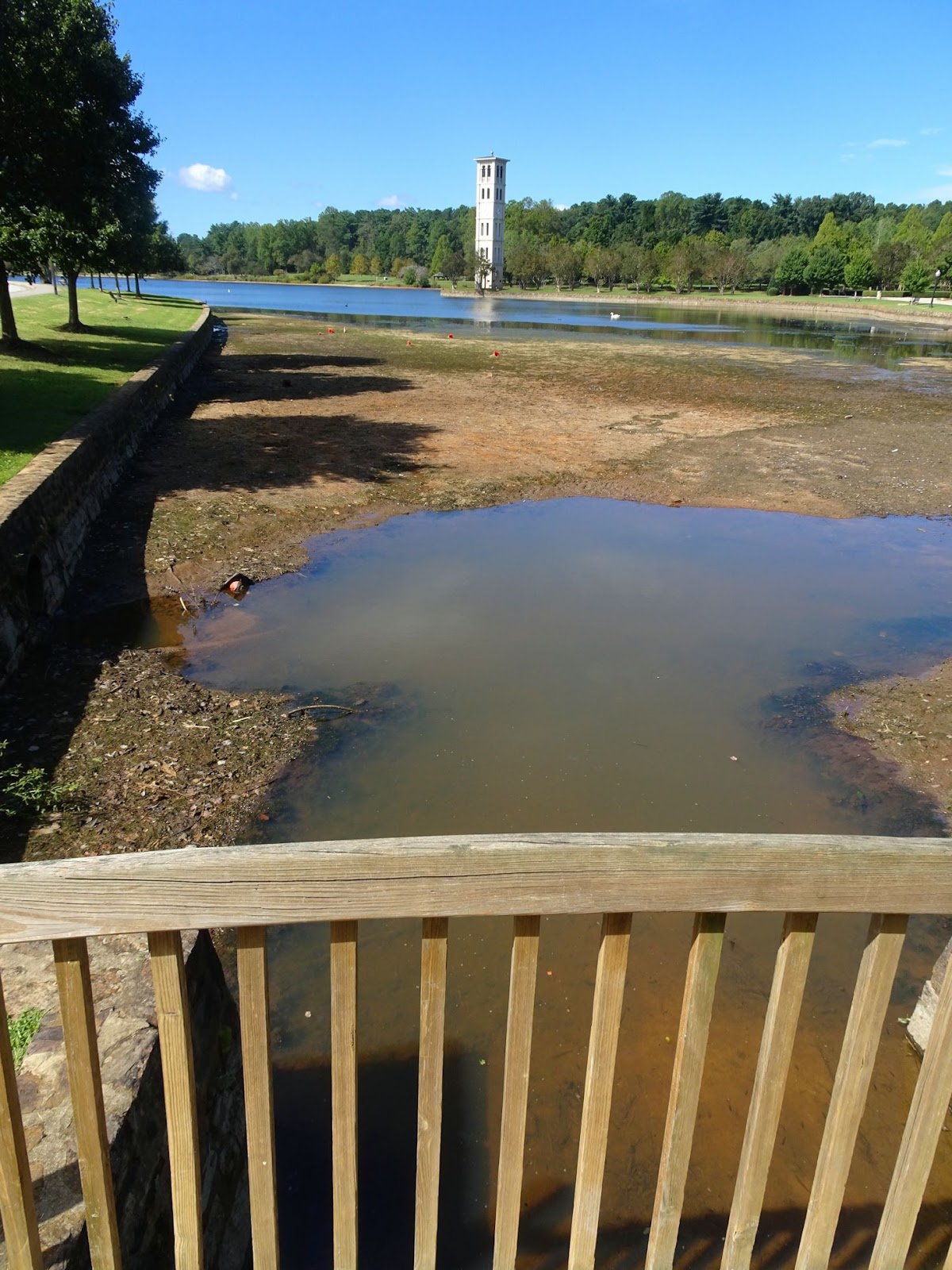
But back to Florence, what I find interesting is that despite the massive rainfall received in portions of the state, South Carolina is barely out of drought status. According to the National Integrated Drought Information System, the portion of the state that received the most rainfall in the past week was actually suffering from abnormally dry conditions just last week. Greenville County had been in a moderate drought up until June 2017, and although we’re now at ‘normal’ levels, it’s clear from the lake levels that it will take a little more to bring us back up to speed. Remember, some of the worst flooding in SC has been from rivers cresting – the same rivers that receive all the runoff water from the impervious surfaces and channeled rivers & creeks here in the Upstate.

On the 1.5 mile trail around Lake Furman - the lake level is LOW

Thinking of all those who had more than their share of this massive storm, and keeping a careful eye on the Atlantic during the next two months of hurricane season,

x your Femme au foyer

Monday, August 27, 2018

Lakeside Trail in the shadow of Table Rock

Despite the cool temperatures the last few mornings, it is still August in the South – summer is (technically) here for four more weeks, and we are taking full advantage of it!


One of the closest state parks to us here in the Upstate is Table Rock State Park, and although the 7.2 mile round-trip hike to the summit of this Upstate landmark beckoned, the August temperatures and humidity nixed that idea. The beach and Carrick Creek swimming hole were full with swimmers, so we hit the trail in search of a little solitude, opting for the 2 mile Lakeside Trail.

Purple-blazed Lakeside Trail

This easy, well-marked trail offers great views of Pinnacle Lake and the mountains in addition to a little bit of history. Just as portions of Paris Mountain StatePark, Table Rock is partially the legacy of the Civil Conservation Corps (CCC). We parked in the lot near the Nature Center, and skirted the swim area to reach the trailhead behind the boathouse. The CCC constructed a portion of the Lakeside Trail in the mid-1930s, and this first portion best showcases the accomplishments of the Depression-era work relief program: a boat landing with stone steps, the Table Rock lodge, and the dam and spillway.


We circled around the East Bay and soon approached Lodge Cove. There is a little up and down in this section, but just enough to make it interesting; I believe that bridges have been proposed to cross the small creeks flowing into the lake, but the boys preferred to rock-hop across, and stopped to look for stones in the cold mountain water. We found plenty of evidence of beavers, and more than one mushroom that required investigating.

The old boat landing on Pinnacle Lake

Soon we reached the old boat landing. Built to allow visitors to paddle from the beach area over to the lodge to have dinner, stone steps allow easy access to the trail and continue up the hillside all the way up to the lodge. The Table Rock lodge is a prime example of CCC construction: fine craftsmanship, locally sourced materials, and much thought given to orientation. It was built with granite and timber taken from local quarries/forests, and the views over the lake to Table Rock are breathtaking. The lodge can be rented for weddings and other gatherings, and the monthly "Music on the Mountain" bluegrass jam sessions brings in musicians and an audience from all over the Upstate.

Table Rock lodge, as seen from Lakeside Trail

It is on this end of the lake that the views to Table Rock open up, and strategically places benches face some of the most scenic vistas. The kids stopped to cast their lines, and we enjoyed watching a great blue heron criss-crossing the lake in search of lunch. Soon after passing the steps that lead up to the lodge, the trail comes to the south end of the lake and Pinnacle Lake dam.


The dam was built to resemble a waterfall, and there is a small parking area offering additional trail access. The trail drops down below the spillway where hikers can get a good view of the water rushing over - Green Creek and Carrick Creek on their way to Lake Oolenoy. A wide spot in the creek where the water slides over a large stone is an inviting swimming hole, although the water is cold, no matter what time of year.

Table Rock peeking over the Pinnacle Lake spillway

Once you cross the bridge, the trail winds around West Cove and turns north. This portion of the trail was completed in 2011 to make the Lakeside trail into a loop, and is more level than the first ¾ mile built by the CCC. Over the 0.8 miles that lead to the picnic shelter parking area we passed one of the cabins and several places to enjoy the view over the lake. We heard the excited shouts of the swimmers long before the beach came into view, and just like that we emerged from the forest. The walk between the two main trail heads is 0.3 miles and passes through the two parking areas and past the playground. If it’s a hot summer day I can suggest taking a swim to cool off as a finale to the hike.

The Table Rock swimming area

Completing a hiking registration card is not necessary to hike Lakeside Trail, however there is an admission fee to this portion of the Park. All the info on boat rentals, swimming, fishing, trails etc. can be found on the SC State Park website, and a YouTube video about Music on the Mountain is worth a watch. We enjoy the cool air coming down the mountain during the summer, but the spring wildflowers and autumn show of color around Table Rock are not to be missed.


* This is a great hike to take visitors to the area who might not want to attempt the long and steep trails to the summits of Table Rock and Pinnacle Mountain; make sure to stop at the Visitor Center across Highway 11 for maps and a quick briefing on the history of the area, and then relax a spell out on the porch while enjoying a spectacular view of Table Rock over Lake Oolenoy. See my guide to the Cherokee Foothills Scenic Highway 11 for plenty of other destinations along the Blue Ridge Escarpment, and this post on how to make the most of one day in the mountains with guests!

Wednesday, April 18, 2018

The Black Lagoon and Wakulla Springs

Billed ‘strange and mysterious waters,’ a 6,000-acre sanctuary is hidden away in a quiet corner of the Florida panhandle, 30 minutes from Tallahassee and more than an hour from St. George Island. However the unique cinematic history as well as its incredible geographic features convinced us to make the trip to Wakulla Springs State Park, and we were so entranced that we are already making plans to return!

The deepest part of the spring is just beyond the buoy

The heart of the park is Wakulla springs, one of the largest and deepest in the world. The freshwater springs are a result of the unique geology created by the prehistoric seas that once covered the area; when the seas retreated they left behind sandy soils over limestone, and when water eats away at the limestone, holes develop. The result is called ‘karst,’ and the holes and tunnels (resembling Swiss cheese) are linked in an enormous underground cave system that serves as the aquifer for the region. The freshwater springs are 185 feet deep with a flow rate of 250 million gallons of water per day.


Several underwater scenes for the 1954 horror movie “Creature from the Black Lagoon” were filmed in Wakulla Springs, as well as Tarzan movies from the 1930s, “Return of the Creature,” “Night Moves” and “Airport 77.” The clear water of the deep spring along with the tropical vegetation growing along the Wakulla River (and the alligators that go with it!) make for ideal filming conditions. If you take the boat tour your guide might point out some of the spots utilized most frequently in filming.

One of the River Tour boats making the rounds

One of the boys’ favorite portions of our visit was the boat tour. When the water is clear enough, the Park offers glass-bottom boat tours over the spring itself, however on our visit rainfall (with higher nitrogen levels) and the invasive & exotic species of hydrilla and algae had teamed up to create a dark water day; on these days visibility in the basin is too low to permit the glass-bottom boats to operate. However, the 3-mile River Tour operates 365 days a year (with exceptions for extreme weather) taking visitors up the river among the giant bald cypress trees to see alligators, native birds, turtles and other wildlife up close. The morning of our visit dozens of alligators were taking advantage of the warm day to sun themselves on the banks, and a manatee was seen on its way out to the coast to feed; the gentle giants cruise the waters in the summer, and a pod has been known to winter around the springs where the water stays a constant 70° year round.

See it?

The tour guide was very knowledgeable on the flora and fauna of the park, but also the historical aspects. Archaeologists have uncovered giant Mastodon bones and evidence of inhabitants dating back more than 14,000 years in the area! A complete mastodon skeleton recovered from the spring is on display at the Museum of Florida History in Tallahassee.

Clockwise from left: white ibis, hooded mergansers, male anhinga (during breeding season flesh around the eyes turns bright emerald green), double -crested cormorants and the common gallinule

The river boat tour presented an opportunity to get up-close views (and identification) of wading birds, anhingas, grebes, ducks, and many others.  A number of species breed and raise their young in the waters of Wakulla River, and migratory species travel through from fall through spring. For boat tour pricing please see the Wakulla Springs website.

A cooter sunning itself among the cypress knees

It isn’t necessary to take the boat tour to see the spring, however. The deepest spot is adjacent to the swimming area, and a dive tower allows for viewing the spring and a two-story perch to plunge into the cool waters. The historic tower used to be four stories; I will admit jumping off the bottom level provided enough excitement for us, and swimming/jumping is at your own risk – no lifeguards are present. Also, swimming and snorkeling are limited to this designated swimming area (alligators!), and although scuba diving is allowed at some designated sinkhole areas, the Wakulla Springs are off limits.

Then and now. Historic photo source here

Another way to see the park is on the 9 miles of trail, either on foot, bicycle or horseback. The Nature Trail leads through southern hardwood and maple-cypress forests, with several state and national champion trees along the way. The entrance to the Cherokee Sink trailhead is on Hwy 61 two miles south of Hwy 267, and leads 1.4 miles to an 80 foot deep sinkhole lake. On the Riversinks Tract of the park visitors can hike the Bob Rose Trail, which follows the cave system and showcases karst features such as dry and wet sinks, swallets, and collapsed caves. On our visit we stopped at Sally Ward Spring, the reason why the area is called Wakulla SpringS, not spring; the second, 18ft deep spring is located near the park entrance and flows into the Wakulla River just downstream of its sister spring.


Placards throughout the park describe the biological, historical and other features that make Wakulla Springs so unique. It was shortly after Edward Ball purchased the property in 1931 that the Historic Wakulla Springs Lodge was built, and period furnishings include a grand piano, marble checker tables, a massive fireplace and the lodges only TV. The Spanish-Moorish style mansion (Mediterranean Revival architecture) is two stories with 27 rooms, lavished with pink and grey marble (including one of the world’s longest marble counters in the gift shop), and cypress beans and ornate hand painted ceilings grace the grand reception room. Upon Ball’s death in 1981 the property went to the State of Florida, and today the Lodge is listed on the National Register of Historic Places and is designated as a National Natural Landmark. Even if you’re not staying/dining in the lodge, plan to stop in, if only to see “Old Joe,” the 11’2” stuffed alligator that was a longtime resident of Wakulla Springs before it was illegally killed in 1966.


Visitors should definitely plan on spending the whole day at Wakulla. We utilized picnic tables for lunch, swam for several hours, toured the grounds, took the boat tour and still had multiple things we wanted to do before we left. In the immediate vicinity of the Park you’ll find other points of interest as well, including state capital Tallahassee, St. Mark’s Wildlife Refuge and the St. Mark’s Lighthouse (on the Forgotten Coast Lighthouse driving tour), the world’s smallest police station in Carrabelle (plus stop here for coffee!), and the National Forest. That evening our route would take us to a favorite spot for Apalachicola Bay oysters back on St. George Island, and the next day we would be on our way west through Apalachicola and St. Joe, to Panama City Beach.


Related Posts Plugin for WordPress, Blogger...