Showing posts with label forestry. Show all posts

Monday, December 1, 2025

Trolls: A Field Study at the NC Arboretum

From the Field Study guide: "Not long ago, we trolls were baffled by little humans - zipping around in metal beasts, scrolling on your pocket stars. But then we saw how your eyes still light up when you see a handsome snail or a beautiful leaf, and we thought... maybe you're not so strange after all! So we've come to study you further, and see if we can find some wild treasure together (much better than shiny coins). You in?"

The North Carolina Arboretum and Explore Asheville are celebrating the arrival of Trolls: A Field Study, which made its North American debut on November 10, 2025 at the Arboretum. Produced by Imagine in collaboration with Danish artist Thomas Dambo, twelve friendly troll sculptures are scattered throughout the Arboretum in a scavenger hunt of epic proportions!

We previously explored one of Dambo's troll exhibits at the Morton Arboretum in Illinois and were so excited to have another chance to see one of his art installations!

The sculptures range from seven to nine feet tall, and are crafted from wooden materials like fallen branches, pallets and twigs. They are created to be interactive, and my kids had so much fun crawling into nets for photo ops, taking up-close looks at the materials used, and learning each troll’s name and story!

"On the night he was born, a little troll named Taks wandered into the human world. What he saw left him puzzled—strange machines, noisy boxes, people rushing around without stopping to talk to the trees. When he returned to the forest, he shared his discoveries with his eleven siblings - and so it started: Trolls: A Field Study!

Make sure to get the map from the education center, it has activities corresponding to each site for the kids to complete, as well as providing a checklist of sorts, so that you can locate all 12 trolls without too much backtracking.

Admission to Trolls: A Field Study is included in the standard Arboretum parking fee, and no advance tickets are required. However, be aware that on weekends you may encounter crowds and a longer wait to enter the Arboretum and should plan accordingly.

The exhibit is at the NC Arboretum from November 15, 2025 through February 17, 2026. As Winter Lights is also currently running at the Arboretum, daily hours have been shortened to 8am to 5pm, with last admission at 4pm. After the holidays normal business hours will resume: 8am to 7pm starting January 5, 2026. A Winter Lights/Daytime combo ticket is available, but those ticket holders must also exit at 5:00 p.m. and return at the entry time listed on their Winter Lights ticket.


While you’re at the Arboretum, make sure to check out the children’s exhibit Snow: Tiny Crystals, Global Impact in the Baker Exhibit Hall, which runs through January 4, 2026. Visitors can peek inside the snowpack to find animals that make their homes in the snow, walk through a snowstorm, or even build a snowman! The outdoor “Playing Woods” area is always a hit with our family; we plan for snack time and a rest there. The NC Arboretum is also a participant in the ecoEXPLORE citizen science program and the Kids in Parks TRACKTrail program, both of which make a visit even more immersive.

Location: NC Arboretum, 20 Frederick Law Olmsted Way, Asheville, NC 28806

Admission: Free, but there is a parking fee for non-members ($20 for standard vehicle)

Hours: 8 a.m. – 5 p.m., with the last entry at 4 p.m.

Exhibit runs from November 15, 2025 through February 17, 2026

Website: Trolls: A Field Study - The North Carolina Arboretum

This article first appeared on Kidding Around Greenville as Trolls Take Over the Arboretum: A New Family Experience.

The article Hunting for trolls at the Morton Arboretum, on the topic of Dambo's "Hunting for Trolls" exhibit can be found here.


Monday, October 1, 2018

Cedar Rock Mountain of DuPont

I see them on my Instagram feed constantly – the gorgeous shots taken from atop the world in spots like Max Patch, Clingmans Dome, Graveyard Fields, Sam’s Knob. What many of these places have in common is that they are mountain summits/crests covered primarily by thick vegetation of native grasses or shrubs (instead of forest growth), providing the Insta-worthy views. Known as balds, these scenic peaks occur at high elevations in the Appalachian Mountains in places where the climate is too warm to support an alpine zone (where trees can’t grow due to short or non-existent growing seasons), but instead are a result of heavy drainage or highly acidic soils, which complicate the growth of trees.


However, the balds of the Nantahalas, Great Smoky Mountains and Blue Ridge Mountains are more than a couple hours’ drive from Greenville, and so are out of range for a casual day trip. Not so for another type of ‘bald’ that is more common in South Carolina – the granite outcrop. One of the most familiar is Bald Rock Heritage Preserve, a complex of granite outcrops with a view of the Upstate including Paris Mountain and Greenville. Another spot is Glassy Mountain in Pickens, with multiple exposed-rock areas along the 1.5 mile trail.


The “flat-rock granite outcrops” are composed of unbroken granite and granite-gneisses, and are implaced within Precambrian metamorphic rocks which are scattered on the eastern side of the Appalachian Mountains. These formations have been exposed due to the combination of uplift and erosion, and provide unobstructed, scenic views due to lack of trees – trees don’t grow on rock. Just over an hour from Greenville in the DuPont State Forest is an area with some of the most exposed granite in the region – Cedar Rock Mountain. Rising only 200′ feet above the surrounding plateau, hundreds of acres alternate between bare and moss/lichen covered rock.


The moderate, 2-mile round-trip hike to the summit of Cedar Rock Mountain on Big Rock trail rewards visitors with far-ranging views west, as well as a look at some of the interesting plant communities that call the granite outcrop home. A reminder to visitors to please stay off moss; the lichens, moss and other plants that eke out their existence on the bare rock are ultra-sensitive to human traffic.


To reach Cedar Rock Mountain, park at the Corn Mill Shoals Access Area of DuPont Forest and proceed on Corm Mill Shoals Trail on the east side of the road. Keep going past Longside Trail, and then take a left on Big Rock Trail. The trail heads steadily upward, crossing a small granite clearing and then emerging onto a large granite dome that looks over the Pisgahs. The view here is fantastic, but keep going up to the summit and through a forested segment to reach another granite area that is used as a helispot by the Forest Service. The coloring of the granite is fascinating, with Here is the intersection with Cedar Rock Trail, which forms a loop when combined with a section of Little River Trail (altogether about 4 miles from Corm Mill Shoals Access).


Peak fall color for DuPont and area is forecast to be mid-October until late October by Appalachian State University and the Smoky Mountains Fall Foliage Prediction Map. While the foliage will not be as brightly hued as further north on the Blue Ridge Parkway (due to the high percentage of softwoods interspersed with the hardwoods), the views of the Pisgah Mountains are dramatic nonetheless, making this a perfect fall hike within easy driving distance of the Upstate.


For my post on DuPont’s waterfalls, please see my post here. A map of DuPont State Recreational Forest can be found here for download, although for extensive hiking/biking/riding I would suggest picking up one of the waterproof/tear-proof topo maps from the DuPont Visitor Centers or Amazon.com.


Friday, August 17, 2018

Our favorite Children's Garden - Morton Arboretum

Our visit to the Morton Arboretum to see the Troll Hunt art installation included some time spent in the Children’s Garden, the award-winning, 4-acre, interactive, educational, and super-fun garden. Filled with numerous different areas of exploration, the Children’s Garden is the most fantastic nature-themed play area I have ever had the chance to explore!


The Children’s Garden has two main areas: Backyard Discovery Gardens and Adventure Woods. The two are linked by a Central Plaza, and have ten smaller, themed gardens within. Engaging and interactive activities abound throughout, and just outside the Children’s Garden is an additional Maze Garden, a one-acre puzzle of hedges, complete with lookout tower.


“At The Morton Arboretum, imagination lives, curiosity grows, and kids flourish in the Children’s Garden. Splash through secret streams, climb colossal acorns, and slide down giant tree roots all day long. Explore, learn, and play among trees and the natural world.”

Leaf Station at the Morton Arboretum Children's Garden

Upon entering, stroll the Kids' Tree Walk and Tree Finder Grove, and spin the one-ton kugel ball in the Central Plaza.


Then head into the Adventure Woods portion of the garden. There you'll encounter Wonder Pond, Under the Trees, Grotto and Secret Stream, Grassy Meadow, and Evergreen Walk and Lookout.


The kids spent more than an hour playing in the stream, building dams and waterfalls. The Lookout was another favorite spot, complete with hanging bridges and multiple vantage points to the Children's Garden, seemingly located far up in the tree canopy. 


The tadpoles that hatch each spring in Wonder Pond are American Toads. This is a natural occurrence, but if you asked the kids, each glimpse of a tadpole was a magical happening! Bring a dry change of clothes if being dry is important to you, otherwise keep playing and the kids will be dry by the time they get in the car... unless they find the stream!


Next, in the Backyard Discovery Gardens area: Curiosity Garden, Bloom, Zoom, & Sprout, Every Which Way, and the Windmill Garden. The Every Which Way Garden allowed the moms to sit down and rest for a bit, while the kids played among tree 'roots', examined live pollinators in the monarch waystation, and learned how it feels to be a plant being watered in the giant mister - yes, you'll have to give them another hour to dry out again!


The Children’s Garden hours vary by season; please visit their website for more information. Children under 16 must be accompanied by an adult while visiting the Children's Garden, and there is an employee stationed at the entrance to help monitor that kids don’t leave the garden without their parents.


In addition to the Maze Garden, there are two other nature play spaces on our grounds: Mud Kitchen and Word Garden. Visitors to the Arboretum through the end of 2018 can also participate in the Troll Hunt; see my post Hunting for Trolls at the Morton Arboretum.


Wednesday, August 15, 2018

Hunting for trolls at the Morton Arboretum

My last visit to the Morton Arboretum was a lifetime ago, but when I heard about the new art installation “Troll Hunt,” I knew we would be making the trek to Lisle during our sojourn in the Midwest. What more appropriate way to become reacquainted with the arboretum and hunt for trolls, than with best friends from my days in the UIUC forestry program? Of course a relaxing day strolling the paths of this Chicagoland institution wasn’t in the books – we hit the trails with three moms and eight kids, severely outnumbered but in for a fantastic adventure.

Meet Little Arturs!

The six trolls and one troll hideout is the work of Danish artist Thomas Dambo, and are crafted entirely from reclaimed wood and natural materials. The 15 to 30 foot tall sculptures serve as protectors of our environment: “The trolls share the Arboretum's desire to care for trees; however, they seem suspicious of humans. We need you to join the investigation and help trolls and humans come to understand each other. What will you discover when you join the hunt?”

Sneaky Socks Alexa had a 'human trap' set up, and was lying in wait to set it off...

“Troll Hunt” first opened in the spring of 2018, and will be on exhibit through 2018 and possibly into 2019. Bearing a resemblance to the trolls of European folklore, the enormous statues were a huge hit with the kids; we spent all day at the arboretum, split between troll hunting and the Children’s Garden.

Rocky Bardur is right off the parking lot - seems like someone parked a little too close!

Step one: Pick up the Troll Hunter's Handbook when you arrive. The trolls are located between two feet and ¾ of a mile from the nearest parking lot, spread over the Arboretum’s 1,700 acres; to see all the trolls, the total hiking distance is six to seven miles. A Morton map and the Handbook will help you find a logical route to visit the trolls, as well as provide prompts to find a clue for each troll; this will allow you to locate the Troll's ‘secret hideout,’ the seventh part of the installation. We opted to visit a few of the closer trolls by foot, and then drive to the remaining sites; see this link for info on accessibility and closest parking lots. You can also rent bicycles (or bring your own), as well as buy tickets to the troll tram; the 1½ hour tour takes you to 4 trolls with less than ½ mile walk at each.

The Troll Hideout

Step two: Try not to spend all day at the Troll Hideout! Once you’ve found all the trolls and filled in the blanks in the Troll Hunter’s Handbook, put your heads together to figure out where the hideout is located. It’s a short hike in but worth every step! There is a giant tepee structure for troll strategy sessions, and everything from a giant-sized mancala game board with pine cone pieces, to a troll-size toothbrush and other troll essentials! The kids took turns posing in the cauldron, banging the giant drum, cooping one another up in the human-size trap, and holding conferences in ‘troll court’. I spent my time admiring the imagination and craftsmanship behind every little detail of the hideout, photographing the shadows created by the tepee, and covering my ears whenever someone found the drum!


FYI: Morton Aroboretum has a Reciprocal Admissions Program with Hatcher Woodland Gardens in Spartanburg and the South Carolina Botanical Gardens, as well as the North Carolina Arboretum – please visit the website for more details. http://ahsgardening.org/gardening-programs/rap/find/statebystate Or, visit on a Wednesday for $5 off an adult ticket.


Troll Hunt, a Fairy Tale

Wednesday, June 27, 2018

Gulf Islands: Naval Live Oaks

What started as a blog to keep family and friends abreast of our adventures whilst living in France has evolved into something completely different: a travel journal, a photo album of three boys growing up, a diary of a mother who can’t bear to lose the adventurous sense of self that sustained her in her 20s… And, somewhere along the way I have written and published 999 posts, the French entries now buried in a sea of southeast US with a smattering of Baltic Christmas articles arriving every December.

For the topic of my 1,000th post it seems only fitting to write about the live oak – also long-lived, southern, and dense! The massive shade tree is the stuff of romance novels, historical fiction, ghost stories, mysteries and many a southern author’s work, as it conjures up images of Spanish moss-draped branches and tree-lined alleys leading to grand estates and plantation homes. A little known fact about this magnificent tree is that the rot-resistant wood and arching branches were ideal for building ships. However, over 2,000 live oaks might be used to build one hull, and so to provide wood for naval shipbuilding, President John Quincy Adams designated the first federal tree farm in 1828.


President Adams called the U.S. Navy “Wooden Walls,” and considered the Navy the 1st line of defense against foreign invasion. The high concentration of military installations in the Florida panhandle testifies to the history of military presence in the area, and it comes as no surprise that the first tree farm was established in the heart of live oak territory, near Pensacola, FL. Although short-lived as a supplier of wood, the Naval Live Oaks Area is today a part of the Gulf Islands National Seashore, and preserves 1,400 acres for visitors to enjoy.


The entrance to the parking area adjacent to Park Headquarters, visitor center and facilities is easily passed, located on a stretch of Highway 98 on a peninsula that lies between two bays; to the south is a barrier island and Pensacola Beach, to the north Pensacola Bay and Pensacola itself. Hidden behind a screen of pines and live oaks, the visitor center is a wealth of information and a great primer for your visit to the Gulf Islands Seashore. However, shortcomings such as separate restroom facilities (visitors and the volunteers manning the center must walk 1/3 mile through the parking area to reach the bathroom) and poor signage guarantee that most tourists will pass on by on their way to one of the other Gulf Islands districts.

The interpretive signs on the boardwalk trail have information in braille

From the Visitor Center it is an easy stroll on the Brackenridge Nature Trail, with markers identifying plants and describing the steps of shipbuilding from locating and felling the trunks and branches, to construction of the ship itself. A portion of the trail is wheelchair accessible, and the figure 8 path has an observation deck at the far end overlooking Santa Rosa Sound.


A second parking area and a network of trails connects to Butcherpen Cove on the north side of the pensinsula (popular for swimming), as well as to Brown’s Pond and an old borrow pit which provided sand for the construction of US Hwy 98. Picnic areas, a pavilion, beach areas, and youth group camping area are the only other amenities, however the trail system does explore the native plant communities, proving Naval Live Oaks to be a worthwhile stop on your exploration of the Pensacola area.


Finally, a few fun facts for the history buff:
The USS Constitution (the US Navy’s oldest commissioned war vessel) is nicknamed “Old Ironsides” because cannon balls bounced off its oak hull in a battle during the War of 1812. Although the ship was originally constructed with live oak from GA, timber from the Pensacola area was utilized for the 1929 restoration.
* President Adam’s successor (President Andrew Jackson) closed the tree farm in a political squabble after taking office. However, the emergence of ironclad ships in the Civil War marked the end of wooden ocean-going vessels regardless of political manuevering. 
* Naval Live Oaks was added to the U.S. National Register of Historic Places on September 28, 1998.

Friday, April 13, 2018

The dunes of Jockey's Ridge

The wind coming off the Atlantic Ocean has played a primary role in the history of the Outer Banks. It provided the Wright Brothers with needed lift at the Kill Devil Hills site of first flight, yet it also blows in hurricanes and storms so powerful that some theorize might have been a factor in the disappearance of English Colony on nearby Roanoke Island. Whether this is fact or fiction, what we do know is that the barrier islands have been shaped – physically and historically – by these winds, and nowhere is this more evident than at Jockey’s Ridge State Park.


Jockey's Ridge is the tallest active sand dune system in the Eastern United States, the shifting winds constantly reshaping the dunes. Nags Head Woods and Jockey's Ridge were designated a National Natural Landmark in 1974 by the National Park Service. Today, the park is a favorite spot for flying kites, sandboarding (with permit), hang-gliding (through vendor) and watching sunsets, and the trails and visitor center provide insight into the history and ecology of this unique region.


You’ll want to start your visit at the visitor center & museum. After exploring the exhibits and picking up maps, take some water and sunscreen and head out onto the dunes on the 360ft boardwalk. From a viewing platform you can get a good perspective of the expansive sands of the park’s 420 acres before heading off into the dunes.


Jockey's Ridge encompasses three distinct ecological environments: dunes, maritime thicket, and the Roanoke Sound estuary. We explored the dunes first, and although for every two steps you take up the dune it’s one step back, don’t let that discourage you from climbing to the top of the biggest dune. There you’ll have a view of sand, surf, and sea - from the Sound all the way to the ocean. The park’s dunes consist of three peaks, and due to the constantly shifting sand, plants and animals do not live there. Around the base of the dunes you’ll find grasses and plants, providing habitat for small animals and insects. Don’t forget to bring shoes (the sand gets hot!), sunscreen, your sunglasses, water bottles, and a kite!


For a closer look at Roanoke Sound head out on the 1.5 mile Tracks in the Sand trail. The trail starts off with a short section through a forest of shrubs. The maritime thicket grows best in areas protected by the dune, which provides protection from wind and salt blown off the ocean. The live oaks, persimmons, red cedar, wax myrtle, bayberry, sweet gum, red oaks and pines are stunted by the effects of the wind and salt, causing them to look like shrubs. Fox, deer and raccoons live in the thickets, but you’re more likely to spot birds and a variety of insects.


The trail crosses a wide section of dune before reentering the forest, and eventually loops for a section along Roanoke Sound. At the shoreline, there is an area of restored marsh where nesting ospreys visit during the summer months, and the views of the dunes and sound are magnificent no matter the season. The trail is a Kids in Parks TRACK Trail, and brochures are available at the trailhead or inside the visitor center. A section of the North Carolina Mountains-to-sea trail is also located within the park.


The Sound-side of the park offers a completely different experience: sunbathing, wading, paddling and the 1-mile Soundside Nature Trail that tours the wetlands, grassy dunes and maritime thickets of the southern corner of the park. The Roanoke Sound Estuary is a rich habitat for a variety of plant, animal and bird life; the sound provides nesting areas for waterfowl, serves as a fish nursery, and is home to the blue crab. Windsurfers and kiteboarders are a common sight, and the sun setting over the sound often brings a crowd.

Events such as this lights on kites festival are a regular occurrance at the park

Legend says the park was named as a result of the early inhabitant’s practice of capturing wild ponies and racing them on the flat surface at the base of the dune, while the steep sides of the ridge served as a grandstand of sorts for spectators. Horses are no longer free to run on this portion of the Outer Banks - you’ll have to head north of Corolla to see the remaining population of wild Spanish mustangs. However, there’s still plenty of motion to be seen from a perch on the ridge: the dunes endlessly shifting, boats on the water, kites in the air… Jockey’s Ridge truly is alive, and a must-see for visitors on the Outer Banks.

Wednesday, November 8, 2017

Pilot Rock on the Blue Ridge Parkway

Morning view from Chestnut Cove overlook

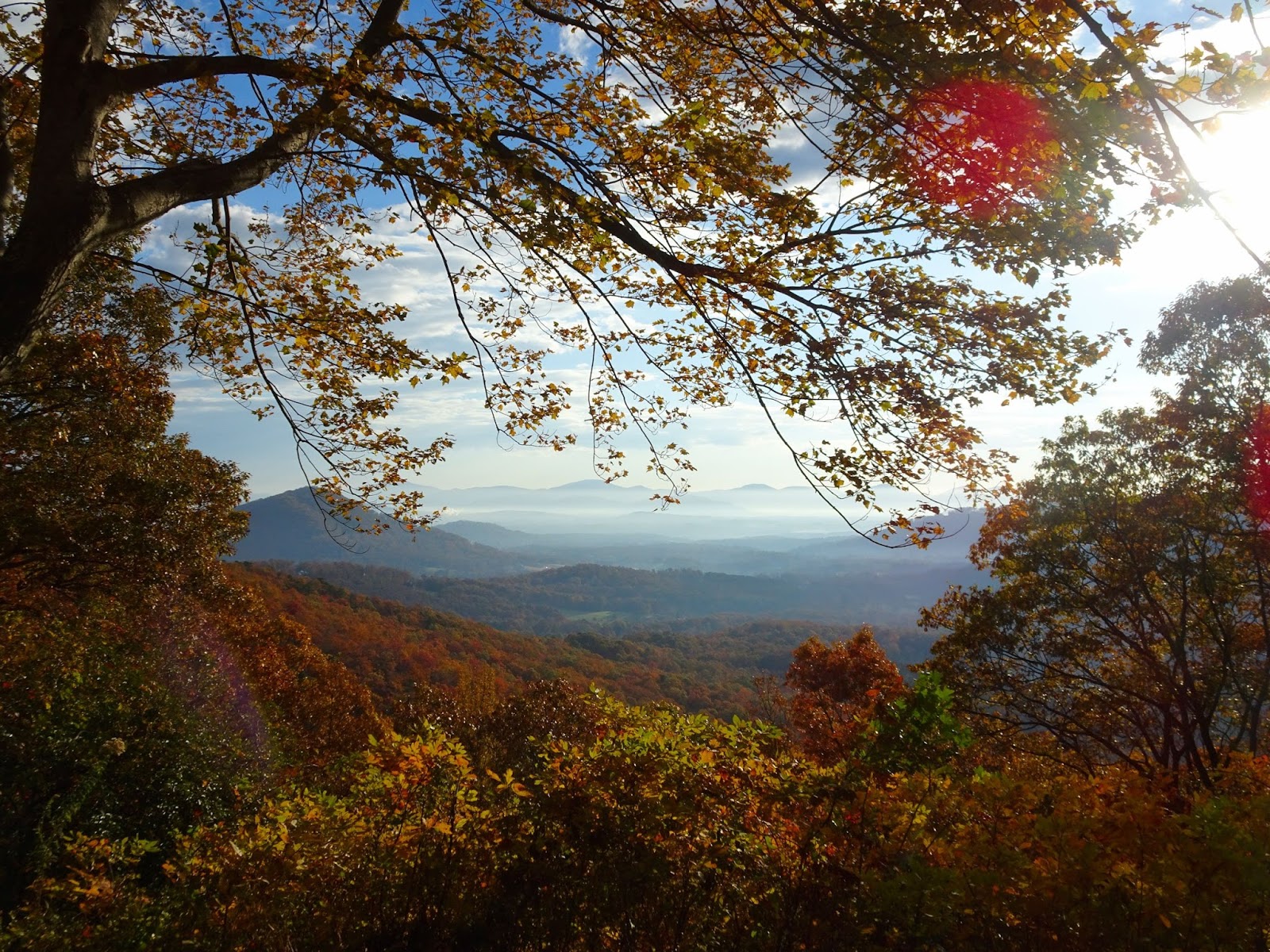
A trail for mountain bikers, rock climbers and hikers – this challenging route on the Pisgah National Forest has it all! With a trailhead on the Blue Ridge Parkway, the Pilot Rock trail is ideal for a fall hike - cooler temperatures and vibrant autumn scenery your companion for a memorable excursion into Pisgah National Forest.

View from the Laurel Mountain Connector

There are several pull-offs in a short stretch past the Buck Springs Tunnel including the Buck Springs trailhead, Mount Pisgah Overlook & trailhead at MP 407.6, Frying Pan Mountain Trail at MP 408.5, and the campgrounds, Pisgah Inn and trailhead at Mount Pisgah, MP 408.6. Our hike to Pilot Rock started at the Buck Spring Overlook on the Blue Ridge Parkway, although it is possible to connect via the Pisgah Inn. Facing south from the Parkway from the parking lot a trail heads off to your right, and 500 feet later you’ll have reached the site of George Vanderbilt’s hunting lodge. In addition to the Biltmore Estate in Asheville, Vanderbilt owned 471 acres here in Buck Springs Gap where he constructed an enormous log hunting lodge; the stone foundation of the spring house is still visible today.

Buck Springs Lodge spring house foundation

When the Blue Ridge Parkway was constructed in 1961, the lodge and outbuildings were razed. We read about the lodge and site on the informational placard, and admired the grand view before continuing on. Soon we reached a split in the trail, the Laurel Mountain Trail following the ridge to the left while continuing straight takes you to the Buck Spring Trail which climbs over the top of Little Bald Mountain. Connecting Pisgah Inn with Buck Spring Lodge is a section of the Mountains-to-Sea Trail, and together this network of trails allows for a small loop – we followed the white blazes of Buck Springs on the way in and the Laurel Mountain Connector on the way back from Pilot Rock.

Note - the milage on this sign is incorrect, it is NOT 2.3 miles to Yellow Gap from this point

From the Mountains-to-Sea Trail intersection with Pilot Rock Trail it is 3.6 miles south to FS 1206 (Yellow Gap Road), although we would be returning once reaching Pilot Rock. The hike starts with an uphill climb to reach the summit of Little Bald Mountain, a grass savanna that is home to Ruffed Grouse and features views to the west, especially now that the trees had started dropping their leaves.

From summit of Little Bald

From Little Bald the trail descends down a dry ridge until reaching the top of Pilot Rock - 2.5 miles and 1,300 feet later. First we passed the intersection with Buck Springs/Pilot Rock Trail, and then following orange blazes through tunnels of rhododendron the descent became rather rocky, slowing our pace as we paid careful attention to our footing on the leaf-covered trail. The granite and shale at this elevation is the result of thousands of years of erosion attacking the pluton, and soon after the forest transitions to hardwoods, the fall foliage ablaze despite the cloud cover.


Along this stretch we found mature American chestnut trees, the spiky seed husks littering the trail. Before the species was devastated by the chestnut blight these giants filled the Appalachians, numbering in the billions and providing an important food source for wildlife as well as livestock. At the beginning of the 20th century the fungal pathogen responsible for chestnut blight was accidentally imported into the US from Asia, and it rapidly spread throughout eastern forests, leaving only the rare American chestnut standing by the 1950s. The fungus enters the tree through an injury in the bark, and spreads, killing tissue as it advances - effectively girdling the tree. Despite being infected, the chestnuts we saw were survivors; it was incredible to see these trees ‘in the wild’. (There has been much success in crossing the American chestnut with the blight-resistant Chinese chestnut – for more on the work being done to reintroduce the American chestnut to the eastern forests, please visit the American Chestnut Foundation’s website.)

American chestnut tree and seed husk

Soon the trail gets steep, each switchback a reminder that you’ll soon be going the other way to return to the trailhead. A rock outcrop gave us the perfect spot for lunch, and as we fueled up we took in the views over the Pisgah.

This rock outcrop makes a good lunch stop

According to the Forest Service website, there are two access points to the rock face, which at this point on the trail will be on your left. From this vantage point the breathtaking 180° views include Funneltop Mountain, the Pink Beds Valley, and the Cradle of Forestry. Down below is Yellow Gap Road; if you kept heading downhill you would descend another 600 feet in elevation over the course of a mile, emerging on the Forest Service road at Grassy Lot Gap where there is room for a couple of cars to park. On the way is also the intersection with the Pilot Rock Extension spur trail, which provides access to the rock’s base for rock climbers looking to scale the pluton.


However, the ascent back up to Buck Springs would provide enough of a challenge to us on this excursion, and so we headed back the way we came, Vilis growing heavy in the backpack carrier before I had even traveled ½ a mile. I carried him over the more steep/treacherous sections, and he would stretch his legs on the more level sections of trail. To avoid an extra bit of a climb, take the Laurel Mountain Connector; it skirts the side of Little Bald to return to Laurel Mountain Trail. On this side of the mountain we found ourselves crossing entire hillsides covered in rocky boulders, the moss-covered rocks a landscape straight out of fairytales. A bit of warning, that although the Connector has less elevation change than crossing the summit of Little Bald, the terrain is a bit more challenging, slippery climbs in some spots with rocky ground making for slower going.


Before too long we reached the junction with the Mountains-to-Sea trail, closing the loop, and just after that arrived at the former site of the lodge. We soaked in the view yet again, and then in the parking lot almost submitted to the lure of climbing Mt. Pisgah as we still had daylight to burn – Vilis was asleep in the carrier after all! But a celebration awaited this birthday girl back in Greenville, so I took one last longing look before loading up the car and turning east on the Parkway towards Asheville.

View from Buck Springs Lodge site

Note: The NC Arboretum is located right where we turn off the Blue Ridge Parkway on our way back to Greenville, meaning the Winter Lights event could be a perfect conclusion to a day on the Blue Ridge this December. Or, if you're headed west on the Parkway, my Pisgah to Cherokee post would be a good guide of sights to see en route! Finally, check out the Meanderthals post on Buck Spring to Pilot Rock for detailed trail descriptions, maps and fantastic photos.   


Mount Pisgah

Related Posts Plugin for WordPress, Blogger...