Showing posts with label geology. Show all posts

Tuesday, February 12, 2019

Finding gold in the Carolinas

All three boys have rock collections. At first, it was piles from pockets turned inside-out after a hike, later secret stashes in their rooms discovered during spring cleaning. Recently we purchased several compartmentalized fishing lure containers, and the boys have taken to labeling their finds; if they can’t identify the stone, we’ll at least add other information such as where it was found.


Our area is rich in mica, the glossy sheets often found in combination with quartz crystals, as good as treasure when found on a hike. What started as research into rocks, minerals and the geology of the region has evolved into more; in addition to the rock collections, the boys also enjoy ‘panning for gold’. First, a book we found at the local library (How to Get Rich in the California Gold Rush: An Adventurer's Guide to the Fabulous Riches Discovered in 1848), later, a gold panning kit that allowed Lauris to become a pyrite prospector. However interesting working with a kit can be, the boys prefer to ‘pan’ creekbeds, looking for gold but more realistically mica, quartz and other treasure. They’ve even traded fossils at the Minneapolis Science Museum, and get just as excited about cracking geodes as trading sports cards with their friends.

A friend of mine out in Colorado has started a YouTube channel chronicling his adventures in the mountains. The episodes play out like a list of ‘most exciting adventures ever’ for the boys: Colorado River gold dredging, arrowhead hunting, old mine exploring, and finding gold in a frozen river (see below). If your kids enjoy rocks & minerals, they will love watching these videos! And while the kids delight in the adventure and the thrills, I appreciate the spectacular backdrop of the Colorado Rockies. Let me know what you think...


Recently things kicked up a notch when Santa sent Lauris a bag of Leadville paydirt for Christmas. (Paydirt is literally sand/rocks that can be panned to reveal gold flakes.) We quickly discovered that panning for gold is much easier when there is real gold in the mix; mica and quartz don’t exhibit the same tendencies to separate out during the panning process. I watched open-mouthed as Lauris picked out gold flakes from his pan and proudly placed them in a display case, now one of the most prized pieces of his collection. Colorado-gold-camp on eBay offers two different sizes of paydirt, a smaller one that is perfect for kids, and a larger option that gives everyone a turn panning. And if you're on Instagram, you can follow their adventures there: Colorado Gold Camp.

Panning an Upstate creek

This gold fever has prompted me to dig around a bit to learn more about the gold mines and prospecting and panning areas of South Carolina. There is a gold belt that extends from Central Alabama to Northern Virginia, and there is a cluster of gold mines and prospecting & panning sites near Rock Hill, York and Gaffney. The famous Haile Gold Mine is near Kershaw in Lancaster County, and Reed Gold Mine in NC is the site of the first documented gold find in the US. One source said that South Carolina's largest gold producing counties include Cherokee, Greenville, Oconee, Pickens, Spartanburg and Union, and in recent decades, South Carolina has been a major producer among the Appalachian states. You can bet we’ll be doing some more research on finding and panning for gold, and that come warmer temperatures the boys will have their prospecting equipment with on hikes!

Wednesday, April 18, 2018

The Black Lagoon and Wakulla Springs

Billed ‘strange and mysterious waters,’ a 6,000-acre sanctuary is hidden away in a quiet corner of the Florida panhandle, 30 minutes from Tallahassee and more than an hour from St. George Island. However the unique cinematic history as well as its incredible geographic features convinced us to make the trip to Wakulla Springs State Park, and we were so entranced that we are already making plans to return!

The deepest part of the spring is just beyond the buoy

The heart of the park is Wakulla springs, one of the largest and deepest in the world. The freshwater springs are a result of the unique geology created by the prehistoric seas that once covered the area; when the seas retreated they left behind sandy soils over limestone, and when water eats away at the limestone, holes develop. The result is called ‘karst,’ and the holes and tunnels (resembling Swiss cheese) are linked in an enormous underground cave system that serves as the aquifer for the region. The freshwater springs are 185 feet deep with a flow rate of 250 million gallons of water per day.


Several underwater scenes for the 1954 horror movie “Creature from the Black Lagoon” were filmed in Wakulla Springs, as well as Tarzan movies from the 1930s, “Return of the Creature,” “Night Moves” and “Airport 77.” The clear water of the deep spring along with the tropical vegetation growing along the Wakulla River (and the alligators that go with it!) make for ideal filming conditions. If you take the boat tour your guide might point out some of the spots utilized most frequently in filming.

One of the River Tour boats making the rounds

One of the boys’ favorite portions of our visit was the boat tour. When the water is clear enough, the Park offers glass-bottom boat tours over the spring itself, however on our visit rainfall (with higher nitrogen levels) and the invasive & exotic species of hydrilla and algae had teamed up to create a dark water day; on these days visibility in the basin is too low to permit the glass-bottom boats to operate. However, the 3-mile River Tour operates 365 days a year (with exceptions for extreme weather) taking visitors up the river among the giant bald cypress trees to see alligators, native birds, turtles and other wildlife up close. The morning of our visit dozens of alligators were taking advantage of the warm day to sun themselves on the banks, and a manatee was seen on its way out to the coast to feed; the gentle giants cruise the waters in the summer, and a pod has been known to winter around the springs where the water stays a constant 70° year round.

See it?

The tour guide was very knowledgeable on the flora and fauna of the park, but also the historical aspects. Archaeologists have uncovered giant Mastodon bones and evidence of inhabitants dating back more than 14,000 years in the area! A complete mastodon skeleton recovered from the spring is on display at the Museum of Florida History in Tallahassee.

Clockwise from left: white ibis, hooded mergansers, male anhinga (during breeding season flesh around the eyes turns bright emerald green), double -crested cormorants and the common gallinule

The river boat tour presented an opportunity to get up-close views (and identification) of wading birds, anhingas, grebes, ducks, and many others.  A number of species breed and raise their young in the waters of Wakulla River, and migratory species travel through from fall through spring. For boat tour pricing please see the Wakulla Springs website.

A cooter sunning itself among the cypress knees

It isn’t necessary to take the boat tour to see the spring, however. The deepest spot is adjacent to the swimming area, and a dive tower allows for viewing the spring and a two-story perch to plunge into the cool waters. The historic tower used to be four stories; I will admit jumping off the bottom level provided enough excitement for us, and swimming/jumping is at your own risk – no lifeguards are present. Also, swimming and snorkeling are limited to this designated swimming area (alligators!), and although scuba diving is allowed at some designated sinkhole areas, the Wakulla Springs are off limits.

Then and now. Historic photo source here

Another way to see the park is on the 9 miles of trail, either on foot, bicycle or horseback. The Nature Trail leads through southern hardwood and maple-cypress forests, with several state and national champion trees along the way. The entrance to the Cherokee Sink trailhead is on Hwy 61 two miles south of Hwy 267, and leads 1.4 miles to an 80 foot deep sinkhole lake. On the Riversinks Tract of the park visitors can hike the Bob Rose Trail, which follows the cave system and showcases karst features such as dry and wet sinks, swallets, and collapsed caves. On our visit we stopped at Sally Ward Spring, the reason why the area is called Wakulla SpringS, not spring; the second, 18ft deep spring is located near the park entrance and flows into the Wakulla River just downstream of its sister spring.


Placards throughout the park describe the biological, historical and other features that make Wakulla Springs so unique. It was shortly after Edward Ball purchased the property in 1931 that the Historic Wakulla Springs Lodge was built, and period furnishings include a grand piano, marble checker tables, a massive fireplace and the lodges only TV. The Spanish-Moorish style mansion (Mediterranean Revival architecture) is two stories with 27 rooms, lavished with pink and grey marble (including one of the world’s longest marble counters in the gift shop), and cypress beans and ornate hand painted ceilings grace the grand reception room. Upon Ball’s death in 1981 the property went to the State of Florida, and today the Lodge is listed on the National Register of Historic Places and is designated as a National Natural Landmark. Even if you’re not staying/dining in the lodge, plan to stop in, if only to see “Old Joe,” the 11’2” stuffed alligator that was a longtime resident of Wakulla Springs before it was illegally killed in 1966.


Visitors should definitely plan on spending the whole day at Wakulla. We utilized picnic tables for lunch, swam for several hours, toured the grounds, took the boat tour and still had multiple things we wanted to do before we left. In the immediate vicinity of the Park you’ll find other points of interest as well, including state capital Tallahassee, St. Mark’s Wildlife Refuge and the St. Mark’s Lighthouse (on the Forgotten Coast Lighthouse driving tour), the world’s smallest police station in Carrabelle (plus stop here for coffee!), and the National Forest. That evening our route would take us to a favorite spot for Apalachicola Bay oysters back on St. George Island, and the next day we would be on our way west through Apalachicola and St. Joe, to Panama City Beach.


Friday, April 13, 2018

The dunes of Jockey's Ridge

The wind coming off the Atlantic Ocean has played a primary role in the history of the Outer Banks. It provided the Wright Brothers with needed lift at the Kill Devil Hills site of first flight, yet it also blows in hurricanes and storms so powerful that some theorize might have been a factor in the disappearance of English Colony on nearby Roanoke Island. Whether this is fact or fiction, what we do know is that the barrier islands have been shaped – physically and historically – by these winds, and nowhere is this more evident than at Jockey’s Ridge State Park.


Jockey's Ridge is the tallest active sand dune system in the Eastern United States, the shifting winds constantly reshaping the dunes. Nags Head Woods and Jockey's Ridge were designated a National Natural Landmark in 1974 by the National Park Service. Today, the park is a favorite spot for flying kites, sandboarding (with permit), hang-gliding (through vendor) and watching sunsets, and the trails and visitor center provide insight into the history and ecology of this unique region.


You’ll want to start your visit at the visitor center & museum. After exploring the exhibits and picking up maps, take some water and sunscreen and head out onto the dunes on the 360ft boardwalk. From a viewing platform you can get a good perspective of the expansive sands of the park’s 420 acres before heading off into the dunes.


Jockey's Ridge encompasses three distinct ecological environments: dunes, maritime thicket, and the Roanoke Sound estuary. We explored the dunes first, and although for every two steps you take up the dune it’s one step back, don’t let that discourage you from climbing to the top of the biggest dune. There you’ll have a view of sand, surf, and sea - from the Sound all the way to the ocean. The park’s dunes consist of three peaks, and due to the constantly shifting sand, plants and animals do not live there. Around the base of the dunes you’ll find grasses and plants, providing habitat for small animals and insects. Don’t forget to bring shoes (the sand gets hot!), sunscreen, your sunglasses, water bottles, and a kite!


For a closer look at Roanoke Sound head out on the 1.5 mile Tracks in the Sand trail. The trail starts off with a short section through a forest of shrubs. The maritime thicket grows best in areas protected by the dune, which provides protection from wind and salt blown off the ocean. The live oaks, persimmons, red cedar, wax myrtle, bayberry, sweet gum, red oaks and pines are stunted by the effects of the wind and salt, causing them to look like shrubs. Fox, deer and raccoons live in the thickets, but you’re more likely to spot birds and a variety of insects.


The trail crosses a wide section of dune before reentering the forest, and eventually loops for a section along Roanoke Sound. At the shoreline, there is an area of restored marsh where nesting ospreys visit during the summer months, and the views of the dunes and sound are magnificent no matter the season. The trail is a Kids in Parks TRACK Trail, and brochures are available at the trailhead or inside the visitor center. A section of the North Carolina Mountains-to-sea trail is also located within the park.


The Sound-side of the park offers a completely different experience: sunbathing, wading, paddling and the 1-mile Soundside Nature Trail that tours the wetlands, grassy dunes and maritime thickets of the southern corner of the park. The Roanoke Sound Estuary is a rich habitat for a variety of plant, animal and bird life; the sound provides nesting areas for waterfowl, serves as a fish nursery, and is home to the blue crab. Windsurfers and kiteboarders are a common sight, and the sun setting over the sound often brings a crowd.

Events such as this lights on kites festival are a regular occurrance at the park

Legend says the park was named as a result of the early inhabitant’s practice of capturing wild ponies and racing them on the flat surface at the base of the dune, while the steep sides of the ridge served as a grandstand of sorts for spectators. Horses are no longer free to run on this portion of the Outer Banks - you’ll have to head north of Corolla to see the remaining population of wild Spanish mustangs. However, there’s still plenty of motion to be seen from a perch on the ridge: the dunes endlessly shifting, boats on the water, kites in the air… Jockey’s Ridge truly is alive, and a must-see for visitors on the Outer Banks.

Monday, November 20, 2017

Pinnacle Mountain, 1 year after the fire

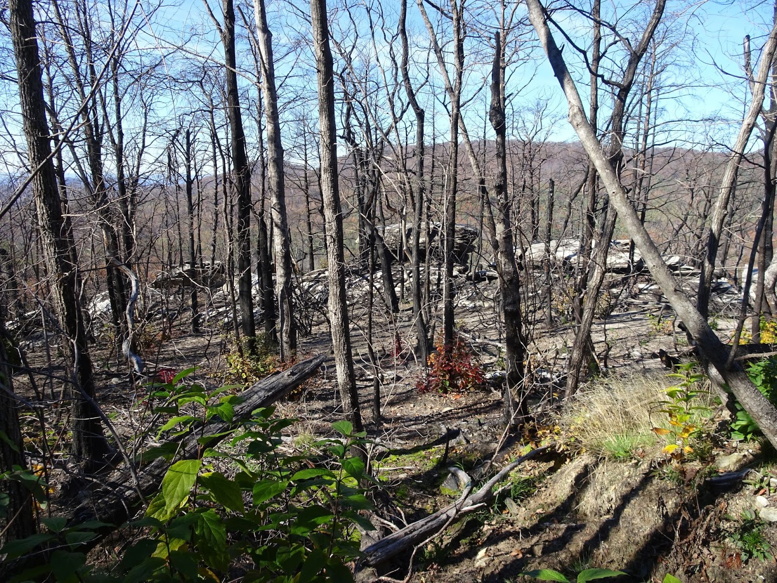
The Pinnacle Mountain fire started on November 9th last year, and in less than a month had blackened over 10,000 acres in and around Table Rock State Park. Although most trails in the area were closed and much of the Upstate smoked out, the fire was finally contained with no structures lost. Historically the Southern Appalachians burn during drought years, so fire on Pinnacle Mountain is nothing new... it had just been a few years since such a high-intensity burn had occurred within State Park borders, and I was curious as to state of things now that a year had passed.


We jumped on the Blue Ridge Electric Co-op Passage of the Palmetto Trail, passing through an enormous field of boulders to reach the section of Foothills Trail that heads up to Pinnacle Mountain. Most foot traffic comes via the Table Rock Mountain State Park Nature Center – following Carrick Creek Nature Trail up Pinnacle Mountain Trail, or on Ridge Trail from Table Rock. From the Nature Center to the summit of Pinnacle is more than 7 miles round-trip, coming in from Sassafras Mountain might be around 10.


From the Foothills Trail you actually have to take a left on Pinnacle Mountain to reach the summit (adding about ½ mile to your hike), but the 3,425 ft peak does not have any views. Taking a right on Pinnacle Mountain Trail would take you to Bald Knob (also about ½ mile detour) and fantastic views, but either route will add a significant climb in elevation. What’s so special to go through all the trouble? Pinnacle Mountain is the tallest mountain contained entirely within the state of South Carolina (Sassafras Mountain at 3,563 feet is partially in NC), and the views near the top overlook both the Jocassee Gorges and the Mountain Bridge Wilderness Area, which remain relatively untouched by development.


Coming up on Pinnacle Mountain along the ridge from the south, the first signs of the fire were scorch marks on trees, easily visible because the trail had been used as a fire break for a short distance. The proximity to the line indicated this had been a back-burn, meaning firefighters had intentionally used a controlled fire to create black that acted as a fire break for the advancing flames. The low intensity fire didn’t leave much evidence other than some partially-burned branches and the occasional charred stump of a tree that had died long before the fire.


It was once we had ascended the ridge and hiked a distance from the firelines that we saw evidence of a higher-intensity fire. The granitic balds had white char marks where layers of organic matter had been scorched off, and the jack pine, although standing, were mostly dead. However, I wasn’t surprised to see the brightly colored autumn foliage of deciduous tree seedlings – an indication that the soil had not been sterilized. The fire simply opened up the canopy and cleared the way for new growth.


In addition to tree seedlings, the grasses and herbaceous plants had really taken off. Nourished by an enriched soil and provided unimpeded access to sunlight, a year’s worth of growth was highly encouraging, serving as a reminder that fire is the natural order for our mountains.


Although in some places the granitic balds had been burned clear of vegetation, in most the moss and lichen communities were left intact, the fire naturally stopped by the expanse of bare rock and the lower intensity back-burns not having much an effect on the moist seep areas. We found prickly pear cactus, grasses and even an occasional wildflower still blooming in November, and marveled at the spectacular views which stretched from the Pinnacle Mountain summit all the way to Lake Jocassee.


It was on one of these granitic balds that more than 600 prehistoric petroglyphs were discovered in the late 1990s. The petroglyphs are believed to be created by the Hopewell culture (pre-dating the Cherokees) and are believed to be between 1,500 and 3,500 years old. What is now the Foothills Trail that follows the spine of the escarpment from Jones Gap to Oconee State Park was once a highway that primitive men and early European settlers used to cross the into the rich valleys of North Carolina. I don’t find it surprising that the granite still holds evidence of these early travelers; instead, I am astounded that the petroglyphs were not identified sooner, as close as they are to such a well-traveled path.


These scars on Pinnacle Mountain – left by fire and man – remained in my thoughts on the hike down. The fire breaks and raw earth as discordant with their surroundings as the white char marks on the granite balds, the circular petroglyphs as symmetrical as the dimples left on the granite by decades of water eroding rock. We descended through the hardwoods lit ablaze, but by sunlight and season, not flames, and I wondered at the wonder of it all. A thick carpet of leaves crunching underfoot accompanied us as Vilis loudly sang “everything is awesome”…  and for once, I felt like joining in. There, on Pinnacle Mountain, just 45 minutes from home – you can experience the millennia.


Wednesday, November 8, 2017

Pilot Rock on the Blue Ridge Parkway

Morning view from Chestnut Cove overlook

A trail for mountain bikers, rock climbers and hikers – this challenging route on the Pisgah National Forest has it all! With a trailhead on the Blue Ridge Parkway, the Pilot Rock trail is ideal for a fall hike - cooler temperatures and vibrant autumn scenery your companion for a memorable excursion into Pisgah National Forest.

View from the Laurel Mountain Connector

There are several pull-offs in a short stretch past the Buck Springs Tunnel including the Buck Springs trailhead, Mount Pisgah Overlook & trailhead at MP 407.6, Frying Pan Mountain Trail at MP 408.5, and the campgrounds, Pisgah Inn and trailhead at Mount Pisgah, MP 408.6. Our hike to Pilot Rock started at the Buck Spring Overlook on the Blue Ridge Parkway, although it is possible to connect via the Pisgah Inn. Facing south from the Parkway from the parking lot a trail heads off to your right, and 500 feet later you’ll have reached the site of George Vanderbilt’s hunting lodge. In addition to the Biltmore Estate in Asheville, Vanderbilt owned 471 acres here in Buck Springs Gap where he constructed an enormous log hunting lodge; the stone foundation of the spring house is still visible today.

Buck Springs Lodge spring house foundation

When the Blue Ridge Parkway was constructed in 1961, the lodge and outbuildings were razed. We read about the lodge and site on the informational placard, and admired the grand view before continuing on. Soon we reached a split in the trail, the Laurel Mountain Trail following the ridge to the left while continuing straight takes you to the Buck Spring Trail which climbs over the top of Little Bald Mountain. Connecting Pisgah Inn with Buck Spring Lodge is a section of the Mountains-to-Sea Trail, and together this network of trails allows for a small loop – we followed the white blazes of Buck Springs on the way in and the Laurel Mountain Connector on the way back from Pilot Rock.

Note - the milage on this sign is incorrect, it is NOT 2.3 miles to Yellow Gap from this point

From the Mountains-to-Sea Trail intersection with Pilot Rock Trail it is 3.6 miles south to FS 1206 (Yellow Gap Road), although we would be returning once reaching Pilot Rock. The hike starts with an uphill climb to reach the summit of Little Bald Mountain, a grass savanna that is home to Ruffed Grouse and features views to the west, especially now that the trees had started dropping their leaves.

From summit of Little Bald

From Little Bald the trail descends down a dry ridge until reaching the top of Pilot Rock - 2.5 miles and 1,300 feet later. First we passed the intersection with Buck Springs/Pilot Rock Trail, and then following orange blazes through tunnels of rhododendron the descent became rather rocky, slowing our pace as we paid careful attention to our footing on the leaf-covered trail. The granite and shale at this elevation is the result of thousands of years of erosion attacking the pluton, and soon after the forest transitions to hardwoods, the fall foliage ablaze despite the cloud cover.


Along this stretch we found mature American chestnut trees, the spiky seed husks littering the trail. Before the species was devastated by the chestnut blight these giants filled the Appalachians, numbering in the billions and providing an important food source for wildlife as well as livestock. At the beginning of the 20th century the fungal pathogen responsible for chestnut blight was accidentally imported into the US from Asia, and it rapidly spread throughout eastern forests, leaving only the rare American chestnut standing by the 1950s. The fungus enters the tree through an injury in the bark, and spreads, killing tissue as it advances - effectively girdling the tree. Despite being infected, the chestnuts we saw were survivors; it was incredible to see these trees ‘in the wild’. (There has been much success in crossing the American chestnut with the blight-resistant Chinese chestnut – for more on the work being done to reintroduce the American chestnut to the eastern forests, please visit the American Chestnut Foundation’s website.)

American chestnut tree and seed husk

Soon the trail gets steep, each switchback a reminder that you’ll soon be going the other way to return to the trailhead. A rock outcrop gave us the perfect spot for lunch, and as we fueled up we took in the views over the Pisgah.

This rock outcrop makes a good lunch stop

According to the Forest Service website, there are two access points to the rock face, which at this point on the trail will be on your left. From this vantage point the breathtaking 180° views include Funneltop Mountain, the Pink Beds Valley, and the Cradle of Forestry. Down below is Yellow Gap Road; if you kept heading downhill you would descend another 600 feet in elevation over the course of a mile, emerging on the Forest Service road at Grassy Lot Gap where there is room for a couple of cars to park. On the way is also the intersection with the Pilot Rock Extension spur trail, which provides access to the rock’s base for rock climbers looking to scale the pluton.


However, the ascent back up to Buck Springs would provide enough of a challenge to us on this excursion, and so we headed back the way we came, Vilis growing heavy in the backpack carrier before I had even traveled ½ a mile. I carried him over the more steep/treacherous sections, and he would stretch his legs on the more level sections of trail. To avoid an extra bit of a climb, take the Laurel Mountain Connector; it skirts the side of Little Bald to return to Laurel Mountain Trail. On this side of the mountain we found ourselves crossing entire hillsides covered in rocky boulders, the moss-covered rocks a landscape straight out of fairytales. A bit of warning, that although the Connector has less elevation change than crossing the summit of Little Bald, the terrain is a bit more challenging, slippery climbs in some spots with rocky ground making for slower going.


Before too long we reached the junction with the Mountains-to-Sea trail, closing the loop, and just after that arrived at the former site of the lodge. We soaked in the view yet again, and then in the parking lot almost submitted to the lure of climbing Mt. Pisgah as we still had daylight to burn – Vilis was asleep in the carrier after all! But a celebration awaited this birthday girl back in Greenville, so I took one last longing look before loading up the car and turning east on the Parkway towards Asheville.

View from Buck Springs Lodge site

Note: The NC Arboretum is located right where we turn off the Blue Ridge Parkway on our way back to Greenville, meaning the Winter Lights event could be a perfect conclusion to a day on the Blue Ridge this December. Or, if you're headed west on the Parkway, my Pisgah to Cherokee post would be a good guide of sights to see en route! Finally, check out the Meanderthals post on Buck Spring to Pilot Rock for detailed trail descriptions, maps and fantastic photos.   


Mount Pisgah

Monday, November 6, 2017

Glassy Mountain

It’s Pickens. It’s only a mile or two long. It’s at 1,700 feet compared to Caesar Head’s 3,215. Whatever the reason for the Glassy Mountain trail’s relatively unknown status, it only adds to the charm of one of the best views of the Blue Ridge Escarpment to be had in the Upstate; and all within a 30 minute drive of Greenville.


The drive to Pickens was scenic, the bright foliage of autumn lining the roadsides as we headed west out of Greenville on Farrs Bridge Road. The Glassy Mountain Heritage Preserve is a straight shot – only on the approach to Pickens did we make the right turn on South Glassy Mountain Road that appears shortly after crossing Wolf Creek. Google tends to direct visitors in on N Cedar Rock Rd; this route allows you a view of the cell tower-covered top of Glassy Mountain before you make the hike up.


Coming in up South Glassy Mountain Road, park on the west side opposite the trailhead just after passing the intersection with South Glassy Mountain Church road. There’s more parking at the top of the mountain if needed, but we prefer start our hike at the bottom, saving the downhill portion for last. The trail isn’t blazed, but sporadic signs point the way in the few spots you might take pause.


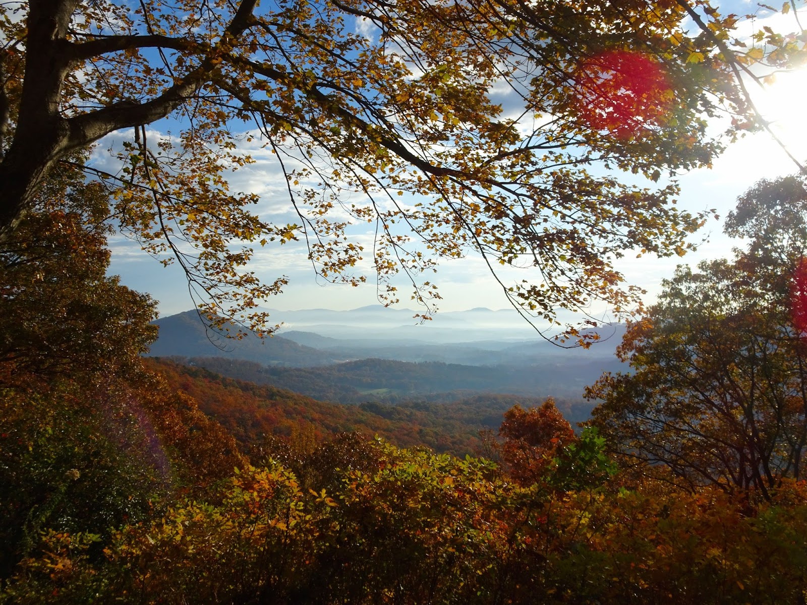
The trail winds around the east side of Glassy Mountain, named for the glassy appearance of the exposed rock face when wet. The Preserve was established on May 8, 1990, the 65 acres today managed by the SC Forestry Commission. What makes this hike special are the multiple rare plant species that grow on the unusual land form; Glassy Mountain is a Piedmont Monadnock, an isolated mountain in the Piedmont with associated granitic dome plant communities. The north face has extensive bare rock areas that in places drop up to 400 feet, and the relative uniformity of the surrounding countryside ensure fantastic views. With leaves already starting to drop there were immediately glimpses to be had of the country to the east, Paris Mountain providing the backdrop for rolling countryside and colorful autumn forests.


Continuing around we saw many flowers, ferns and other interesting plants, despite the chilly October temperatures. The exposed rock outcrops provide up-close looks at dozens of mosses and lichens, although please be careful to stay on the trail, to help conserve the fragile plant communities that call these outcrops home.


From a rocky pine/oak forest we entered sugar maple woods, corroborating evidence that the soil on the north side of the dome is surprisingly rich, a result of thousands of years of weathering without the high elevations typical of granite domes. Stay on the lookout for all sorts of wildflowers that love these fertile and moist soils.


About ½ mile into your hike you’ll reach an intersection: the two trails to the right make a loop out to the edge of the dome, the trail to the left climbs up to the top of the mountain. We went straight, and the trail soon curved around to the most stunning view; stretched out in front of awed visitors is the Blue Ridge Escarpment, punctuated by Table Rock and Pinnacle mountains.


Closing the loop back to the intersection and taking the remaining branch of trail you’ll find that the last bit up to the summit is the steepest; however 2/10ths of a mile from the scenic viewpoint you’ll reach the open area at the Glassy Mountain summit. Various communications towers dot the top, an old fire tower standing vigil over the gravel parking lot.


If you’ve got the time, descend back to the trailhead the way you came, winding through the forest to catch all the things you missed on your way up. Or you can just head down the road, enjoying the views of some of the exposed rock surfaces from a different perspective and cutting about ½ mile off your hike. Either way, you’ll promise yourself that you’ll soon be back: in the winter months to take in unobstructed views once the leaves fall, in the spring to admire the biological diversity of this incredibly rich natural resource, in the summer for the wildflowers and verdant understory. Or again in another week, as the progression of fall color creeps down the Blue Ridge Escarpment!  


Related Posts Plugin for WordPress, Blogger...