Showing posts with label rail. Show all posts

Tuesday, July 21, 2020

Your Guide to the Palmetto Trail

The Palmetto Trail is really not one trail at all; it is a network of them, stitched together from the trail systems and roads that criss-cross the state. The nearly-continuous passageway stretches from Oconee State Park in the Upstate Foothills, to its low-country terminus at Awendaw and Buck Hall on the Intracoastal Waterway. Established in 1994, it is South Carolina’s longest pedestrian & bicycle trail. Today 350 of the proposed 500 miles of trail have been completed!

By offering 26 passages ranging from 1.3 to 47 miles, with easy, moderate, and strenuous levels of difficulty, the Palmetto Trail is accessible for day trips, weekend excursions, and longer treks. The entire Palmetto Trail is open to hiking and backpacking, but designated sections are available for biking, horseback riding and camping. Whether thru-hiking, or just out for a stroll, the trail explores the rich diversity and fascinating history, culture, and geography of the Palmetto State.

The goals of the Palmetto Trail (according to the Palmetto Trail Conservancy) are to:
  • Showcase conservation and preservation from mountains to sea
  • Provide free public access to active, healthy outdoor recreation
  • Foster tourism, business, and economic development 


THE PASSAGES (from NW to SE)

Stumphouse Passage: 1.5 mile hiking trail and 9.34 mile mountain bike park
The Stumphouse Mountain Passage is the newest addition to the Palmetto Trail. It begins in Sumter National Forest at the Stumphouse Tunnel Park in Oconee County’s Walhalla. Stumphouse Mountain Tunnel is an incomplete railroad tunnel for the Blue Ridge Railroad of South Carolina, listed on the National Register of Historic Places in 1971. The park is also home to Issaqueena Falls.

Ross Mountain: 5.0 miles

The newest passage to be completed along the Palmetto Trail, this passage connects the Stumphouse Passage to Oconee State Park.

Oconee Passage: 3.2 miles

This Passage begins in Oconee State Park and ends at Oconee Station State Historical Site, a backcountry military garrison and trading post from the 1790s. Make sure to visit Station Cove Falls on the way! Intersections with the Foothills Trail and Tamassee Knob Trail allow easy access to Hidden Falls and Tamassee Knob in Oconee State Park.

A ¼ mile spur trail from the Oconee Passage leads to Station Cove Falls

Eastatoe Passage: 4.6 miles
Starting in Keowee Toxaway State Park on Natural Bridge Trail, this Passage travels along Eastatoe Creek upstream from Lake Keowee and climbs through mountain forest in the acclaimed Jocassee Gorges with its abundance of flowers, birds and wildlife. Two new bridges including the Zeke wilderness trail bridge were recently opened to the public and are destinations in themselves!

Blue Ridge Electric Co-Op Passage (Jocassee Gorges): 12.3 miles
This section of the Palmetto Trail offers a view of the remote and rugged Jocassee Gorges area, with it abundance of wildflowers and wildlife, mountaintop vistas, and waterfalls. The Passage starts in Table Rock State Park, which boasts stunning trails such as the Pinnacle Mountain, Carrick Creek and Table Rock Trails. The Foothills Trail can also be accessed from the Park.

Roundtop Mountain: 5.9 miles
Connecting the Blue Ridge Electric Co-Op Passage to the Foothills Trail and Sassafras Mountain, this section creates opportunities for circular hikes in the Jocassee Gorges wilderness in Pickens County. 

Middle Saluda Passage: 10.9 miles
With its waterfalls and challenging elevation, this passage connects about 14 miles of existing trails in the Mountain Bridge Wilderness Area of Jones Gap and Caesars Head State Parks. Highlights include Hospital Rock, Rainbow Falls, and 420-foot Raven Cliff Falls. Camp in Jones Gap State Park, or continue beyond Hospital Rock to Falls Creek Falls for an added 2½ miles. (For more on Jones Gap Falls: click here)'

Rainbow Falls, as seen from spur trail

Saluda Mountains Passage: 9.1 miles
The Saluda Mountains Passage runs along the ridge dividing the Carolinas, with the Poinsett Watershed to the south. The 19,000-acre watershed is a pristine wilderness area providing habitat for multiple rare plants and animals, including the threatened Peregrine falcon.

Poinsett Reservoir Passage: 6.6 miles
Poinsett Reservoir Passage travels the mountain ridges along the northern boundary of Poinsett Watershed. This pristine watershed of 19,000 acres contains the headwaters feeding Poinsett Reservoir of the Greenville Water System.

Blue Wall Passage: 14 miles
The Blue Wall Passage is home to a wide array of wildlife, stunning scenery including a 30-foot cascading waterfall, and 100+ species of birds. The eastern trailhead is located in the Foothills Equestrian Nature Center (FENCE), and country roads and sidewalks wind through Landrum and around lovely Lake Lanier before entering the Blue Wall Preserve and climbing the Southern Blue Ridge Escarpment to Vaughns Gap.

View of Hogback Mountain from Blue Wall Passage

Peach Country Passage: 14.1 miles
The numerous peach orchards of the region are spectacular when blooming, which is why cycling the Peach Country Passage along the back roads from Inman to Landrum brings such joy in the spring. The passage traverses mostly lightly traveled gravel roads, except for a quarter mile on the Cherokee Foothills Scenic Highway (SC Hwy 11) near Campobello.

USC Upstate Passage: 1.3 miles
This short passage begins on the campus of the University of South Carolina Upstate campus in Spartanburg, SC, and descends through the woods to Lawson’s Fork Creek.

Hub City Connector: 12 miles
The Connector includes sections of greenways, bicycle lanes, and safe, signed sidewalks through the city of Spartanburg, traveling along the Mary Black Foundation Rail Trail and through Liberty Garden, and connecting the School for the Deaf and Blind, with downtown, Converse College, Wofford College, Spartanburg Regional Heart Center, Spartanburg Medical Center, and USC Upstate. Trail spurs include Chinquapin Greenway, a 1.6-mile trail spur located at the city’s northern gateway.

Croft Passage: 12.6 miles
In the 1700s, the area that today is part of Croft State Park was a hotbed of mills, trading, and political activity centered around the shoals. There was a Revolutionary militia victory at the First Battle of Cedar Springs in 1780, and during World War II it served as an Army training center.


Glenn Springs Passage: 7 miles
Rolling farmlands, mature forests, and the historic town of Glenn Springs highlight the Glenn Springs Passage. In the 19th century, Glenn Springs was known for the health benefits of its mineral waters. Now listed in the National Register, the historic district includes 20 historic buildings from about 1840 to 1940 and the site of a popular resort hotel.

Blackstock Battlefield Passage: 4 miles
Enjoy four miles of nature trails, camping, and mountain biking along the Tyger River at the site where Revolutionary War patriots defeated the British; on November 20, 1780, patriot militia fighting under Gen. Thomas Sumter prevailed over British regulars under Lt. Col. Banastre Tarleton. Two months later Tarleton lost the Battle of Cowpens and fled north with his remaining troops.

Life on the Enoree

Enoree Passage: 36 miles
Hike or bike the 36 miles of trail through Sumter National Forest linking Newberry, Laurens and Union counties. The trail meanders through the diverse habitats located in the Enoree Ranger District and River corridor, while Macedonia, Sedalia, and John’s Creek lakes provide plenty of opportunities to fish on the way to the northern trailhead at Sedalia Campground.

Lynch’s Woods Passage: 4.9 miles
This 
Park is a well-kept secret just outside of Newberry. Created by the 1930s Civilian Conservation Corps, the park protects 276 acres of woodlands full of old-growth hardwoods and the rambling Rock Branch Creek and tributaries, and allows hiking, cycling and horseback riding. 

Newberry Passage: 11 miles
The Newberry Passage is one of three urban passages on the trail, taking you through the heart of Historic Downtown Newberry and showcasing a number of historical and cultural points of interest.

Peak to Prosperity Passage: 10.8 miles
The highlight of this section of trail is the impressive 1,100-foot-long Broad River trestle. From there the former railway follows Crims Creek west through the Dutch Fork area to Pomaria and Interstate 26. Read more about this Passage here.

Crossing the trestle bridge over the Broad River between Peak and Prosperity

Capital City Passage: 10.2 miles
The first urban passage on the Palmetto Trail features South Carolina’s largest city and seat of state government. The passage follows city sidewalks through Columbia’s neighborhoods, past city parks and schools, along the historic Horseshoe at the University of South Carolina, and across the steps of the State Capitol. The passage links Fort Jackson Passage to Riverfront Park and the Broad River.

Fort Jackson Passage: 16.2 miles
Fort Jackson Passage takes you through the heart and into the woods of this military facility located just east of Columbia, SC. Fort Jackson was established in 1917 in preparation for WWI, named in honor of Major General Andrew Jackson. At 52,000 acres, it’s the Army’s largest basic training center.

Wateree Passage: 11.4 miles
One of the most diverse sections of the Palmetto, this portion of the trail crosses swamps and hills on its way from Poinsett State Park then through the SCE&G property to Hwy 601. Passing through a section of Manchester State Forest traveling along the remnants of the old SC Railroad through Sumter Junction, it crosses over the Wateree River and Molly’s Bluff - elevation 260 feet – with excellent views across Wateree swamp.

High Hills of Santee Passage: 9.4 miles
Named for the high, sandy ridges that are part of the Sandhills geographical region, these rolling hills are the remains of an ancient ocean shoreline found in the Carolinas and Georgia. Over time, the beach sand and shells transformed into coquina, which can be seen today throughout the park. In the 1930s, the Civilian Conservation Corps used the native stone to build many structures in the park. Birdwatching includes the endangered red-cockaded woodpecker.


Lake Marion Passage: 33.6 miles
This passage skirts along the north side of Lake Marion between Santee and Mill Creek County Park. A short side trip down Fort Watson Road leads to the site of ancient Santee Indian burial mounds (3,500 years old); the site is now part of Santee National Wildlife Refuge.

Santee Passage: 12.7 miles
This passage utilizes the dirt roads and rural highways of Orangeburg County, traveling through farmlands to the town of Santee.

Eutaw Springs Passage: 21.3 miles
From the site of the Revolutionary War Battle of Eutaw Springs to downtown Eutawville, with a 5-mile spur trail that connects to Santee-Cooper Wildlife Management Refuge and Lake Marion.

Lake Moultrie Passage: 26.9 miles
Hugging the eastern and northern shores of 60,000-acre Lake Moultrie, the views make this a popular passage for mountain bikers. Following levees and service roads, the trail crosses the Santee Canal and traverses the swamps around Bulltown Bay.


Swamp Fox Passage: 47.2 miles
This passage named for Revolutionary War hero Francis Marion is the Palmetto Trail’s longest. From the swamps of Francis Marion National Forest, to long-leaf pine forests that are home to the endangered red-cockaded woodpecker, from the grassy savannas near Dog Swamp and Turkey Creek, to Wadboo Swamp; three trailheads provide users with plenty of options! Just make sure to bring plenty of water, as there is only one water source on the Swamp Fox Passage at the Ranger Station off Steed Creek Road.

Awendaw Passage: 7.1 miles
The coastal terminus of the mountains-to-sea Palmetto Trail, the Trail’s namesake trees greet users at the Buck Hall Recreation Area trailhead. Starting at the Intracoastal Waterway, the Trail meanders westward through maritime forest and offers sweeping vistas of Lowcountry salt marsh along Awendaw Creek. At Walnut Grove, look for a scenic overlook and boardwalk. A canoe launch for Awendaw Creek is located at the end of Rosa Green Road.

------------------------------------------------------------

One way to see the trail is during the Annual Palmetto Trail Challenge. Each year, Palmetto Conservation Foundation hosts The Palmetto Challenge to inspire teams of two, three, or four to hike or bike as many miles as possible between March 9 and April 26; more information can be found here.


If you want to see the state - really get out there and experience what South Carolina has to offer - the Palmetto Trail is the way to go! As Palmetto Conservation puts it: “Backcountry. Rails-to-Trail. Greenways. City sidewalks. Urban bikeways. Steps of the State Capitol. Bridle. (The trail) connects state and county parks, national forests, nature preserves, wildlife management areas, Revolutionary War battlefields, Native American paths, urban to rural, swamps to mountains, maritime to sandhills to piedmont, and much more…"

Well, what are you waiting for? You've got 350 miles to go!!!

Tuesday, July 14, 2020

From Peak to Prosperity on the Palmetto Trail


The Palmetto Trail is South Carolina’s longest pedestrian & bicycle trail and will measure 500 miles when finished, stretching from Walhalla in the Blue Ridge Mountains to Awendaw on the Intracoastal Waterway. Established in 1994, 350 miles of trail have been completed so far, eleven of which make up the Peak to Prosperity Passage.


Using the railbanking process, Palmetto Conservation purchased an 11 mile, 200” wide right-of-way from Norfolk Southern Railroad. The first 6.5 miles of the passage were opened to the public in 2009 after two volunteers, Charles Weber and Furman Miller, cleared and decked eight trestles. The trail has a total of 20 trestles, mostly crossing back and forth over Crims Creek, which parallels the trail to flow into the Broad just south of the Parr Reservoir.

Alston Trailhead

The east end of the passage is in Alston. Fairfield County donated the funds to develop the small trailhead park that includes the parking area, as well as a canoe launch and picnic tables right on the Broad River. A popular fishing spot, we saw the US Fish & Wildlife Service releasing fingerlings into the river on our recent visit.


From Alston, the trail crosses the Broad River on a former trestle, thanks to SC Parks, Recreation & Tourism who funded the conversion. The 1,100-foot-long bridge is a wonderful vantage point for glimpsing bald eagles, and turtles can usually be spotted sunning on the banks below. The trestle is also a popular location for photography and birdwatching. This first ½ mile section of trail is an official Kids in Parks TrackTrail (opened in June, 2020), you can find the brochures here.


Once across the bridge, the trail enters Newberry County and skirts Peak, SC. Established in the early 1850s to house workers building the Greenville and Columbia Railroad, it was named for railroad superintendent, H.T. Peak. The town incorporated in 1880, witnessed Federal troops destroying the tracks in 1865, and survived multiple fires, the most recent in 1978.

An access trail into Peak

The area between the Saluda River and the Broad River that the trail traverses west of Peak is known as the Dutch Fork, named for the Pennsylvania Dutch that settled the area between 1730 and 1766 when the SC government offered incentives for foreign Protestants to settle the backcountry.


Make sure to climb the stairs down to Crims Creek at Nathan's Trestle (#6). The rock structure that can be seen there is the original trestle buttress built in 1848 as part of the Greenville to Columbia Railroad. The trestle was burned in 1865 by the Union cavalry while withdrawing from the Confederate forces of Palmer's brigade, who were advancing from Newberry. 

Nathans Trestle 

At milepost 6.5 the trail passes by Pomaria. Originally named Countsville, there was a post office as early as 1823. In 1840 it was renamed Pomaria for William Summer’s nearby Pomaria Nursery; the root of the town’s name – pomology – is the study of fruit cultivation, which was a specialty of Summer. The Columbia and Newberry Railroad line came through in 1851, and the town was incorporated in 1903.


After crossing under Interstate 26, the trail soon arrives at Kibler Bridge Trailhead, the current western-most parking area for the passage (the trail continues another 1.25 miles west to just north of Eptings Pond). I recommend leaving a car at the Alston trailhead and then driving to Kibler Bridge if you plan on hiking/biking the trail one way; when traveling the trail east, you are descending around 225 feet in elevation to the Broad River over the 10 miles, and the Broad River Bridge makes a great finale to the adventure.

Turn-off for parking area on Kibler Bridge Road

Additional amenities include a campground between trestles 11 and 12 (at around mile marker 5.25), water and supplies at the Pomaria trailhead, and parking areas in Pomaria, Hope Station and Kibler’s Bridge. There are stairs at several of the trestles that lead down to picnic areas, and educational signage detailing the history and nature of the area along the way.


You can find the Palmetto Trail Peak to Prosperity Passage page here
Download the map here
The rail trail features a dozen small, round signs with QR codes you can scan into your phone or tablet to learn about the history, culture and natural resources of the area. Read more here
Finally, Tom at Random Connections has a great write-up here

Wednesday, April 11, 2018

The peak of spring ephemerals and a waterfall


Invited to view wildflowers on a Conserving Carolina property on the North Pacolet River, I didn’t hesitate – I convinced a few friends to join us, and we headed north a few days later, knowing that there was only a narrow window to catch the peak bloom of the spring ephemerals. I knew we were in for a treat when we started seeing trillium from the car window as we slowly wound along the North Pacolet, and the notion was confirmed upon parking at the small trailhead – enormous trillium among Solomon’s Seal literally just outside the car door.

Jack-in-the-pulpit, Arisaema triphyllum

Sweet white trillium, Trillium simile

Formerly the Pacolet Area Conservancy, Conserving Carolina owns and protects several parcels of land between US176 and decommissioned railroad tracks along the North Pacolet River. A trail was installed to discourage visitors from utilizing those tracks to access a waterfall on a side creek, and that trail has also opened a one-of-a-kind property to those seeking the ultimate spring wildflower experience.

Sessile bellwort, Uvularia sessilifolia

Wild ginger, Asarum canadense

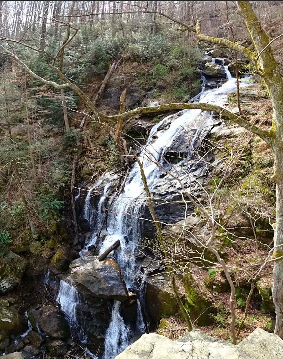
The trail was promoted to me as “the best place for spring ephemerals in the region,” and it didn’t disappoint – this was the most incredible wildflower experience I have ever had. Our progress was incredibly slow as we stopped to look at every new flower we found, and although this tempo considerably added to the total hike time, it also distracted us from the terrain. Though not a difficult hike, there is enough change in elevation to rate this trail moderate. However, the trail ends at a rocky overlook to a 60ft waterfall, and the trail at this end is steep and dangerous. Just last week a local man fell 70 feet at this point, sustaining severe injuries; please know that a slip or moment’s inattention can end in disaster, and use common sense and more than a grain of caution. 


The trail also crosses two small tributaries, both homes to multiple species of salamanders. The streams can be crossed by rock hopping, or getting your feet a little wet – possibly both, if you’re a three year old.


Branch lettuce, Micranthes micranthidifolia

There are also two unofficial trails head down to Big Fall Creek, however both are heavily eroded in steeper sections. The second of the two provides a safer method of access to the bottom of the waterfall (than climbing down from the top), although the falls themselves aren’t completely visible. And finally, closest to the trailhead there is a spur trail that leads past rock outcrops to the railroad tracks.

Dutchman's Breeches, Dicentra cucullaria

Yellow mandarin, Disporum maculatum

In addition to the hazardous cliffs area of this hike, there is also a high concentration of poison ivy; even this early in the year we found vines and budding leaves that could transmit their poisonous oils.

White baneberry, Actaea pachypoda


So, sum total: moderate terrain, creek crossings, dangerous drops, poison ivy, plus the usual hazards (ticks, chiggers, snakes etc.) = the most incredible spring ephemerals in our area… Choose your own adventure!

*****

In addition to the wildflowers pictured above, we also saw: violets, Solomon's Seal, toadshade (Trillium cuneatum), trout lily (Erythronium americanum), mayapple (Podophyllum peltatum), bloodroot (Sanguinaria canadensis), wild bleeding heart (Dicentra eximia) and another dozen that I'm not confident enough to identify...

Sunday, March 25, 2018

The “Birthplace and Deathbed of the Confederacy," Abbeville SC

Abbeville was settled by French Huguenot settlers in 1758, and together with the county was named for the French town of the same name. Officially incorporated on December 20, 1832, it was the city’s role in the Civil War that has earned it the nickname of “Birthplace and Deathbed of the Confederacy.” The meeting that prompted the state's secession from the Union took place on Nov. 22, 1860 on Secession Hill, and then five years later Jefferson Davis and his cabinet decided to dissolve the Confederacy at the Burt-Stark Mansion. The noteworthy historic district featuring these locations as well as dozens of other historic sites is just a little over an hour from Greenville and the Upstate.


The very center of Abbeville is the Court Square, quaint historic storefronts lining the greenspace that contains the monument that honors those who served in the Civil War. Beginning with the death of J. Allen on Sullivan’s Island in 1861, almost 350 Abbeville residents would lose their lives in the Civil War, close to ½ the male population of the district at this time. The monument is a replacement that was erected in 1996, 90 years after the Daughters of the Confederacy first placed a monument there. The original was replaced after the Christmas tree surrounding the marker burned in 1991, flaking off large sections of stone.


Across the street is a marker that symbolizes the remembrance of the lynching of Anthony Crawford. On October 21, 1916, a white mob lynched a black leader for refusing to sell his cottonseed to a white merchant for a lower price. The marker is located near the Abbeville County Courthouse, the 1908 Beaux Arts building which is on the National Register of Historic Places. 


Facing the square directly next to the court house is the Abbeville Opera House, whose doors first opened on October 10, 1908. The ‘Official Rural Drama State Theatre of South Carolina’ is listed on the  National Register of Historic Places, and is the only "Hemphouse" remaining in South Carolina, the 7,800 ft² stage using the same rope-pulled rigging system as when it was originally built.


The actual spot where the secession speeches were made is a little to the east of the square, near the intersection of Branch Street and Secession Avenue. The location is marked by a stone, historical markers, and the grave of an unknown Confederate soldier.


About ¼ mile northeast from Court Square is the Burt-Stark Mansion, the Greek Revival style home that is now property of the Abbeville County Historic Preservation Commission. It was in this stately mansion that Confederate President Jefferson Davis held the last council of the war of the Confederacy on May 2nd 1865. Fleeing from Richmond with the Confederacy in shambles, Davis was convinced by his generals and cabinet that Southern resources were completely exhausted and that any attempt to continue the campaign would be futile. Davis officially acknowledged the dissolution of the Confederate government.


Another site listed on the National Register of Historic Places is the Trinity Episcopal Church, the French Gothic church built in 1860. The pink hue is due to the locally made bricks (and native clay) which are beneath the exterior layer of cement, and the original bell still hangs in the tower to this day. The historic churchyard beyond contains the graves of several Confederate soldiers and one Union soldier.

McGowan-Barksdale-Bundy House

If you are touring Abbeville with children, make sure to schedule a stop at the park behind the McGowan-Barksdale-Bundy House, headquarters of the Abbeville County Historical Society. The grounds contain three servants’ cabins, two of which date back to 1857; however it is Caboose No. 5759 that draws their attention, built in August 1963 and a testament of Abbeville at a rail-crossroads. The caboose traveled through town on its way to Richmond, Atlanta, Miami, Washington DC, Baltimore and Cincinnati, and as far as Chicago IL, St. Louis MO & New Orleans LA.


Finally, film buffs should plan to drive down Magazine Street. There they'll find the white Victorian which Julia Roberts moved into in the movie Sleeping With the Enemy

404 Magazine Street, Abbeville

The area around Abbeville is home to a number of state parks, as well as the Long Cane Ranger District of Sumter National Forest. Located near the Savannah River Basin, nearby Lake Secession is owned and operated by the City of Abbeville. Abbeville is also part of the South Carolina National Heritage Corridor due to its rich heritage of textiles; the Heritage Corridor stretches from the coast near Charleston to the mountains of Oconee County. It is this combination of the historic with natural that makes Abbeville a great weekend destination from the Upstate.

Gothic Revival style servants cabin
Livery stable built in 1870s after original destroyed in fire


Tuesday, April 25, 2017

The confluence at Harpers Ferry

View from Jefferson Rock

Harpers Ferry is located at the confluence of the Potomac and Shenandoah Rivers - the Shenandoah mirroring our trip up Interstate 81 from its headwaters in the mountains of Virginia, and the Potomac tracing a more easterly route through West Virginia on its journey to the Chesapeake Bay. However, it isn’t only the rivers that converge in this corner of WV; state lines, national parks and trails, and American history collide for an intense experience that has all the hallmarks of the perfect spring break destination.

St. Peter's Catholic Church

We started our morning closer to Interstate 81, where we had arrived late the previous evening after a day spent in Appomattox Court House and Natural Bridge State Park in Virginia. The short drive didn’t net the boys any new state lines crossed; it was only another mile east of Harpers Ferry (after our visit) that we re-entered Virginia from WV in order to access the bridge across the Potomac and into Maryland. This means the total # of states traversed that day was 6; we would still venture into Pennsylvania and cross New Jersey on our way to New York that evening.

View across Arsenal Square

Despite seemingly being at the center of everything, Harpers Ferry has an isolated feel to it. We utilized the large parking lot at the Harpers Ferry National Historic Park Visitor Center and then took the free bus 2 miles into town as there isn’t really any public parking in what is termed “Lower Town”. Once there, we realized that the rivers effectively cut the town off from everything except the rest of West Virginia – and as it is the furthest, most northeast corner of the state, the town seems remote as you’re trying to get there. The seclusion is somewhat of an illusion though, as we soon found ourselves on Shenandoah Street with a network of roads and trails leading every which way, one of those being the Appalachian Trail. As it winds through the mountains from Maine to Georgia, the AT crosses the Potomac from Maryland utilizing the Potomac Railroad Bridge, skirts the original site of John Brown’s Fort, and then cuts right through the heart of town. Deciding to start our Harpers Ferry experience by getting a lay of the land, we started up the stone steps on the AT and worked our way up to Jefferson Rock.

Ruins of St. John's

Steep steps led past St. Peter’s Catholic Church and the ruins of St. John’s Episcopal Church, one of the five earliest churches in Harpers Ferry (1852). Although Jefferson Rock is only ¼ mile from the fort, it is an ascent in elevation, which is what makes the rock a worthy destination.
“On your right comes up the Shenandoah, having ranged along the foot of the mountain a hundred miles to seek a vent. On your left approachs the Patowmac, in quest of passage also. In the moment of their junction they rush together against the mountain, rend it asunder, and pass off to the sea… This scene is worthy a voyage across the Atlantic.”
This is how Thomas Jefferson described the view during his visit in 1783. The uppermost slab of Jefferson Rock originally rested on a narrow base that threatened to crumble from the weight of weather and tourists. Sometime around 1855 four pillars were placed under the corners of the slab, and today it is illegal to walk on, climb, ascend, descend or traverse Jefferson Rock or its supporting base rock.

John Brown's Fort

Having descended we made our way towards John Brown’s fort. In October 1859, determined to arm slaves and spark a rebellion, John Brown and his followers seized the armory at Harpers Ferry along with several other strategic points. The raid failed, and most of the men involved were killed or captured. Brown was tried and executed, and the nation took several large steps towards Civil War. Today the fort stands between Arsenal Square and the original site of the fort, and visitors can experience the raid at the John Brown Museum through film and interactive exhibits. (See this article for an interesting read on the “Second Raid on Harpers Ferry”)

Footbridge to C&O Canal and Maryland Heights

From there we headed to the Point to see where the Potomac and Shenandoah converge. This natural corridor where the Potomac cuts through the Blue Ridge Mountains has seen traffic for centuries: first American Indians, then European settlers. Robert Harper started a ferry across in 1747, and the rushing waters inspired George Washington to locate the US armory here some years later. Further downriver the bridge connecting Virginia to Maryland can be seen, and a train trestle that still is used by trains crosses towards the Harpers Ferry tunnel. In addition to the Potomac Railroad Bridge now carrying foot traffic and the Appalachian Trail, the ruins of the old Baltimore & Ohio (B & O) railroad bridge are still present. Once a majestic wood covered bridge that spanned the Potomac River, this was the bridge used during John Brown’s raid across the river. When Virginia seceded in April, 1861, the bridge remained a physical connection to the Union, one that would be rebuilt and destroyed nine times (four times by war, five times by floods).

View from footbridge back towards the Point

From the Point we descended the stairs to reach the trails along the Shenandoah River. The Chesapeake and Ohio Canal (the aforementioned C&O) National Historical Park stretches all the way from Washington DC to Cumberland in Maryland, and for the section in Harpers Ferry, the Potomac Heritage Trail follows the C&O Canal Towpath as well. This developing network of hiking and water trails extends all the way from western Pennsylvania to the Chesapeake Bay. On our visit the floodplain was awash with bluebells, and while there are trails to bring visitors back to the Visitor Center, we opted to return to the shuttle stop to save our strength for the next leg of our trip.

On the banks of the Shenandoah


There remained much of Harpers Ferry that went unexplored; from the Civil War battlefields at Bolivar heights, to General Stonewall Jackson’s 1862 battle line at Schoolhouse Ridge, to the panoramic views of the town and river from Maryland and Loudoun Heights. The 4,000 acres includes 20 miles of trails ranging from easy riverside strolls to four-mile hikes across Civil War battlefields to eight-mile adventures into the mountains; the best place to start planning your trip to Harpers Ferry is the National Parks website. For us however, this portion of the adventure came to a close – we crossed the two rivers, several state lines, and hundreds of years back into the present, and headed north to the site of the bloody Civil War battle, Antietam.

Note: not Jefferson Rock

Related Posts Plugin for WordPress, Blogger...