Wednesday, November 8, 2017

Pilot Rock on the Blue Ridge Parkway

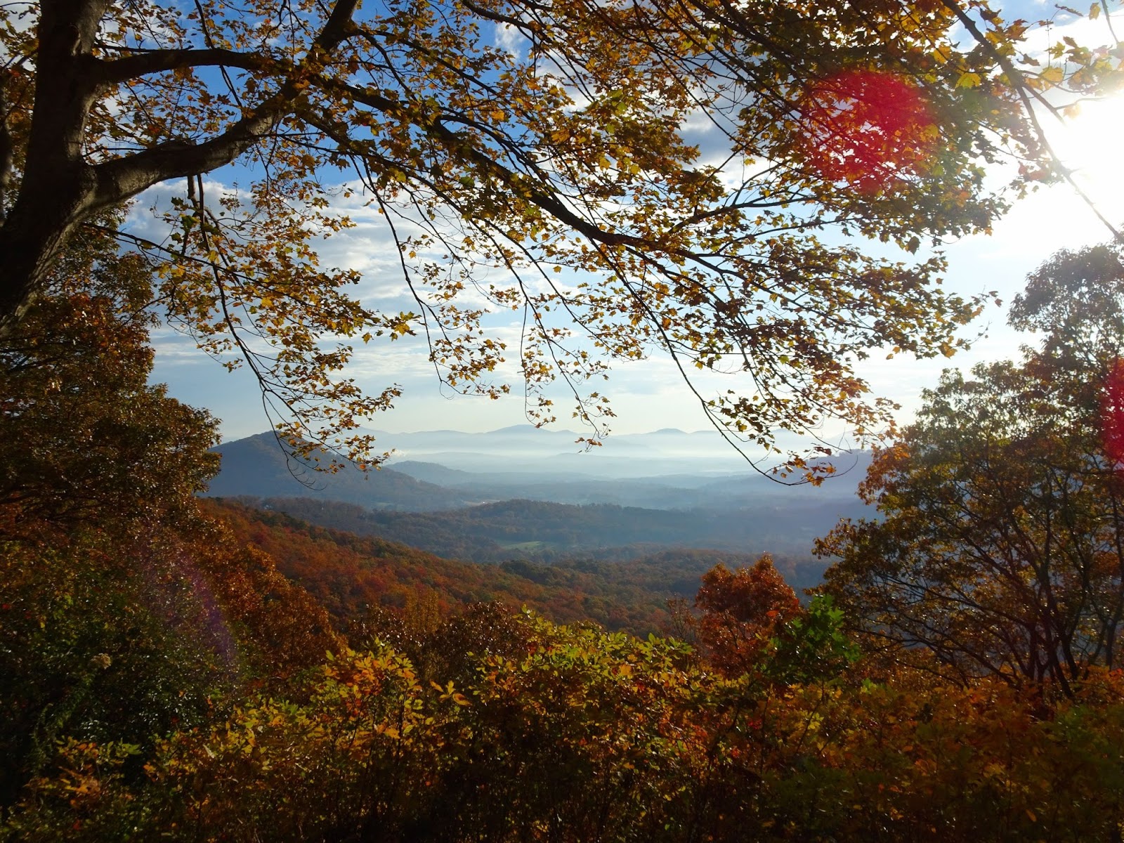
Morning view from Chestnut Cove overlook

A trail for mountain bikers, rock climbers and hikers – this challenging route on the Pisgah National Forest has it all! With a trailhead on the Blue Ridge Parkway, the Pilot Rock trail is ideal for a fall hike - cooler temperatures and vibrant autumn scenery your companion for a memorable excursion into Pisgah National Forest.

View from the Laurel Mountain Connector

There are several pull-offs in a short stretch past the Buck Springs Tunnel including the Buck Springs trailhead, Mount Pisgah Overlook & trailhead at MP 407.6, Frying Pan Mountain Trail at MP 408.5, and the campgrounds, Pisgah Inn and trailhead at Mount Pisgah, MP 408.6. Our hike to Pilot Rock started at the Buck Spring Overlook on the Blue Ridge Parkway, although it is possible to connect via the Pisgah Inn. Facing south from the Parkway from the parking lot a trail heads off to your right, and 500 feet later you’ll have reached the site of George Vanderbilt’s hunting lodge. In addition to the Biltmore Estate in Asheville, Vanderbilt owned 471 acres here in Buck Springs Gap where he constructed an enormous log hunting lodge; the stone foundation of the spring house is still visible today.

Buck Springs Lodge spring house foundation

When the Blue Ridge Parkway was constructed in 1961, the lodge and outbuildings were razed. We read about the lodge and site on the informational placard, and admired the grand view before continuing on. Soon we reached a split in the trail, the Laurel Mountain Trail following the ridge to the left while continuing straight takes you to the Buck Spring Trail which climbs over the top of Little Bald Mountain. Connecting Pisgah Inn with Buck Spring Lodge is a section of the Mountains-to-Sea Trail, and together this network of trails allows for a small loop – we followed the white blazes of Buck Springs on the way in and the Laurel Mountain Connector on the way back from Pilot Rock.

Note - the milage on this sign is incorrect, it is NOT 2.3 miles to Yellow Gap from this point

From the Mountains-to-Sea Trail intersection with Pilot Rock Trail it is 3.6 miles south to FS 1206 (Yellow Gap Road), although we would be returning once reaching Pilot Rock. The hike starts with an uphill climb to reach the summit of Little Bald Mountain, a grass savanna that is home to Ruffed Grouse and features views to the west, especially now that the trees had started dropping their leaves.

From summit of Little Bald

From Little Bald the trail descends down a dry ridge until reaching the top of Pilot Rock - 2.5 miles and 1,300 feet later. First we passed the intersection with Buck Springs/Pilot Rock Trail, and then following orange blazes through tunnels of rhododendron the descent became rather rocky, slowing our pace as we paid careful attention to our footing on the leaf-covered trail. The granite and shale at this elevation is the result of thousands of years of erosion attacking the pluton, and soon after the forest transitions to hardwoods, the fall foliage ablaze despite the cloud cover.


Along this stretch we found mature American chestnut trees, the spiky seed husks littering the trail. Before the species was devastated by the chestnut blight these giants filled the Appalachians, numbering in the billions and providing an important food source for wildlife as well as livestock. At the beginning of the 20th century the fungal pathogen responsible for chestnut blight was accidentally imported into the US from Asia, and it rapidly spread throughout eastern forests, leaving only the rare American chestnut standing by the 1950s. The fungus enters the tree through an injury in the bark, and spreads, killing tissue as it advances - effectively girdling the tree. Despite being infected, the chestnuts we saw were survivors; it was incredible to see these trees ‘in the wild’. (There has been much success in crossing the American chestnut with the blight-resistant Chinese chestnut – for more on the work being done to reintroduce the American chestnut to the eastern forests, please visit the American Chestnut Foundation’s website.)

American chestnut tree and seed husk

Soon the trail gets steep, each switchback a reminder that you’ll soon be going the other way to return to the trailhead. A rock outcrop gave us the perfect spot for lunch, and as we fueled up we took in the views over the Pisgah.

This rock outcrop makes a good lunch stop

According to the Forest Service website, there are two access points to the rock face, which at this point on the trail will be on your left. From this vantage point the breathtaking 180° views include Funneltop Mountain, the Pink Beds Valley, and the Cradle of Forestry. Down below is Yellow Gap Road; if you kept heading downhill you would descend another 600 feet in elevation over the course of a mile, emerging on the Forest Service road at Grassy Lot Gap where there is room for a couple of cars to park. On the way is also the intersection with the Pilot Rock Extension spur trail, which provides access to the rock’s base for rock climbers looking to scale the pluton.


However, the ascent back up to Buck Springs would provide enough of a challenge to us on this excursion, and so we headed back the way we came, Vilis growing heavy in the backpack carrier before I had even traveled ½ a mile. I carried him over the more steep/treacherous sections, and he would stretch his legs on the more level sections of trail. To avoid an extra bit of a climb, take the Laurel Mountain Connector; it skirts the side of Little Bald to return to Laurel Mountain Trail. On this side of the mountain we found ourselves crossing entire hillsides covered in rocky boulders, the moss-covered rocks a landscape straight out of fairytales. A bit of warning, that although the Connector has less elevation change than crossing the summit of Little Bald, the terrain is a bit more challenging, slippery climbs in some spots with rocky ground making for slower going.


Before too long we reached the junction with the Mountains-to-Sea trail, closing the loop, and just after that arrived at the former site of the lodge. We soaked in the view yet again, and then in the parking lot almost submitted to the lure of climbing Mt. Pisgah as we still had daylight to burn – Vilis was asleep in the carrier after all! But a celebration awaited this birthday girl back in Greenville, so I took one last longing look before loading up the car and turning east on the Parkway towards Asheville.

View from Buck Springs Lodge site

Note: The NC Arboretum is located right where we turn off the Blue Ridge Parkway on our way back to Greenville, meaning the Winter Lights event could be a perfect conclusion to a day on the Blue Ridge this December. Or, if you're headed west on the Parkway, my Pisgah to Cherokee post would be a good guide of sights to see en route! Finally, check out the Meanderthals post on Buck Spring to Pilot Rock for detailed trail descriptions, maps and fantastic photos.   


Mount Pisgah

Monday, November 6, 2017

Glassy Mountain

It’s Pickens. It’s only a mile or two long. It’s at 1,700 feet compared to Caesar Head’s 3,215. Whatever the reason for the Glassy Mountain trail’s relatively unknown status, it only adds to the charm of one of the best views of the Blue Ridge Escarpment to be had in the Upstate; and all within a 30 minute drive of Greenville.


The drive to Pickens was scenic, the bright foliage of autumn lining the roadsides as we headed west out of Greenville on Farrs Bridge Road. The Glassy Mountain Heritage Preserve is a straight shot – only on the approach to Pickens did we make the right turn on South Glassy Mountain Road that appears shortly after crossing Wolf Creek. Google tends to direct visitors in on N Cedar Rock Rd; this route allows you a view of the cell tower-covered top of Glassy Mountain before you make the hike up.


Coming in up South Glassy Mountain Road, park on the west side opposite the trailhead just after passing the intersection with South Glassy Mountain Church road. There’s more parking at the top of the mountain if needed, but we prefer start our hike at the bottom, saving the downhill portion for last. The trail isn’t blazed, but sporadic signs point the way in the few spots you might take pause.


The trail winds around the east side of Glassy Mountain, named for the glassy appearance of the exposed rock face when wet. The Preserve was established on May 8, 1990, the 65 acres today managed by the SC Forestry Commission. What makes this hike special are the multiple rare plant species that grow on the unusual land form; Glassy Mountain is a Piedmont Monadnock, an isolated mountain in the Piedmont with associated granitic dome plant communities. The north face has extensive bare rock areas that in places drop up to 400 feet, and the relative uniformity of the surrounding countryside ensure fantastic views. With leaves already starting to drop there were immediately glimpses to be had of the country to the east, Paris Mountain providing the backdrop for rolling countryside and colorful autumn forests.


Continuing around we saw many flowers, ferns and other interesting plants, despite the chilly October temperatures. The exposed rock outcrops provide up-close looks at dozens of mosses and lichens, although please be careful to stay on the trail, to help conserve the fragile plant communities that call these outcrops home.


From a rocky pine/oak forest we entered sugar maple woods, corroborating evidence that the soil on the north side of the dome is surprisingly rich, a result of thousands of years of weathering without the high elevations typical of granite domes. Stay on the lookout for all sorts of wildflowers that love these fertile and moist soils.


About ½ mile into your hike you’ll reach an intersection: the two trails to the right make a loop out to the edge of the dome, the trail to the left climbs up to the top of the mountain. We went straight, and the trail soon curved around to the most stunning view; stretched out in front of awed visitors is the Blue Ridge Escarpment, punctuated by Table Rock and Pinnacle mountains.


Closing the loop back to the intersection and taking the remaining branch of trail you’ll find that the last bit up to the summit is the steepest; however 2/10ths of a mile from the scenic viewpoint you’ll reach the open area at the Glassy Mountain summit. Various communications towers dot the top, an old fire tower standing vigil over the gravel parking lot.


If you’ve got the time, descend back to the trailhead the way you came, winding through the forest to catch all the things you missed on your way up. Or you can just head down the road, enjoying the views of some of the exposed rock surfaces from a different perspective and cutting about ½ mile off your hike. Either way, you’ll promise yourself that you’ll soon be back: in the winter months to take in unobstructed views once the leaves fall, in the spring to admire the biological diversity of this incredibly rich natural resource, in the summer for the wildflowers and verdant understory. Or again in another week, as the progression of fall color creeps down the Blue Ridge Escarpment!  


Friday, November 3, 2017

Hatcher Garden and autumn storms

Severe weather including a tornado left a trail of destruction across the Upstate last week, with a commercial area of Spartanburg County bearing the brunt of damage. Hatcher Garden and Woodland Preserve was also hard hit, and on our recent visit there were still multiple trails closed.


“The tornado of 10/23/2017 devastated the Hatcher Garden forest, covering paths with broken limbs and uprooted trees. Volunteers are desperately needed to help remove the debris. Please help if possible!”


In some places uprooted trees had completely pulled up the trail and irrigation pipes, while in others they had torn branches and crushed plants on their way down. However volunteers and staff have been hard at work, and the Gardens are open to the public.


On our visit I was reminded that Hatcher Garden is truly a place for all seasons. While cooler temperatures mean there aren't as many flowers blooming, the camellias are flowering and the leaves are beginning to change color. We saw a multitude of butterflies, and the mosquitoes that breed in the ponds during the summer were thankfully absent.


You can read more about the history of Hatcher Garden and Woodland Preserve in my post Summer in Hatcher Garden. They can also be found on facebook at Hatcher Garden and on their website


Gulf Fritillary butterfly

Wednesday, November 1, 2017

Be a part of 24 Days of a Baltic Christmas!

The Opportunity! This is the Call for submissions to 24 Days of a Baltic Christmas! If you are a photographer, writer, artist or blogger and would like to participate in this year’s 24 Days of a Baltic Christmas, this is the time to reply! We are currently accepting material, posts and sponsors for 2019, with the idea to keep it related to the Baltics and the holiday season. Want in/want more info? Get in touch with me, LLucane (at) yahoo (dot) com.

Make History! This will be the sixth year of 24 Days of a Baltic Christmas here on the blog; please join us in counting down the days until Christmas with a showcase of Latvian, Lithuanian and Estonian holiday food, crafts and traditions starting December 1st! We were excited to welcome a group of new contributors to the series last year, with Baltic food bloggers, knitters, authors and photographers joining us for 24 Days of a Baltic Christmas, right here on Femme au Foyer.


24 Days of a Baltic Christmas is also on facebook! Now you can follow the countdown as well as see other articles and events pertaining to the Estonian, Latvian and Lithuanian holiday season. Like and follow here: https://www.facebook.com/24DaysofaBalticChristmas/


And Hashtags! As always we’ll be using the hashtag #24DaysofaBalticChristmas, as well as pinning related material on Pinterest. This is in addition to the daily post you’ll find on Femme au Foyer throughout the month of December! I hope you’ll make 24 Days of a Baltic Christmas part of your holiday tradition this year by following, joining and sharing with your circles of friends.


Monday, October 30, 2017

Bear Cove at Devils Fork

*** This trail has been closed by the South Carolina State Parks, indefinitely. I do not have any additional information on this closure. Hopefully will update that it was reopened, at future date.***

After all the hype about how this will be the brightest and most beautiful autumn in decades, a couple of weeks of hot weather coupled with high winds and stormy weather has left the Upstate and Western North Carolina a little short on fall color. No doubt it was there - individual sourwoods, maples and hickories dressed in vibrant reds, yellows and oranges – but despite our multiple trips up into the mountains and foothills we were left without the technicolor dreamscapes of last year.


That’s not to say it has been a bust; I’ve enjoyed every single minute spent outdoors this October! And on a recent hike in Devils Fork State Park I was reminded that it’s not only about fall color and high-elevation views this time of year… it’s about getting out on the trail with the kids, even on those chilly mornings that you would rather sit back with a cup of coffee while they busy themselves with Legos.


Bear Cove Trail is one of two trails at Devils Fork State Park, the other being the 1.5-mile Oconee Bell Trail which starts near the Ranger Station. The trailhead for the 2.5 mile Bear Cove lollipop-loop is on the other side of Devils Fork, off the parking area next to Concessions and the playground. The online maps don’t show the entire trail, so if you would like a map either head over to the SC Trails website or ask at the Park Visitor Center.


We packed up our backpacks and headed into the forest following the blue blazes, soon crossing Turkey Ridge Road (that leads to the campground) and then starting the loop portion of the hike. Although it was predominantly hardwoods throughout our hike, there just wasn’t much color; either it was too early, or the temperature fluctuations/weather had dulled the colors. The red maples and dogwoods were brighter shades of red, suggesting there is still hope despite all the brown foliage already underfoot.


We hiked the loop clockwise; this puts the Lake Jocassee overlook past the halfway point of the hike making it a logical lunch stop. The trail heads out onto a finger of land between two inlets, and although I’m not sure which one is Bear Cove (if either!), across the water to the north is the Devils Fork SP Dive Training Site, while the peninsula to the south is where the walk-in campground is, accessible from behind the playground on Buckeye Drive. The trail took us almost right out to the tip of the peninsula, and after scrambling down the rocky bank we found ourselves surrounded by the blue waters of Lake Jocassee on three sides.


The water level seemed low, about 10 feet lower than the lines visible on the shores. This is most obvious back at the swimming area, where 30 feet of beach has been revealed by the retreating waters, however it was easy to see that the rocky point we were standing on sometimes is visible only through the blue waters of the lake. A little further on the trail is a bench and signage describing the history of the valley, and beyond that is a path down to a little beach where we spent some time skipping stones.


Bear Cove was ideal for a short autumn hike, as we made it back to the parking lot with plenty of time to spare despite our leisurely pace on the trail – about 2 hours including the lunch stop. The views of Lake Jocassee more than made up for the lack of fall color, although if we were to return today it might be a different story; cooler temperatures and several inches of rain have no doubt influenced the foliage as well as lake levels. We packed up the car and then took one last stroll over to the shore near the swimming area for an final look out over the blue waters of Jocassee. I always find the view bittersweet as I think of all that was lost when the valley was flooded, and these losses hard to reconcile with the beauty of Jocassee that is visible today.
_________

Devils Fork State Park website here
Map of Devils Fork SP trails here
Exploring Lake Jocassee and its waterfalls here
My previous post on the park here
More on the Oconee Bell Trail here
Your Guide to the Cherokee Foothills Scenic Highway 11 here...
and a post on the other end of Lake Jocassee and Jumping Off Rock here.

Related Posts Plugin for WordPress, Blogger...