Showing posts with label waterfall. Show all posts

Wednesday, April 27, 2022

Femme au Foyer Guide to the Foothills Trail

Waterfalls, wilderness areas, wildflowers and epic views… No, I'm not talking about a national park somewhere out west, but our very own Foothills Trail! Backpacker magazine rated it as “one of the best long trails (fifty plus miles) in the country,” and it traverses the Jocassee Gorges, which National Geographic named one of "50 of the World's Last Great Places—Destinations of a Lifetime"… this isn’t just any walk in the park! Well-suited for a through-hike for families looking for a challenge, yet accessible even for the shortest day-trip ramble, the Foothills Trail is rapidly gaining notoriety as one of the premiere trails in the southeast.

Map via Foothills Trail Conservancy

Totaling 77 miles, the trail stretches from Oconee to Table Rock State Park with additional spur trails to numerous waterfalls and Caesars Head State Park. Major trailheads are located at the state parks, as well as US 178, SC 130 and SC 107. You’ll find all this and more on the trail’s website, and the following interactive map has access points, campsites, water sources and other info:

With 77 miles of trail, it can be daunting to choose the right hike for your family. I’ve put together a guide to help identify shorter hikes on/near the Foothills Trail and spurs that will take you to points of interest, as well as give you the info you’ll need to plan your trip: parking, hike difficulty, cost, etc. The trail is broken down into sections, the numbers corresponding to the system the Foothills Trail Conservancy uses on their website: “A” denoting access points and “S” spur trails.

A short history of the Foothills Trail

The push to protect the Appalachian Foothills began in the 1960s, with Clemson University and the US Forest Service (USFS) leading the way. The first component connecting Oconee to Table Rock was built in Sumter National Forest by the USFS, and by the early 1970s, the Foothills Trail effort was gaining momentum. Duke Power offered to build and maintain the central section of the Foothills Trail during the process of planning the Bad Creek Hydroelectric project, and in 1974 the Foothills Trail Conference was established.

The 77-mile trail linking Oconee and Table Rock State Parks was finished in 1981, and for the last 40 years the Conservancy has promoted and supported the trail through trail maintenance and developing the Foothills Trail Guidebook and map. To become a member, please visit the FTC’s website! Join Now – Foothills Trail Conservancy


The Trail
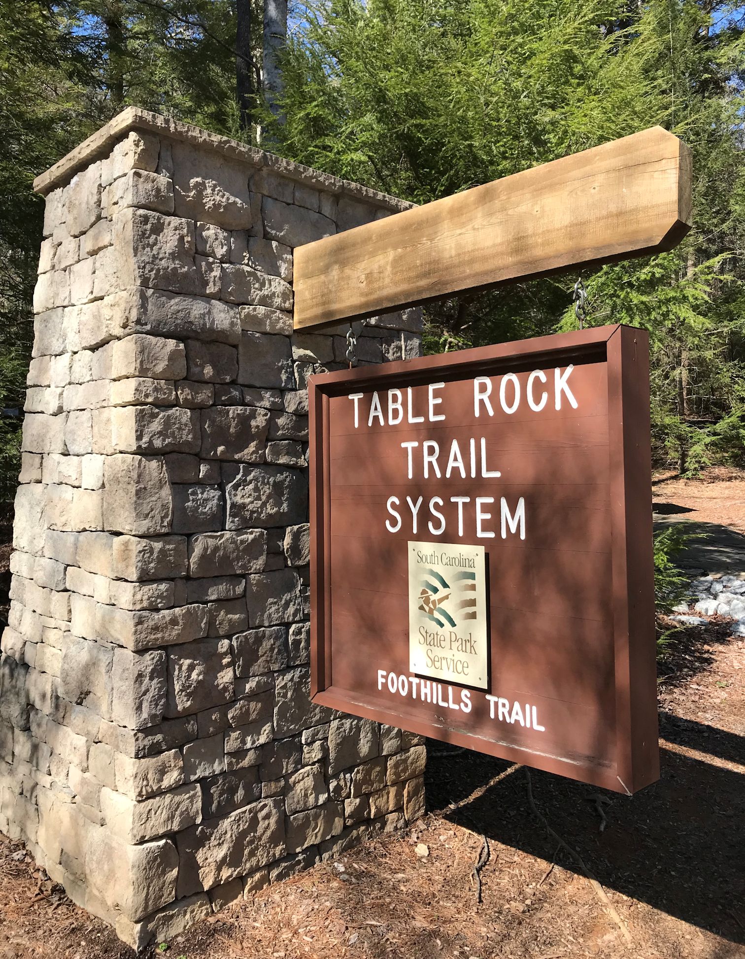
Table Rock State Park (A1)

Chances are, you’ve been on the Foothills Trail already, as a portion of this section shares trail with beloved Carrick Creek Trail in Table Rock. The one mile of trail that follows Carrick Creek up from the Nature Center has a waterfall, countless cascades, and a gentle grade with well-maintained trail - perfect for young children. From there you can keep hiking, although the trail gets much steeper. A short spur goes up to the summit of Pinnacle Mountain, though all the views are found along the Foothills Trail: Bald Knob (3.6 miles from Table Rock) and Drawbar Cliffs (4.6 miles from Table Rock). Both make great destinations, though be warned they are difficult hikes; less experienced hikers will want to stick to Carrick Creek!

The easy way out(side): Carrick Creek loop trail 

Know before you go: State Park pass required, hikers must register at kiosk at Nature Center.
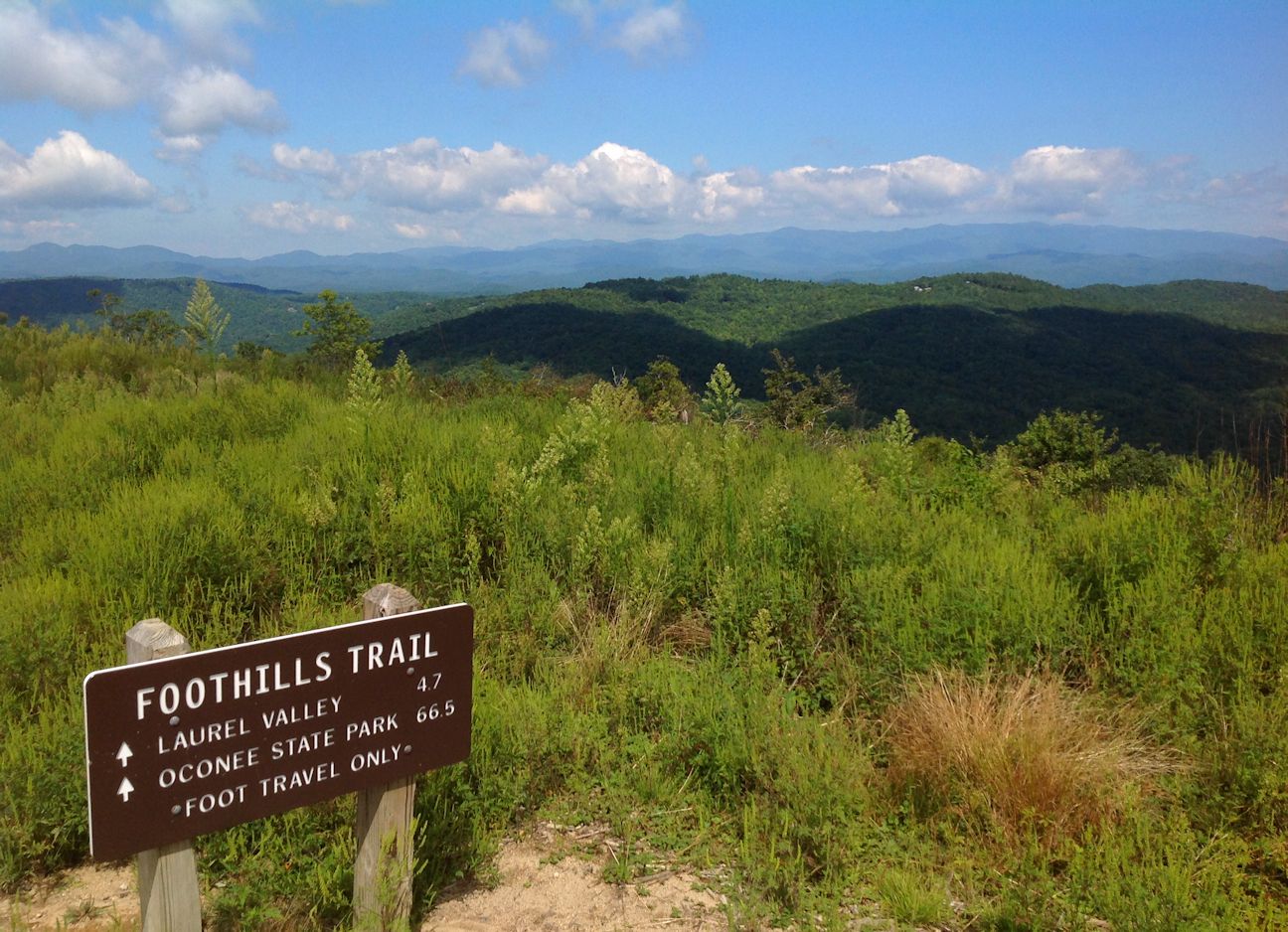
On the top of Sassafras Mountain

Sassafras Mountain (A2)

Another spot on the Foothills Trail you may have already checked out is Sassafras Mountain. Remember, as it’s the highest point in the state, any direction you hike will be descending from the summit… which means you’ll have to go back up to get to your car!

The easy way out(side): The observation tower and the rock outcrops located adjacent to the medium-sized parking area guarantee that you will not have to go far to soak in those views! Remember to bring a picnic to enjoy at one of the picnic tables.

Know before you go: Parking is free, but the road up can be closed in the winter for inclement weather; to check on the status, call the Pickens County Sheriff’s Office at (864) 898-5500.

Beech Bottom Falls

Chimneytop Gap (A3)

Just two miles from the summit, the section of trail from Chimneytop to the top of Sassafras makes for a nice day hike. Start at the Chimneytop parking area to get the hard part out of the way first; the views at the peak will be so much more spectacular as for having earned them with the climb up!

The easy way out(side): Park at Chimneytop and hike the Beech Bottom Falls trail

Know before you go: Up until Sassafras the Foothills Trail has just been passing back and forth into the Jim Timmerman Natural Resources Area at Jocassee Gorges, but after Chimneytop it heads right into the heart of the wilderness area. Be prepared for fewer road access points and limited cell service!

Raven Cliff Falls from Naturaland Trust Trail spur

Caesar's Head Trail: Sassafras (S1) to Caesars Head (S2) spur

The 14.2 miles from Sassafras Mountain to Caesars Head are strenuous, but the trail borders Greenville watershed property, some of the most pristine forest in South Carolina. A highlight of this section is Raven Cliff Falls, the tallest waterfall in the state. To reach a viewing platform across the valley from the falls, hike in from the Caesars Head SP end (use the Raven Cliff Falls parking area) – the 4-mile in-and-out hike is moderate in difficulty.

The easy way out(side): Park at the Caesars Head Visitor Center and walk out to the overlook to get a birds-eye view of the terrain!

Know before you go: State Park pass required, hikers must register at kiosk. Parking lot fills up fast, plan to get an early start and have a back-up plan if overflow lot is full.

Jumping Off Rock

Laurel Valley (A4)

The medium-sized parking area on Horsepasture Road serves as a gateway to the Jim Timmerman Natural Resources Area at Jocassee Gorges, and marks the last vehicle access point to the Foothills Trail for many miles. A popular dayhike destination from this trailhead is Virginia Hawkins Falls, an 8.5 round trip, although by driving a bit further on Horespasture Road you can reach a second trailhead that cuts down the mileage to 2.6 miles in-and-out.

The easy way out(side): Take a slow, scenic drive on Horsepasture Road, with a stop at Jumping Off Rock to take in one of the most epic views of the Jocassee Gorges.

Know before you go: Horsepasture Rd. is a primitive road maintained by the SC DNR. It’s open year-round, but allow for extra travel time – the 9 miles to Jumping Off Rock can take around an hour.


The Narrows

Eastatoe Gorge: Laurel Valley (S3) to the Narrows (S4)

A moderate hike of 5.4 miles round trip (with a steep, if short section that might tend towards strenuous), a Foothills Trail spur takes hikers into the Eastatoe Creek Heritage Preserve. This section is characterized by amazing spring wildflowers and a view of Eastatoe Creek as it funnels through a narrow rock channel called “the Narrows.”

Know before you go: Park at the Laurel Valley parking area, not at the gate a little further up the road where the trail enters the forest – the road there serves as emergency access, and blocking the gate can get you heavy fines and possibly towed.

Bad Creek Access (A7)

The Bad Creek Hydroelectric Site is a 360 acre "pump-back" storage facility that pumps water from Lake Jocassee and stores it until needed for peak energy demands. It has a scenic viewpoint over Lake Jocassee as well as a public parking area providing access to the Foothills Trail, the Jocassee Gorges Wildlife Management Area, and Lower Whitewater Falls.

The easy way out(side): It is 0.7 miles one-way from the parking area to the Foothills Trail and Whitewater River, a nice destination for those looking for a short hike with some time by the water. The viewing platform for Lower Whitewater Falls is a little more of a challenge, 4 miles in-and-out.

Know before you go: There are three boat access points to the Foothills Trail in the 33 miles from Laurel Valley to Bad Creek Access (Laurel Fork A5, Canebrake A6 and Horsepasture River) and a 5-mile connector trail (Cane Brake Trail from Frozen Creek), though no vehicle access save for a few intersections with 4WD forest roads. This is a popular section for camping, especially with families and novice hikers looking to get a feel for backpacking. The Foothills Trail Hiking group on Facebook can be very helpful for planning purposes, with advice from experienced hikers/campers as well as up-to-date trail conditions. It is very important to be well-prepared if entering this section, as there is little-to-no cell service, and you are crossing through the heart of the Jim Timmerman Natural Resources Area at Jocassee Gorges in addition to Laurel Fork Heritage Preserve, NC Gorges State Park and the NC Gamelands. 

Upper Whitewater Falls

Upper Whitewater Falls (A8)

The NC Hwy 281 Upper Whitewater Overlook parking area proves access to spectacular views of Upper Whitewater Falls, the highest waterfall east of the Rockies!

The easy way out(side): A paved, accessible, ¼ mile trail leads to the upper observation area, then 154 steps further you’ll have reached the lower observation area. You can continue on to descend to the river – just remember, you’ll have to climb back up!

Know before you go:  A parking fee of $3 per vehicle goes toward continued improvements of the park. Please don’t venture off-trail, as deaths and serious injuries have occurred here!

View from Wigington Overlook

Sloan Bridge (A9)

The 5.5-mile hike from Whitewater to Sloan Bridge is along a ridge, and has superb views of Jocassee in the winter, but the majority of visitors are drawn to Sloan Bridge for a picnic at one of the tables, to cool down in the East Fork of the Chattooga River, or for a short hike to one of the several waterfalls to the south.

The easy way out(side): After a picnic at Sloan Bridge, drive over to the nearby Wigington Overlook for a picture-perfect view of Lake Jocassee.

Know before you go: There are no trash receptacles at Sloan Bridge Picnic Area; remember, if you pack it in, please pack it out!

Fish Hatchery Road (A10)

It’s just 3.3 miles to Sloan Bridge from Fish Hatchery Road, and with multiple trails in the area, many hikers plan a loop to make a day out of their visit to this corner of the state.

The easy way out(side): Just a little bit further up the road is the Walhalla State Fish Hatchery: take a self guided tour, go fishing, have a picnic, and enjoy the natural beauty of the Ellicott Rock Wilderness Area!

Know before you go: A visit to the Walhalla State Fish Hatchery is free, but if you want to feed the fish, bring quarters for the fish food dispensers.

King Creek Falls

Burrell’s Ford (A11)

There is so much to do in this remote corner of the state! In addition to numerous major waterfalls, Burrell’s Ford offers camping, fishing and picnicking along the Chattooga Wild & Scenic River. For more on Burrell’s Ford, see my post King Creek Falls and Burrells Ford.

The easy way out(side): Enjoy a hike to King Creek Falls or Spoonauger Falls

Know before you go: Burrell’s Ford is free, but can be popular on weekends. Get there early for parking and first choice of a campsite!

Chattooga River, as seen from the Foothills Trail

The Highway 107 access points

Headed south on Highway 107 from Sloan Bridge you’ll pass several access points to the Foothills Trail. However, being small dirt lots that only have room for a handful of cars, we’ve grouped them together for this guide.

Nicholson Ford Access: This access point to the Foothills Trail is also the trailhead for hikes to Licklog and Pigpen Falls. The gravel road can sometimes get a little washed out, if you would rather stay on pavement park at Cheohee Road.

Cheohee Road (A12): Just off Highway 107, Cheohee Road is also known as Winding Stairs Rd. A gravel forest road leads to several popular waterfalls and a Forest Service campground.

Jumping Branch Trailhead (A13): The last access point before entering Oconee State Park!


Oconee State Park (A14)

The southern terminus to the Foothills Trail, Oconee also serves as a connector to Oconee Station via the Palmetto Trail

The easy way out(side): Enjoy Oconee State Park! From multiple hiking trails leading to historic sites, views and waterfalls, to putt putt golf, boat rentals and a beach – Oconee has got it all!!

Know before you go: State Park pass required, hikers must register at kiosk at Nature Center

The rest of it! 

Hikers who complete all 77 miles of The Foothills Trail—from Oconee State Park to Table Rock State Park – are eligible for the Peregrine Award, which was started in 2011 in honor of longtime FTC member Heyward Douglass. The word peregrine comes from the Spanish word peregrino, which means pilgrim. It is also the name of one of Heyward’s favorite birds; he was instrumental in the re-introduction of the Peregrine Falcon to the mountains of Upstate South Carolina. For more information, please visit the Foothills Trail website

Hopefully this guide helps you identify which sections of the Foothills Trail are closest to your home, and will assist in figuring out how you can best get your family out on the trail this summer! Please remember to hike within your comfort and skill level, and always plan ahead – research the trail, local regulations, weather, hazards, and what to do in an emergency. Happy hiking!

Friday, May 7, 2021

Junior Waterfall Keepers program

If your family enjoys participating in the Kids in Parks program and earning Junior Ranger badges at the National Parks, then the new program from Waterfall Keepers of North Carolina will have you excited to get out exploring!

What is the Junior Waterfall Keepers program?

The Junior Keepers program was kicked off this year as part of the Waterfall Keepers nonprofit, because kids love waterfalls, too!  The free program is all about exploring and learning about waterfalls and streams: water play, learning about the critters that call the creek home, exploring waterfalls, and identifying the mushrooms, wildflowers, and other plants that grow near them. The program focuses a lot on safety and good habits around a waterfall, and encourages junior waterfall keepers to leave a place better than they found it. Learn about how litter affects wildlife and water quality, and earn badges while doing it!


How do I sign up?

When you sign up to become a Junior Waterfall Keeper you’ll receive a special Junior Keeper patch and sticker. Signing up is easy; just fill out the Junior Waterfall Keeper Signup Form (find the link here: Junior Keepers | Waterfall Keepers of NC). There’s an added benefit for adults to sign up to become a member of Waterfall Keepers; family members of Waterfall Keepers who sign up for the Junior Keepers program will also receive a free pass to Chimney Rock State Park.

I’ve signed my children up – now what?

As a Junior Keeper, your kids can work on two Badge Challenges: the conservationist, and creek critters. The challenges concentrate on observing the critters and plants you find on your hike, and on improving the waterfall experience by making good choices to help our environment. New badges will be announced each year so work hard to earn them ALL!

The Waterfall Passport will be added to the program in 2022, but all the work done this year will count. The Passport includes five state parks that feature some of North Carolina’s most beautiful waterfalls, and Junior Keepers will receive passport books to keep track of all the waterfalls they visit. Currently waterfall passport info can be found online on the Waterfall Keepers website; you can download the pages to start working on these challenges now.

As a bonus, the Waterfall Keepers have developed a curriculum that adults can use with their kids or homeschool group. They can be used as a standalone adventure with kids or combined with Junior Keeper badge challenges for a fun, and educational waterfall experience.

But wait – we’re in South Carolina, isn’t this in NC?

While the Junior Keepers program is based in NC, there are dozens of North Carolina falls within an hour’s drive of Greenville! I’ve featured Chimney Rock State Park (one of the parks featured in the Park Passport) here on Femme au Foyer, and have another dozen articles with inspiration for your next waterfall adventure, in North and South Carolina, here:


Remember to stay safe while exploring - people have died at many of our Upstate SC waterfalls! I wrote about some of the local incidents in my article Humans Vs. Nature, and following Leave No Trace ethics is always a good decision.


There’s no denying summer is here, along with the hot weather that has every kid longing to cool off at the closest swimming hole. As you explore the beautiful waterfalls of our region this summer, earn badges with the Junior Keepers program while also learning a little something to help keep you safe, our trails enjoyable, and the tremendous beauty of these natural places intact!


Thursday, October 8, 2020

Cruise into an Upstate Autumn

Autumn is here, bringing cooler temperatures and breathtaking fall foliage in the Blue Ridge Mountains! Take a driving tour this fall up the Blue Ridge Escarpment for a showcase of what our region has to offer...

Travelers Rest SC to Brevard NC Loop 

Get an early start to beat the crowds at Tandem Creperie, a local favorite in Travelers Rest. Fortified with coffee and crêpes, head north on Highway 276 into the Foothills. Passing through Marietta it is only a short detour to the Beechwood Farms farmstand, where you can stock up on freshly-picked apples to snack or pick a pumpkin from their pumpkin patch. Continuing north, soon after Cleveland, SC is your second stop, Wildcat Wayside. The roadside destination is the perfect introduction to the mountains, as Wildcat Branch tumbles down over three waterfalls on its way to the South Saluda River. Have just 15 minutes? Take a photo at the lower falls and then buy a bag of boiled peanuts from the vendor who has usually set up in the parking lot before heading on. Have 1-2 hours? Hike the 1-mile loop path that leads up past the middle falls to the upper waterfall.


Wildcat Branch Falls

Next stop, Bald Rock Heritage PreserveIn recent years the vandalism of this beautiful natural area has been on the uptick, however the views from the enormous granite escarpment are still unbeatable. From Greenville, stay on Highway 276 North, following signs to Caesars Head State Park. From Fire Station #64 on the left, drive 1.4 mile to turn right into Persimmon Ridge Road. Another 0.4 mi to the parking lot on the left, and you'll find the trailhead across the road. It's an easy half mile walk through the woods to the iconic view of Table Rock and the surrounding mountains from Bald Rock’s large open rock face. From this vantage point you will be able to look out over Pickens and Greenville County, as well as have a great view of Table Rock and the surrounding mountains. After returning to the trailhead, backtrack on Persimmon Ridge Road and make a right to continue up 276 into the Mountain Bridge Wilderness.


View from Bald Rock

As you climb the Blue Ridge Escarpment through endless switchbacks, you’ll find plenty of fall color; from the red maples and sourwoods at the very beginning of the season, to the deep reds and purples of the oaks into November. Take a break from the winding road at Caesars Head State Park, walking a few hundred feet to the overlook for more breathtaking views, and keep an eye out for migrating hawks; although the numbers are at their highest in mid-September, you’ll find members of Hawkwatch on duty through November to count the migrating raptors soaring the thermals en route south.


View from Caesars Head State Park overlook

Making your way north into Brevard you’ll pass through the community of Cedar Mountain, with an eclectic collection of shops, galleries and other curiosities. The descent into Brevard gives you time to discuss your options of where to stop for lunch!


Headed north on US-276

Once back on the road, take US-64 W to US-178 and head south from Rosman. You’ll soon cross back over the Eastern Continental Divide (the first time was on 276 crossing into NC) into South Carolina, and start your descent from the Escarpment. There’s still a 'high' point to come, however; from Rocky Bottom head east up to Sassafras Mountain, the highest point in South Carolina. From the brand new observation deck you can take in views of the entire region, with views extending to Georgia on a clear day.


End of summer goldenrod on Sassafras Mountain

Once you’ve descended from the escarpment, take the Cherokee Foothills Scenic Highway east to Table Rock State Park. Stop at the Visitor Center, walk out on the pier on Lake Oolenoy, and soak in the view from the rocking chairs overlooking a meadow, the lake and Table Rock in the distance. Have more time? Drive over to the other side of the highway and drive Table Rock State Park Road all the way around, with stops at the Lodge, Pinnacle Lake and a scenic overlook as inspired. Note: the north portion of the Park has an entry fee.


View of Table Rock from the Table Rock State Park Visitor Center

Continuing west on Scenic Highway 11 you’ll pass Table Rock Tea Company, and then a little further Aunt Sue’s Country Corner (Victoria Valley Vineyards just to the north) & Pumpkintown Mountain. If you’re planning a stop here, make sure to check websites for operating hours. Finally, enjoy the last light of the day reflecting the gold and orange hues of the forests blanketing the Blue Ridge Escarpment as you make your way back east on the Cherokee Foothills Parkway!

While the entire driving tour takes a good 2.5 hours, plan to make several stops along the way to enjoy the sights; I would plan 5-8 hours to allow for time at the scenic overlooks. Remember to bring a camera, a coat for once you’re up on the Escarpment, and a map if you’re not familiar with the area – you won’t have cell service for a portion of the drive. Enjoy your Blue Ridge autumn, and let me know in the comments if you have any favorite stops along this route!


For more options on seeing the best of autumn in the Upstate, see the following posts:


Tuesday, October 6, 2020

Stumphouse Mountain Bike Park

Stumphouse Park gets busy on weekends! It is home to the unfinished Stumphouse Tunnel that was dug using hand tools prior to the Civil War, as well as the well-known Issaqueena Falls, both of which I've previously written about here on the blog. There is also the Blue Ridge Railroad hiking trail, a moderate hike to two more abandoned rail tunnels. However, the highlight of the 440-acre park is the least-crowded – Stumphouse Mountain Bike Park.


The main entrance for the Mountain Bike Park is also the trailhead for the Stumphouse Mountain Passage of the Palmetto Trail. The nearly-continuous network of trails stretches from Oconee State Park in the Upstate Foothills, to its low-country terminus at Awendaw and Buck Hall on the Intracoastal Waterway. Established in 1994, it is South Carolina’s longest pedestrian & bicycle trail. Today 350 of the proposed 500 miles of trail have been completed, and the Stumphouse Passage is one of the newest!


From the trailhead, the Stumphouse Passage follows Cane Creek past the Walhalla Reservoir for 1.5 miles. In the future, the Ross Mountain Passage will connect it with Oconee State Park, but for now it provides access to an additional 10 miles of bike trails within the park. A few more trails are in the works, including a short spur trail (hikers only) that leads to a small waterfall on a tributary of Cane Creek.


The Passage/Mountain Bike Park was a collaboration between many parties: the City of Walhalla, Oconee County, Upstate Forever, Oconee Forever, Palmetto Conservation Foundation, Walhalla Partners for Progress, Oconee County Chamber of Commerce, Visit Oconee SC, the SC Dept. of Parks, Recreation & Tourism, the SC DNR, the U.S. Forest Service, REI, Upstate SORBA, Benchmark Trails, and the South Carolina National Heritage Corridor - WOW. While the city of Walhalla owns the 440-acre Heritage Preserve, Upstate Forever holds a permanent conservation easement on the property, allowing visitors to enjoy the trails for generations to come.

Clockwise: Yellow-tipped Coral Fungus, Cardinal Flower, Imperial Moth, snail

There is an entry fee of $5 per vehicle (but free for City of Walhalla Residents, and annual passes are available). For parking, follow signs for the Palmetto Trail trailhead, where you will also find picnic tables and restroom facilities. There is no water available once you’re on the trails, so pack in/pack out.

This mushroom had been knocked over, catching our eye because of its size!

On our most recent visit I hiked the Palmetto Trail with my youngest in a carrier, while the six year old rode his bike; there were some sections that he had to dismount and push his bike up, but not many. Meanwhile, the two older boys set off with their dad to explore the rest of the mountain bike trails. They gave rave reviews, and in terms of technical difficulty only the 0.68 mile one-way, black diamond trail was close to being too challenging - but as always, know your capabilities. 

Palmetto Conservation Project Manager Jim Majors made sure the trail route passed by this giant
when he was mapping out the trail

Things to do before hiking/biking Stumphouse Park:
  • Call (864) 638-4343 option 4 to find out if the park is open or closed. The park is closed after significant rainfall in order to protect the trails.
  • Review your bike etiquette. Mountain bikers must yield to hikers, and on descent yield to uphill traffic.
  • Download a map (or print out a paper copy), available here.
  • For additional information, email info@stumphousepark.com.


If you still haven’t gotten your fill after the three mile roundtrip hike, drive to nearby Yellow Branch Falls on the other side of Highway 28; Stumphouse Park is bordered by the Andrew Pickens Ranger District of Sumter National Forest. The moderate 3-mile hike leads to a beautiful 50-ft cascade. You can also head to Oconee State Park and Oconee Station, or just cruise Scenic Highway 11. One of our favorite areas in the state, whatever mode of transportation you might choose – bicycle or foot – you’ll find adventure at Stumphouse Park!

Tuesday, July 28, 2020

Opossum Creek Falls

We’ve been putting in extra energy to find places to recreate that don’t have the summer crowds, and are finding that the key is to be flexible, and to be willing to put in a bit of work. The roadside waterfalls, state parks and easy-to-get-to scenic overlooks are slam full, unless you’re willing to get up early. The out-of-the-way trailheads are much better, however we always have a back-up-plan just in case. The longer and steeper the hike, the better the chance of having the place to yourself; of course, this has to be realistic to account for heat and small children. And it helps to have a reward – either a plunge pool to cool off in, or a treat waiting in the cooler for after the hike.


One of the most successful of these excursions has been Opossum Creek Falls and the Chattooga River. Located in the Andrew Pickens Ranger District of Sumter National Forest, the trailhead is off Turkey Ridge Road (FS 755, also has the trailhead for Long Creek Falls) about 1.5 hours from Greenville. Make sure to download driving and hiking instructions as there is little service out that way, although strangely enough I had a signal once I got down on the Chattooga.


The hike is 5 miles round-trip if you take the trail that leaves from the road slightly before the parking area (the trail takes off between two boulders). For 2.2 miles you will be descending down to the Chattooga River along Camp Branch. The trail is easily followed, and the poison ivy avoided if you stay on-trail. There is an elevation change of more than 750ft, so plan accordingly!


Once you reach the river, the trail continues to the left along Opossum Branch. It is only another 1/3 mile to the falls, however there are a couple of tricky spots to reach the base.


After spending some time at the waterfall, we returned to the Chattooga for a few hours on the beach. The shoals just upstream have deposited a nice sandy beach, along with a shallow area great for kids. The opposite bank is Georgia, and you’ll see rafts and kayaks coming down the river on warm summer days.


The Chattooga River is designated a Wild and Scenic River, which means no roads to the river or development of any kind are allowed on 39.8 miles of the river since 1974. This is a remote corner of the state, the river bisecting the Ellicott Rock Wilderness which straddles three states (Georgia, North Carolina and South Carolina) and three National Forests (the Chattahoochee, Nantahala and Sumter National Forests). To read more about the region, see my post The Wild and Scenic Chattooga River.

 
On the way back to Greenville, you might want to check out Chattooga Belle Farm. If you have any energy left, they have you-pick peaches, blueberries and nectarines. Or, pick up fresh produce from the farm store, have lunch at the bistro, or even enjoy a tasting at the distillery. More information here.

Thursday, May 9, 2019

Little River Canyon

For millions of years, the Little River has flowed down from the top of Lookout Mountain to Weiss Lake, carving a canyon that is one of the deepest and most extensive canyon and gorge systems in the eastern US. The canyon and surrounding areas became part of the National Park Service in 1992, the 15,000+ acres in Alabama forming the Little River Canyon National Preserve.


We had crossed the border into northern Alabama the previous evening after a stop at Kennesaw Mountain, opting to stay the night in Fort Payne for easy access to the Preserve the next morning. The drive had in fact taken us up and over Lookout Mountain. For most of its length Little River actually flows along the top of Lookout Mountain, making it one of the cleanest and wildest rivers in the southeast, undammed aside from an old hydroelectric project at DeSoto Falls on the West Fork near Mentone, Alabama. Before it was the Little River Canyon NP, most of the canyon was part of DeSoto State Park, and after breakfast we opted to begin our explorations of the Canyon in the State Park, at DeSoto Falls.


DeSoto Falls is named for Spanish explorer Hernando De Soto. The A.A. Miller Dam and upper falls can be seen from the parking area, but to view the 104-foot waterfall, visitors must descend stairs to the overlook.


From the DeSoto Falls Picnic Area we drove south about 16 miles, passing through DeSoto State Park and then climbing back up the Cumberland Plateau to the Little River Canyon Center. The LEED-certified building is a Jacksonville State University public facility with programs, events, gift shop, classrooms, movie theater and National Park Service offices. From the Center there is a trail that connects to Little River Falls picnic area.


45-foot Little River Falls marks the beginning of the canyon. A short boardwalk leads from the parking area to an overlook with a view of the waterfall. Being that a storm system had passed through the previous evening the falls were considerable, and we took a moment to enjoy the view before continuing on ¾ mile Little Falls trail. The trail winds south along the east rim of the canyon, with a final steep descent to the river at the end.


The bottom of the canyon was once the floor of a shallow sea during the Paleozoic Era, while the sandstone cliffs consist of sandstone and conglomerate shale, siltstone and coal. It was interesting exploring the rock formations along the river at this point, with the sound of Little Falls (also known as Martha’s Falls or Hippie Hole) accompanying our examination.


Having returned to the car, we drove over the bridge and then turned south on Little River Canyon Parkway. The first 12 miles drive along the rim of the canyon follow State Road 176, while the next 9 miles make a steep descend on Canyon Rim Drive. The Parkway features multiple overlooks and trailheads, while Canyon Rim Drive is mostly a connector to Canyon Mouth picnic area on the south end of the Preserve. While 176 is curvy and steep, Canyon Rim Drive is considered impassable to trucks, trailers and RV’s; I would suggest asking at the Visitor Center if you are unsure about the state of the road and suitability of your vehicle.

View from Little River Falls Overlook

The first overlook is Little River Falls overlook. Having seen the falls from a much closer vantage point, we took a look but then headed to the next one, Lynn Overlook. A sandstone rock glade stretches along the length of the parking area, allowing easy access to the eight rare plant species that live there. One of those is Elf Orphine, a small red plant about an inch tall. We were lucky to spot some blooming, and the kids enjoyed catching glimpses of lizards as we explored the rocks.


The next pull-off is for Beaver Pond Trail. The easy 1.24-mile loop trail is a favorite for bird watchers, winding through the woods to an area that used to be a pond dammed by beavers; be warned, the pond is no longer there. We opted to continue on to Mushroom Rock. This rock formation cannot be missed – it is literally right in the middle of the road. Legend has it that the road crew constructing the original scenic drive refused to remove the giant mushroom, and instead built the road around it. On the rim side of the road is a series of rock outcrops, and the kids had fun climbing and exploring before we continued on.


There are three trails that lead from the Parkway down to Little River. The first is Lower Two-Mile Trail, up next after Mushroom Rock. Although the shortest of the three, it is proof that the quickest way to the bottom of the canyon is straight down. We opted to skip these trails, no matter how short, as we had already descended into the canyon on Little Falls Trail, and were planning on a second exploration at Canyon Mouth.

View from Canyon View Overlook

Subsequent scenic overlooks include Hawks Glide, Canyon View, Wolf Creek and Crow Point. At Eberhart Point we took the left turn onto Canyon Rim Drive and immediately saw some steep, winding sections of road. There is really only one turn-off on this section, which is for Powell Trail. We continued down to Canyon Mouth Picnic Area, paid a parking fee, and pulled into the parking lot to discover we had the entire place to ourselves.


Canyon Mouth Trail was a quick 1.6-mile hike that led us up the banks of Little River to the point where Johnnie’s Creek flows in. There was quite a bit of poison ivy, we saw a snake or two, and the trail kind of petered out with no particular scenic view. On the other hand, there were a couple of sandy spots along the river that made for a nice place to sit and enjoy the river, and we spent a considerable amount of time there just listening to the sound of rushing water.

Little River, near Martha's Falls

Overall, Little River Canyon was a nice surprise. An excellent visitor center combined with a variety of trail options and the scenic drive make for an easy one-day exploration. The Preserve could be combined with time (and camping) at DeSoto State Park, and it’s only about 4 hours from the Upstate – doable for a long weekend. For us it was just day two, as we continued west across Alabama into Mississippi…

Related Posts Plugin for WordPress, Blogger...