Showing posts with label CCC. Show all posts

Thursday, September 9, 2021

Givhans Ferry State Park & the Edisto River

 As correspondent to the South Carolina 7 Wonders expedition for family website Kidding Around Greenville, our family had the opportunity to explore the Lowcountry, including the Edisto River area and Givhans Ferry State Park. What we found is that not only is the Edisto deserving of the title 5th Wonder of South Carolina, but together with the surrounding area makes a unique destination for a family weekend in the Lowcountry!

Edisto slough

The Edisto River is the longest, free-flowing, blackwater river in North America, the water appearing tea-like from the tannins released by decaying vegetation. Blackwater rivers such as the Edisto are typically slow-moving waterways that flow through forests, swamps, or wetlands. From the spring-fed headwaters in the central Sandhills, the Edisto flows through the heart of old-growth stands of tupelo-cypress forests to the rich estuary of the ACE Basin.

Edisto River’s name originated from the word edisto, a Native American term that means “black.” It was most likely named as such by the Edisto Tribe, a member of the Cusabo family of tribes that lived along the river in present-day Edisto Island and surrounding Charleston and Colleton counties. This tribe disappeared from the area in the early 1700s as a result of disease and warfare, however, the Kusso-Natchez Tribe adopted Edisto Indian Organization as their new name in the 1960s in honor of their ancestral settlements along the river in present-day Dorchester and Colleton counties, and communities of their descendants live there today.

Paddle the Edisto River Canoe and Kayak Trail

There are many ways to experience the Edisto, but one of the best ways to explore it is from the water: by kayak, canoe or tube. The Edisto is a paddler’s paradise, with 62 of its 250 miles officially part of the Edisto River Canoe and Kayak Trail (ERCKT), and among a multitude of public and private camping and access points to the ERCKT are two state parks, Colleton and Givhans Ferry. Both offer camping & picnicking sites and have convenient launch sites for an Edisto paddle – it is 23 miles from one park to the other via the river.

Givhans Ferry Canoe launch

For maps, river access points and more information, check out the ERCKT website.

Go fishing, hiking or tubing at Givhans Ferry State Park

Givhans Ferry State Park is one of 16 SC State Parks built by the Civilian Conservation Corps, including its 4 cabins and Riverfront Hall on a bluff overlooking the river. It is the closest park to Charleston with overnight facilities, and also has 25 full-service campsites and 2 picnic shelters. Both Givhans Ferry and Colleton participate in the SC Dept. of Natural Resources sponsored Tackle Loaner Program, with rods and reels available for loan at the park office. With a valid SC fishing license, your family can fish the Edisto for flathead, catfish, bass and eel.

The Park also offers hiking, with the 1.5-mile River Bluff Nature Trail boasting scenic views and opportunities to birdwatch, bike and geocache. It is a very short walk down to the kayak launch, where there is a small beach area and riverfront. Although there are no lifeguards on duty, the Edisto access is very popular with families looking to cool off during the hot summer months. For admission information, please visit the SC State Parks website.


A favorite Givhans Ferry activity is tubing with Edisto River Adventures. After launching from the kayak launch, you’ll float the two miles to the Edisto River Adventures take-out where you can play a game of sand volleyball or cornhole, picnic, and utilize the changing rooms before the drive home. For more information and pricing, please visit the Edisto River Adventures website.

Discover the wildlife of Audubon Beidler Forest

Another great way to experience the area is with a visit to Francis Beidler Forest, the 18,000-acre bird and wildlife sanctuary in the South Carolina Lowcountry. Beidler is the world’s largest virgin cypress-tupelo swamp forest, home to thousand-year-old trees and a wide range of wildlife. It is a great place to visit for families, as the entire 1.75-mile trail is a boardwalk: easy to follow, and provides safe viewing of wildlife without getting muddy or wet. On our recent visit we saw numerous lizards and snakes, as well as birds of all sizes, even in the heat of a summer afternoon!

Tickets are required for boardwalk admission, and the Center’s hours are currently limited; please visit the website for more information. The second Saturday of every month is free admission, or if unable to register for a walk on the boardwalk, there is the new Grasslands-Woodland Trails near the entrance to the center instead that doesn’t require tickets. You can follow Beidler on Instagram and Facebook for a virtual look at the Sanctuary and the animals that call it home!


For the adventurous kayaking the ERCK Trail to Givhans Ferry, a short side trip will take you to the confluence of the Edisto River and Four Holes Swamp in Beidler Forest; keep your eyes open for wild turkey, beaver, kingfisher, great blue heron and egrets along the way!

An uncertain future

In 2014 the South Fork of the Edisto appeared in America’s Most Endangered Rivers report, and the year after that Edisto was added as well. As the state’s most heavily used river for irrigation, excessive water withdrawals continue to be a major threat; lower water levels allow sunlight to penetrate further into the water, allowing for more vegetation in the water as well as algae blooms, as well as causes salt water to encroach higher upstream.

Together with the Ashepoo and Combahee Rivers, the Edisto is part of the ACE Basin. More than 130,000 acres of land have been protected through public/private partnerships in the heart of the ACE Basin, and organizations such as American Rivers continue to work to provide sustainable water supplies for all, while supporting river health and recreation on the Edisto and neighboring rivers.

The South Carolina State Parks such as Givhans Ferry and Colleton are excellent places for us to learn more about these unique ecosystems of South Carolina, including the black waters of the Edisto. It is easier to protect the places that we know and love, and the opportunity to get our families outside and to be active in these beautiful places is a blessing. I hope you’ll enjoy discovering the beauty of this area of South Carolina as much as our family has!

Have you ever been swimming in a blackwater river? Please let us know what your family’ s favorite place to visit on the Edisto River is!

This post first appeared on Kidding Around Greenville in conjunction with the South Carolina 7 Expedition as Givhans Ferry State Park & the Edisto River: Things to do at the 5th Wonder of SC.

Wednesday, October 10, 2018

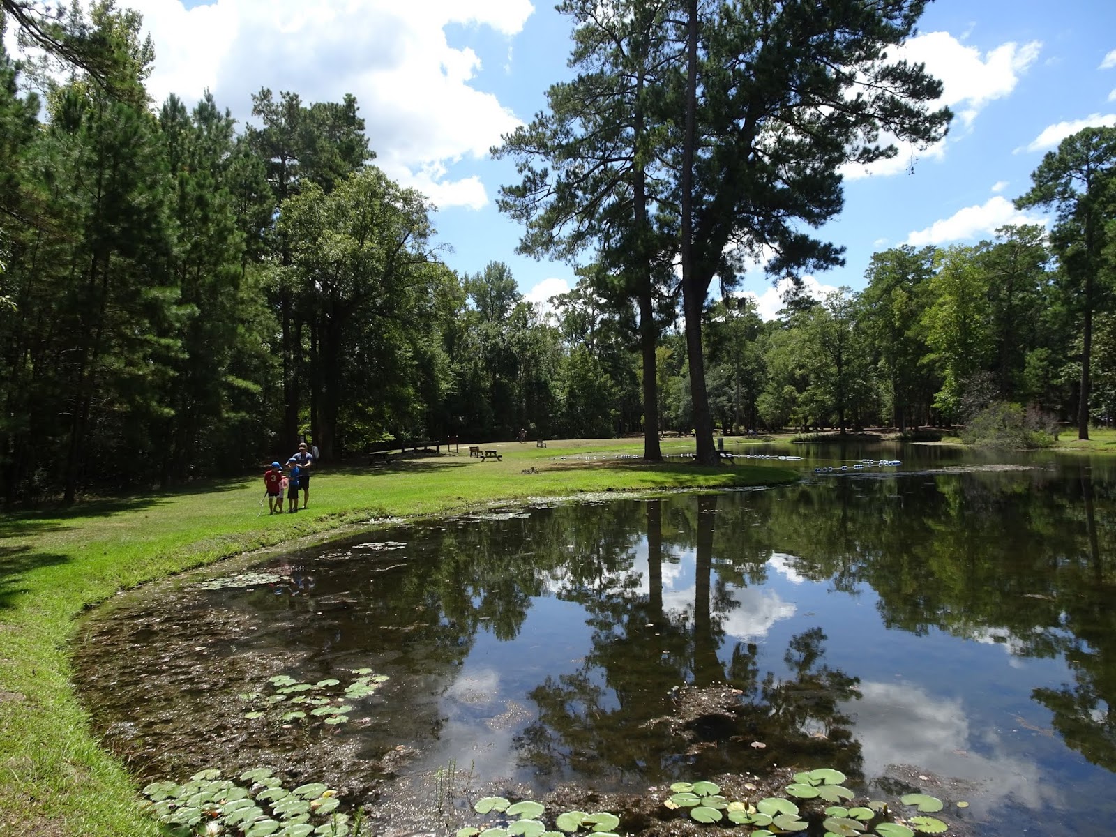
Artesian springs in Lee State Park

We are slowly crossing off State Parks on our Ultimate Outsider list, the ultimate goal to visit all 47 state parks in South Carolina, but with the intent to take our time and enjoy each park. Last month we spent a couple of nights camping at Huntington Beach SP, but needed a stop on the way there to help break up the drive. As it turns out, Lee State Park is located not too far past Columbia, just before Florence, SC – only 2.5 hours from Greenville.

Artisan well at Lee State Park

Lee State Park is one of several Civilian Conservation Corps parks in the state, built in 1935 to provide recreational opportunities for the residents of Lee County on the shores of the Lynches River. Named for Thomas Lynch, Jr., signer of the Declaration of Independence, the headwaters of Lynches are in North Carolina near Waxhaw. From Lee SP it flows southeast into the Pee Dee, which in turns empties into the Waccamaw River just west of Brookgreen Gardens and Huntington Beach State Park – it would have been perfect if we could have just floated from Lee the rest of the way to the Atlantic instead of having to finish the drive.


While the favorite thing to do in Lee State park may be kayaking and canoeing through the park’s hardwood forest floodplain, we were drawn to the ponds created by the artesian wells near the Visitor Center. The wells tap into confined aquifers, the pressure of the water seeping in pumping water out of the well. The CCC drilled seven wells at Lee in the 1930s of which five are still operational.


Definitely walk down the 0.2 mile boardwalk and observe the aquatic wildlife that thrives in the surrounding waters. We saw a snake, frogs, and an assortment of birds. 144 species of birds have been documented in the Park.


For a longer hike, head out on the 5 mile Loop Road. Open to all traffic, the loop takes you around to the equestrian campground, the equestrian trails on the north end, and then back along the Lynches River. There are additional artisan wells along the way. A group area that is located adjacent to the show ring and stables is available for horse clubs and other equestrian groups to rent. Lynches is designated a State Scenic River, and unique wildlife seen in the bottomland forests include the endangered wood stork, marsh rabbits, and fox squirrels.


If you bring a picnic, head to one of the two historic CCC shelters. Be sure to stop in at the Visitor Center and stamp your Park passport, but while there pick up some of the excellent brochures featuring everything from the flora and fauna of the park, a scavenger hunt (which the boys enjoyed), to a CCC history brochure. Quite a few of the State Parks we visit have the CCC in their history, but fewer and fewer have surviving structures with the classic Conservation Corps architecture.

CCC constructed bridge at Lee State Park

Lee also offers a variety of educational programs; for more on the hikes and crafts (such as pine needle basket workshops), check the Park website.

Monday, August 27, 2018

Lakeside Trail in the shadow of Table Rock

Despite the cool temperatures the last few mornings, it is still August in the South – summer is (technically) here for four more weeks, and we are taking full advantage of it!


One of the closest state parks to us here in the Upstate is Table Rock State Park, and although the 7.2 mile round-trip hike to the summit of this Upstate landmark beckoned, the August temperatures and humidity nixed that idea. The beach and Carrick Creek swimming hole were full with swimmers, so we hit the trail in search of a little solitude, opting for the 2 mile Lakeside Trail.

Purple-blazed Lakeside Trail

This easy, well-marked trail offers great views of Pinnacle Lake and the mountains in addition to a little bit of history. Just as portions of Paris Mountain StatePark, Table Rock is partially the legacy of the Civil Conservation Corps (CCC). We parked in the lot near the Nature Center, and skirted the swim area to reach the trailhead behind the boathouse. The CCC constructed a portion of the Lakeside Trail in the mid-1930s, and this first portion best showcases the accomplishments of the Depression-era work relief program: a boat landing with stone steps, the Table Rock lodge, and the dam and spillway.


We circled around the East Bay and soon approached Lodge Cove. There is a little up and down in this section, but just enough to make it interesting; I believe that bridges have been proposed to cross the small creeks flowing into the lake, but the boys preferred to rock-hop across, and stopped to look for stones in the cold mountain water. We found plenty of evidence of beavers, and more than one mushroom that required investigating.

The old boat landing on Pinnacle Lake

Soon we reached the old boat landing. Built to allow visitors to paddle from the beach area over to the lodge to have dinner, stone steps allow easy access to the trail and continue up the hillside all the way up to the lodge. The Table Rock lodge is a prime example of CCC construction: fine craftsmanship, locally sourced materials, and much thought given to orientation. It was built with granite and timber taken from local quarries/forests, and the views over the lake to Table Rock are breathtaking. The lodge can be rented for weddings and other gatherings, and the monthly "Music on the Mountain" bluegrass jam sessions brings in musicians and an audience from all over the Upstate.

Table Rock lodge, as seen from Lakeside Trail

It is on this end of the lake that the views to Table Rock open up, and strategically places benches face some of the most scenic vistas. The kids stopped to cast their lines, and we enjoyed watching a great blue heron criss-crossing the lake in search of lunch. Soon after passing the steps that lead up to the lodge, the trail comes to the south end of the lake and Pinnacle Lake dam.


The dam was built to resemble a waterfall, and there is a small parking area offering additional trail access. The trail drops down below the spillway where hikers can get a good view of the water rushing over - Green Creek and Carrick Creek on their way to Lake Oolenoy. A wide spot in the creek where the water slides over a large stone is an inviting swimming hole, although the water is cold, no matter what time of year.

Table Rock peeking over the Pinnacle Lake spillway

Once you cross the bridge, the trail winds around West Cove and turns north. This portion of the trail was completed in 2011 to make the Lakeside trail into a loop, and is more level than the first ¾ mile built by the CCC. Over the 0.8 miles that lead to the picnic shelter parking area we passed one of the cabins and several places to enjoy the view over the lake. We heard the excited shouts of the swimmers long before the beach came into view, and just like that we emerged from the forest. The walk between the two main trail heads is 0.3 miles and passes through the two parking areas and past the playground. If it’s a hot summer day I can suggest taking a swim to cool off as a finale to the hike.

The Table Rock swimming area

Completing a hiking registration card is not necessary to hike Lakeside Trail, however there is an admission fee to this portion of the Park. All the info on boat rentals, swimming, fishing, trails etc. can be found on the SC State Park website, and a YouTube video about Music on the Mountain is worth a watch. We enjoy the cool air coming down the mountain during the summer, but the spring wildflowers and autumn show of color around Table Rock are not to be missed.


* This is a great hike to take visitors to the area who might not want to attempt the long and steep trails to the summits of Table Rock and Pinnacle Mountain; make sure to stop at the Visitor Center across Highway 11 for maps and a quick briefing on the history of the area, and then relax a spell out on the porch while enjoying a spectacular view of Table Rock over Lake Oolenoy. See my guide to the Cherokee Foothills Scenic Highway 11 for plenty of other destinations along the Blue Ridge Escarpment, and this post on how to make the most of one day in the mountains with guests!

Tuesday, October 18, 2016

Autumn on Newfound Gap Road

Great Smoky Mountains National Park is bisected by Newfound Gap Road, a 33-mile drive that extends from Cherokee, NC to Gatlinburg, TN. Driving this stretch of US 441 is a fantastic way to see the highlights of this 520,000 acre National Park: awe-inspiring views from Clingmans Dome (the highest point in the state of TN), tranquil cove hardwood forests, remnants of pioneer settlements, tucked away campgrounds and trails, and seasonal shows of wildflowers and fall foliage.


Our recent trip to GSMNP included a drive on Newfound Gap Road, unforgettable vistas awaiting us around every turn during what is peak fall-foliage season in the Smoky Mountains. We started our journey at the Oconaluftee Visitor Center, where visitors can pick up a basic map to the park as well as purchase additional resources to tailor the trip to their interests. The fields adjacent to the Visitor Center also provided our first sighting of elk, the wapiti having been reintroduced to the Park in 2001.


The road is named as such because in the 1850s it was discovered that it's not Indian Gap that is the lowest point through the mountains, but the "Newfound" gap. For the NC portion of the trip the highway runs parallel to the Oconaluftee River, which flows into Tuckasegee River near Bryson City and eventually the Mississippi River and the Gulf of Mexico. Not far from the Visitor Center we passed the Smokemont Campground where Bradley Fork joins the Oconaluftee. Once a lumber company town with a school, church, store and boarding houses, it now consists of 142 campsites. As we continued our climb alongside the river, we came to Deep Creek Valley Overlook, with a long view of the mountains rolling away as far as the eye can see.

View from the Clingmans Dome parking area

Halfway to Gatlinburg is the Oconaluftee River Valley Overlook, another spectacular view of the Smokies that highlights the cut the river makes on its journey down from the mountains. Soon after we took the 7-mile spur road to Clingmans Dome for an invigorating hike up to the highest point in the Park that features some of the grandest 360˚ views in the Park. For more on that please see my previous post, On the summit of Clingmans Dome. From the intersection of this spur road it’s just a little further to Newfound Gap, the highest elevation on Newfound Gap Road at 5,048 feet.


The overlook is dominated by the Rockefeller Memorial, a stone terrace that commemorates the efforts of those whose vision and resources helped establish the Park. The memorial is named for Laura Spelman Rockefeller, the mother of John D. Rockefeller Jr., who donated $5 million of the $12 million needed to purchase most of the Park’s acreage. President Franklin D. Roosevelt dedicated Great Smoky Mountains National Park on September 2, 1940 from the terrace, which had been completed by the Civilian Conservation Corps (CCC) the previous September. The memorial also features a newer plaque acknowledging the designation of GSMNP as a World Heritage Site (1983).


Newfound Gap is also the only place within GSMNP that the Appalachian Trail crosses a paved road in the approximately 70 miles that it traverses the Park. The AT mostly follows the State Line Ridge through the Park, which serves as the boundary between the states of Tennessee and North Carolina. Those driving the Gap Road can get a taste of the trail without the elevation gain of the Clingmans Dome Trail hike by taking a short walk from the Gap, an especially enticing option this time of year when sun is shining through a kaleidoscope of colors as the hardwoods turn. From the trailhead it is 7.5 miles to Clingmans Dome, 15.6 miles to Mount LeConte (via the Boulevard Trail) and 1,972 miles to the terminus of the AT in Katahdin, Maine.


Once back on the road, there are a multitude of opportunities to park for scenic views and hikes. As you start descending in elevation you are now following the West Prong of the Little Pigeon River. Ultimately the Little Pigeon River also finds its way to the Tennessee River and into the Gulf of Mexico, but it is named for the passenger pigeons that once filled the skies right here over the Smoky Mountains. Well into your descent to Gatlinburg, the river runs through the Chimney Tops picnic area which is home to one of the few remaining stands of mature cove hardwoods in the US. This is remarkable if you consider that this area (along with many of the higher regions of the Smoky Mountains) was once owned by paper and lumber companies.  Stop for a picnic, or for the trailhead to the Chimney Tops; the strenuous 4 mile hike leads to an outstanding view from the twin knobs that rise from a ridge like chimneys. On this stretch of Gap Road you’ll also pass through two tunnels built by the CCC in the 1930s, one of which curves around and back over itself.


The Campbell Overlook offers a wonderful view of Mt. LeConte (6,593 feet), the third highest peak in the Smokies. I found it astonishing that within the Park, where elevations range from 875 feet at the mouth of Abrams Creek to 6,643 feet at Clingmans Dome, sixteen mountain peaks exceed 6,000 feet in elevation! Mt. LeConte is the tallest mountain east of the Mississippi in that it rises more than a mile from the foot of the mountain to the summit. Once you’ve soaked up the views it’s only 3 more miles on your descent down to the Sugarlands Visitor Center. In the Sugarlands Valley there are a multitude of walkways for optimal leaf-peeping, the sugar maples from which the valley takes its name an explosion of reds, oranges and yellows.


The Sugarlands Visitor Center is the most visited due to its proximity to Gatlinburg. Featuring the usual Visitor Center maps, exhibits and gift shop, there are also rangers on hand to answer any questions, and the 3.8 mile Gatlinburg Trail which allows pets and bicycles – a rarity in the park. The Park boundary includes the stretch of Trail, River and the Road all the way until Pigeon Forge, but the proximity to Gatlinburg and civilization signaled the end of our excursion on the Newfound Gap Road. We headed to Sevierville for a good night’s rest to prepare for our adventures the next day…

Monday, October 10, 2016

On the summit of Table Rock

If there is one geographic feature that is instantly recognized by residents of the Upstate, it’s Table Rock. Located in Table Rock State Park, the mountain serves as a backdrop for Highway 11 and is easily seen from Bald Rock and Caesars Head. Table Rock is part of the edge of the Blue Ridge Escarpment that sharply rises from the foothills of Upcountry South Carolina to evolve into the mountainous western North Carolina. The Cherokee referred to this area as Sah-ka-na-ga, which translates as the “great blue hills of god,” and it was here at the giant Table Rock that they believe their god sat down to feast, using the rocky mountain as his table & Stool Mountain as his seat.

Table Rock and Stool Mountain

The leaves have just started to turn here in the Upstate, and with clear, sunny skies we decided to escape to the mountains and Table Rock State Park, an Upstate treasure on the National Register of Historic Places. The Visitor Center located south of Highway 11 (with its scenic view of Table Rock rising above Lake Oolenoy) is a frequent stop of ours when showing guests around the Upstate. However, on this visit we turned north on Table Rock State Park Rd. into the park, drove past the historic CCC Lodge on Pinnacle Lake, and stopped at the Table Rock overlook for a great view of the barren mountainsides rising above the green valley.

The boys at the overlook

Parking for the Table Rock trailhead is across from the Nature Center. All hikers must fill out a hiker registration form (at the Nature Center or the kiosk), and then can proceed up the trail that parallels the creek on its descent from the mountain. There is a viewing area at a lovely waterfall, and then the trail splits; the left fork is Pinnacle Mountain  Trail and the Carrick Creek Nature Trail looping one way, while to the right is Table Rock Trail and the other end of the Carrick Creek loop. This is also the intersection with the Foothills Trail - Sassafras Mountain only 9.5 miles! At this point our party split up, the boys headed clockwise on the 2-mile Carrick Creek Nature Trail, while I was setting my sights on the summit of Table Rock.

The Nature Center

After about ½ mile up a gentle grade I passed the intersection for the Carrick Creek loop, and after crossing a bridge I left Green creek behind me and started the climb. The elevation of the Nature Center is 1160’ and the summit of Table Rock is 3124’; this hike climbs 1,964 feet over its length of 3.6 miles (one way). The ascent is persistent, and hikers should be prepared for a strenuous hike with little reprieve for legs and lungs. Other than resting on one of the flat boulders that are strewn across the forest floor, there is no break from the steady climb for most of the hike.


At an elevation of 2400′ I reached the halfway-up point, the Civilian Conservation Corps (CCC) shelter with a view of Pinnacle Lake. As part of President Franklin D. Roosevelt’s New Deal, the work relief program CCC built all of the pre-WWII structures within the park, including the Lodge on the drive in, and this shelter.

view from shelter

Not long after passing the shelter I hit Panther Gap (2.1 miles in), where the trail forks once more. From this point it is 2 miles west along Ridge Trail to Pinnacle summit (3,415 feet), South Carolina’s tallest mountain that rests entirely within state lines (3,553’ Sassafras Mountain straddles the NC/SC state line). Turning right I continued my climb up Table Rock Mountain, and after a short respite of rather level ridgeline I hit the steepest section of the hike.

View from Governor's Rock: Pinnacle & Sassafras Mountains

The climb up to Governor’s Rock was almost a deal-breaker for me, but thankfully I made it up the near-vertical steps up giant boulders to reach this incredibly scenic vista. With 2800’ of elevation the view extends to Pinnacle, Hickory Nut and Sassafras Mountains. Governor’s Rock marks the approach of the turn-around point of the hike, but it seemed as though a large portion of hikers didn’t know or didn’t care to continue; many turned around and returned the way they had come after a short rest. The view from this large granite bald is gorgeous, but the remainder of the hike is a piece of cake compared to the first 2 ½ miles, and features even more spectacular scenery… I recommend continuing on, following the red blazes back into the forest on the right side of the exposed rock.


There was definitely more color up along the ridgeline, as the persimmon & occasional maple was bright red and the understory of blueberries tinged yellow.  Several outcrops on the right provided additional rest points and a view of Stool Mountain just before hitting the summit of Table Rock Mountain at 3,124 feet, 0.6 miles from Governor’s Rock. At this point the trail starts descending to the overlooks, the first of which is not far from the summit. The view across the surface of the granite dome & subsequent gorge features 400’ Slicking Falls, and the mosses, grasses and stunted trees growing on the bald provide a completely different milieu from the wooded ascent.


Follow the red paint to the end of the trail, a third of a mile after the summit. This is the grand finale, the reward at the end of a rather difficult hike; the view across Table Rock Reservoir to Caesars Head State Park is a stunning climax, the perfect spot to take a breather and soak it all in.


After a short ascent back to the summit, it is all downhill to return to the Nature Center. On this beautiful day of crystal-clear skies the trail was crowded; I encountered almost 100 people on my way up and probably double that on the way down, including a couple of speaker-toting, music-blasting parties that disrupted the peace of the hike far more than any trail chatter I may have overheard. I anticipate Table Rock Trail will see elevated usage in the next couple of weeks as the Blue Ridge Escarpment reaches peak fall color, and then once the cold weather descends it will revert to the peaceful ambience that its 2,000’ elevation gain and 7.2 miles usually commands.


What else is there to say about this hike? Come prepared: warm clothes for cool/windy weather at the summit, water, proper footwear, knowledge of the trail. Stay on the trail, as many of the outcrops and rock areas have precipitous edges that would mean certain injury or death with a misstep. The recommended time to budget for this hike is 4 hours, although I’m sure that it can take longer with stops at all the scenic points. And hang in there – the last bit to the Table Rock Reservoir is the easiest, and most rewarding. 


PS. You can see the view of Table Rock without leaving your home with the SC Parks webcam here

Monday, June 6, 2016

Wildcat Branch Falls

As the Upstate heats up, we head into the mountains to cool down. One of our favorite spots to take guests to is Wildcat Wayside State Park; with three waterfalls and a one-mile hike looping into a beautiful oak-hickory-rhododendron forest, this can be made into a day’s excursion or a first stop on a longer tour of the foothills.


When the automobile became popular in the 1920s a whole new kind of roadside culture was born, one of gas stations, motels and diners. In the late 1930s the National Park Service began experimenting with small wayside parks located along major highways, meant to serve as convenient stopping points for the motoring public and to provide picnic areas, hiking trails and fishing spots to travelers. One of six trial parks in South Carolina was the Greenville Wayside Park, built by workers hired under New Deal emergency relief programs. Although the CCC-constructed picnic shelter is long gone, the foundation and chimney stands testament to almost a hundred years of recreation along Wildcat Branch.


Today the area has been incorporated into a larger area known as the Mountain Bridge Wilderness Area, which includes Bald Rock Heritage Preserve as well as Jones Gap and Caesars Head State Parks. Wildcat Wayside is located at the foot of the Blue Ridge Escarpment, and contains a diversity of plant and animal communities adapted to life where the mountains join the Piedmont.


Parking for the trail is just off Geer Highway (scenic Highway 11), close to where 276 cuts north towards Caesars Head. During busier seasons you’ll easily spot it due to the multitude of cars in the pull-off, as well as the boiled peanut vendor that sets up shop there. Lower Wildcat Branch Falls are visible from the road, and the trail heads up alongside the west bank of the creek. Only a few dozen feet past the lower falls are what I call the middle falls, a 10-foot cascade with a nice wading pool at the base and photo opportunity at the top.


The trail crosses over the creek between the lower and middle falls, and then follows the creek north, past the old CCC-built chimney to a fork which marks the beginning of the loop. We often choose to hike this portion clockwise, and cross back over the creek by hopping across stones.


Tunneling through the rhododendron and mountain laurel you’ll soon come to base of the upper falls, featuring a 100-ft drop across a large rock face. This area has been the site of multiple fatal accidents over the years, and it is important to stay on the trail and utilize the designated viewing areas. Depending on rainfall, the falls range from a small trickle to a rushing chute, but the area around the waterfall is always slippery and caution should be exercised to avoid injury. To see how the falls look after a heavy rainfall you can visit Mark’s photo journal here.


Continuing on you’ll come to yet another waterfall (which is more of a slide really) which features a beautiful 30-foot long rush of water just off the trail. On a hot summer’s day we’ve usually worked up a sweat by this point, and are ready to complete the loop and retrace our steps back to the lower falls.


Although the Wildcat Branch Falls hike is perfect in the summer, as the grand finale includes wading in the cool waters below the falls, it really shines during the other seasons as well. While spring brings an abundance of wildflowers and blooming mountain laurel and rhododendron, fall brings a cacophony of color and that crisp mountain air. We’ve hiked in the winter also, the cove somewhat protected from biting wind but exhilarating in the cold air – it’s a year-round paradise only 35 minutes from Greenville!


So pack a picnic and bathing suits, or even just a water bottle and camera, and head to Wildcat Branch. Put the 1-mile trial on your Upstate summer bucket list, and plan a day-long excursion as to fit in a stop at Bald Rock and Caesars Head. Just don’t miss this beautiful attraction, and once you’ve been you’ll want to return again and again!


Wednesday, March 16, 2016

Paris Mountain's fire tower

There are three different ways to access the Fire Tower trail in Paris Mountain State Park. Your first option is to take the Sulphur Springs trail from Mountain Lake, and there’s also a connector linking it to Kanuga trail; however, the easiest and shortest choice is to take Sulphur Springs from the upper parking area where the Brissy Ridge loop departs. (For the Paris Mountain State Park trail map click here)

  
The section of Sulphur Springs from the kiosk to its intersection with Fire Tower is somewhere about 1.3 miles, while Fire Tower is 0.4 miles one way, making the there-and-back hike a total of about 3.4 miles. It would be a whole lot shorter, but instead of crossing the Mountain Lake drainage it skirts around the various side-tributaries, making for a slightly longer, but less strenuous hike. As the trees haven’t leafed out yet there were some nice views to the Southwest, and exposed rock jutting out to the ridge side provided contrast to panoramas over the predominantly hardwoods draw.


At its intersection with the Fire Tower trail, Sulphur Springs cuts south in a steep descent into the drainage, following the creek to Mountain Lake. Meanwhile the Fire Tower trail turns north, ascending 400 feet in elevation along an old road bed. You see the private homes before you see the ruins of the old fire tower house, as this is the very west boundary of Paris Mountain State Park.


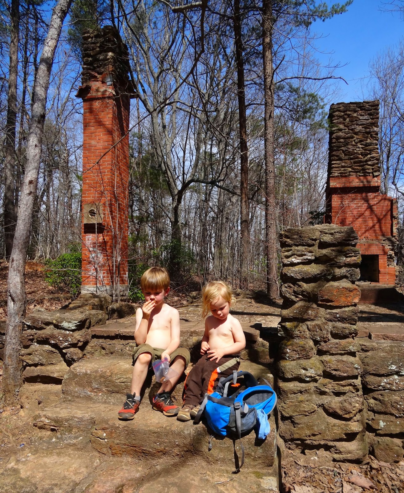
What is today only a foundation and a couple of chimneys was once a four-room house, well, barn, smokehouse, chicken coop and outhouse, along with an 84-ft steel fire tower. Built by the Civilian Conservation Corps in 1938, the site was abandoned only five years later when the tower was moved to a spot at a higher elevation. Although there are fantastic views to the west, the mountain blocks a 360˚ view – not the case in the Tower Road location.


That fire tower has since been decommissioned; for more on the Paris Mountain summit and the Altmont Hotel that once stood there, here are two articles on the subject…


It was turning into a rather warm March day, and running dangerously low on snacks and energy we headed back the way we came. It took us (two moms, a 4 year old, a 3 year old and a 1 year old riding in a backpack harness) a total of 2.5 hours to hike there and back, allowing for frequent stops to explore, examine objects found on the trail, and to snack. I would have liked to spend additional time at the summit, exploring the ruins and taking in the view, and the last ½ mile was slightly hurried – next time I will budget closer to 3 hours for the round trip. 

Related Posts Plugin for WordPress, Blogger...