Monday, September 30, 2013

Touring Sapelo Island - a riveting history

A great way to see Sapelo island and learn more about the complicated history is to take a tour. On our second day on the island we got an early start and headed back to the ferry landing to join the tour group that was arriving on the first ferry. Our tour guide was knowledgeable Yvonne Grovner, master sweetgrass basket maker and resident of the island.

Spanish moss framing the purple blazing star growing around the airstrip
The oldest Native American civilization in the state of Georgia can be found on Sapelo Island. Known as the Sapelo Island Shell Ring Complex, this site consists of three doughnut-shaped Indian mounds built from successive layers of different types of shells, and has been radiocarbon dated at 2170 BC. The rings rise approximately 20 feet above the tidal marsh and the largest of the three has a diameter of 255 feet. Theories regarding the formation include that they were built as monuments or that possibly they were the result of the Native Americans living in circular villages and discarding their trash behind their homes to form a protective surrounding wall over time. (This was not a stop on our tour as we were on the south-end tour, but visits to this site and more can also be arranged.)

The excavated cross-section of a shell ring, source: GeorgiaEncyclopedia.org
Fast forward to 1526 when Sapelo Island was speculated to be the site of San Miguel de Gualdape, the first European settlement in the present day US. If true, it would also be the first place that a Catholic mass was celebrated. The name Sapelo originates from the word Zapala given to the area by Spanish missionaries who lived on the island from about 1573 to 1686. Officially a part of the Guale missionary province of Spanish Florida, after 1680 several missions were merged and relocated to the island under the mission Santa Catalina de Guale.


When the English first colonized Georgia in 1733 an agreement with the Creek Indians gave the land between the Savannah and Altahama Rivers to the British while reserving Sapelo and several other barrier islands as hunting lands for the Indians. Not long after another treaty resulted in the cession of Sapelo, Ossabaw, and St. Catherines islands to the royal colony.

Previous owners include Patrick Mackay, who grew crops there before the Revolutionary War (1775-83), and then John McQueen. In 1789 a consortium of Frenchmen purchased the island with plan to develop it, but disagreements over expenditures led to the breakup of the partnership and the death of two of the men in 1795; one was shot and killed in a duel, another died of yellow fever.

A portion of Sapelo Island’s residents today are direct descendants of the 400 slaves from West Africa and the West Indies brought to the US by Thomas Spalding. The future Georgia Senator and US Representative bought the island in 1802 and developed it into a plantation, selling live oak for shipbuilding and cultivating Sea Island Cotton, sugar cane and rice. Spalding’s plantation house (now known as the Reynolds Mansion and since rebuilt/restored several times) was built on the south end of the island, and the remains of an enclave of slave houses and plantation barns can still be seen today on the north end. Our tour brought us to Behavior Cemetery, established in 1805 and now listed on the National Register of Historic Places.

After passing a gorgeous purple field of Liatris, blazing star (the field also doubles as the island’s airstrip), our next stop was Long Tabby. Site of the 1809 old tabby sugar mill (of which the ruins are still visible), this is also where the island’s post office is located. We had stopped in the previous evening to watch the sun set, but arriving with the tour allowed us to explore the science center and check out the ‘swimming pool’; now filled in and a garden, as they just couldn’t keep the alligators and deer out. Ten years after the sugar mill was built Spalding ordered the construction of the brick lighthouse on the south end, and after fifty years of island ownership, he died returning from a convention to assert Georgia's position on the abolishment of slavery.

Ruins of the old tabby sugar mill at Long Tabby
During the Civil War most of the slaves were ferried to the mainland and marched to Milledgeville to avoid the Union army. Afterwards many of the freed slaves managed to return to Sapelo Island where they created five settlements with acreage they had purchased through the Freedman’s Bureau (established by Congress during Reconstruction to provide aid to newly freed slaves). Those communities were Hog Hammock, Raccoon Bluff, Bell Marsh, Shell Hammock and Lumber Landing. The First African Baptist Church was organized in 1866 at Hanging Bull, eventually moving to Raccoon Bluff which was also the site of a black school (the church can be seen on the north end tour). Our next destination was Hog Hammock, and after a tour of the community including First African Missionary Baptist Church, we stopped at the general store. Mrs. Bailey, the author of “God, Dr. Buzzard, and the Bolito Man” just happened to be resting on the porch, and our tour guide’s cookbook was for sale there along with cold drinks and snacks.

First African Missionary Baptist Church
In 1912, the Spalding heirs sold Sapelo (except for the communities) to Henry Coffin of Detroit, who had been brought to the region by the International Road Races in Savannah. Coffin was chief engineer of the Hudson Motor Company and entertained such influential guests on Sapelo such as presidents Calvin Coolidge and Herbert Hoover, as well as aviator Charles Lindbergh (he landed his plane in 1929 on the airstrip we passed that morning). During the time the Coffins owned the island miles of roads were built, creeks were bridged, old fields were cultivated, large tracts were set aside to graze cattle and improvements were made to the island, such as the addition of artesian wells.

Deer browsing next to the crumbling greenhouses near the Reynolds mansion
Due to financial reversals brought about by the Great Depression, Coffin sold the island to tobacco heir Richard J. Reynolds Jr. of Winston-Salem (NC) in 1933 (son of the founder of R.J. Reynolds Tobacco Company). During the 30 years that Reynolds utilized Sapelo as a part-time residence, the five African American settlements were forcibly consolidated into just one - Hog Hammock. The residents worked as servants in the Reynolds Mansion, found part time work at the timber and road operations on the island or were forced to search employment on the mainland. Reynolds established the Sapelo Island Research Foundation and provided facilities and other support for the University of Georgia Marine Institute (founded in 1954). Having separated from his third wife Muriel in 1959, he lived alone for two years, engaging in increasingly erratic behavior. After his death of emphysema on December 14, 1964 in Lucerne, Switzerland, Sapelo was deeded to the state of Georgia by his widow Annemarie Schmidt Reynolds.

Our tour continued in the Reynold’s Mansion and to the Sapelo Island lighthouse; we felt it was a great value considering it was a near three-hour tour, complete with transportation, commentary and entry to the mansion and lighthouse (note, verify beforehand what your tour entails, usually it is either the lighthouse or the mansion, not both). However, we were immensely grateful that although the rest of the tour group was boarding the ferry back to the island, we still had two days of Sapelo before our return trip.

More on Sapelo Island:
An Introduction, Nanny Goat Beach and the Hog Hammock community
The Sapelo Island lighthouse
Tour the Reynolds Mansion
Your guide to visiting Sapelo Island

Friday, September 27, 2013

The Sapelo Island lighthouse

On our way from Nanny Goat Beach to the Hog Hammock community for afternoon naps we took a small dirt side-road leading through the marsh. An osprey with a fish in its claws circled around to land in an old tree, and just as suddenly we emerged into the large grassy clearing where Sapelo Island’s lighthouse stands.


A guide for mariners in Doboy Sound on their way to and from the Port of Darien, it was activated in 1820 and received a fourth-order Fresnel lens in 1854. In 1856 a beacon light was built, forming a range with the lighthouse and guiding ships into the sound. Confederate forces removed the lens from Sapelo Island Lighthouse before the Union Army occupied the island in 1862 and the lighthouse suffered partial damage during the war. 1868 saw the completion of repairs and its return to service, along with a new beacon mounted on a fifty-foot frame tower.  


On October 2, 1898, the most powerful hurricane to ever strike Georgia came ashore near Cumberland Island. The storm killed at least 179 people, and on Sapelo Island lighthouse keeper William G. Cromley and his family survived the storm by seeking refuge in the lighthouse. The old tower and dwelling were partially undermined, and when the keeper’s dwelling was demolished its bricks were placed under and around the base of the threatened tower and cemented in attempt to save the old structure. Predicting the eventual collapse of the lighthouse a new tower with metal framework was built farther inland in 1905, and it served alongside the original lighthouse until 1933. This steel tower was ultimately dismantled and shipped to South Fox Island in Lake Michigan, where it was active for several years and can still be seen today. Meanwhile, the old lighthouse stood empty for many years until the 206-acre southern portion of the island was purchased (by the State of Georgia and the National Oceanic and Atmospheric Administration) in 1991 and set aside as the Sapelo Island National Estuarine Research Reserve. In 1998 the tower was restored, the light relit and a spiral staircase added to allow visitors to enjoy the view of Doboy Sound.


To visit the island you must join a tour group; for more information please visit the Georgia DNR website. Take into consideration that the climb to the top is steep; there are over 70 steps to climb to reach the platform from which visitors must ascend a ladder through a hatch to reach the viewing station at the top. With no air circulation the heat can be rather stifling, but we found the view to be worth the temporary discomfort.


More on Sapelo Island:
An introduction, Nanny Goat Beach and the Hog Hammock community
A short history of the island
Tour the Reynolds Mansion
Your guide to visiting Sapelo Island

Wednesday, September 25, 2013

Georgia's best kept secret - Sapelo Island

Our journey to Sapelo Island first led us to Darien, GA. Located about 50 miles south of Savannah at the mouth of the Altamaha River, it was founded in 1736 near the site of Georgia’s oldest fort, Fort King George. Not long ago I read “Drifting into Darien” by Janisse Ray about the extraordinary biodiversity of the Altamaha River corridor, but our arrival long after the sun had already set ensured that we saw little of the town and surrounding area except for during the short drive to Meridian landing the next morning – and we were in a hurry to catch the ferry.

Our first glimpse of Sapelo Island from the ferry
 
Spending the very last days of summer on Sapelo Island was not the original plan. We had hoped to spend a few days near the ocean, enjoying the beach and relaxing before getting sucked into the busy days of autumn. Upon doing research I was looking for a place we hadn’t been to before, not too far from Greenville and allowing us the option of leaving the crowds behind. Something kept pulling me back to the remote barrier island, despite the five-hour drive from Greenville; maybe it was the fascinating history of the Geechee people whose descendants still live there today, maybe that all but 3% of the island belongs to the State of Georgia, or maybe it was the story of tobacco magnate RJ Reynolds, but the thought of miles of beach all to ourselves convinced me to start planning.

 
We climbed aboard the Katie Underwood (named for the last midwife of Sapelo Island who delivered just about every baby born on Sapelo Island between 1920 and 1968) and settled in for a twenty minute ride through the tidal saltwater marshes of coastal Georgia. As it is only possible to visit the island as part of an organized tour or as guests of residents on the island, the boat was nearly empty. Our host easily spotted us upon landing, and after a quick ride to our lodgings we had in our possession a map and keys to a vehicle for use while on the island: we were on our own.

 
The island is managed by the State of Georgia’s Department of Natural Resources (DNR), which operates the ferry service and also serves as the state liaison between the various parties on the island. These include the Sapelo Island National Estuarine Research Reserve (SINERR) - a partnership between the DNR and federal National Oceanic and Atmospheric Administration (NOAA), the University of Georgia Marine Institute, and the civilian Hog Hammock community.

 
Hog Hammock was named for a former resident by the last name Hogg, a hammock being a dry area jutting up from the marsh. It is the only one of five communities established by former slaves after the Civil War that survives today, and includes a general store, bar, and church. Most inhabitants of the town are African Americans, part of Geechee community, and have been living on the island for generations. The population was estimated to be 47 in 2009; the residents must bring all supplies from the mainland or purchase them in the small store on the island, the children of Hog Hammock take the ferry daily to go to school, and the community keeps losing its inhabitants to mainland Georgia where jobs are more plentiful. Most recently the acquisition of land by outsiders to build vacation homes and a property tax increase have raised tensions to a new high, and many fear that the Geechee culture will be lost forever from the island. It is not hard to understand the appeal of Sapelo Island to mainlanders; with a small population, the promise 97% of the island will stay as is (mostly undeveloped) and with a controlled number of visitors, the island is quiet and secluded, the six miles of beach virtually deserted.

 
Our first day on Sapelo was spent at Nanny Goat Beach on the south end of the island. 17.5 nautical miles offshore is Gray's Reef National Marine Sanctuary, one of the largest live-bottom reefs in the southeastern United States and the only marine protected area in the federal waters between Cape Hatteras, NC to Cape Canaveral, FL. Unlike reefs built by corals, the sanctuary contains limestone rock outcroppings that stand above the sandy ocean floor. This reef supports soft corals, non-reef building hard corals, bivalves and sponges, as well as associated fishes and sea turtles. The shoreline is no less special. It wasn’t even twenty minutes before we had seen dozens of dolphins swimming north along the coast and twenty different shorebirds flying by. Watching small sharks chase the schools of fish that were forced into deeper water by the receding tide was a unique experience, and large portions of the day passed without seeing a single person. We soaked up the sun, built sandcastles, dug holes, collected dozens of intact whelk shells and watched the shrimp boats at work far on the horizon. A shelter just off the beach provided us with shade and a spot to eat lunch, but the ocean was a magnet and we were soon back in the surf watching the beach revealed foot by foot as the tide retreated even more.


More on Sapelo Island -
The Sapelo Island lighthouse
A short history of the island
Tour the Reynolds Mansion
Your guide to visiting Sapelo Island

Monday, September 23, 2013

An unexpected detour while apple picking in NC

Just like that, fall has arrived. We returned from Sapelo Island where we spent the last days of summer, to cool weather, leaves changing color and the smell of autumn in the air. My thoughts instantly have turned from beaches to raking leaves and other fall chores; luckily we’ve gotten a little bit of a head start with our apple-picking trip last weekend.

 
We visited Sky Top Orchard in North Carolina just as we’ve done every year we’ve lived in Greenville with kids, and I hear the picking at Niven’s is good too, although we’ll save that for choosing a pumpkin in mid-October. We returned home with a bushel of apples, half Gala for eating and baking with, and the rest giant Mutsus, of which 2/3rds have already been boiled, pressed and canned into applesauce. I expected disaster without my mother here to help, but last year’s experience/lessons learned helped enormously and the afternoon passed without incident. The first muscodine jelly attempt didn’t go quite as well, but I can tell you that so far the cupboard is filling quickly with jelly, fig preserves and that beautiful applesauce.

 
If you make the trip to North Carolina to pick apples, please make one other stop as well. The orchard is a great fall activity with the fresh donuts, the hay rides, all the kids activities and of course the apple picking, but we only spend a few hours there. It was on a whim that we continued north on Greenville Highway to Flat Rock and the Carl Sandburg Home Historic Site.

 
A nationally renowned poet, biographer, folk singer, and Pulitzer Prize-winning author, Carl Sandburg spent the last twenty years of his life on a beautiful property in the mountains of North Carolina. His wife Liliana had discovered the farm “Connemara”, which was also called home by Christopher Memminger (biographer of Abraham Lincoln and Secretary of the Confederate Treasury) and textile tycoon Ellison Smyth. The Sandburgs moved from Michigan with three daughters, two grandchildren, a library of over 14,000 books and the Chikaming goat herd, and spent the next quarter-century running the farm in addition to Carl continuing his writing. Mr. Sandburg died at home on July 22, 1967 after which the family sold the property which today is preserved as the Carl Sandburg Home National Historic Site.

 
We did not choose to take the tour of the home (which still contains all the family's personal effects), but instead stroll the grounds. The beautiful Front Lake was full of frogs and fish, and the 0.3-mile trail to the main house led us over the dam, through the woods and past the pasture and Margaret’s garden. We circled around back of the Main House (which also houses the visitor center) to see the rock outcrop which was Carl Sandburg’s favorite outdoor writing spot.

 
With trails (several lead all the way to Glassy Mountain), a visitor center, various annual activities, guided house tours as well as self-guided tours, there is much to do*. We especially enjoyed the goat farm, which is no longer a commercially run dairy but has descendants of Lilian’s original herd. I was told spring is especially exciting on the farm, as that is when the kids are born. After feeding the goats and exploring the barn we set off back to the car, passing all the other historic structures on our way out. Our visit was short, but it was enough to experience the beauty of Connemara and convince us a return trip is in order.

 
The sun on the hills is beautiful,
Or a captured sunset sea-flung,
Bannered with fire and gold.
(Carl Sandburg)

*There is a Junior Ranger program at the National Historic Site, but it is more suited for children a little older than my boys.

Friday, September 20, 2013

Fine dining in the strip malls of Greensboro

That nagging voice in the back of my head that insists I will not find good food in the restaurants in strip malls is often right, however there has been a stretch of exceptions recently that has me thinking I should try them more often. First we found Kannika’s Thai Kitchen here in Greenville, and then we had fabulous food two nights in a row in Greensboro.


The mixed grill, with chicken kebab, shish kebab, kofta, beef and chicken shawerma
 
The first place was close to our hotel (and therefore the highway), and was suggested by my husband who had eaten there once on business. He not only enjoyed the food, but was floored by the attention from the owner, who  helped make the evening a memorable experience. Our visit was no different, as Chef Samir was in the kitchen!

Unassuming from the exterior
 
Chef Samir Shaltout serves authentic Egyptian/Mediterranean/Arabic food using fresh ingredients and flavorful meat. The mixed grill was perfect for those looking to try a bit of all of it, but there are also a wide range of vegetarian options, soups and appetizers. We were served large portions for a fair price, the service was attentive and helpful with explanations (I wasn’t too familiar with the desserts and drinks on the menu) and the restaurant was super-family friendly. I was only disappointed that they were out of the caramel dessert, but according to the server it always goes quickly when Chef Samir has made up a bunch. The flip side was that I was able to try the Umm Ali - delicious, and a perfect end to a wonderful meal. Please be aware that Chef Samir Shaltout does not serve alcoholic beverages.

Chef Samir Shaltout on Urbanspoon
 
The following night I chose a Thai place, also close to the hotel, and once more we were not disappointed. My first impression (strip mall aside) of Pho Hien Voung wasn’t the most positive, as they seated us at the opposite end of the restaurant as all the other patrons, I’m assuming because of the boys. But the service was impeccable and most importantly, the food absolutely delicious! I would be hard pressed to choose between it and my hometown favorite Thai place, something I’m not sure I ever thought I would say!

The interior is rather forgettable - the food most definitely is not
 
I was surprised not to see satay on the appetizer menu but gave them the benefit of the doubt (as they are a Vietnamese and Thai place) and ordered the fried spring roll instead. We ordered drinks, and even as I brought out a book to keep Mikus occupied the appetizer and Thai ice coffee were served. This was the first surprise, as I’ve had iced coffee at Thai restaurants across the country, however I have never had it as it was at Pho Hien Voung. Imagine an individual tea kettle, but with coffee, and you might understand the contraption that was set before me; I required instructions from our server! First I was to wait for the hot water to finish filtering through the coffee into the bottom portion. Then, I was to remove the little plate on top and flip it onto the table. After putting the top portion of the device onto this little plate I could stir the coffee into the cream, and finally I was instructed to pour the result into the glass provided, over the ice. It tasted just as it should, but the experience was completely unique!

 
Our food was also presented in a flash. I had no sooner finished sighing in delight over my spring roll than the main course was in front of me. My husband ordered the chicken/beef/shrimp stir fried with lemon grass & onions over steamed vermicelli noodles, and I was jealous for about five seconds until I had a second bite of my beef broccoli. I only wish I had been more adventuresome as they have a great menu of soups, pho and all sorts of vegetarian options, but in the end all four of us ate well from the two entrees and couldn’t have been any happier with the food. A great value, excellent Vietnamese and Thai cuisine, and they do serve alcoholic beverages if you are so inclined.

Pho Hien Voung on Urbanspoon

Wednesday, September 18, 2013

The Revolutionary War in the Carolinas

It was mom more than Lauris or Mikus who was excited about the Guilford Courthouse National Military Park in Greensboro, NC. The next morning after an exciting day at the Greensboro Science Center we drove back up to the same area to visit this historic site of a Revolutionary War battle considered by some to be a turning point of the war in the South.

Nathanael Greene's statue
On March 15th, 1781, the deciding battle of the Revolutionary War's Southern Campaign was fought at the small North Carolina town (really just an intersection) of Guilford Courthouse. Major General Nathanael Greene and his army of almost 4,500 American militia and Continentals were defeated by a smaller British army of about 1,900 soldiers led by Lord Charles Cornwallis. After 2 1/2 hours of fighting Cornwallis triumphed, pushing through all three of his opponent’s lines, but at the cost of 25% of his army; Greene's retreat lost the battle but may have won the war. Weakened in his campaign Cornwallis abandoned the South to head north for reinforcements, under the belief that possession of Virginia was the key to the war. Seven months later in Yorktown Lord Cornwallis would surrender to the combined American and French forces under General George Washington.

Maj. Joseph Winston's grave - fought under Lee and Campbell on the left front
The 220 acre Park is managed by the National Park Service. Established in 1917, it is partially the legacy of local resident David Schenck. At one point owned by his Guilford Battle Ground Company organization, the park was partially landscaped with memorials that often did not correspond to actual battle points but instead convenient locations. Today joggers, hikers and bicyclists outnumber visitors touring the battlefield, but the fact remains; the Park Service has created an easy-to-understand and educational memorial to this decisive battle.

One of the GBGC monuments - "who slew in this engagement eleven of the enemy"
We started our visit in the Visitor Center, obtaining Junior Ranger activity booklets and stamping our National Park passports. To better present the battleground to the public, a 2.25 self-guiding auto/bicycle tour has been devised, with 8 stopping points emphasizing various events/places of the battle, the first of which was just beyond the Visitor Center. This was where the first engagement against the Redcoats took place, and the next three stops presented information on the retreating troops and the second line. Then we learned about the preservation of the battlefield, and finally the last points told of the third line and the retreat, as well as contain monuments to General Greene and other important persons. Growing tired from several short hikes and weary under the hot sun, we headed back to the Visitor Center (completed Junior Ranger booklet in hand) for Lauris’s badge and a pit stop before trading in the heat for Greensboro Science Center.

The Turner monument honors the mother who rode all the way from Maryland to nurse her injured son
After such a successful morning at Guilford Courthouse we decided to stop at Kings Mountain National Military Park on our way back to Greenville the following day. Only a year before the Battle of Guilford Courthouse the English had changed their strategy in the War. They turned their attention towards the South, hoping to reestablish the southern royal colonies, after which they would then turn north to connect with troops at Chesapeake Bay and finally claim the eastern seaboard. Instead they encountered a fiercely divided South, not the loyalist colonies they had hoped for; plundering, burning and looting convinced many mountain settlers who had been to that point unconcerned about the war to saddle up and fight. Gen. Lord Cornwallis ordered Maj. Patrick Ferguson (who was reputed to be the best marksman in the British Army) to gather the loyalists into a militia, and eventually to lead an attack into western North Carolina. Patriot forces gave pursuit, and on October of 1780 they clashed at Kings Mountain.
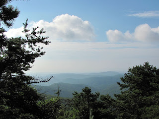
Named for an early settler, Kings Mountain is a rocky spur of the same Blue Ridge Mountains that we had been touring this Labor Day weekend. Ferguson chose the small plateau on the spur to lay in wait for the Patriots, but the guerrilla tactics of the frontiersmen defeated the open-field trained Loyalists. Ferguson was shot and killed, and Cornwallis lost the entire left flank – possibly a deciding factor in the Guilford Courthouse battle? Once again, the Visitor Center is a wealth of information, and the 1.5 mile self-guiding Battlefield Trail (foot travel only) explores the ridge and slopes of the former battlegrounds.

A monument in the Guilford Courthouse NMP
Not even 30 miles east of Kings Mountain is yet another Revolutionary War site – Cowpens National Battlefield. However, this piece of the puzzle that is Revolutionary war history in the Carolinas would have to wait, as we were en route home to Greenville after a week on the road...

To read about another Revolutionary War site in the Carolinas, check out my post on Ninety Six National Historic Site.

Monday, September 16, 2013

Greensboro and the Science Center

Have you ever been completely surprised by a place? Maybe you didn’t expect a lot, or had preconceived notions that were completely off? Such was my experience with Greensboro, NC. After a memorable Labor Day weekend on the Blue Ridge Parkway I found myself in this city an hour west of the popular Research Triangle, unsure what I would do with the boys all day while my husband was working, and wondering if I wouldn’t have to cut the trip short. It was just the opposite – we ran out of time to see all that we had hoped!

It's electrifying!
In my research before the trip I had read reviews of a museum geared towards children that also encompassed a small zoo and aquarium, the Greensboro Science Center. I thought we would have enough to look at to keep us busy for at least a morning, and was happy to discover our Greenville Zoo membership would get us in for free. I always check if our local zoo, aquarium or museum membership has reciprocal agreements with those of other towns, this time our membership saved us the $12.50/adult, $11.50/children 3-13 entry fee.

An African penguin zooming by
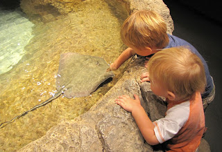
We started in the “sciquarium” portion of the center, as it opens an hour earlier than the rest and the penguins were scheduled to be fed in a few minutes. The fishing cat was out (but not fishing) and the otters playing in their lagoon, and before long we were watching the African penguins gulp down entire fish carefully fed to them by two keepers. The center attraction is the “hands on harbor” where a half-dozen rays glide around an open pond with plenty of spots for visitors to pet them. Both boys bravely touched a stingray, although seemed to be more interested in splashing around.

The stingrays have had their barbs removed and are harmless
My favorite was the “open ocean shark tank” (similar to our Georgia Aquarium experience) with all sorts of colorful fish, rays, sharks and other creatures. There is daily shark reef dive, as well as informative talks at the stingray and otter exhibits for those interested. We also saw moray eels, an Anaconda, a two-toed sloth and mata-mata turtles. Then it was out into the heat to see the zoo.

Mesmerized...
I was surprised at the size of the zoo; I had expected a small petting zoo but in actuality it was closer in size to our zoo here in Greenville. We started out in the “friendly farm” with the sheep and goats, then worked our way around to the coatimundis and tamanduas. After walking through the wallaby enclosure (always a cool concept but in reality you never get any closer to them than you would if they were behind a fence, something we also saw in the Columbia zoo) it was the red pandas and monkeys. I’m tempted to put up videos of the howler monkeys in Greensboro and the gibbons of Greenville side-by-side to see which ones are louder…

It's a rough life in the petting zoo...
Lauris was most impressed by the tigers, one of which came very close to us in his rounds – I was amused by the “tiger spray zone” signs posted at the fencelines. At the farthest end we found the maned wolves, which to me looked more foxlike, but the heat was starting to get to us and so we headed indoors to grab a snack.

There is safety glass between that giant cat and the boys
Many places don’t allow visitors to bring in food, but the Science Center has a designated cafeteria in addition to their Fresh Market Café, and I found it refreshing to not spend a fortune on food that the kids don’t even eat. We rested and dived right back in, starting with the Kids Alley. A children’s museum in two rooms, we could have spent an entire day in this section alone! A water table, shopping market, train table, reading nook, playhouse… it was an hour-long breather for mom until time came for us to head back to the hotel for naps.
After such a great experience we decided to come back the next day after we had had our fill of the Guilford Courthouse National Military Park. Definitely getting our money’s worth, wink wink. It was a good decision, mainly because we had the opportunity to explore the rest of the Science Center, as we hadn’t seen everything on the first day. The boys got their first glimpse of the world of dinosaurs in the “prehistoric passages” rooms, and have been showing a lot more interest into everything dino-related since. A quick glance into the extreme weather gallery and “healthquest” exhibits confirmed they are meant for older children, but down in the lower level we found even more things to see. The herpetarium was full of lizards, snakes and such (the boys even got to hold a turtle) that gave mom the chills, and the safari room and other displays kept them squealing with delight over all the cool animals.

Definitely wasn't ready to stand that close without keeping on eye out for sudden movement!
We decided to venture out into the zoo again, and found that we had skipped a section in haste to get out of the heat. This time we peeked into the meerkat enclosure by crawling into a big tunnel, we played in the “locomotion zone” and then watched the crocodiles. Despite the fences, I had a fleeting feeling of being prey – those crocs (and really all I could see of these two was eyes) came swimming our way with a seemingly singular purpose of having a snack. The Kavanagh Discover House had more creepy crawlies, and then we took another stroll to see the tigers. This visit was a bit depressing, as both big cats seemed so sad that day to be in the enclosure; I cut the viewing short and we headed back indoors.
One more loop around the sciquarium, more playtime in the kids alley, a stop in the gift shop, and we were finally finished with the Greensboro Science Center. It was off to the hotel pool for us!

Saturday, September 14, 2013

Blue Ridge Parkway and Stone Mountain State Park

Upon departing from the Julian Price Memorial Park campground we were in the final stretch of the Blue Ridge Parkway portion of our vacation; still, around each curve, over each hill, after each mile that we drove we found another scenic viewpoint to stop at, another vista to take our breath away, another glimpse of the blue hills that have given the Parkway its name.

 
There are miles upon miles of trails departing from the Parkway, everything from long hikes to short strolls like the “Jumpinoff Rock” trail at mile marker 260.6. We didn’t take advantage of these options to the fullest because of time constraints, but looking back at our trip I wish we had pulled off the highway more to explore. The various recreation areas (such as Julian Price Memorial Park that we camped in the previous night, or Linville Falls which we explored the day before) have miles of trails, and there is always the Appalachian Trail. Running parallel to the parkway from mile 0 to marker 103, hiking the AT has always been a dream of mine, however I feel as though I’ve at least gotten glimpses into the things I have in store for me some distant day, through the treks we made these last three days.

 
Our driving tour was far from over however, we still had some 80 miles to cover before our final exit from the Parkway. After numerous stops to stretch our legs, change a diaper, photograph an especially scenic spot or simply breathe the fresh mountain air we arrived at Stone Mountain State Park. A short distance from the Blue Ridge Parkway (unlike Mt. Mitchell which is adjacent to the highway), the park is famous for the 600 foot granite dome that towers over the park as well as the mountain climbing opportunities it has to offer to those more daring than me.

A selfie at the base of Stone Mountain, looking up
 
After a stop at the Park Office to obtain a map we continued to the lower trailhead parking lot. From this point several trails depart, including the 4.5 mile Stone Mountain Loop trail marked “strenuous” in my notes. I was sure we would not be able to complete the length that day due to time and child constraints, but I like to think I’ll have the chance someday. Taking hikers across the summit of Stone Mountain, it loops past a 200 foot waterfall and the Hutchinson Homestead. We were hoping to make it far enough to check out the homestead and possible get some great views of the dome itself.

 
The magnificent Stone Mountain is part of a 25 square-mile pluton, an igneous rock formed beneath the surface of the earth by molten lava. Time and the elements have eroded the layers of rock atop the granite block leaving the outcrop that is visible today, and in 1969 the park was established to protect the area. During our hike I experienced the strongest feeling of déjà vu; I later realized the park strongly resembled the National Forest of Fontainbleau, in France. 

Can you spot the climber on the right in the picture on the left?
 
It was near the homesite that we found the best views of the stone face. A most interesting historic site, the Hutchinson Homestead is a restored version of the farm built in the mid-19th century. With a log cabin, barn, blacksmith shop, corn crib and meat house, visitors can get a feel for the lives of early settlers in the area. From the fields beyond there is also a convenient entry to the boulder-strewn base of the large dome.

 
We found a large, flat rock I believe is the “threshing” rock described in the Visitor Center as the spot the settlers did all their threshing, and spread out our picnic. With one eye on the oh-so-fearless boys and the other on those adventurous souls climbing Stone Mountain, I believe my heart rate increased and adrenaline started flowing much the same as if I had been the one gearing up for some mountain climbing!

What, no fence on the threshing rock?!?!
 
A short hike later we emerged back at the parking lot and packed up for our final stretch on the Blue Ridge Parkway. It turned out we would have one final stop before turning off the scenic highway, at Cumberland Knob. More a testament to the vision and work to realize the Parkway than a scenic overlook, this northernmost North Carolina stop has picnic areas and hiking trails with informational placards about the history of the Parkway. In fact, Cumberland Knob was the first Visitor Center of the Parkway as well as the location of the first paved section of this 469-mile scenic Park that stretches across two states.

 
As I returned to the car and we drove the final stretch to our exit from the Parkway, I half expected there to be some grand finale to commemorate the 170 miles we had traveled. Instead there was just the unassuming Park Service sign quietly waiting for our return to this Blue Ridge paradise.

Related Posts Plugin for WordPress, Blogger...