Showing posts sorted by relevance for query great smoky mountains national park. Sort by date Show all posts

Friday, August 26, 2016

100 years of the National Park Service!

Yesterday marks 100 years of the National Park Service, stewards of our National Parks as well as our national monuments, battlefields, military parks, historic sites, lakeshores, seashores, recreation areas, scenic rivers and trails and even the White House.

Arches National Park

Our first National Park, Yellowstone, actually precedes the NPS by over forty years, established by President Ulysses S. Grant on March 1, 1872. Yellowstone was followed by Mackinac Island (MI) in 1875, Sequoia, Kings Canyon and Yosemite in 1890, Mount Rainier in 1899, and a half dozen others through 1916: Crater Lake in Oregon, Wind Cave in South Dakota, Glacier in Montana, Mesa Verde & Rocky Mountain in Colorado, and what is now Hawai’i Volcanoes. On August 25, 1916 President Woodrow Wilson signed a bill into law creating the National Park Service to oversee all these national parks, with the mission to conserve our natural spaces for generations to come.

Glassy Mountain, Carl Sandburg Home NHS

Today the National Park Service employs more than 20,000 men and women in the 412 national parks (and monuments, battlefields etc.), and last year 307.2 million people visited our public spaces. With the 2016 Find Your Park initiative, that number is expected to be surpassed; Find Your Park encourages everyone to find the park nearest them and to share their stories.

My junior rangers at Big South Fork NRRA

In celebration of its 100th birthday, the National Park Service invites visitors to celebrate with free admission to all 412 national park sites through Sunday, August 28th. In addition there are hundreds of special events taking place across the US; check out your local park’s website for more information.


In honor of this historical day, here are a few of my favorite National Parks as visited by Femme au Foyer…

South Carolina’s only National Park is Congaree National Park. But we’ve got a bunch more NPS sites in our neck of the woods, including Cowpens National Battlefield and Ninety Six National Historic Site, and on the coast you’ll find Fort Sumter National Monument which includes Fort Moultrie.  Just across the North Carolina border are the Carl Sandburg National Historic Site and Kings Mountain National Military Park, and up towards Asheville and further north are the Blue Ridge Parkway, the Guilford Courthouse National Military Park and Great Smoky Mountains National Park.

Underground in Mammoth Cave

Of recently visited National Parks, Mammoth Cave is one of my favorites. We had just as much fun exploring aboveground as underground! I also enjoyed our brief tour of Everglades National Park, possibly the most famous of Florida’s national parks.


The view of Moccasin Bend from Point Park, Chickamauga and Chattanooga NMP

Roberts is a history buff, so he enjoys sites that document our nation’s history. One such stop was the William Howard Taft National Historic Site in Ohio. Another was the first (and largest) military park in the US, the Chickamauga and Chattanooga NMP with its combination of historical battlefields and scenic views.

Shenandoah NP's Blackrock Summit

Last fall we visited Shenandoah National Park, the vibrant autumn foliage just as breathtaking as the panoramic views from Skyline Drive. I recommend getting off the well-beaten path and getting in a hike or two, such as the Blackrock Summit Trail. On another recent trip we visited Big South Fork National River and Recreation Area, which really could be a national park – it’s got the breathtaking scenery and the unique geological formations.

Big South Fork - Twin Arches
Last, but not least, the very first national park I featured on Femme au Foyer, Arches NP.

From this rather short list it’s easy to see the wide range of sites managed by the National Park Service, although not as obvious are the challenges facing the agency as climate changes, urban areas sprawl and budgets shrink. After celebrating the first 100 years of the National Park Service we must now look forward to the next 100 years of our National Parks, and what better way to start than to Find Your Park! Visit the NPS website for all sorts of centennial info, not limited to just events but including everything from the national parks postal stamps to IMAX films to historic pictures. And lastly, if you haven’t already, watch the absolutely magnificent videos by More Than Just Parks (most recently one on Grand Teton). Here’s the trailer for the “They are More Than Just Parks: A Centennial Celebration," coming out this fall.


Wednesday, March 1, 2017

Tail of the Dragon

On our return trip from Sweetwater TN we elected to take the more direct route back to Upstate SC, one that would add a couple of hours to our travel time but take us straight through the mountains. With Nantahala National Forest on one side and Great Smoky Mountains National Park on the other, our course would hug the Little Tennessee River and the shores of the lakes created by multiple dams for the duration. The river flows through six impoundments in total: Fontana Dam, Cheoah Dam, Calderwood Dam, Chilhowee Dam, Tellico Dam and Porters Bend Dam. Tellico Dam is actually further west from our start point (see my post on Fort Loudoun), and Porters Bend is closer to the headwaters of the Little Tennessee, but Chilhowee Lake is at the intersection of US 129 and the Foothills Parkway, and from there we passed the rest of the dams on our way east towards Fontana.


This section of road heading to the TN/NC border & Deals Gap twists and snakes its way up in elevation, the curves popular with motorcycle and sports car enthusiasts who flock to the region for the 318 curves encompassed in a mere 11 miles. Named “The Dragon” or "Tail of the Dragon" (for its supposed resemblance to a dragon’s tail), the curves have names like Copperhead Corner, Hog Pen Bend, Wheelie Hell, Gravity Cavity, Beginner's End, and Brake or Bust Bend.


My first visit to the Tail of the Dragon was on a UIUC ecology trip to the Great Smoky Mountains National Park. I don’t remember if I was behind the wheel of the 8-person passenger van, but I do remember the emergency stop we made when someone (not me!) became carsick… If you can believe it, the speed limit on the Dragon used to be 55 mph; in 2005 it was lowered to 30 mph due to the increased amount of emergency calls stemming from frequent motorcycle accidents. 


0.7 miles south of the gap (and the state line) is the community of Deals Gap, located at the intersection of US 129 and NC 28. From here we followed NC 28 along Cheoah Lake to continue east, while 129 cuts south to Robbinsville*. Despite the fact that we had been driving the southern border of the Great Smoky Mountains National Park almost the whole way from the Foothills Parkway, the only Park Service facilities on this end of the Park are the 20 Mile Ranger Station and Twentymile Trail Trailhead, about halfway between Deals Gap and Fontana. However, don’t expect too much in the way of facilities; it’s really only a jumping-off point to the trails on this end of the park. One popular destination is Twentymile Cascade, a 1.25 mile roundtrip, although the Twentymile loop trail will take you on an eight mile hike from the trailhead.

stretching our legs at Twentymile

Just a little further is the Lewellyn Branch lake access point on Cheoah Lake. A result of a partnership between NC Wildlife Resources Commission and Alcoa Power, the boat ramp and pier are open to the public. Not only a great spot for fishing and boating, Cheoah Lake is also a spot to do some sightseeing; Cheoah Dam was the location of the scene in the 1993 movie “The Fugitive” where Kimble jumps from the dam to escape his pursuers…


About 23 miles from our starting point on the Foothills Parkway we finally reached our next destination. There, just before NC 28 crosses over the Little Tennessee, a road splits off to the left, leading to the bottom of the highest dam east of the Rocky Mountains – the TVA Fontana Dam. We skipped the view from the bottom this time in favor of more time on top, but that's a story for next time...


*Another route from Sweetwater back to SC would have been to take the Cherohala Skyway, the National Scenic Byway that crosses through the Cherokee and Nantahala National Forests connecting Tellico Plains TN with Robbinsville NC. Over forty miles long, it runs roughly parallel to the route we took; however it can easily be accessed from Deals Gap by continuing on US 129 south instead of east on NC 28…

Tuesday, October 18, 2016

Autumn on Newfound Gap Road

Great Smoky Mountains National Park is bisected by Newfound Gap Road, a 33-mile drive that extends from Cherokee, NC to Gatlinburg, TN. Driving this stretch of US 441 is a fantastic way to see the highlights of this 520,000 acre National Park: awe-inspiring views from Clingmans Dome (the highest point in the state of TN), tranquil cove hardwood forests, remnants of pioneer settlements, tucked away campgrounds and trails, and seasonal shows of wildflowers and fall foliage.


Our recent trip to GSMNP included a drive on Newfound Gap Road, unforgettable vistas awaiting us around every turn during what is peak fall-foliage season in the Smoky Mountains. We started our journey at the Oconaluftee Visitor Center, where visitors can pick up a basic map to the park as well as purchase additional resources to tailor the trip to their interests. The fields adjacent to the Visitor Center also provided our first sighting of elk, the wapiti having been reintroduced to the Park in 2001.


The road is named as such because in the 1850s it was discovered that it's not Indian Gap that is the lowest point through the mountains, but the "Newfound" gap. For the NC portion of the trip the highway runs parallel to the Oconaluftee River, which flows into Tuckasegee River near Bryson City and eventually the Mississippi River and the Gulf of Mexico. Not far from the Visitor Center we passed the Smokemont Campground where Bradley Fork joins the Oconaluftee. Once a lumber company town with a school, church, store and boarding houses, it now consists of 142 campsites. As we continued our climb alongside the river, we came to Deep Creek Valley Overlook, with a long view of the mountains rolling away as far as the eye can see.

View from the Clingmans Dome parking area

Halfway to Gatlinburg is the Oconaluftee River Valley Overlook, another spectacular view of the Smokies that highlights the cut the river makes on its journey down from the mountains. Soon after we took the 7-mile spur road to Clingmans Dome for an invigorating hike up to the highest point in the Park that features some of the grandest 360˚ views in the Park. For more on that please see my previous post, On the summit of Clingmans Dome. From the intersection of this spur road it’s just a little further to Newfound Gap, the highest elevation on Newfound Gap Road at 5,048 feet.


The overlook is dominated by the Rockefeller Memorial, a stone terrace that commemorates the efforts of those whose vision and resources helped establish the Park. The memorial is named for Laura Spelman Rockefeller, the mother of John D. Rockefeller Jr., who donated $5 million of the $12 million needed to purchase most of the Park’s acreage. President Franklin D. Roosevelt dedicated Great Smoky Mountains National Park on September 2, 1940 from the terrace, which had been completed by the Civilian Conservation Corps (CCC) the previous September. The memorial also features a newer plaque acknowledging the designation of GSMNP as a World Heritage Site (1983).


Newfound Gap is also the only place within GSMNP that the Appalachian Trail crosses a paved road in the approximately 70 miles that it traverses the Park. The AT mostly follows the State Line Ridge through the Park, which serves as the boundary between the states of Tennessee and North Carolina. Those driving the Gap Road can get a taste of the trail without the elevation gain of the Clingmans Dome Trail hike by taking a short walk from the Gap, an especially enticing option this time of year when sun is shining through a kaleidoscope of colors as the hardwoods turn. From the trailhead it is 7.5 miles to Clingmans Dome, 15.6 miles to Mount LeConte (via the Boulevard Trail) and 1,972 miles to the terminus of the AT in Katahdin, Maine.


Once back on the road, there are a multitude of opportunities to park for scenic views and hikes. As you start descending in elevation you are now following the West Prong of the Little Pigeon River. Ultimately the Little Pigeon River also finds its way to the Tennessee River and into the Gulf of Mexico, but it is named for the passenger pigeons that once filled the skies right here over the Smoky Mountains. Well into your descent to Gatlinburg, the river runs through the Chimney Tops picnic area which is home to one of the few remaining stands of mature cove hardwoods in the US. This is remarkable if you consider that this area (along with many of the higher regions of the Smoky Mountains) was once owned by paper and lumber companies.  Stop for a picnic, or for the trailhead to the Chimney Tops; the strenuous 4 mile hike leads to an outstanding view from the twin knobs that rise from a ridge like chimneys. On this stretch of Gap Road you’ll also pass through two tunnels built by the CCC in the 1930s, one of which curves around and back over itself.


The Campbell Overlook offers a wonderful view of Mt. LeConte (6,593 feet), the third highest peak in the Smokies. I found it astonishing that within the Park, where elevations range from 875 feet at the mouth of Abrams Creek to 6,643 feet at Clingmans Dome, sixteen mountain peaks exceed 6,000 feet in elevation! Mt. LeConte is the tallest mountain east of the Mississippi in that it rises more than a mile from the foot of the mountain to the summit. Once you’ve soaked up the views it’s only 3 more miles on your descent down to the Sugarlands Visitor Center. In the Sugarlands Valley there are a multitude of walkways for optimal leaf-peeping, the sugar maples from which the valley takes its name an explosion of reds, oranges and yellows.


The Sugarlands Visitor Center is the most visited due to its proximity to Gatlinburg. Featuring the usual Visitor Center maps, exhibits and gift shop, there are also rangers on hand to answer any questions, and the 3.8 mile Gatlinburg Trail which allows pets and bicycles – a rarity in the park. The Park boundary includes the stretch of Trail, River and the Road all the way until Pigeon Forge, but the proximity to Gatlinburg and civilization signaled the end of our excursion on the Newfound Gap Road. We headed to Sevierville for a good night’s rest to prepare for our adventures the next day…

Friday, October 14, 2016

On the summit of Clingmans Dome

It’s the highest peak in Great Smoky Mountains National Park (GSMNP) at 6,643 feet. It’s also the highest point in the state of Tennessee. OK, it’s only the third highest mountain east of the Mississippi, but to make up for this shortcoming, it is the highest point on the Appalachian Trail. And it was the first stop on our recent trip to GSMNP.

Great Smoky Mountains is America’s most visited National Park; the park receives over 9 million visits per year! Much of this traffic is situated along the northern edge of the park near Gatlinburg TN, and along the Newfound Gap Rd. (US- 441) that bisects the park from Gatlinburg to Cherokee, including the 7-mile spur road that follows the TN/NC border to Clingmans Dome.


The high point is named for Thomas Lanier Clingman, one of several explorers who studied and measured North Carolina’s peaks. Known as the “Prince of Politicians,” Clingman represented North Carolina in the United States House of Representatives (1843-1845 and 1847-1858) and the U.S. Senate (1858-1861). During the Civil War he refused to resign his Senate seat and was one of ten senators expelled from the Senate in absentia, after which he served as a general in the Confederate States Army. After the Civil War, Clingman explored and measured mountains in western North Carolina and Tennessee, and as half of the mountain is in the state of NC, the dome was named in his honor.


From the parking area it’s a short, steep, ½ mile hike to the summit observation tower, but the 360˚ view is worth the effort; we lucked out with a clear day and could see as far as Mount Mitchell outside of Asheville, NC, some 73 miles away.


Just before reaching the summit the paved Clingmans Dome Trail intersects with the Appalachian Trail, which follows it for a few hundred feet before veering off again to continue on to Newfound Gap, 7.5 miles east. The section that heads west to Cades Cove is a 24.4-mile rollercoaster over 7 gaps, 4 knobs and 3 mountains. Part of this stretch of the AT coincides with the Mountains-To-Sea Trail, which stretches 1,000 miles all the way to Jockey’s Ridge on the Outer Banks.


At the summit, a concrete tower winds its way up above the treeline to offer outstanding views of the surrounding mountains. The structure is listed on the National Register of Historic Places, and replaced a wooden tower that visitors had to climb to be able enjoy the view before the present concrete tower was erected (1960). Visibility from the summit and tower can be severely impacted by the haze; records show that during the last half of the 20th century the average distance it is possible to see decreased by about 40% in the winter and 80% in the summer.


It isn’t only the air quality that has suffered in the past 50 years. The Southern Appalachian spruce-fir forest that covers Clingmans Dome only occurs at the highest elevations in the southeastern US. It is more similar to forests at northern latitudes than to the forests in the adjacent valleys, and has been especially hard hit in recent decades by a small wingless insect native to Europe.  In the pictures you can easily see thousands of white skeletons in the forest; these are the victims of the balsam woolly adelgid, the culprit in the large die-off of Fraser fir. Balsam woolly adelgids have destroyed about 95% of the Fraser firs in the Great Smoky Mountains National Park.


We enjoyed the views and took dozens of photos before heading back down. Vilis wasn’t too impressed with it all, he fell asleep and missed the entire ride back to the visitor center (which is located just next to the parking area). Lauris and Mikus accompanied me in to stamp our National Parks passports, and we picked up a couple of Jr. Ranger booklets for them to work on over the coming days before heading back to the car.


I had hoped to arrive at Clingmans a little earlier in the day as this would have given us the opportunity to hike to Adams Bald, the highest grassy bald in GSMNP; the 3.5-mile trail departs from the Clingmans Dome parking area and would have given us the opportunity to get off the paved roads. However, a chill was settling in and we would have been cutting it close with daylight, and so Adams Bald was left for another day. As we wound our way back out on Clingmans Dome Rd. the boys quickly grew absorbed in their books as we descended in elevation, leaving Clingmans Dome with another state highest point checked off of our list…


Monday, February 27, 2017

Look Rock and the Foothills Parkway

The Foothills Parkway might be the least well-known of the ten National Parkways that include popular drives such as the Blue Ridge and the Colonial Parkway; probably because it’s the only one of the congressionally mandated parkways that remains unfinished! When completed, the 72-mile parkway will connect US Route 129 and the Little Tennessee River on the west end with I-40 and the Pigeon River in the east, winding through the northern foothills of the Great Smoky Mountains for its entirety.


Authorized in 1944, about 22.5 miles are complete and open to the public, crossing a series of high ridges with views of Great Smoky Mountains National Park to the south and the Tennessee Valley to the north. The longest section is the 16.5 mile segment on the west end that connects US 129 with the town of Walland. Another 6 mile section connects US 321 in Cosby to I-40 in Pigeon River valley, and on the east end the Gatlinburg Bypass links the north end of Gatlinburg with the Great Smoky Mountains Parkway.


On our return trip from Sweetwater TN we elected to take the more direct route back to Upstate SC, one that would add a couple of hours to our travel time but take us on a more direct path home, cutting between Great Smoky Mountains National Park and Nantahala National Forest. This course took us to the western terminus of the Foothills Parkway on the Little Tennessee River.

Look Rock tower

It is 11 miles from US 129 to Look Rock, the highest point on the Parkway that has 360-degree panoramic views of the mountains. Look Rock features a picnic area and a campground, but the highlight is the observation tower. From the south Look Rock parking lot (Southwest Parking #6) the ½ mile trail crosses the road and then gains altitude as it scales the ridge. Just before reaching the concrete tower hikers pass the air quality monitoring station which (I believe) is where the Look Rock webcam is located. Note that the enclosed portion of the tower is not open to the public


There is a natural ledge on the south end of the parking lot that does not require hiking, but it only offers views in one direction. Still, it will give you a good idea of visibility at the tower, which due to pollution (and on our visit, rain) can be rather severely impacted at this high altitude. On a clear day you can easily see Mt. LeConte and Clingmans Dome (29 and 26 miles away, respectively), and possibly Mt. Guyot (40 miles away). Cades Cove is only 8 miles away, although to reach it takes over an hour (and a 30+mile drive) around through Walland and Townsend.

View south from parking lot

An additional portion of the parkway is scheduled for completion this June; the Walland to Wear's Valley section that will add another 16.1 miles. Under construction since the 1960s, structural fill failures and environmental/erosion concerns have plagued the project since the very beginning. Construction was halted in the 1980s with just a 1.65 mile segment remaining unfinished; nine bridges were required to span the series of steep ravines in it, and the ‘missing link’ as it came to be called is finally nearing completion. As for the rest of the Parkway, Park officials say that the last three segments have not even entered the planning phase.


There are multiple other pull-offs that showcase the grandeur of the foothills along the west end of the parkway, every view seemingly better than the last. Similar to Skyline Drive or the Blue Ridge Parkway, each season brings something new to the view - in autumn this is a far less-crowded route to see spectacular fall foliage. On this particular trip the spring buds and blooms were not yet visible, but without leaves on the trees the views were less obstructed. Reluctantly we retraced our steps back to the Little Tennessee River and highway 129, with the curviest section of our journey still ahead; to reach North Carolina we would have to traverse The Dragon…


Monday, October 24, 2016

A night in Cataloochee Valley

Cataloochee Valley from the overlook

There are two ways into Cataloochee Valley. The first and most direct route involves about 11 miles of winding mountain roads, 3 of which are gravel. A second, more scenic route is to take highway Route 32 (the Old Cataloochee Turnpike) from Cosby, TN, a good 14 miles of gravel road. Great Smoky Mountains National Park is about 520,000 acres, but the mileage to reach this eastern vestige of the Park that is daunting: 65 miles from Gatlinburg and 39 from Cherokee. However, I had booked the last available campsite at the primitive campground for that evening, and so it was all in as we turned off Interstate 40 near the TN/NC border and headed into the mountains.


We opened the sunroof to let the filtered autumn light in, rolled the windows down to breathe in the cool mountain air, and crossed our fingers that the noise coming from the rear driver’s side wouldn’t get any worse. The ‘turnpike’ is a marvel in road-building, what was originally a livestock trade route was completed in 1860 just in time for the Union Army to move into North Carolina from Tennessee during the Civil War. The road immediately turned into gravel, and as we wound our way up into the mountains from Jonathon Valley we passed a few homes and driveways. Later, nothing but endless forest - other than the two (probably) locals in their pickups who barreled down that one-lane road without guardrails with only a curious glance at the out of state sedan just moseying on along. Then down we went, twisting and turning on our descent into the valley, finally coming to a large bridge over Cataloochee Creek and the hydrologic bench-mark streamflow station operated by the US Geological Survey. Boards rattling as we pulled across, we were in the home stretch; a few more miles and we crossed back over the creek to enter the meadows.


Cataloochee Valley is nestled among 6000-foot peaks, an isolated area that used to have one of the largest and most prosperous settlements in what is now the Great Smoky Mountains National Park. The Cherokee hunted and fished in the valley, naming the area “Gadalutsi” (meaning standing up in a row), but white settlers pushed into the valley in the early 1800s. In 1910 there were 1,200 residents, and although they were amazed when rumors surfaced that the government would buy the land to form the Park, by 1938 all but a few families had moved on. The history of these former residents of the Valley can be explored in the preserved school, churches, barn, and several homes in the valley.


Viewing wildlife in the Smokies can be challenging because of the dense forest cover, which is why areas like Cades Cove attract so many visitors; the open meadows provide some of the best opportunities to see deer, elk, bear and turkey. As many animals are most active at night, often it is during the early morning and late evening when they can be seen – and we weren’t disappointed as we made our entrance in the waning light.


In the spring of 2001 the National Park Service released 25 elk in the Park. Originally roaming over much of the eastern United States, elk were eliminated from the region by over-hunting and loss of habitat. Another two dozen elk were released in 2002, and today an estimated 150 to 200 animals residing in GSMNP. The majority live in Cataloochee Valley, although in recent years a satellite herd has appeared on Balsam Mountain and a group of about 20 elk have taken up residence near the Oconaluftee Visitor Center.


By camping in the Valley we were able to enjoy prime wildlife-viewing time without having to drive the narrow mountain roads at dark or attempt to make the trip in the early morning hours. The campground was ideal for car camping, with 27 sites open mid-March through October for tents or RVs up to 31 feet (group camping is also available by advance reservation). We set up our tents, cooked up some chili for dinner, and topped it off with hot chocolate and s’mores before crawling into our sleeping bags and settling in for the night.


The next morning we proceeded down the Cataloochee Entrance Rd to the main meadows. White-tailed deer and wild turkey were grazing in the distance, and while we were speaking to a pair of volunteers (that had a portable wildlife lab in their vehicle!), an elk bugled off in the distance.


The morning was spent exploring the historical structures and enjoying the colorful show of foliage. Five historic buildings are located along the road in the valley, and other buildings can be reached from the 6-mile Little Cataloochee Trail. Make sure to pick up the Self-guiding Auto Tour booklet at one of the visitors centers; it provides brief histories of each structure as well as a map and interesting background information on the area.


It wasn’t long until the valley started filling up with visitors who had made the trip that morning from Maggie Valley or Cherokee. We decided to let them have a turn, and packed up for our trip out of the valley… this time a mere 10 miles on the ‘short’ route to the interstate!


One final stop; the overlook near the intersection with Big Creek Rd. is worth the stop (the first picture in this post is taken from the lookout). A little path leads to a higher point that allows for an unimpeded view of the valley and mountain peaks surrounding it, and if you’ve lucked out to be there on a beautiful fall day – well, it’s enough to make you wish you had a week’s reservation at the campground instead of a day!


Wednesday, October 26, 2016

Oconaluftee River

On our way into Great Smoky Mountains National Park on Newfound Gap Road we came through Cherokee NC, at which time we passed right by the Oconaluftee Visitor Center; this was actually where we saw our very first elk (a small part of the Cataloochee Valley herd has split off and now lives in the area). However, it wasn’t until we had completed our loop of the east half of the National Park that we stopped in with several goals in mind.


First, we wanted to have lunch; we had worked up an appetite hiking up to Mingo Falls in Cherokee. We navigated through the traffic jam that had formed around the elk already out in the field, and luckily found a spot in the overflowing parking lot. Having grabbed a picnic blanket we headed to the grassy area just next to the Visitor Center with our sandwiches, only to find that our arrival was just in time for live music! The timing couldn’t have been better; on the porch there were half a dozen musicians playing traditional Appalachian music as part of the Back Porch Old-Time Music Jam series.


Our next item of business after lunch was for the boys to show their completed Junior Ranger activity books to a Park Ranger and receive their Junior Ranger badge and certificate. We had picked the booklets up on the way in at the Clingmans Dome Visitor Center, and the boys had diligently completed each task, picked up litter on their hikes, and engaged with Park Service volunteers in Cataloochee Valley. Once again I am impressed by how involved the boys got into the activities, the material covering a wide range of topics but very well thought out, age-appropriate and suitable to each portion of our visit. Here I would like to note that there was a cost of $2.50 for each Junior Ranger booklet, but as entry to the Park is free, we felt this was a reasonable fee.


The Visitor Center has the usual exhibits, facilities and knowledgeable employees, as well as maps and informational brochures concerning to all sorts of topics related to the Park, its history and its inhabitants. The Visitor Center also has the distinction of being a “green” building; constructed and donated by the Great Smoky Mountains Association, the state-of-the-art facility features energy efficient design and eco-friendly materials.  We stamped our Park Passports, chose a couple of souvenirs from the gift shop, and then headed out to the Mountain Farm Museum.


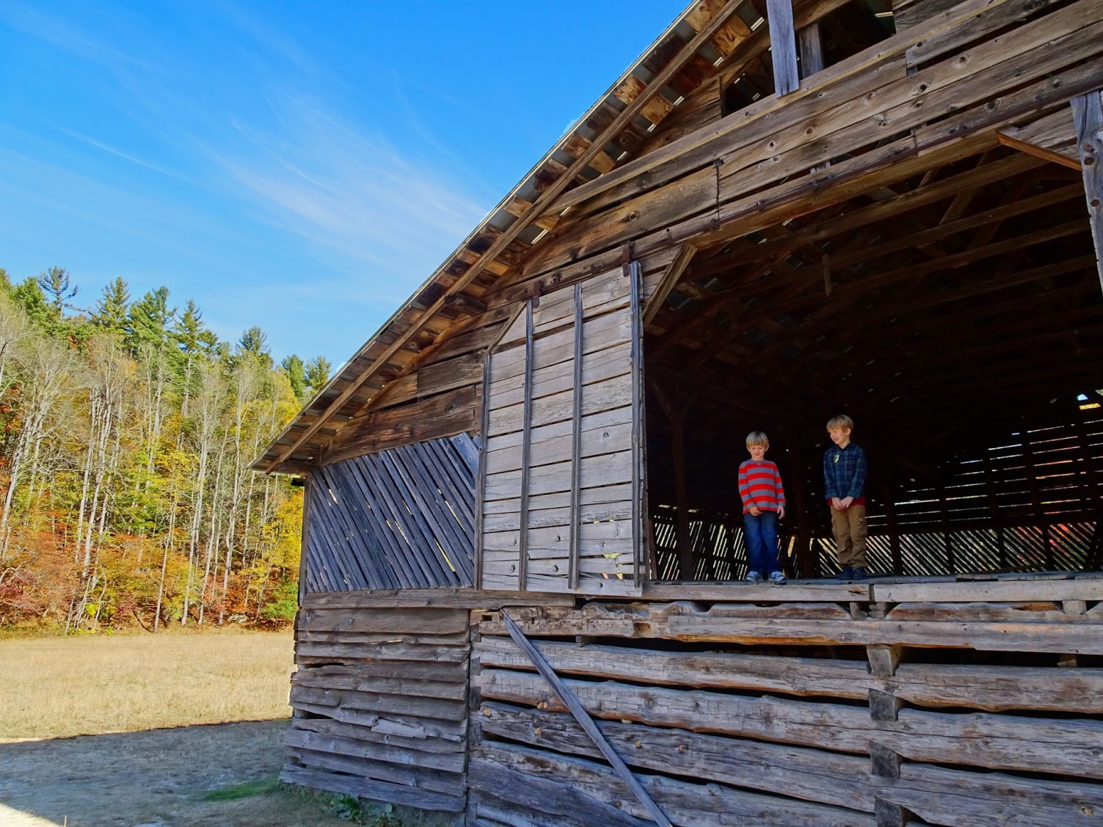
Most of the farm buildings in the Mountain Farm Museum date back to around 1900, and were moved from their original locations to create the open-air museum. Originally located throughout the area that is now the Park, visitors can explore the structures at their leisure. The Museum includes a log farmhouse, barn, apple house, springhouse, and a working blacksmith shop. Make sure to check out the Davis house, as it was built out of chestnut wood before the chestnut blight eliminated the American Chestnut from our forests in the 1940s.


We continued on along the Oconaluftee River Trail, a 1.5 mile hike that connects the Visitor Center to the boundary of the Park with the Cherokee Indian Reservation. Not only is the trail one of only two in the Park to allow dogs and bicycles, but it is also the Cherokee Oconaluftee River TRACK Trail, with the trailhead on the Cherokee end. On our hike we examined interpretive panels about Cherokee folklore (it was fascinating to see the information translated into Cherokee Syllabary!), passed under the terminus of the Blue Ridge Parkway (the 469-mile drive that connects GSMNP with Shenandoah NP in Virginia) and stopped at the entrance to the Park to snap a picture at the welcome sign.


At the southern end of the trail we picked up the Animal Athletes TRACK Trail brochure, and on the hike back various Cherokee legends came to life as we listened to stories of how animals helped create the world and why certain animals look the way they do. As we were doing the pictured exercises to be as strong and fast as the animals in these legends, we kept an eye out for animals that call the area around the river home – and we weren’t disappointed. Not even two dozen feet from the trail an elk was resting in the shade, waiting for dusk to arrive so that it can go feed in the meadow. Groundhogs were running to and fro around their burrows, wild turkeys were foraging along the treeline, and at the confluence of the Oconaluftee with Raven Fork we watched a woman catch and release a beautiful rainbow trout.

Can you spot the elk in the upper right photo? (Groundhog center top, turkeys lower right)

Once we were back within sight of the Mountain Farm Museum we cut over to the river where we spent the next hour relaxing as the sun slowly sank in the sky. Although we had one day left to explore the Smokies, this would be our last day in the Park. It was only fitting that we would get caught in an elk-viewing traffic jam on our way out…


The next Back Porch Old-Time Music Jams at the Oconaluftee Visitor Center are on November 19th and December 17th. The December date is also “Holiday Homecoming,” with demonstrations of old time crafts such as quilting, weaving, basket & doll making, apple cider pressing and apple butter churning. The event is free and runs from 10am to 3pm; for more information visit the Great Smoky Mountains Association website.

Crossing under the terminus to the Blue Ridge Parkway

Related Posts Plugin for WordPress, Blogger...