 |
| Cataloochee Valley from the overlook |
There
are two ways into Cataloochee Valley. The first and most direct route involves
about 11 miles of winding mountain roads, 3 of which are gravel. A second, more
scenic route is to take highway Route 32 (the Old Cataloochee Turnpike) from
Cosby, TN, a good 14 miles of gravel road. Great Smoky Mountains National Park
is about 520,000 acres, but the mileage to reach this eastern vestige of the
Park that is daunting: 65 miles from Gatlinburg and 39 from Cherokee. However, I
had booked the last available campsite at the primitive campground for that
evening, and so it was all in as we turned off Interstate 40 near the TN/NC
border and headed into the mountains.

We
opened the sunroof to let the filtered autumn light in, rolled the windows down
to breathe in the cool mountain air, and crossed our fingers that the noise
coming from the rear driver’s side wouldn’t get any worse. The ‘turnpike’ is a
marvel in road-building, what was originally a livestock trade route was completed
in 1860 just in time for the Union Army to move into North Carolina from
Tennessee during the Civil War. The road immediately turned into gravel, and as
we wound our way up into the mountains from Jonathon Valley we passed a few
homes and driveways. Later, nothing but endless forest - other than the two
(probably) locals in their pickups who barreled down that one-lane road without
guardrails with only a curious glance at the out of state sedan just moseying
on along. Then down we went, twisting and turning on our descent into the
valley, finally coming to a large bridge over Cataloochee Creek and the hydrologic
bench-mark streamflow station operated by the US Geological Survey. Boards
rattling as we pulled across, we were in the home stretch; a few more miles and
we crossed back over the creek to enter the meadows.

Cataloochee
Valley is nestled among 6000-foot peaks, an isolated area that used to have one
of the largest and most prosperous settlements in what is now the Great Smoky
Mountains National Park. The Cherokee hunted and fished in the valley, naming
the area “Gadalutsi” (meaning standing up in a row), but white settlers pushed
into the valley in the early 1800s. In 1910 there were 1,200 residents, and although
they were amazed when rumors surfaced that the government would buy the land to
form the Park, by 1938 all but a few families had moved on. The history of
these former residents of the Valley can be explored in the preserved school,
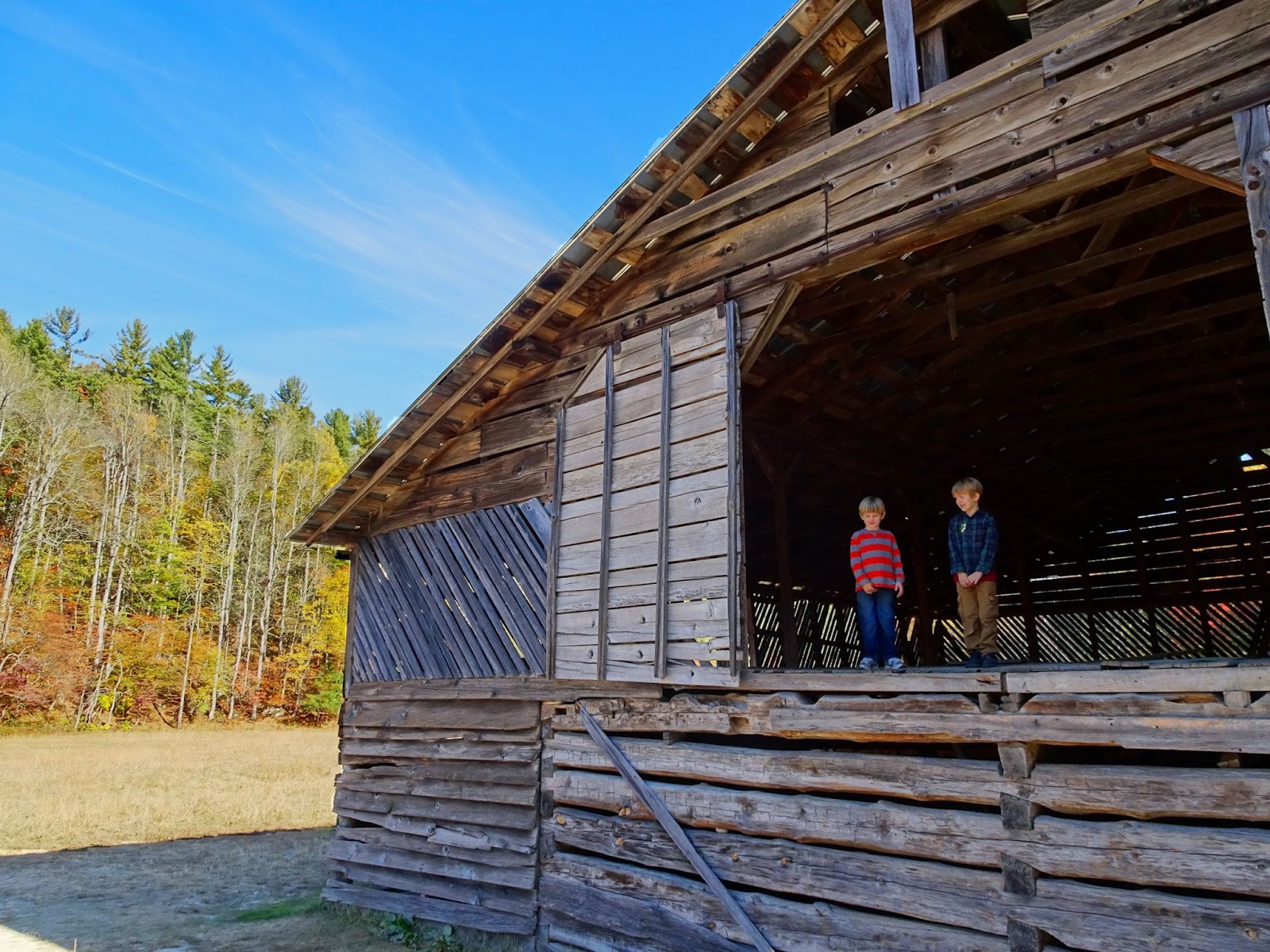
churches, barn, and several homes in the valley.

Viewing
wildlife in the Smokies can be challenging because of the dense forest cover,
which is why areas like Cades Cove attract so many visitors; the open meadows
provide some of the best opportunities to see deer, elk, bear and turkey. As
many animals are most active at night, often it is during the early morning and
late evening when they can be seen – and we weren’t disappointed as we made our
entrance in the waning light.

In the
spring of 2001 the National Park Service released 25 elk in the Park.
Originally roaming over much of the eastern United States, elk were eliminated
from the region by over-hunting and loss of habitat. Another two dozen elk were
released in 2002, and today an estimated 150 to 200 animals residing in GSMNP.
The majority live in Cataloochee Valley, although in recent years a satellite
herd has appeared on Balsam Mountain and a group of about 20 elk have taken up
residence near the Oconaluftee Visitor Center.

By
camping in the Valley we were able to enjoy prime wildlife-viewing time without
having to drive the narrow mountain roads at dark or attempt to make the trip
in the early morning hours. The campground was ideal for car camping, with 27
sites open mid-March through October for tents or RVs up to 31 feet (group
camping is also available by advance reservation). We set up our tents, cooked
up some chili for dinner, and topped it off with hot chocolate and s’mores
before crawling into our sleeping bags and settling in for the night.

The
next morning we proceeded down the Cataloochee Entrance Rd to the main meadows.
White-tailed deer and wild turkey were grazing in the distance, and while we
were speaking to a pair of volunteers (that had a portable wildlife lab in
their vehicle!), an elk bugled off in the distance.

The
morning was spent exploring the historical structures and enjoying the colorful
show of foliage. Five historic buildings are located along the road in the
valley, and other buildings can be reached from the 6-mile Little Cataloochee
Trail. Make sure to pick up the Self-guiding Auto Tour booklet at one of the
visitors centers; it provides brief histories of each structure as well as a
map and interesting background information on the area.
It
wasn’t long until the valley started filling up with visitors who had made the
trip that morning from Maggie Valley or Cherokee. We decided to let them have a
turn, and packed up for our trip out of the valley… this time a mere 10 miles
on the ‘short’ route to the interstate!

One
final stop; the overlook near the intersection with Big Creek Rd. is worth the
stop (the first picture in this post is taken from the lookout). A little path leads to a higher point that allows for an unimpeded view
of the valley and mountain peaks surrounding it, and if you’ve lucked out to be
there on a beautiful fall day – well, it’s enough to make you wish you had a
week’s reservation at the campground instead of a day!

Beautiful scenery!
ReplyDelete