To the southwest of the rounded hills of the Auvergne where we live and to the west of the famous Provence Lot river and the gorges are the rugged Cévenne mountains with their complex network of ridges and gullies. The Cévennes were impenetrable for centuries partially due to the impressive fortifications along the ridges.
On our recent trip south we witnessed the changes in topography farther to the west, where soft hills and fertile valleys sport the ségalas, the rye fields (although we saw more rapeseed fields, noticeable because of the striking yellow blossoms). Between the Causses and the Cévennes are the limestone hills of the Garrigues and the wine-growing plains of the Bas Languedoc.
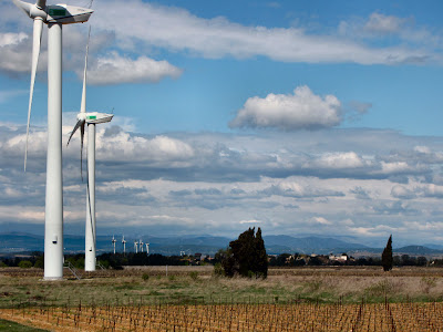
Once we entered the Garrigues, the scenery dramatically changed; the white rocks, olive trees, vines and clumps of oaks, broom and aromatic wild thyme and rosemary resembled a truly Mediterranean landscape. Between the Garrigues and the coast vineyards seem to stretch as far as the eye can see. Summer brings the tourist crowds, and fall brings the bustle of the grape harvest. And since the Languedoc c'est le pays du vent (is the land of the wind), in addition to the five winds, Le Vent Tramontane, Le Vent Cers (and the prenom, is it Edgars?), Le Vent Scirocco, Le Vent Autan and Le Vent Marin, there are windfarms everywhere.
And finally at the southern edge the Pyrenees make a natural border between Spain and France Pyrenees to the inland plains and the coastal lagoons.


No comments:
Post a Comment