It’s
the highest dam east of the Rocky Mountains. As if this weren’t enough to
guarantee some fantastic scenery, to the north is the Great Smoky Mountains
National Park and to the south Nantahala National Forest. Between the dam,
Fontana Lake and the spectacular mountain views, Fontana Dam is one western NC
attraction you won’t want to miss, only 3 hours from Greenville!
The
Little Tennessee River is a 135-mile tributary of the Tennessee River that
flows through the Blue Ridge Mountains of GA, NC and TN. The headwaters of the
Little Tennessee are high up in the Blue Ridge Mountains of the Chattahoochee
National Forest in Rabun County GA. After flowing north into North Carolina it
turns northwest, flowing through the Nantahala National Forest and into Tennessee
where it ultimately joins the Tennessee River 25 miles southwest of Knoxville.
In 1942 construction was started to help alleviate skyrocketing electricity
demands in the Tennessee Valley at the height of World War II, and when
finished two years later it was the 4th tallest dam in the world.
480
feet tall and 2,365 feet across, the dam impounds the 10,230 acre Fontana Lake.
Both dam and lake are named for the town of Fontana, a lumber and copper-mining
hub that was located at the mouth of Eagle Creek before the dam was built. It,
along with the towns of Bushnell, Forney, and Judson were completely inundated;
a total of 1,311 families, 1,047 graves and over 60 miles of road had to be
relocated.
Multiple
rivers empty into Fontana Lake, including Tuckasegee River (from Cherokee and
Bryson City) and the Nantahala, a portion of its scenic Gorge underwater. Currently
NC 28 is the only major road access to the area, although the National Park
Service originally agreed to build a road along the lake's north shore to
connect the dam to Bryson City. Financial issues and environmental concerns kept
this road from being completed, and in 2007 Swain County accepted a $52 million
cash settlement from the NPS in exchange for dropping its demand for the north
shore road.
The
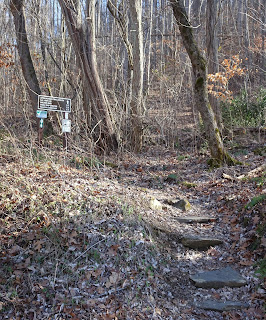
Appalachian Trail crosses the top of the dam, the shower facilities earning it
the title of “Fontana Hilton” by through hikers. A Visitor Center is managed by
the Tennessee Valley Authority and is open seasonally with exhibits featuring
the history of the region. Nearby Fontana Village (where the construction crews
were originally housed) is now a resort mountain town offering fishing
excursions, boating, horseback riding and other adventure sports, and the Great
Smoky Mountains National Park and Nantahala Forest own and protect about 90% of
the 238-mile shoreline of the lake, offering camping and hiking in this remote
corner of North Carolina.
To access views from the bottom of the dam,
proceed west on Fontana Rd and immediately after crossing the Little Tennessee
River turn east (right), following the signs to the parking area. Above the dam
there are three parking areas: one adjacent to the Visitor Center, one
overlooking Fontana lake (with a picnic pavilion and pier), and a third with a
view of the dam.
 |
| south to Springer Mountain - only 166.1 miles |
A few
notes: The water level fluctuates seasonally by about 57 feet, although on our
visit it was low enough that the pier was not in the water. Also, the Visitor
Center is open 9am to 7pm daily from May through November, and on our visit
port-a-potties served as facilities for visitors.


hot dam!
ReplyDelete