Monday, December 1, 2025
Christmas events in the Upstate
Trolls: A Field Study at the NC Arboretum
From the Field Study guide: "Not long ago, we trolls were baffled by little humans - zipping around in metal beasts, scrolling on your pocket stars. But then we saw how your eyes still light up when you see a handsome snail or a beautiful leaf, and we thought... maybe you're not so strange after all! So we've come to study you further, and see if we can find some wild treasure together (much better than shiny coins). You in?"
The North Carolina Arboretum and Explore Asheville are celebrating the arrival of Trolls: A Field Study, which made its North American debut on November 10, 2025 at the Arboretum. Produced by Imagine in collaboration with Danish artist Thomas Dambo, twelve friendly troll sculptures are scattered throughout the Arboretum in a scavenger hunt of epic proportions!We previously explored one of Dambo's troll exhibits at the Morton Arboretum in Illinois and were so excited to have another chance to see one of his art installations!
The sculptures range from seven to nine feet tall, and are crafted from wooden materials like fallen branches, pallets and twigs. They are created to be interactive, and my kids had so much fun crawling into nets for photo ops, taking up-close looks at the materials used, and learning each troll’s name and story!
"On the night he was born, a little troll named Taks wandered into the human world. What he saw left him puzzled—strange machines, noisy boxes, people rushing around without stopping to talk to the trees. When he returned to the forest, he shared his discoveries with his eleven siblings - and so it started: Trolls: A Field Study!”
Make sure to get the map from the education center, it has activities corresponding to each site for the kids to complete, as well as providing a checklist of sorts, so that you can locate all 12 trolls without too much backtracking.
Admission to Trolls: A Field Study is included in the standard Arboretum parking fee, and no advance tickets are required. However, be aware that on weekends you may encounter crowds and a longer wait to enter the Arboretum and should plan accordingly.
The exhibit is at the NC Arboretum from November 15, 2025 through February 17, 2026. As Winter Lights is also currently running at the Arboretum, daily hours have been shortened to 8am to 5pm, with last admission at 4pm. After the holidays normal business hours will resume: 8am to 7pm starting January 5, 2026. A Winter Lights/Daytime combo ticket is available, but those ticket holders must also exit at 5:00 p.m. and return at the entry time listed on their Winter Lights ticket.
While you’re at the Arboretum, make sure to check out the children’s exhibit Snow: Tiny Crystals, Global Impact in the Baker Exhibit Hall, which runs through January 4, 2026. Visitors can peek inside the snowpack to find animals that make their homes in the snow, walk through a snowstorm, or even build a snowman! The outdoor “Playing Woods” area is always a hit with our family; we plan for snack time and a rest there. The NC Arboretum is also a participant in the ecoEXPLORE citizen science program and the Kids in Parks TRACKTrail program, both of which make a visit even more immersive.
Location: NC Arboretum, 20 Frederick Law Olmsted Way, Asheville, NC 28806
Admission: Free, but there is a parking fee for non-members
($20 for standard vehicle)
Hours: 8 a.m. – 5 p.m., with the last entry at 4 p.m.
Exhibit runs from November 15, 2025 through February 17,
2026
Website: Trolls:
A Field Study - The North Carolina Arboretum
This article first appeared on Kidding Around Greenville as Trolls Take Over the Arboretum: A New Family Experience.
The article Hunting for trolls at the Morton Arboretum, on the topic of Dambo's "Hunting for Trolls" exhibit can be found here.
Saturday, September 27, 2025
Hurricane Helene // 1 year
September 27, 2024
After a sleepless night spent listening to the wind and reports of the hurricane as it came tearing in from the Gulf, we started our morning resigned to the fatigue of knowing there wouldn’t be any more sleep. At about 7:30 (with the boys’ alarms set for 8am to begin e-learning), Roberts opted to start making coffee just in case the power went out. V is somewhat of a light sleeper, and upon hearing the coffee grinder, he rolled out of the top bunk to come join me in in the back of the house while Roberts worked in the living room.
As the now-weakened tropical storm passed to the west of Greenville, the winds abruptly switched from NW to SW – and trees fell all over our town, including the 135 year-old water oak in our front yard. It sounded like a train, felt like an earthquake, and was over in seconds.
The enormous trunk smashed through the front corner of the house, its fall only arrested by a large limb that came down directly on the chimney. As a branch came through the roof in the front bedroom, the top bunk (vacated just 10 minutes previously) stopped the ceiling from falling on L, still asleep in the bottom bunk. In the living room, Roberts had a front row view out our front door – where the tree and front porch were now settled – and luckily was on the opposite side of the room from where the ceiling collapsed. The other boys’ bedroom’s ceiling remained intact.
Over the next days we found out just how remarkable our community of friends and neighbors is, as they housed us, fed us, supported us, took in the kids for days at a time while we worked to mitigate the damage and start our recovery. Many of them had trees fall on their homes, their cars, their sheds and fences – yet they still came in endless streams with boxes & totes, food & supplies, kind words & hope. To move our belongings to their homes for safekeeping, to help us carry, clean, cry.
The entire front half of the roof was crushed, the back end of it shifted off the house. Walls remain canted, windows unopenable, cracks appearing in the plaster throughout. There is no ceiling to the front 1/3 of the house. We can not even begin to understand the full extent of the water and electrical damage, as we have not yet been able to start repair work. But the foundation stands. And thankfully the master bedroom & bath are an addition to the original structure and emerged mostly unscathed.
Eight days later the tree was finally removed from the house. Thanks to our wonderful community, we found a crew to put a temporary roof on by week 3. Yet 12 months later, here we are – temporary roof still holding as a pair of hurricanes approach from the Atlantic, house still uninhabitable, belongings still mostly in storage. I still mourn, not just for the front porch swing and the kids artwork that was stored in the attic, but for the 2 years that the boys will not be able to select a favorite book from their bookcases. For the perennials lost to machinery. For the shade and birdsong that was a gift from our oak. For the independence day celebration that went unhosted, all the time lost to worry & stress. For all the times I have to say “no” because it is all just too much.
One year, one story. Thank you for reading.
Sunday, September 21, 2025
Ecusta Trail: New rail trail in Hendersonville!
You may be familiar with the Swamp Rabbit, Mary Black & Doodle Trails, maybe you’ve even taken a road trip up to ride the Virginia Creeper trail near Damascus, but if your family is looking for a brand-new trail to explore, I’ve got great news! The first 6 miles of the long-awaited Ecusta Trail are open to the public, with another dozen miles set to eventually connect Hendersonville to Brevard, NC!!
Hundreds of people gathered in Hendersonville earlier this summer to celebrate the ribbon-cutting for the Ecusta Trail, the newest rail trail added to the growing network of multi-purpose trails crisscrossing our region. The Ecusta rail line was built in 1894 to service a paper mill, but the last time a train used the rails was in 2002. It has taken 15 years of community efforts from nonprofits including Friends of Ecusta Trail and Conserving Carolina to transform it into the trail it is today!
The eastern terminus of the Ecusta Trail (and to the section of trail that is currently open) is Main Street in Hendersonville. The town recently reworked their traffic pattern to make a safe and convenient bike lane that allows trail users to explore downtown, including some of our favorites like the Mineral & Lapidary Museum, the E.C.C.O. Aquarium & Shark Lab, the Appalachian Pinball Museum, Mast General Store and Black Bear Coffee. Be sure to check out the Bearfootin’ Bears, a public art display featuring decorated, life-size bear sculptures! A good starting point to exploring downtown is the Welcome Center and Trailhead (with bathrooms and water fountains). As you work your way south, the Ecusta Trail splits off going west just before S. Church & S. Main merge - and the adventure continues!
A popular stop comes up in about ½ mile: Lennox Station. Trail users can grab a quick bite from Ecusta Market & Café, and just next door is Trailside Brewing Company. Then at around mile 1.5 is Southern Streams Coffeehouse and Laurel Green Park, with the Little Laurel Green playground. Next up at mile 2 are a slew of dining options, as well as a convenience and grocery store. And around mile 3 is Basecamp: the Elijah Mountain Gem Mine and Goat Farm, and Guidon Brewing Co.
While on the trail, users should follow the usual trail etiquette. Please respect private property and stay on the trail! Pedal-assist e-bikes are permitted on the Ecusta, but wheels yield to pedestrians, and you should keep right except to pass. We’ve found it’s great practice for our “on your left” warning when passing – even the 5yo who is just learning his left from right! Helmets are required for children 16 years of age and under (who are on wheels), and pets must be on a leash no longer than 6ft & under control. Please clean up after your pet as you would anywhere!
The trail currently ends at mile 6 in Horse Shoe, but plans
are already underway for the next two sections. 5 more miles in Henderson
County through Etowah and another 8 in Transylvania County will take the trail
to Pisgah Forest and the western terminus, Main Street in Brevard. For this
part, the trail roughly parallels the French Broad River and Hendersonville
Highway. Etowah has more than a couple of eateries and stops, as well as the
Horse Shoe River Bend Access point to the French Broad River. Upon reaching
Pisgah Forest and Brevard, the trail will intersect with the Brevard greenway
near Oskar Blues, just west of where the Davidson River flows into the French
Broad.
To view the interactive trail map visit the Ecusta Trail website. It’s also got all the newest on the status of the remaining portion of the trail, as well as info on volunteering and trail events. Ecusta Trail also has a Facebook and Instagram page.
If you’re looking for more family-friendly mountain biking trail info,
click here for my article Mountain biking with kids in Upstate SC.
Monday, July 22, 2024
Adventure awaits on the Blue Ridge Snorkel Trail
To learn more, visit www.BlueRidgeSnorkelTrail.com. There is a map to find the snorkel trail locations closest to you, as well as learn about the different wildlife that are native at that particular site. Inclusion within the snorkel trail means there is parking available and that the river access is public, and restrooms and other conveniences are often available.
Never snorkel alone
Don’t move rocks around as they provide shelter to our native species
Practice LNT and help keep our banks and waters clean
Be aware that rocks are often slick, and know your limits regarding water depth & currentWednesday, March 20, 2024
Scenic Overlooks and Pull-offs in Upstate SC
While my family loves a good hike (and there’s no shortage of them in the Upstate!) we sometimes find ourselves looking for those stunning views – but with little to no hiking. Whether it’s because we have an out-of-town guest visiting that might have less experience on the trail or not be physically capable of tackling local hikes, or because I was pregnant (or adventuring with an infant), we found a dozen sites that we could pull right up to for that spectacular vista – with just a short walk! Head out to one or two of them, or take an epic driving tour of all of them for a taste of the SC Upcountry.
Wildcat Branch Falls
After breakfast at one of the many
cute spots in Traveler’s Rest, head north to Cherokee Foothills Scenic Highway
11 and drive west. The first stop is Wildcat Wayside, the old rest stop for
travelers on their way to Asheville. With over a mile of trail that loops into
the Mountain Bridge Wilderness Area, this trailhead can be a popular spot; be
careful pulling in and out of the roadside parking area. However, you won’t
have to go far to see the star attraction, as the 30ft waterfall is visible
from the road. The shallow pool at the base is a popular swimming hole on hot
summer days!
Address: 5500 Geer Hwy, Cleveland, SC 29635
Bald Rock Heritage Preserve
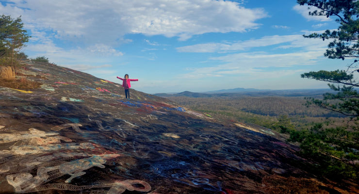
From Greenville, stay on Highway 276 North, following signs to Caesars Head State Park. From Fire Station #64 on the left, drive 1.4 mile to turn right into Persimmon Ridge Road. Another 0.4 mi to the parking lot on the left, and you'll find the trailhead across the road. It's an easy half mile walk through the woods to the iconic view of Table Rock and the surrounding mountains from Bald Rock’s large open rock face. 165-acre Bald Rock Heritage Preserve is home to several rare plants, as well as panoramic views stretching from Table Rock to downtown Greenville.
Address: Highway 280 Persimmon Ridge Rd.Cleveland, SC 29635
Caesars Head State Park
In another 4.6 miles’ drive north on Highway 276 you’ll reach the Caesars Head State Park Visitor Center. There is ample parking here, as well as restrooms, picnic tables and a gift shop. Take the short, 0.1-mile trail to the overlook featuring a wonderful view of Table Rock and the reservoir.
Address: 8155 Geer Highway, Cleveland, SC, 29635
Grant Meadow Overlook
From Caesars Head, retrace your steps back to Cherokee Foothills Scenic Highway 11 and continue west. Just under a mile after Aunt Sue’s Country Corner look for Grant Meadow Overlook to your right. This scenic pull-off is newly open, an Upstate Forever conservation easement protecting the 57-acre property that includes the meadow and streams to the north. Behind them, the focal point – Table Rock. Take a minute to read the historical marker that tells the story of the granite dome, or just soak in the view from the bench before continuing on to Table Rock State Park.
Address: Grant Meadow Overlook,
Pickens, SC 29671
GPS Coordinates: 35.034126,
-82.684248
Table Rock Overlook
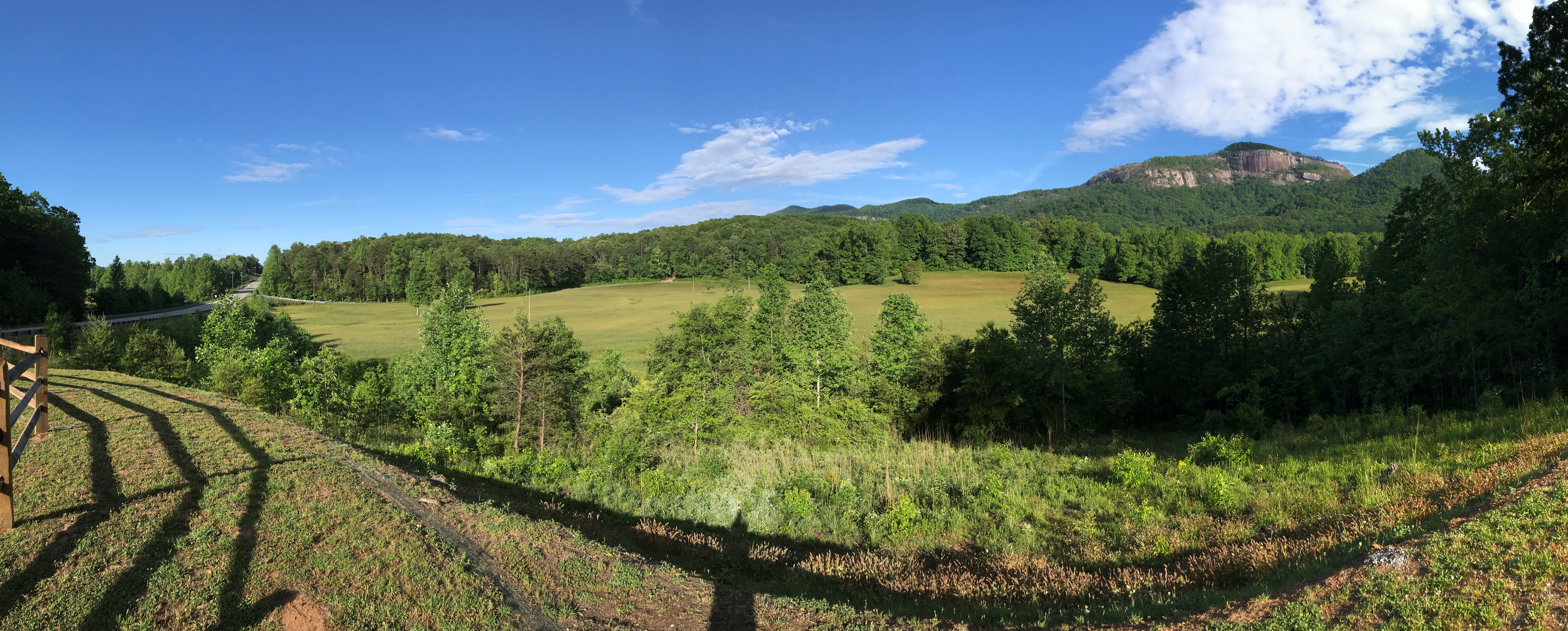
Table Rock Mountain rises 3,124 feet above sea level and can be seen miles. But if you want to get up close without the strenuous 7+mi hike, just head to the Table Rock Viewpoint within Table Rock State Park. To access the pull-off you’ll need a State Park Pass (or to pay admission); it is located about halfway between the Table Rock Nature Center and Gaines Lodge parking areas. If the Park is full or you don’t have a Park pass, head instead to the Table Rock State Park Visitor Center on Lake Oolenoy, where you’ll find restrooms and a gift shop, plus rocking chairs on a wide porch with a prime view of Table Rock.
Address for overlook: 182-346
Table Rock State Park Rd, Pickens, SC 29671
Address for Visitor Center: 158 E Ellison Ln, Pickens, SC 29671
Sassafras Mountain
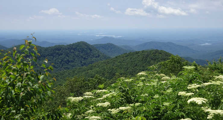
From Table Rock State Park it’s another 4 miles or so to the intersection of Highway 11 and Moorefield Memorial Highway, where you make a right to drive north 7.5 miles to Rocky Bottom, SC. Make another right on F. Van Clayton Memorial Highway (Sassafras Mountain Rd) and take it all the way to the end to Sassafras Mountain Observation Tower. From the parking lot to the tower is just over a tenth of a mile, but the short stroll is worth it as on a clear day you’ll have 360-degree views of North & South Carolina and Georgia.
Address: 1391 F Van Clayton Memorial Hwy, Sunset, SC 29685
Jumping Off Rock
This next stop requires a bit of time, and patience, as it requires a long drive down a gravel road. Once you are back on Moorefield Memorial Highway, go north 0.9 miles to Horse Pasture Road. This road is open year-round, but will close due to hazardous weather conditions: see SCDNR for updates. High clearance is recommended for the 9.6-mile drive to the overlook, but not required. On your way in you’ll pass several Heritage Preserves and Wildlife Management Areas, with multiple waterfall hike and Foothills Trail trailheads located on Horse Pasture Road. Look for a small pull-off with an obvious trail, it’s only a couple hundred feet to the view. Jumping Off Rock is the first of several stops located in the Jocassee Gorges region in this driving tour that features views of Lake Jocassee; if you opt to skip it you’ll get similar views from the Bad Creek Overlook.
Address: 448 Horse Pasture Rd, Sunset, SC 29685
Long Shoals Wayside Park
Once back on Cherokee Foothills Scenic Highway, look for the intersection with Roy F. Jones Rd. After driving 1.4 miles west on Highway 11 you’ll see the entrance to Long Shoals Roadside Park. There are picnic tables located right next to the parking area, but this stop does require a short climb to reach Little Eastatoe Creek. While not as long as the walk to the Sassafras Mountain tower, it is a little steeper – it descends about 100ft.
Address: Scenic Hwy 11, Pickens, SC 29671
GPS Coordinates: 34.949246,
-82.851151
Bad Creek Overlook
From Long Shoals Park drive west on Highway 11 for almost 10 miles. Turn right on SC-130 N and continue for 10.1 miles. Bad Creek is the site of the largest hydroelectric station operated by Duke Power, and includes 7,500-acre Lake Jocassee, a 375-acre upper reservoir, an underground powerhouse and a one-mile long tunnel bored through the mountain bedrock connecting the reservoirs and powerhouse. The site is open to the public year-round, however visitors must abide by the Bad Creek visitor regulations posted at the electronic gate at the entrance to the site, which is at the turn off SC-130 N onto Bad Creek Road. Proceed carefully on Bad Creek Rd. for 3.6 miles until you come to the entrance to the parking lot for the Bad Creek Visitor Overlook. This overlook has more breathtaking views of the emerald Lake Jocassee, with a backdrop of the mountains of the Jocassee Gorges.
Address: Bad Creek Visitor Overlook, Bad Creek Rd, Salem, SC 29676
GPS Coordinates: 34.995363,
-82.992124
Note: Just to the north is the North Carolina border and Whitewater Falls, one of the tallest waterfalls in the east. We’ve chosen not to include it in this guide as the hike to the viewing platform is about 0.6 miles and involves stairs; this is also a fee area. However, it is close enough that it is definitely an option if interested!
Wigington Overlook
Once back on Whitewater Road drive south for 0.7 miles, then turn right and head west on Oscar Wigington Memorial Highway. This short connector route between SC-107 and SC-130 offers a fantastic bird's-eye-view of Bad Creek Reservoir and the Carolina foothills from the Wigington Overlook, which is 1.4mi from Whitewater Rd.
Address: Oscar Wigington Memorial Highway Scenic
Overlook, State Rd S-37-413, Tamassee, SC 29686
GPS Coordinates: 35.001087,
-83.043677
Sloan Bridge & Chattooga Pull-Offs and Picnic Areas
Continue west on Wigington Highway until you reach Highway 107, Falling Waters Scenic Byway. Just north of the intersection is the Sloan Bridge Picnic Area, with restroom facilities and picnic tables. 2.3 miles south is Fish Hatchery Road, which leads to the Walhalla State Fish Hatchery, another picnic area, and a popular spot for fishing.
Sloan Bridge address: Sloans
Bridge Access, Tamassee, SC (GPS Coordinates: 35.003620, -83.054143)
Walhalla State Fish Hatchery
address: 198 Fish Hatchery Road, Mountain Rest, SC 29664
Burrell's Place Pull-off
One mile south of Fish Hatchery Road is a memorial site for five service members who were killed when a B-25 Army Air Corps plane crashed into a mountain top at night on March 10, 1943. At the Burrell’s Place Pull-Off visitors can find a memorial marker with the names of the servicemen. 1/3 mile further is a wide spot in the road that has room for a couple of cars, with a view of Cantrell Mountain and the Upstate beyond.
GPS Coordinates: 34.964861, -83.078429
Russell Farmstead (Chattooga Town)
After cruising the rest of Falling Waters Scenic Byway, you’ll reach Highway 28S. Make a right and continue towards the SC/GA border, and in 7.5 miles you’ll reach the pull-off for Chattooga Town, which is listed in the National Register of Historic Places. The Russell house was a busy Appalachian farmstead in the late 1800s and early 1900s, and served as a stopover for travelers headed north to NC to escape the hot South Carolina summers. A fire destroyed the main house and three outbuildings in 1988, leaving only a chimney of the main house, but the foundations are visible and an interpretive sign on the site details the layout of the farmstead.
Address: Mountain Rest, SC 29664
GPS Coordinates: 34.909300,
-83.172708
![]() |
| Source: Google Maps |
Chattooga River (Oconee county) pulloff
Retracing your steps to Mountain Rest, SC, you’ll take Chattooga Ridge Road to Long Creek Highway; the next destination is where Highway 76 crosses the Chattooga. Just before the river there is a 10-minute parking pull-off with room for about 6 cars, and a walkway that leads to an overlook of the Chattooga River and the bridge. If you would prefer a closer look at the river, park at the US Forest Service Chattooga River Access site across the way, though that will require a short walk.
Address: Highway 76 Chattooga
River Access, Mountain Rest, SC 29664
GPS Coordinates: 34.814151,
-83.303892
The fastest way back to Greenville
from the Chattooga River is through Clemson on Highway 123, though if you’re
looking to take the scenic route (or headed to our our starting point in
Traveler’s Rest) you’ll want to take Highway 11. We often detour through Pickens to stop for
food, or watch the sun
set from Glassy Mountain.
Pack that bag of gear & snacks, and hit the road this spring with this guide to scenic viewpoints and pull-offs. Make sure to leave a comment to let us know what you enjoyed most!
This article first appeared on Kidding Around Greenville as Stunning Scenic Spots With No Hiking: An Upstate SC Driving Tour.